Hello,
Below I have compiled recent news related to the OSM Foundation (OSMF) board’s work. Most of these are or are going to be publicly documented on the OSMF website, so if you follow the Atom feed for the board meetings’ page, you can skip this.
What this diary entry is
It contains my personal selection and recollection of recent OSMF board-related updates.
What this diary entry is not
It is not intended to include details or all OSMF board-related updates. For these, you can refer to the published board minutes. This entry has not been reviewed by the OSMF board.
Why?
Informing the OSMF members is important. The board minutes describe in detail what was discussed in public board meetings, but many people don’t have time or follow the Atom feed for the OSMF’s website recent changes. At some point, I was creating annual or more frequent updates for the whole Foundation, which was a lot of work during a short period, while other tasks were ongoing.
I’m posting this experimentally, and I’m going to see whether I can continue to do so semi-regularly.
2026 OSMF budget
The 2026 budget of the OSM Foundation is now published. You can find previous budgets here. Please note that the board may revise the budget throughout the year.
April 2026 OSMF board updates
The board had a meeting on Thursday, 30 April 2026.
You can read the Secretary’s report by Dani Waltersdorfer and the Treasurer’s report by Roland Olbricht.
OSMF’s move to the EU
Craig Allan (Chair) committed to informing the community about the status of the OSMF’s move to the EU, after a comment by Simon Poole (former OSMF and LWG chair) during the April board meeting.
OSM Local Chapters and regional communities
OSM US Inc:
The OSM US and OSMF Boards had a closed, introductory meeting on 2026-04-09. The OSMF board, after a comment by imagico (guest) during the April board meeting, said that it is open to meeting with other OSM Local Chapters, if they are interested.
OSM France:
Apologies were expressed again to OSM France during the April board meeting (previous apology on February 2026), as the board did not inform them about the communications with the French Cadastre.
Presentations during OSMF board meetings:
The board wants to restart presentations by Local Chapters and communities during board meetings (previous presentations). If you are interested, please email the board at the address mentioned here.
OSMF Corporate Members
Héctor Ochoa Ortiz (Deputy Secretary) had a private meeting with TomTom (Corporate Member) to discuss their intention to share information with the OSM community regarding their detection of potential vandalism and problematic edits. Héctor pointed them to the Data Working Group. rphyrin (guest) suggested that OSMF (and TomTom) could facilitate a community discussion to address this issue together.
Financial
2026 fundraising drive:
The board will hold a closed chat on 2026-05-07 to discuss fundraising communications for the proposed 2026 fundraising drive.
BTC:
The board decided to use Monetum as a service to exchange Bitcoin donations to fiat. The OSMF’s BTC address is this one.
OSMF bank accounts:
The Treasurer has already regained access to the main Bank of Ireland account and is working to regain access to the Fire EU account.
Contract extensions:
The board extended the contracts of Martin Raifer’s (iD maintainer) and myself (assistant to the OSMF board).
Operations
QGIS tile server load:
On average, QGIS users access more OSMF tiles daily than users of osm.org. Some OSMF people are in contact with the QGIS board. Suggestions include upgrading the QGIS Corporate Membership to Platinum, or buying OSMF a server dedicated to their traffic.
State of the Map (SotM) 2026
The board decided to finance the travel of the three Sovereign Tech Fund contractors to attend the State of the Map (SotM) 2026 conference.
Board members’ participation at external meetings
2026-04-20:
Dani Waltersdorfer Jimenez (Secretary) was invited by the US National Academies of Sciences, Engineering, and Medicine, and on 2026-04-20 gave a presentation and participated in discussions during the Bureau of Transportation Statistics (BTS) National Transportation Atlas Database (NTAD) meeting of experts.
2026-05-01:
Héctor Ochoa Ortiz attended the 2026 Geospatial World Forum and participated in the GKI Summit 2026-05-01 panel discussion “Scaling GKI: Public–Private Partnerships and Cross-Agency Delivery Models”. Héctor mentioned that there were discussions about bot usage/scraping at the conference and that he might post a diary entry. OSMF was offered a free ticket to participate.
2026-06-19:
Héctor Ochoa Ortiz, together with Yannick Brosseau (OSM community member in Canada), will facilitate an OSM online mapathon organised by Gore Mutual (Canada) for their employees. The company will offer a €1,450 honorarium to OSMF.
2026 Board face-to-face (F2F) meeting in June
Six of the seven board members will meet in person in Madrid at TomTom’s office, from 6 to 7 June 2026. Unfortunately, Brazil Singh will not be able to attend. The meeting will be facilitated by Aspiration Tech.
The current OSM Foundation board members are:
Brazil Singh 🇧🇩
Craig Allan 🇿🇦
Daniela Waltersdorfer 🇵🇪
Héctor Ochoa Ortiz 🇪🇸
Laura Mugeha 🇰🇪
Maurizio Napolitano 🇮🇹 and
Roland Olbricht 🇩🇪.
Read their biographies and find out their officer and other roles.
OSMF board members are volunteers.
Minutes of public OSMF board meetings are on the OSMF website.
I would also like to take this opportunity to thank the weeklyOSM volunteers, including those who attend the OSMF public board meetings, as well as the community members who submit news to the weekly :)


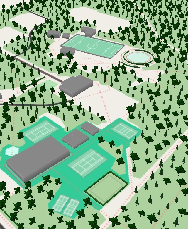
 in their OSM User Diary. A mapping sprint around
  a talk about OSM at the Latinamerican Festival for Free Software Installation in Córdoba. Their slides and materials are
  for 26 and 27 September 2026. This event
  /
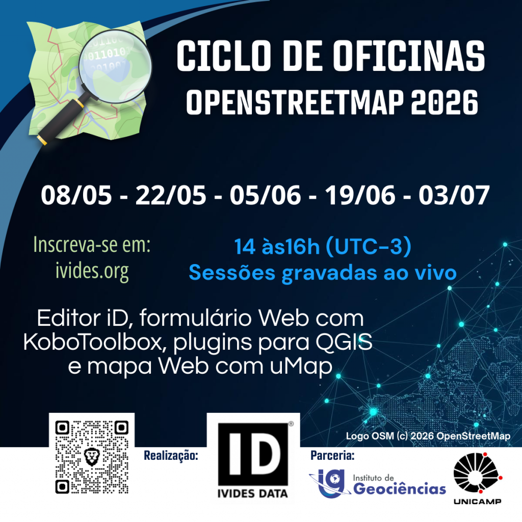
/ for its 2026 OpenStreetMap Workshop series (which will be in Portuguese), which consists of five sessions covering a variety of topics, such as mapping with OSM, QGIS plugins, web forms with KoboToolbox, and web maps with uMap. The focus of this edition of the series is to provide participants with the tools they need to develop a small practical project. The organisers believe that, in this way, the knowledge gained through these free software tools can be better integrated by the participants.


 Capacitação OSM 2026 – IVIDES DATA ® – Editor iD – Parte I