-
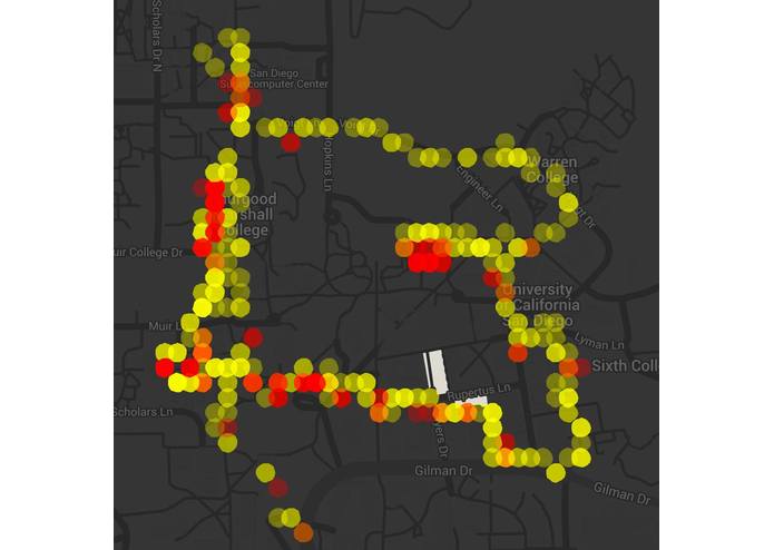
Light and dark data for UCSD campus. Showing the safest route as well as places to avoid when walking or biking.
-
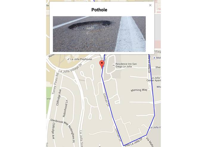
Encourages biking by showing dangerous situations to avoid in one's Strava application.
-
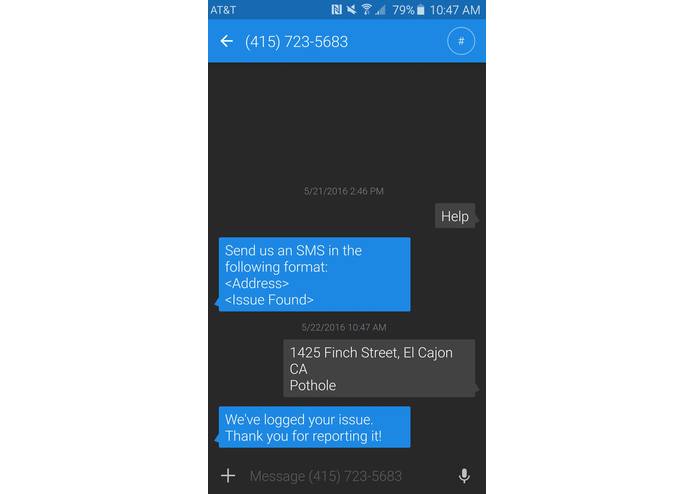
Our application is also accessible through SMS. Everyone's opinion matters, not just those who can afford a smartphone.


Inspiration
We were inspired by our own personal struggles with walking and biking around San Diego. For many of us, poor road conditions and a lack of proper infrastructure limited us and even discouraged us from walking or biking. We wanted to create a voice for community members, letting them identify problem areas and celebrate good areas, and encourage walk ability and cycling.
What it does
Enables residents to engage in their neighborhoods by uploading photo submissions and tags to either "identify a problem" or "celebrate the good". The app then shows suggested biking, running, and walking routes via maps based on user-submitted data. This data can then be viewed by users who may then choose the best the best route nearest to them.
How we built it
A lot of tools are responsible for our product. Our server is built using Node.js and express.js. The frontend is written in angular.js.
We used MongoDB for our database. This gave us access to a lot of powerful geospatial queries.
Challenges we ran into
Making our application accessible to lower income neighborhoods. One challenge with this was finding a service to send and receive SMS quickly and easily. We ended up using Plivo to handle this issue.
Accomplishments that we're proud of
We are very proud of the light and dark data we have collected in our own community. Using Google API, we were able to successfully map out safe areas and dark areas, allowing residents to choose the safest route through their community.
What we learned
We learned new languages, programs, and methods of data collection. For many of us, this was a completely new experience.
What's next for enhanSD
In the future, we would like to incorporate a commenting system so that users can have more in depth conversations about negative and positive aspects in one's community.


Log in or sign up for Devpost to join the conversation.