-
-
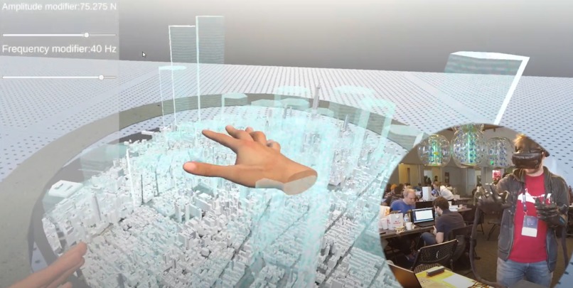
Feel the data
-
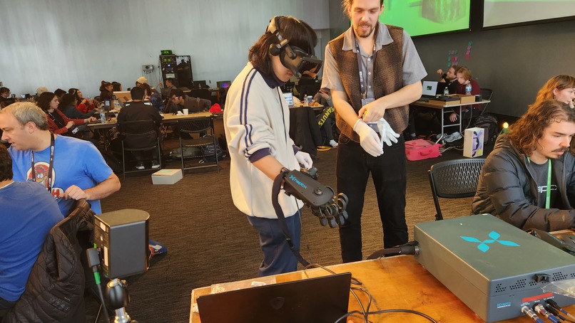
Demo in between test builds
-
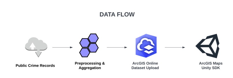
Data flow
-
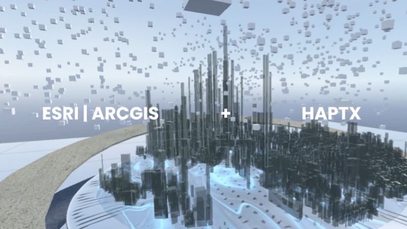
Key Visual
-
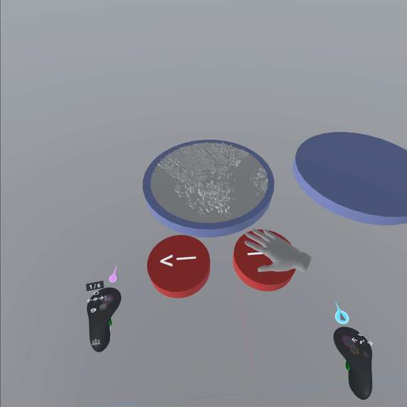
Prototyping with ShapesXR


Inspiration
- Our inspiration for creating inTouch is driven by the realization that global challenges are often abstract and that data has been presented in a way that can feel raw and distant to many people. We aim to bridge that gap by creating an application that brings data to life in a tangible and impactful way.
What it does
- inTouch uses haptic gloves and VR headsets to present data in tactile and immersive ways, making global challenges more tangible and impactful for those who have limited knowledge about data.
How we built it
The prototype is built with Unity, integrating two major components: ArcGIS Maps SDK and the HaptX SDK for interfacing with the HaptX gloves.
Our team had a broad range of skills of Unity development, spatial data analysis, user interface design, product development, and education. Throughout the process, we divided work into isolated components or collaborated on developing the code in real-time - depending on the need in the moment.
Early on in the process, we used ShapesXR to prototype the interactions of switching between different cities on the data visualisation map.
Challenges we ran into
- The ArcGIS SDK and the HaptX SDK had to slightly modified to allow them to work together. We collaborated with the Sponsors to figure out what needed to be adapted in the libraries to enable this new use of both SDKs.
- Finding the right datasets for the hackathon context, and converting/preprocessing them to upload to ArcGIS Online REST API and show 3D models on the map.
Accomplishments that we're proud of
- Developing a feature for downloading point data from ArcGIS online API and displaying custom aggregate visualisations (3D hexagonal bars) for the online data.
- Developing a feature for combining the ArcGIS SDK and Haptx SDK with each other.
- We've done three different iterations for demo and documentation.
What we learned
- Learned how Haptx and ArcGIS for Unity work with VR devices.
- Learned about data visualization and specific datasets such as US city crime and air pollution
What's next for inTouch
- Implement features for other types of the datasets (e.g. raster data such as heatmaps of air pollution and flood data)
- Tweak the haptic sensations for data visualization - this is a completely new space, that is almost hard to comprehend, and so it will require a lot of time to achieve optimal effect


Log in or sign up for Devpost to join the conversation.