-
-
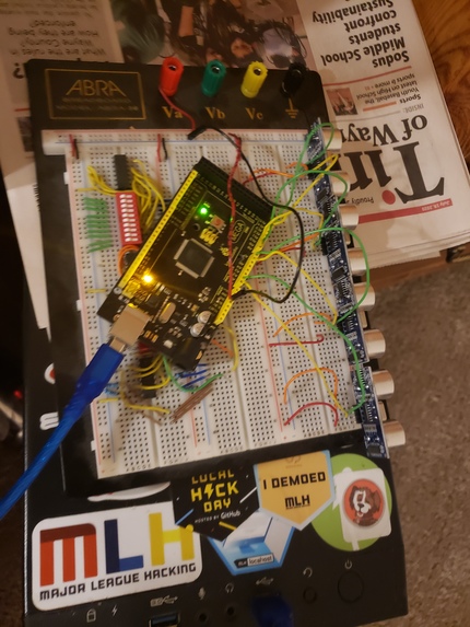
The wiring for everything
-
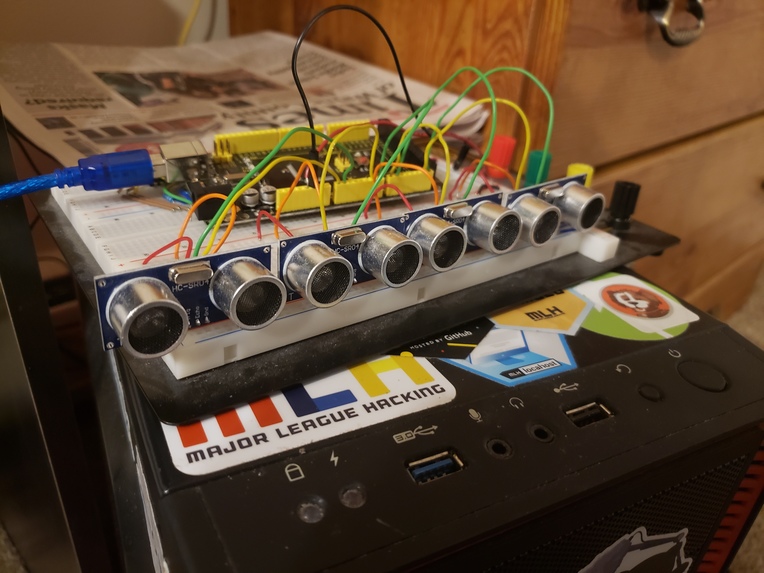
The front of the hardware portion


Inspiration
I do a lot of urban exploring, and it's easy to walk face first into a wall even with a flashlight. I thought having a general idea of what the layout of a place is not only increases safety, but also would allow me to avoid backtracking and have more fun.
What it does
Using ultrasonic sensors, the distance of each solid object in front of you is recorded. This information is then used to draw a map of an area. By stitching a bunch of these maps together, it's possible to chart entire floors of buildings or caves automatically.
How I built it
I built it using four ultrasonic sensors, an Arduino ATMega 2560, and python. The Arduino passes the python code the raw data from the sensors. The python code then turns this data into a map and charts it on a canvas.
Challenges I ran into
I don't own very much hardware, so I was really panicking when one of my sensors broke. A tiny bit of soldering and compensatory code later and everything had worked out though. Another problem I ran into was the timing of all the ultrasonic sensors. Because they are so close, without a delay between pings they become essentially useless.
Accomplishments that I'm proud of
I ended up writing a really good ultrasonic sensor utility in order to get everything I needed out of the hardware on this project. Hardware compensation was really the name of the game here, and I think I managed extremely well considering the limited resources.
What I learned
A lot about the pulse widths and I/O for ultrasonic sensors, and the python graphics library
What's next for MapGun
As I acquire more hardware, the plan is to slowly improve on this design until it is something I can properly show off next time I go exploring.


Log in or sign up for Devpost to join the conversation.