-
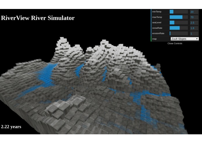
Snowy Slopes of RiverView Simulator

Inspiration
Water, such a calming yet powerful force, has the amazing ability to completely change the landscape over many years. With Riverview, we wanted to explore water’s cyclic nature and destructive capacity by looking at the effect winding rivers can have on real mountain terrains.
What it does
When you open our web app, you see a terrain with mountains, rivers, and snow. As you watch, seasons pass, and the environment reacts accordingly; snow falls, ice caps melt, and rivers form, shaping the mountainside.
RiverView is meant to be an interactive exploration, so the user can then manipulate the system by adjusting temperature ranges, sea level, snow and erosion rates, and even change the map to different famous mountain terrains!
How we built it
Our web app is built from scratch using javascript. The frontend is built using three.js.
Challenges we ran into
Going into this project, no one on the team knew javascript, so tackling this project at all was an interesting challenge for us.
It actually took us a long time to ideate at the beginning of the hackathon -- we only started hacking at around 5pm, after sitting down more than five hours earlier -- which was a little worrying, but it was certainly time well-spent. We may not have created the web app that will change the world as we know it, but we’ve really enjoyed the hackathon and learned way more than we would have otherwise, which we’re really proud of.
What we learned
None of us have ever used javascript (or created simulations) before, so this was a brand new experience for all of us. Half of our team is coming out of this with a lot of visualization experience, and the other half has gained a lot of general javascript and jQuery programming skills. We’ve had a ton of fun throughout this project, and are really excited to apply our new skills elsewhere!
What's next for RiverView
There are many ways to extend this project. In terms of features, we want to add more parameters to our simulator, to get a more accurate model. We also want to allow the user to dynamically change the landscape after loading a map, such as adding mountains or water sources.
For the big picture, we hope to get RiverView usable and accurate enough that it can be used in secondary school geology classrooms across the world, because we think that being able to interact with geology is a much more engaging way to learn important concepts such as erosion and terrain formation!
Built With
- html
- javascript
- jquery
- three.js
- wolfram-mathematica


Log in or sign up for Devpost to join the conversation.