-
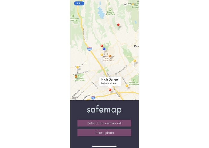
Home view
-
Assessment of danger


Inspiration
There are lots of dangerous areas and there is no good way for people to report dangerous situations. Parents may want their child to avoid dangerous areas and they don't know where it is currently safe.
What it does
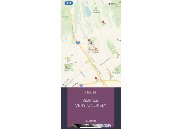
The app lets users take photos of situations that they believe are dangerous, checks to see if it is actually dangerous, and displays those on a map for the community to see.
How we built it
We built the app using react native for the front end, Firebase for the backend, and Google Cloud Vision and Natural Language Processing to verify dangerous situations.
Challenges we ran into
We ran into challenges of setting up the Firebase backend system, as well as getting our app to run smoothly across platforms.
Accomplishments that we're proud of
We are proud of setting up a system where we allow users to take photos and successfully processing the image and rendering locations using Firebase.
What we learned
We learned how to use react native, build apps, use APIs, and use Firebase.
What's next for Safemap
Next, we want to add a feature where we can route people around dangerous places to keep them safer.
Built With
- expo.io
- firebase
- google-cloud
- google-maps
- google-vision
- natural-language-processing
- react-native
- react-native-maps


Log in or sign up for Devpost to join the conversation.