-
-
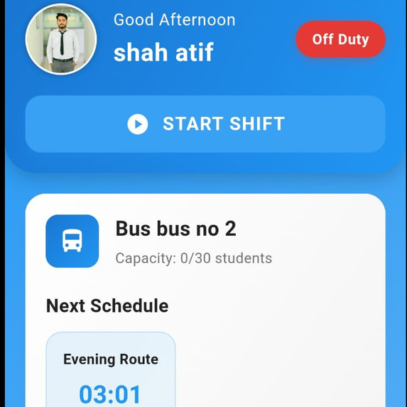
Driver Dashboard
-
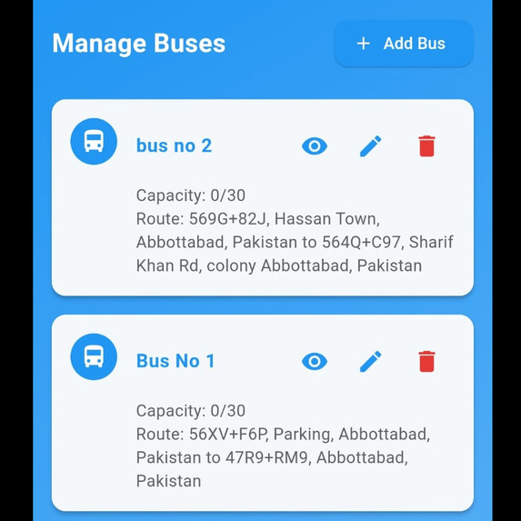
Admin Manage Buses
-
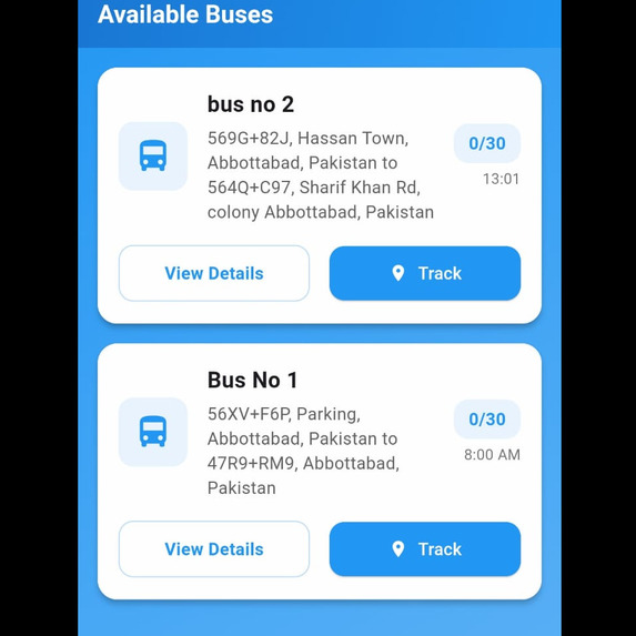
Student Dashboard
-
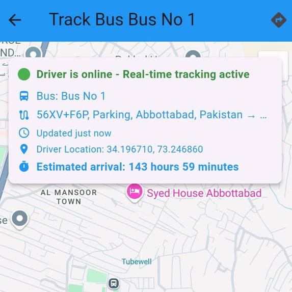
Student(Bus Tracking Screen)
-
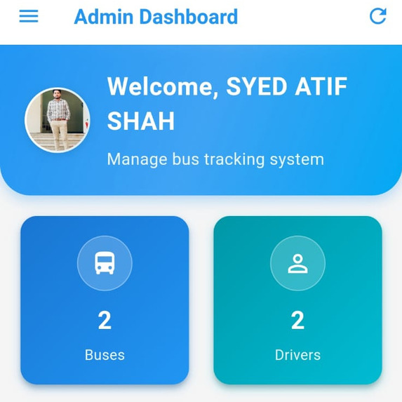
Admin Dashboard


🚌 Real-Time Bus Tracking System
“Public transport should never feel like a mystery. Technology makes it transparent.”
💡 Inspiration
The idea behind the Real-Time Bus Tracking System was sparked by a common frustration: not knowing when your bus will arrive, where it currently is, or how long the wait might be especially in areas lacking organized transit systems.
Millions of daily commuters waste time and energy because of unreliable public transport information. Our team envisioned a modern, mobile-first solution that could eliminate the guesswork by delivering real-time GPS-based tracking, accessible to both passengers and system admins like school or university staff.
By transforming any smartphone into a tracking device and integrating a cloud-based backend, we created a platform that bridges the gap between users and moving vehicles in real time.
⚙️ What it does
The Real-Time Bus Tracking System offers a feature-rich experience for passengers and admin users:
- 🗺️ Live Bus Tracking – View real-time bus movement on Google Maps from any mobile device.
- ⏱️ ETA & Schedule Updates – Get notified of upcoming arrivals, delays, and route changes instantly.
- 🔐 Role-Based Access – Admins, drivers, and students each get their own interface and control panel.
- 📍 Driver-Side GPS Sync – The driver’s device continuously pushes live location data to Firebase, visible to users.
- 🔄 Cross-Platform Access – Designed with Flutter, the app works seamlessly across both Android and iOS devices.
🛠️ How we built it
The project combines modern mobile app development, cloud database integration, and GPS technologies to provide a reliable tracking experience:
- 📱 Frontend – Built using Flutter for its expressive UI, fast performance, and multi-platform compatibility.
- ☁️ Backend – Firebase powers real-time updates, Firestore stores structured data, and Firebase Auth handles secure login.
- 📡 Location Services – The driver app continuously shares coordinates, enabling users to view exact bus location via Google Maps API.
- 🔑 Authentication System – Secure role-based login ensures that only authorized users can access admin features.
- 🛠️ Modular Codebase – The codebase is organized to support easy scaling, modular service injection, and dynamic role rendering.
🧗 Challenges we ran into
Building a real-time location system isn't as straightforward as it seems. Our key challenges included:
- ⚡ Low Latency GPS Sync – Minimizing the time delay between location sharing and user updates was essential to ensure true real-time tracking.
- 📵 Permission & Compatibility – Getting consistent GPS accuracy across devices while handling permissions proved to be device-sensitive.
- 🔐 User Role Logic – Designing and implementing clear separation of functionality and UI between admin, driver, and student roles.
🏆 Accomplishments that we're proud of
Despite these hurdles, we’re proud to have built a fully functional tracking solution that:
- ✅ Tracks Buses Live with Real-time Map Updates
- ✅ Handles Multi-role User Authentication Seamlessly
- ✅ Delivers a Clean and Intuitive User Interface
- ✅ Reduces Waiting Time for Passengers
- ✅ Requires No Expensive Hardware – Just a smartphone and internet
The project not only worked in real-world simulation but also showed potential for wider deployment in schools, universities, and public bus fleets.
📚 What we learned
From this journey, we gained valuable experience in:
- 🛠️ Working with Firebase Ecosystem – Including Firestore, Realtime Database, Firebase Auth, and Firebase Hosting
- 📍 GPS & Maps Integration – Learned how to embed and customize Google Maps in Flutter and dynamically update coordinates
- 📦 Building for Scale – We developed an architecture that supports adding more buses, users, and routes without major changes
- 🧑💻 User Experience Design – Recognized the importance of smooth onboarding, clean layout, and device responsiveness
- 💡 Team Collaboration – Coordinated effectively under time pressure, managing tasks like debugging, testing, and design simultaneously
🚀 What's next for RTBTS
The current system is already functional—but we're only getting started.
🤖 AI/ML Integration Use AI to automate route optimization, predict delays based on traffic patterns, and generate personalized commuting suggestions.
📲 Smart Notifications Push notifications for arrival estimates, reroutes, breakdowns, or ETA changes—based on user location or saved favorites.
📡 Offline Mode Tracking Enable limited offline access by caching recent routes and updates, especially useful in low-connectivity zones.
🧠 Passenger Behavior Modeling Analyze usage patterns to adjust frequency, stops, and optimize schedules based on data.

Log in or sign up for Devpost to join the conversation.