Log inSign up
o2r
481 posts
@o2r_project

o2r

@o2r_project
Opening reproducible research in #GIScience and beyond @WWU_Muenster | #OpenScience #rstats #ReproducibleReserach #Docker #rspatial
Münster, Germany
o2r.info
Joined January 2016
255
Following
295
Followers
RepliesRepliesRepostsRepostsMediaMedia

Log in or sign up for X

See what’s happening and join the conversation

Continue with phone
or
Log in with username or email
Terms·Privacy·Cookies·Accessibility·Ads Info·© 2026 X Corp.
  • @o2r_project
    o2r
    @o2r_project
    Apr 5, 2022
    📢🆕 New blog post: Talks, preprints, papers, and a leave of absence o2r.info/2022/04/05/tal… #CatchingUp
    Image
    GIF
  • @o2r_project
    o2r
    @o2r_project
    Aug 3, 2021
    📢 New blog post: o2r.info/2021/08/03/geo… o2r team member Sebastian Garzon presented his work on our tool {geoextent} at the recent @EarthCube annual meeting. Find out more about an initial assessment of the potential for geospatial metadata in @ZENODO_ORG!
    Exploring research data repositories with geoextent

    Sebastian Garzón and Nüst, Daniel. 2021. Exploring Research Data Repositories with geoextent. EarthCube annual meeting. Binder

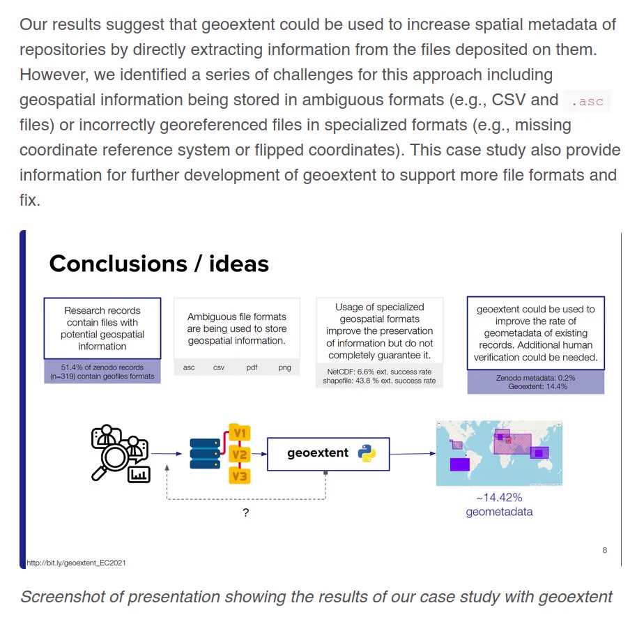
The notebook, accessible through Binder, includes an introduction of geoextent’s usage and a case study where we explored more than 300 Zenodo repositories (over 25.000 files!) with geoextent. An initial exploration of Zenodo’s API showed that spatial metadata is rarely available, difficulting data integration and discovery. The objective of our case study was to verify if we can increase the current percentage of repositories with geospatial information on Zenodo by using geoextent.
    Our results suggest that geoextent could be used to increase spatial metadata of repositories by directly extracting information from the files deposited on them. However, we identified a series of challenges for this approach including geospatial information being stored in ambiguous formats (e.g., CSV and .asc files) or incorrectly georeferenced files in specialized formats (e.g., missing coordinate reference system or flipped coordinates). This case study also provide information for further development of geoextent to support more file formats and fix.
    1
  • @o2r_project
    o2r
    @o2r_project
    Jul 8, 2021
    A new blog post about the latest preprint from o2r team member @nordholmen. o2r.info/2021/07/08/new… #ReproducibleResearch #GIScience #o2r #ResearchCompendium
    This Post is from an account that no longer exists. Learn more
  • @o2r_project
    o2r
    @o2r_project
    Apr 16, 2021
    @o2r_project team member Daniel Nüst @nordholmen is glad to participate in the @knowexchange group Reproducible Research Outcomes (RRO). This survey conducted by @rschconsulting is a great effort to capture the #ReproducibleResearch landscape and helpful input for the RRO team.
    @knowexchange
    Knowledge Exchange
    @knowexchange
    Apr 15, 2021
    .Our latest work with @rschconsulting presents an overview of the research reproducibility landscape, focusing on publication and dissemination. See a summary of key findings below and read the full report here: bit.ly/KEPRROLitReview @drAChiarelli @LoffredaLucia @rschrobUK
    Image
  • @o2r_project
    o2r
    @o2r_project
    Dec 22, 2020
    New blog post: o2r student assistants Tom @herrniers and Nick present their Bachelor theses 🎉 o2r.info/2020/12/22/bac… Big thanks to both - it's great when up-and-coming researchers and research software engineers advance the state of the art in #OpenSciene #ScienceCommunication
    Screenshot of geoOJS – input of geospatial metadata, author can define temporal properties by calendar view, spatial properties by drawing or accept them by suggestions
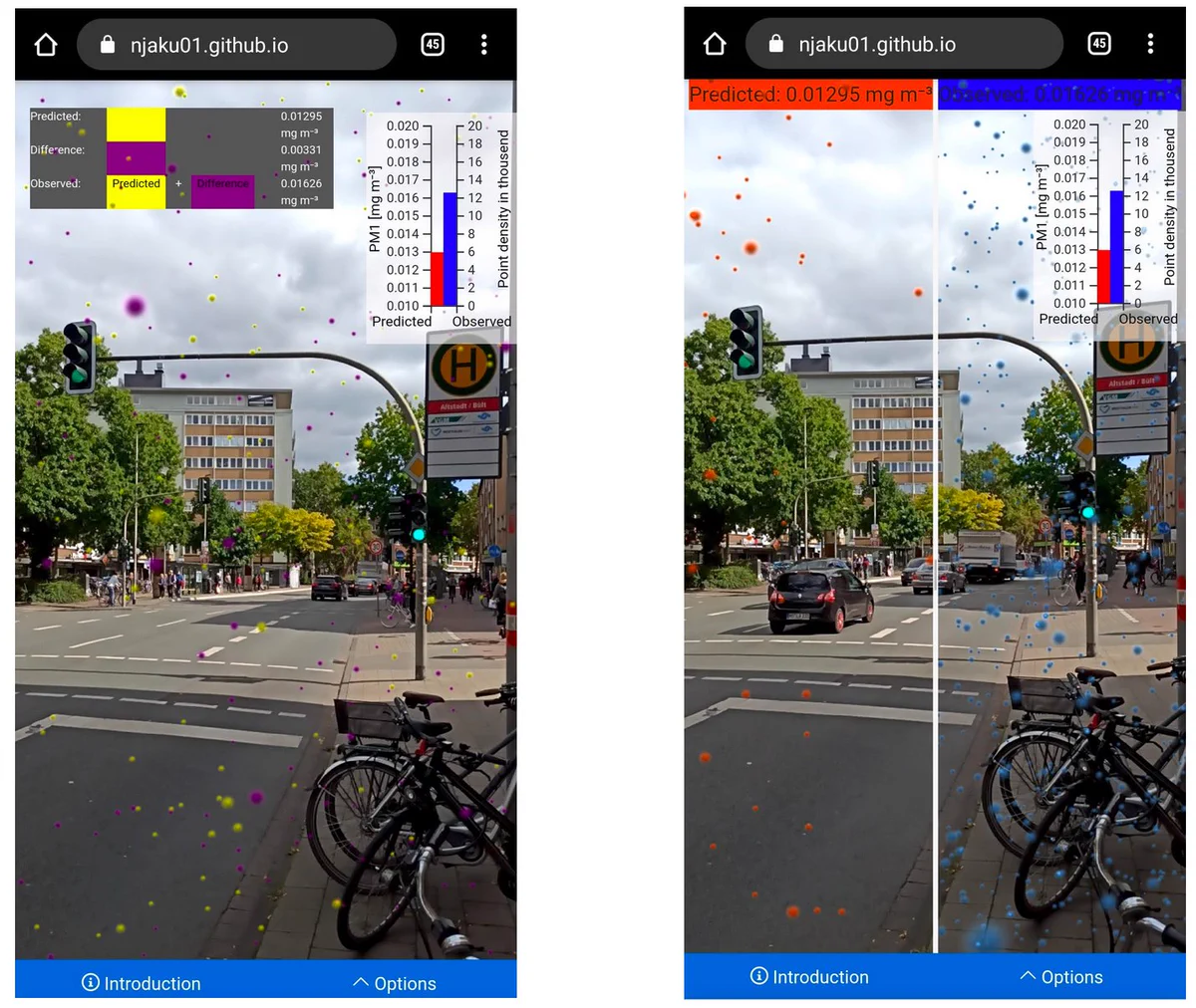
    Screenshots of the Augmented Reality application to convey spatio-temporal results showing results of the paper in two different views.
Advertisement
Advertisement