AI-Powered Earth Observation v2.0 Live
Unlock Earth’s
Intelligence
Transform satellite imagery into actionable insights. Monitor land, detect changes, and make data-driven decisions with AI-powered earth observation.
Trusted by 500+ teams
Crop Health
98% Optimal
New Construction
+12 Detected
Our Partners
Collaborating with global leaders in Geospatial technology


Powerful Earth Observation Tools
Everything you need to analyze satellite data. From raw imagery to processed intelligence.
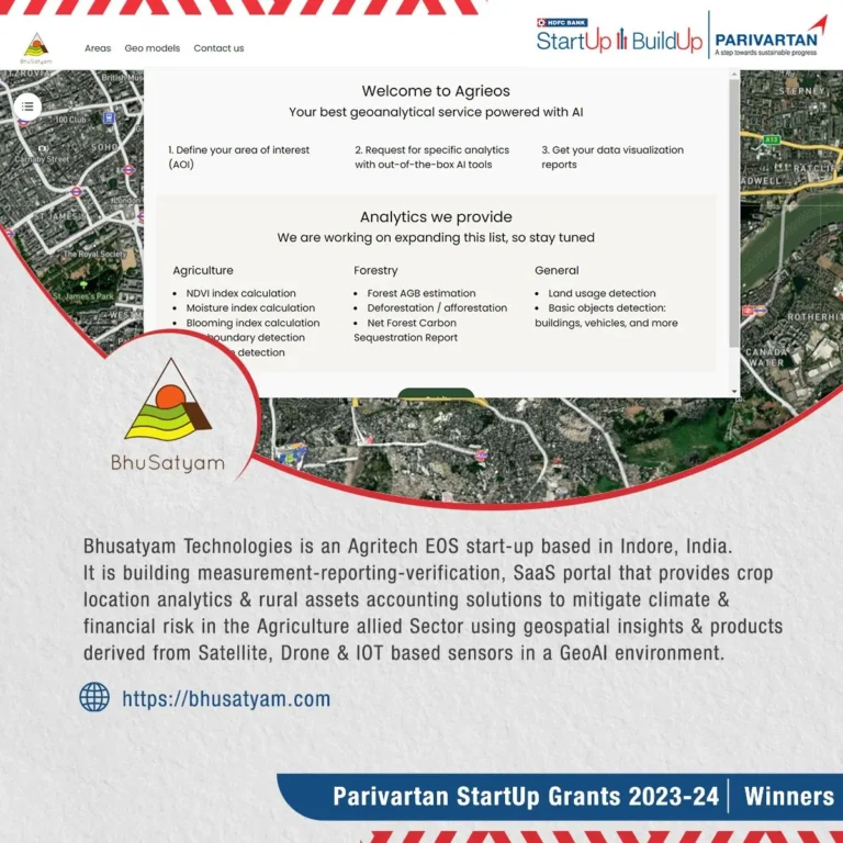
SatSight Dashboard
Interactive map-based platform for comprehensive land analysis. Search, evaluate, and generate reports effortlessly with our intuitive UI.
Vegetation Monitoring
Track NDVI changes, detect deforestation, and monitor crop health with historical comparison tools that go back up to 5 years.
Construction Detection
AI-powered building detection to identify new constructions, unauthorized structures, and track urban growth patterns automatically.
High-Resolution Imagery
Access the latest satellite imagery with multi-spectral analysis and temporal comparisons. Supports up to 30cm resolution.
Get Started in Minutes
1. Search Location
Enter any address or coordinates to find your area of interest instantly.
2. Draw & Analyze
Draw your field boundary and select the AI models you want to run.
3. Get Insights
Receive detailed reports, downloadable data, and actionable recommendations.
Simple, Transparent Pricing
Start free, upgrade when you need more power.
Starter
- check_circle 5 analyses/month
- check_circle Basic NDVI
- check_circle Email support
Professional
- check_circle 100 analyses/month
- check_circle All Pro tools
- check_circle Priority support
- check_circle API Access
Enterprise
- check_circle Unlimited analyses
- check_circle Custom integrations
- check_circle Dedicated support
- check_circle Custom SLA
Meet Our Team
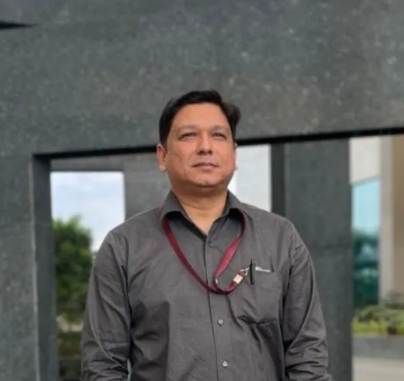
Dr. Naveen R Shahi
Founder & CEO

Sujoy Nath
Machine Learning Engineer

Rajat Dhakad
Full Stack Developer (JAVA)

Aryan Das
Data Scientist
Our Advisors

Dr. Swalpa Kumar Roy
AI Advisor

Dr. Sanjay Sharma
Agriculture Advisor
See Bhusatyam EOS in Action
Watch how our AI-powered platform transforms satellite data into actionable intelligence.
What Our Clients Say
star
star
star
star
“Bhusatyam EOS has revolutionized how we monitor our agricultural assets. The vegetation analysis is incredibly accurate.”
Rajesh Kumar
AgriTech India
star
star
star
star
“The construction detection tool saves us hundreds of hours of manual surveying. A must-have for urban planning.”
Sarah Jenkins
Urban Dynamics
star
star
star
star
“Integration was seamless via API. We built our internal dashboard on top of Bhusatyam in less than a week.”
David Chen
TechLead, GeoWorks
Official Membership & Affiliation

Ready to Transform Your
Earth Observation?
Join 500+ organizations leveraging the power of Bhusatyam EOS to make smarter decisions.
Start Your Free Trial
No credit card required