-
-
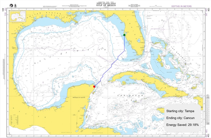
Optimized Path Plotted with 29.18% energy saved
-
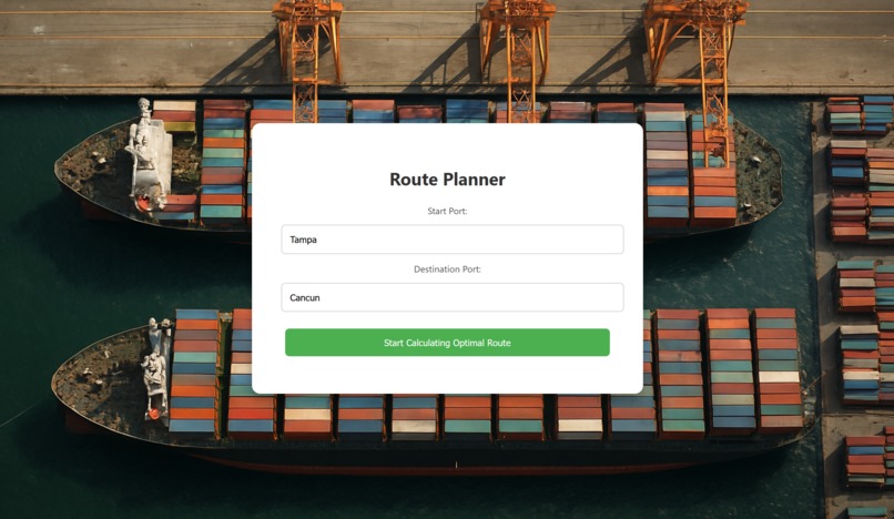
Starting Page to enter starting and destination cities
-
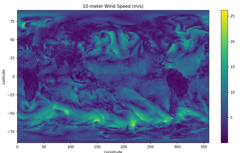
wind maps across the world
-
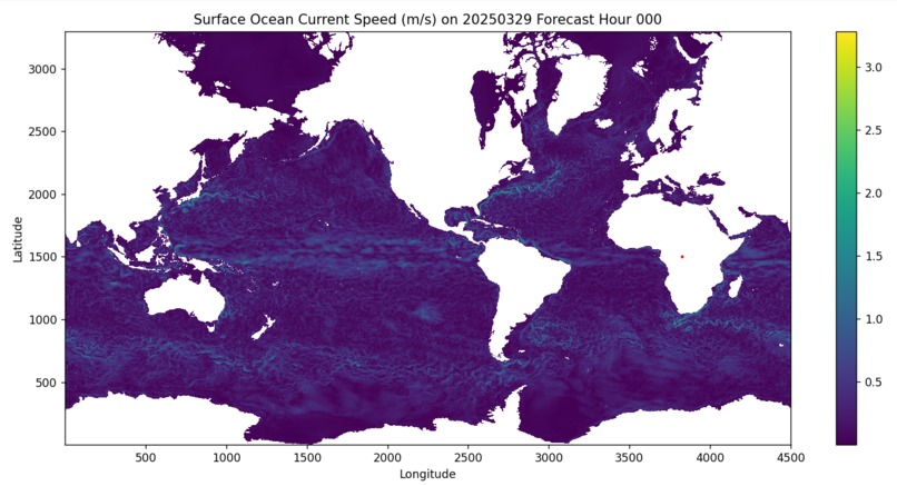
current maps across the world


Inspiration
In the modern age, maritime shipping has become a ubiquitous form of the shipping industry. It has become responsible for approximately 80% of shipping worldwide. However, this sector significantly contributes to environmental pollution, notably through carbon emissions. In 2022, international shipping alone was responsible for nearly 3% of the world's greenhouse gas emissions. Emissions from the shipping industry could also increase by up to 130% by 2050.
In the hopes of decreasing the carbon emissions from this large, growing industry, we have created BlueVect. An application for sustainable maritime shipping.
We aim to reduce fuel consumption, promote sustainability goals, and minimize environmental impact - all while maintaining reliable and resilient supply chains.
What it does
We have created a novel pathfinding algorithm to minimize the total fuel cost of a shipping route from port to port. BlueVect leverages wind and ocean current data from NOAA to determine how weather and climactic variables affect ship speed and fuel usage. By combining advanced A* pathfinding with vector-based force modeling, the website enables shipping companies to optimize operational efficiency while supporting their sustainability goals.
How we built it
The main website was built with pure HTML, CSS, and Javascript. The website connects into a python backend through flask. The modified A* algorithm itself was created from scratch. To find current and wind data for force calculations, data was pulled from the NOAA GFS and RTOFS datasets. The data maps current and wind vectors to points at every 0.25 latitude and longitude.
Challenges we ran into
To get impact of wind vectors on ship velocity, the resultant velocity is given as a function of a time differential and current velocity. Because of this, it took some time to think of utilizing Euler's method to approximate velocity given some time step size.
We had to massage the data into something we could use, and ran into many bugs/integration issues.
Accomplishments that we're proud of
We had to code an entire physics modeling system from scratch and implement that in a atypical path-finding problem, and somehow, we still made it work.
What we learned
We learned how to work with data-intensive algorithms and implement them into web applications. We also learned how to think through problems in terms of process and methods that we understood.
What's next for BlueVect
We want to host all our data on servers so that anyone can run the algorithm from the website. Since our algorithm is able to compile fairly fast, we can expand our search to much larger oceans rather than just the Gulf of Mexico. Ideally, we could compute the optimal shipping routes for even the largest routes, such as the North Pacific Shipping Lane.
We can greatly improve accuracy with finer latitude and longitude coordinates, and right now, some coordinates are rounded to land or coastlines, so a path may skim through land sometimes. This could be prevented with better sources and further data processing.

Log in or sign up for Devpost to join the conversation.