-
 GIF
GIF
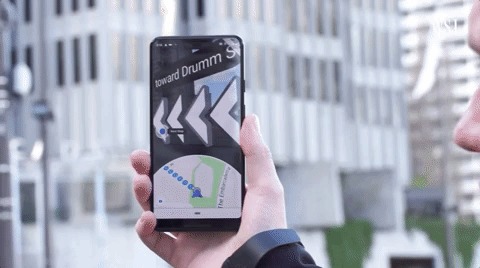
Outdoor Navigation System build using GPS, digital compasses, and motion tracking.
-
 GIF
GIF
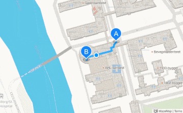
Indoor Navigation System Map Interface Overview
-
 GIF
GIF
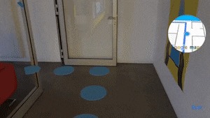
Indoor Navigation Using Augumented Reality and Wi-Fi Positioning System
-
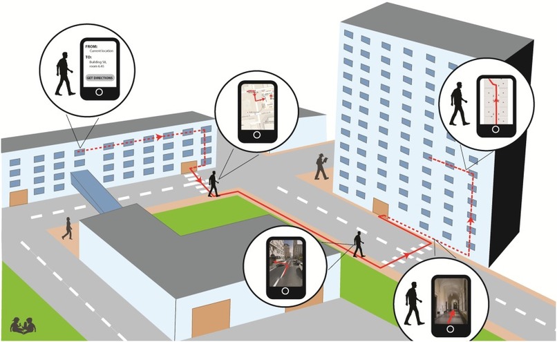
Indoor and Outdoor Navigation System Overview
-
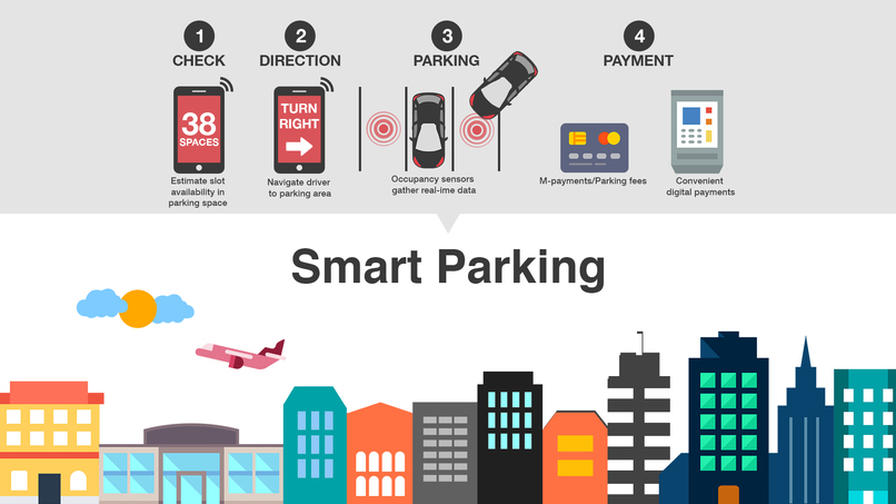
Smart Parking Management System using Internet of Things (IoT), IR sensor, and NodeMCU
-
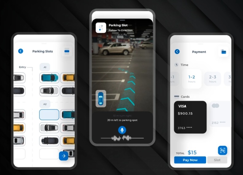
Parking lot navigation using Augumented Reality and Slot Reservation using mobile application.


Inspiration
Indoor Navigation is confusing especially in large buildings. The hard copy of the building layout is hard to guide the students, staff, and visitors. Visually impaired people always need an assistant to walk through a building or outside the campus. Parking is another major problem for everyone inside the campus. It is hard to find parking spots if the parking lot is crowded, If the visibility is poor during night times, and bad weather conditions then there is more probability of accidents in the parking lot.
What it does
It is a mobile application compatible with both android and IOS which will facilitate users with both indoor and outdoor navigation for all people along with physically handicapped persons. If the maps are confusing, then users can use their mobile phone camera to get a real-time navigation experience. After implementing indoor navigation then it is easier to find anyone or any classrooms inside the campus. It can also save lives by pressing an emergency button so that they can be located easily. The next problem is finding a parking spot for the vehicles entered into the university. Because of less parking space is difficult to find an open spot, especially during peak hours or in popular areas. Even after finding a parking spot, maneuvering in tight spaces can be challenging. In some parking lots, visibility can be poor, with limited lighting or obstructed views. The design of the parking lot itself can also pose challenges. For example, narrow aisles, sharp turns, or steep inclines. Parking lots can be hazardous places, with the risk of accidents, theft, or vandalism.
How we built it
Indoor Navigation System: Parameters Needed: Client's current location: Accuracy, Integrity, Availability, and Continuity Techniques for indoor Positioning: Location Fingerprinting, and Triangulation. Techniques for determining line of sight: Cell of Origin, Angle of Arrival, Angle Difference of Arrival, Time of Arrival, and Time Difference of Arrival. Triangulation Technique: Signal strength varies with the inverse of the square of the distance between transmitter and receiver in free space. To accurately convert to distance in a real setting, factors such as antenna gains and interference from objects in the signal path must be accounted for.
Location Fingerprinting: Location fingerprinting is a technique that compares measured RSSI data to a database of expected values to estimate location. It is based on the sampling and recording of radio signal behavior patterns in specific environments.
Algorithms Used For Indoor Positioning: Android and iOS Pedometer algorithm: Estimates the length and moment of a person's steps based on accelerometer readings. Complementary filter algorithm: Evaluates spatial orientation by combining data from the gyroscope, magnetometer, and accelerometer. Based on RSSI readings, the position estimator calculates the current location as the position of the nearest transmitter (an RSSI-based algorithm for indoor localization). Navigation via GNSS: GNSS positioning is combined with an indoor solution to provide seamless transitions between indoor and outdoor areas. Radiomap localization: Allows for the creation of a navigation system without the use of any additional equipment by measuring the radio map of the area and using it as a reference for a KNN algorithm. Augmented Reality Implementation: Location-based augmented reality apps are geo- and position-based AR solutions that can pinpoint the exact location. The app relies on GPS, digital compasses, motion tracking, or indoor positioning systems to accomplish this for indoor and outdoor AR navigation. Computer vision is used in navigation AR apps to render virtual objects in the scene and make them visually comprehensive. Smart Parking Management System: We will employ the IOT (Internet Of Things) concept, which relies on the collection of data and information from sensors via connectivity for usage by people and processes to take action or re-transmit the information to another embedded system. This is done using the Python programming language. Magnetic Sensors: The wireless magnetic sensor is made to detect parking space availability and be installed on streets. In asphalt or other types of road pavement, sensors are installed. When a car is parked overhead, the sensor reacts to the earth’s magnetic field shift. Payment Integration using PayPal API based on the start and end time of parking.
Challenges we ran into
Hard time in figuring out which technology is suitable for Indoor Positioning System. There are different ways to do it based on Bluetooth beacons, wifi modules, and IR sensors. Finally, we decided to go with the Wifi based indoor navigation as the campus building has access points all over the building. Integrating Augmented Reality with the application is another major task that needs to be accomplished.
Accomplishments that we're proud of
Able to implement the indoor navigation system using wifi triangulation, location fingerprinting, and different algorithms. It is built using the java programming language for the backend API and react-native for the frontend. For database
What we learned
Analyzing different business scenarios that need solutions. Implementing innovative ideas into the real-world application using different web development technologies
What's next for Campus Navigator
Integrating the Augmented Reality with the on-campus navigator app. Adding a Panic Button feature to the application to report any emergency inside the campus.


Log in or sign up for Devpost to join the conversation.