-
Crisis Matters in Pittsburgh, PA

Inspiration
We saw a lack of cohesion between public safety and communication. In a day and age where technology and internet communication is so prevalent, there is still a distinct divide between incidence reporting and public awareness. Our inspiration was helping the public stay safe and be aware and involved within their community.
What it does
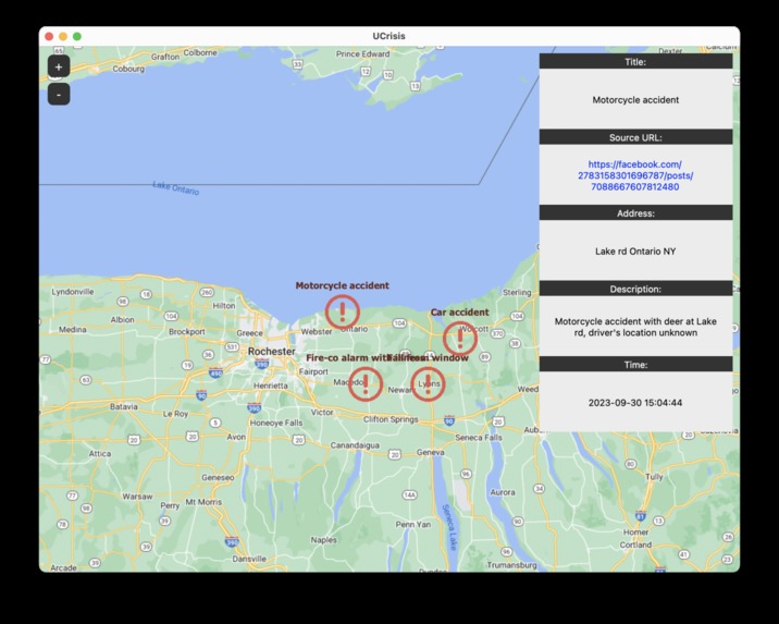
Crisis Mapper alerts users of incidence reports in their area. Given a user's location, they are provided a map of media reports in their area regarding safety, public affairs, and more. Through Crisis Matters, users are able to see the report's source, descriptions, and recency. They can explore areas across the world and search through individual reports.
How we built it
We utilized Tkinter (a Python framework) for front end development, and Facebook-scraping, open-ai, CSV, and Pandas for backend. We start with an open map, send over users' location (by input), search through our database, identify key issues/reports, and plot this information on the map for the user to interact with.
Challenges we ran into
We had a very limited data-pool for our project, which we hope to expand on in further development. We will also need to work on handling mass data, as our current plan does not support this.
Accomplishments that we're proud of
We were able to utilize several APIs, frameworks, and concepts that we did not previously know to curate a project that can benefit our community.
What we learned
We learned to utilize CSV to communicate between different scripts.
What's next for Crisis Mapper
Deploying to iOS and developing better data collection.


Log in or sign up for Devpost to join the conversation.