-
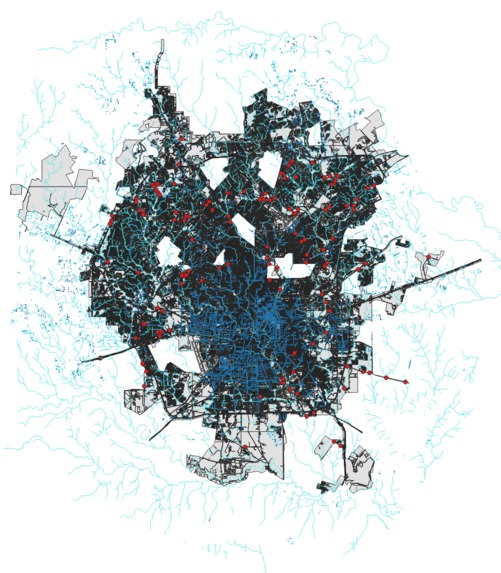
San Antonio Surface/Underground Waterways and Low Water Crossings, overlaid on Impervious Cover
-

Unfortunately, the USGS elevation map downloader had an outage Saturday night through Sunday morning.
-
After finding a DEM data source, I was able to begin integrating digital elevation maps.


Inspiration
Commercial and residential land development poses many environmental challenges for humans and wildlife alike. Development must strike a balance between societal needs, ecological conservation, and the economic feasibility of both. One large area of concern is water management. San Antonio is prone to experiencing both flash flooding and extended periods of drought, so adequate storm drainage and aquifer recharging are paramount to our city's resiliency in the coming decades.
What it does
This map depicts surface water channels and underground stormwater drainage, as well as low water crossings, overlaid on impervious ground cover such as roads and buildings in San Antonio.
How I built it
ChatGPT4 was instrumental in structuring this project. Through querying, I learned about available GIS software and chose QGIS (Quantum Geographic Information System) for its beginner-friendly GUI, robust file support, plugin extension availability, extensive documentation, and free/open-source status. ChatGPT4 also assisted in creating python scripts to scrape web data for importation into QGIS.
Challenges I ran into
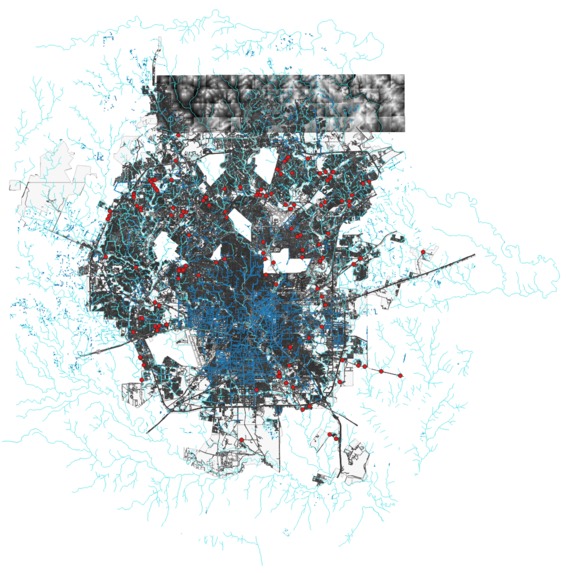
The availability of Digital Elevation Model data. The USGS open source data downloader experienced an outage for the duration of the hackathon, and many other sources were paywalled. I eventually found data from the Texas Natural Resources Information System DataHub, but its piecewise nature has increased the complexity of importing it into QGIS, so I was unable to complete this stage in time to continue onto the modelling phase.
Accomplishments that I'm proud of
I'm a math/stats major, not a programmer, so I was delighted when I got images to appear in QGIS. Each layer I added was a victory, and while I wasn't able to complete any modelling, I'm really proud of producing something from literally zero starting knowledge.
What I learned
Over the course of this project, I learned a lot about GIS data (literally everything I know, since I started at zero!). I spent a lot of time reading through data documentation to understand what I was looking at, as well as getting an introduction to the power and potential of GIS data. I definitely look forward to incorporating this modality in future data projects.
What's next for Flow210
Integrating piecewise DEM data into my GIS map. With elevation data, I hope to be able to model the flow of water through San Antonio. In the future, this could be combined with precipitation data to monitor and forecast aquifer recharge rates, aiding water security planning.
Built With
- chatgpt
- python
- qgis

Log in or sign up for Devpost to join the conversation.