-
-
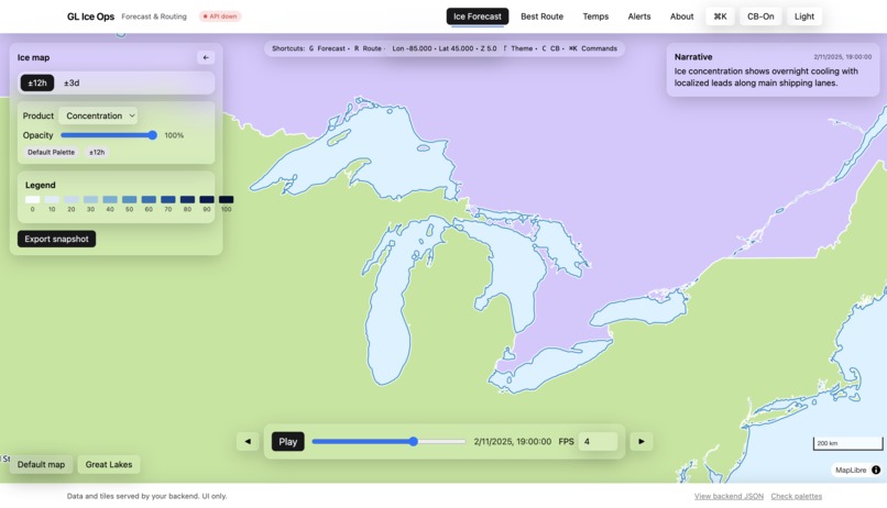
UI Showcase
-
Route Planner Showcase
-
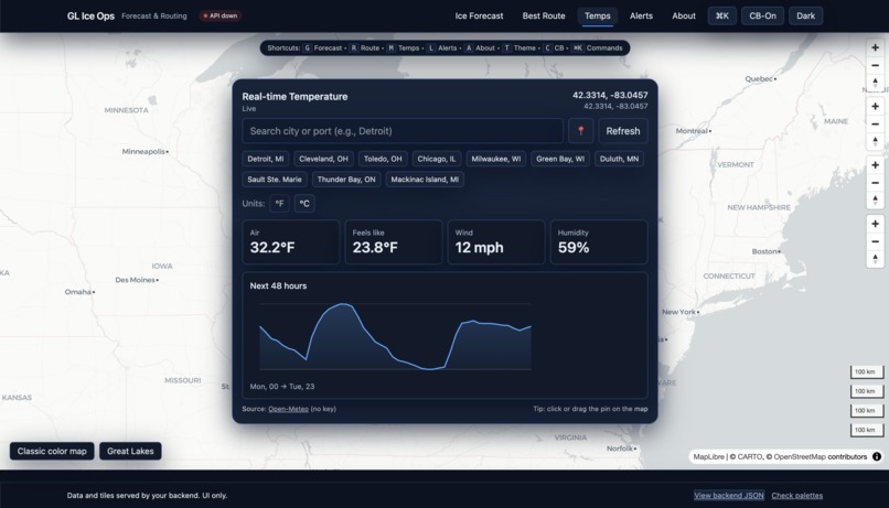
Temperature Showcase
-
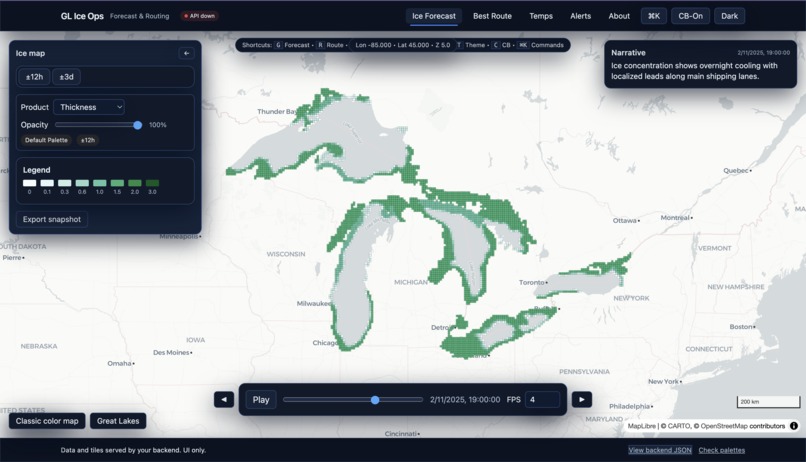
Ice Thickness Showcase
-
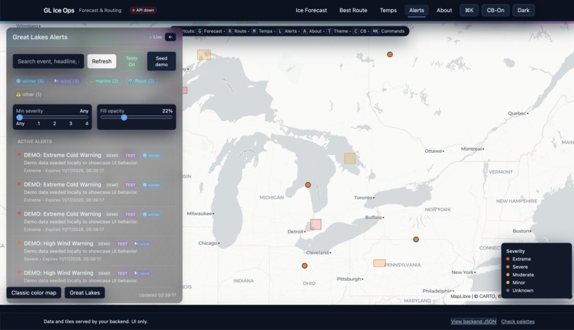
Alerts Showcase


📄 License
This project is open source under the MIT License.
Full license text is available in the LICENSE file in the repository.
How We Built the Ice Forecast and Routing System – Our Modeling Approach
We approached the problem like an operations team would: start from the data you can trust, then layer on simple, explainable models that run fast. We used 21 days of GLSEA lake-surface temperature NetCDF data as our training window and fit a global AR(1) model ((T_{t+1} = \alpha T_t + \beta)) to forecast surface temperatures four days ahead. For the test period, we took the provided GLSEA initial condition, ran the AR(1) model forward, and applied a physics-motivated heuristic to convert near-freezing water into ice concentration, thickness, and coarse ice-type classes.
Those gridded fields were downsampled into GeoJSON polygons tagged by product and forecast time, which the frontend renders as interactive forecast layers. For routing, we combined a land mask (land = impassable) with the forecasted ice polygons to generate a cost grid where heavier ice means higher cost. An A* pathfinding algorithm then produces routes that avoid land and prefer lower-ice corridors. The result is a lightweight, fully local pipeline that turns raw Great Lakes datasets into clear maps, narrative summaries, and advisory ship routes in the browser.
📖 About the Project
In winter, Great Lakes operators need fast answers to questions like:
- What will ice look like along this route in the next few days?
- Is there a safer path that still fits our schedule?
- How are lake temperatures changing near key choke points?
IceScope GL (our Great Lakes Ice Ops prototype) pulls these pieces together in one interface with three panels:
🧊 Ice Forecast
- 4-day ice products: Concentration, Thickness, Type
- Playback bar with frame stepping and speed control
- Legends fetched from backend (or fallbacks), color-blind-friendly when enabled
- Export map snapshots for briefings and reports
🧭 Best Route
Advisory routing across the Great Lakes with:
- Port presets (Detroit, Chicago, Duluth, etc.)
- Draggable start/destination markers + quick swap button
- Vessel inputs: draft, ice class, speed
Backend cost grid:
- Land polygons → impassable
- Ice polygons → higher cost where concentration rises
A* pathfinder returns a route that:
- Never crosses land
- Prefers lower-ice corridors
- Stays between requested ports
Returned as GeoJSON, overlaid on the live map, exportable or shareable via URL params.
🌡 Temps
- Current lake temperatures + 48-hour outlook
- Powered by Open-Meteo (no API key)
- °F / °C toggle
- Quick-pick chips to jump between basins
🔮 Future Work
- Stronger forecast models
Replace the AR(1) baseline with ConvLSTM or other spatiotemporal models trained on multi-year GLSEA + ice data. - Weather coupling
Add wind, air temperature, and wave forecasts (GFS/HRRR) so ice evolution responds to storms and cold outbreaks. - Vessel-specific risk
Include draft, power, and certified ice class directly in the routing cost to produce ship-specific safe tracks. - Multi-criteria routing
Let users choose between shortest time, lowest ice exposure, or lowest fuel use and display multiple candidate routes. - Interactive “what-if” tools
Drag waypoints, adjust tolerance to heavy ice, lock corridors, and instantly re-run A* with updated constraints. - Operational integration
Export layers and routes in standard formats usable by Coast Guard and commercial navigation systems.
🌐 Live Demo
🔗 https://mi-space-hackathon-2025.vercel.app
🛠 Built With
👍 Like This Project?
If you enjoyed it, please give the repo a star ⭐

Built With
- a*
- ar(1)-modeling
- geojson
- maplibre-gl
- numpy
- pathfinder
- python
- react
- tailwind-css
- vite
- xarray


Log in or sign up for Devpost to join the conversation.