-
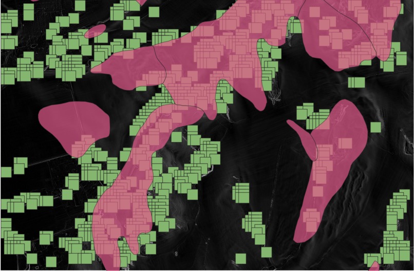
prediction and ground truth together (green prediction, pink truth), bigger area
-
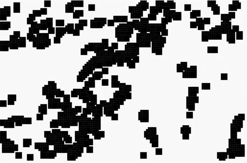
our prediction
-

correct img
-
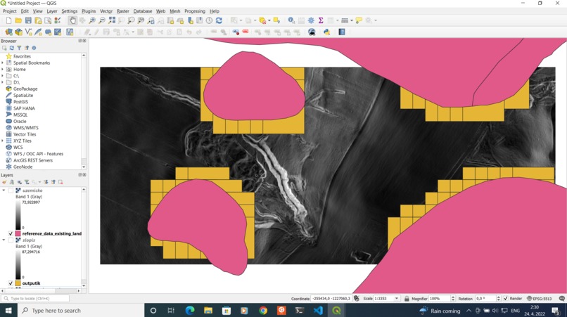
prediction and ground truth together (yellow is prediction), very small image
-
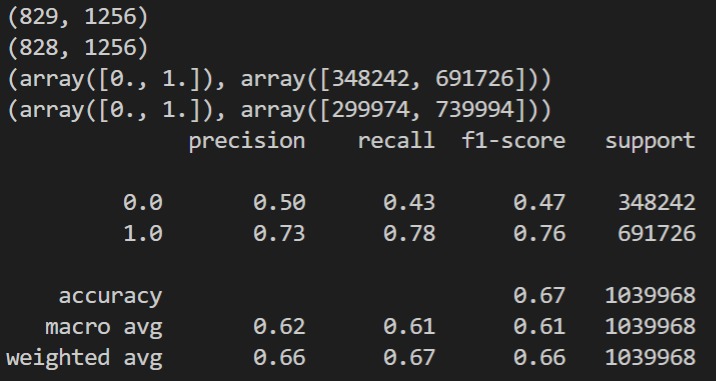
evaluation of the bigger prediction (0s are landslides, 1s are not)


Inspiration
What it does
The main test_learn.ipynb expects a tif file, that represents the slopes of the area. It also expects the correct solutions of what areas are landslides.
Then, it selects a training area, which it converts to an array of 0s and 1s describing whether a given square is a landslide or not. Then it learns using linear model regression the relationship between the slopes in a square_size window with the landslide valuse. Finally, it produces shapefiles that can be visualized in QGIS which are our predictions of landslides in the designated test area.
There is a file compare.py, that evaluates our prediction based on black and white images.
How we built it
Challenges we ran into
Accomplishments that we're proud of
What we learned
What's next for Kolkoo?
Built With
- python
- qgis


Log in or sign up for Devpost to join the conversation.