-
-
Park Review
-
Main Page
-
Park Information
-
Parks Near Me


Inspiration
Ever since the city was announced to be under a state of emergency and the new travel restrictions were implemented, it has become more challenging to spend time outdoors. Recently the government has released a 3 stage plan, stage one is basically lifting some restrictions on public and outdoor open spaces. It is important to understand that social distancing is still very important even with public spaces opening up so we wanted to create a platform that would allow users to locate parks and see various statistics about the parks, when the peak hours of the park are, such as how many people have visited during peak hours, and other tasks.
The frontline workers are today’s heroes and they are trying their best to terminate the coronavirus, one patient at a time, so the rest of us should do our part in helping terminate this disease by keeping the community safe and healthy. We want to help flatten the curve by helping people stay safe by practicing social distancing when going outside and being more conscious of their environment and surroundings.
What it does
Our web page is a tool that allows individuals within a community to be informed, stay safe, and stay healthy during a global crisis.
How I built it
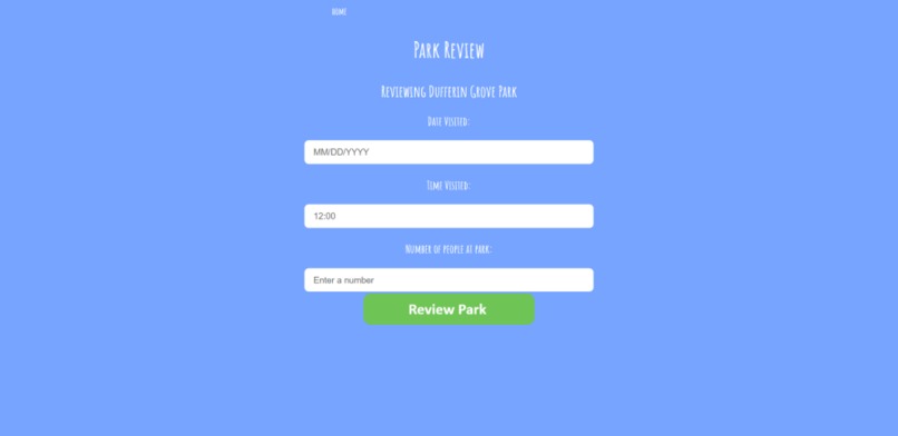
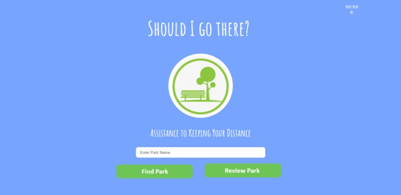
The name of our web application is Should I Go There and it was developed using HTML, CSS, and javascript. Our first goal was to create a simple design with an easy-to-use User Interface. When users arrive on the home page there is a search bar provided for users to enter the name of a park. The search bar uses GooglePlaces API to find the name of the park and allow users to continue with the features of the application. Then, users have two options to continue with their entered park name. They can either leave a review for the entered park or find more information about a park. If they choose to leave a review for the entered park, they will be directed to a survey.
This survey is a fundamental part of how our web application works since we take crowdsourced data to generate statistics and information that people would know about the park. Users fill out data based on their latest visit to the park, which includes the date, time and an estimate on how many people were at the park at the same time as the user. This data would be stored using Firebase Realtime Database so the information could be uploaded in realtime.
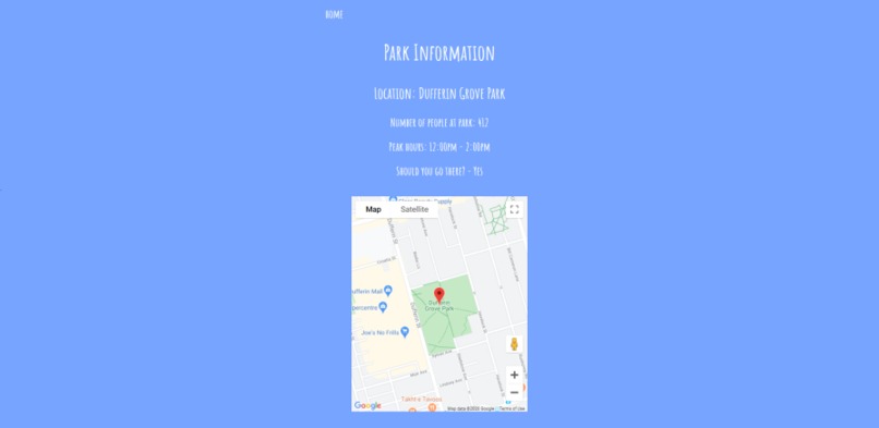
If the user decides to see the information about their chosen park, they can click the find park button. This page shows the average number of people, the peak hours of the park for that day, and whether or not the users should go to the park. If the amount of people at the park is over 20% of the maximum capacity of the park or cannot follow the city guidelines, then the webpage will advise users to not go to the park.
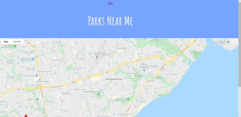
The last feature of our application is the ability to find parks near you. This was created with a GoogleMaps API that places markers on various parks in the area.
Challenges I ran into
We ran into various challenges with implementing API’s as it is something we are not very familiar with. We had to go through pages of documentation to understand the way they are implemented.
Another major issue we ran into occurred when we began using firebase to store data and upload the “find a park” page in realtime. It proved difficult to implement a function that would allow us to take in multiple data entries and create a text file which would then be uploaded to the data storage and called to by the find a park page.
Accomplishments that I'm proud of
One of the many accomplishments the team is proud of, would be the implementation of google’s maps API. Proven to be challenging at first, the team overcame the problem and found a solution to it. Since the very app itself relies heavily on location this implementation makes it much easier for the users to experience our app to its fullest potential.
What I learned
We learned how to implement the google maps API as well as the google place API. We also gained some basic/advanced knowledge on visual studio and the development of web apps using javascript and html.
What's next for shouldIgothere
We hope to expand this web page to be more than just for parks. This idea could be expanded to grocery stores, retail stores, banks, restaurants, or any public place. It would be useful to have for the upcoming months as quarantine restrictions are being lifted so more people would want to be aware of where high volumes of people are. The more people that are aware, the more we can do our part to flatten the curve.


Log in or sign up for Devpost to join the conversation.