-
-
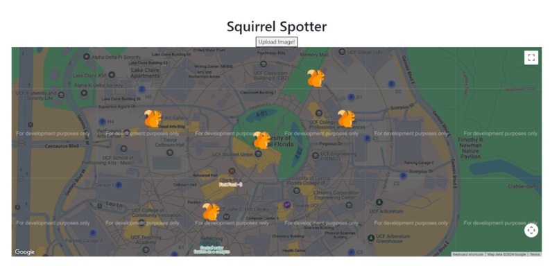
Main Page (Intended)
-
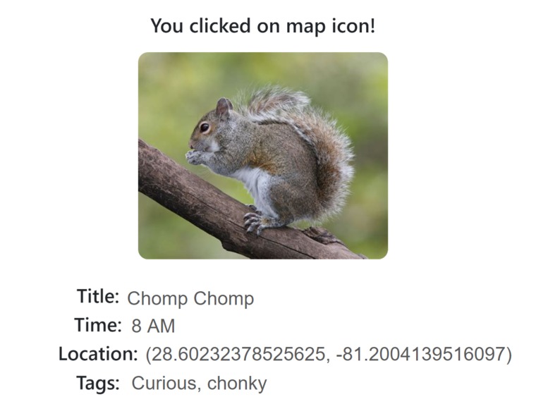
Squirrel Report (Intended)
-
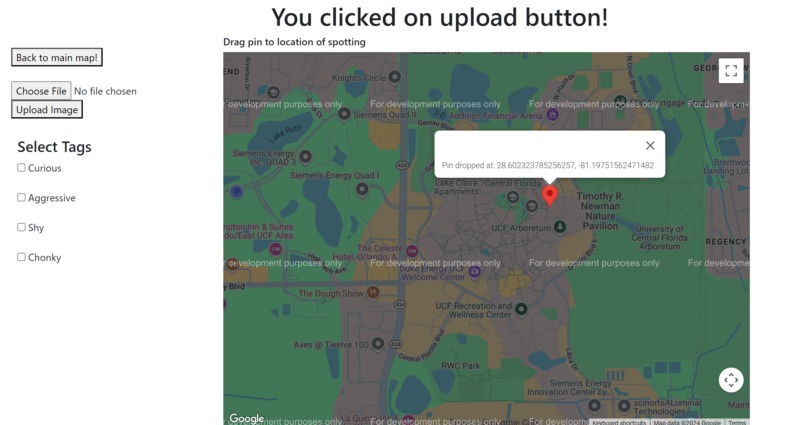
Upload Squirrel (before)
-
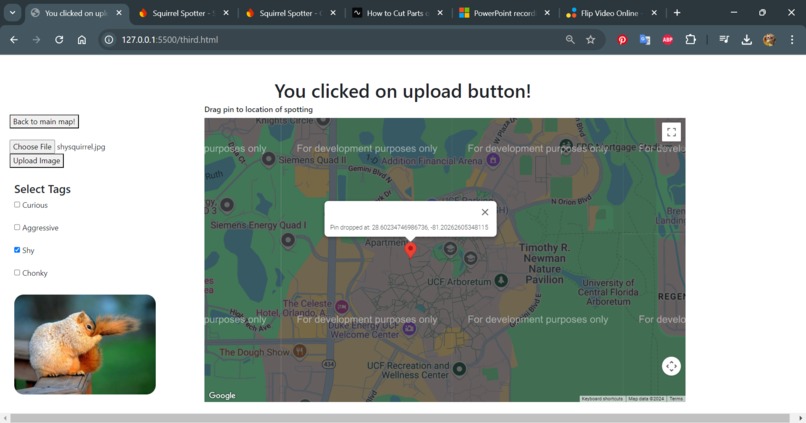
Upload Squirrel (after)


Inspiration
UCF is home to a diverse selection of flora and fauna. But perhaps the most important of them all … squirrels! However, if you wish to bask in the cuteness that is the UCF squirrels, you first need to find them. This can pose a challenge.
What it does
This is a work-in-progress website. Users report squirrels they find by uploading pictures. During the picture upload, they can add tags and drop a marker on the location they found it at. This adds geographical coordinates to the database which will be used to map each squirrel's location on the main map. You can see when the squirrel was reported and where it was seen.
How we built it
Using Google Maps API, we developed a map where you can find the location of your local squirrels. We used HTML, CSS, and Javascript for the website and Firebase to store squirrel reportings.
Challenges we ran into
- Map Markers: Figuring out how to get marker locations to show up on the map
- Project Scope: First time working on a project with Google Maps API and Firebase
Accomplishments that we're proud of
- Getting the squirrel map marker to load onto the map
- Enabling users to upload data
- Collecting and storing data in a database
What we learned
- How to integrate external APIs and databases
- Use GitHub version control techniques
- Effective project management techniques to tackle large, complex projects
What's next for Squirrel Spotter
Once the project is finished, we would be interested in finding ways to potentially apply to the local communities. One idea we had was to work with UCF Arboretum to help keep track of and verify the UCF squirrel population.


Log in or sign up for Devpost to join the conversation.