-
Application

Inspiration
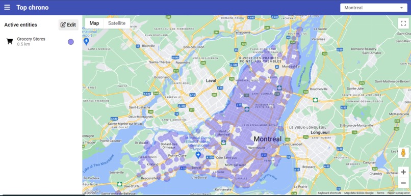
In a 15-minute city, ideally, every service is available in a 15-minute walk. We wanted to show, for the island of Montreal, where the services are available in the city
What it does
Top chrono is an interactive web-based map, in which we can see where in the island of Montreal we have services in a 15-minute-radius
How we built it
The Front-end uses Angular and the Google Map API for the map. The backend is a server ran by node to filter the data
Challenges we ran into
We initially had issues with filtering and finding the right data. We also had some technical difficulties with Angular and Google Maps while doing the Front-end. We also had quite a challenge doing the intersections for the polygons
Accomplishments that we're proud of
We were able to manipulate the polygons, to create intersections between them. We're also proud of our interface, which is good.
What we learned
We learned how to use the Google Map API. We also learned how to display zones and filter polygons in the backend
What's next for Top chrono
We could do score system, also add more services, add statictics and visualize a precise point


Log in or sign up for Devpost to join the conversation.