-
-
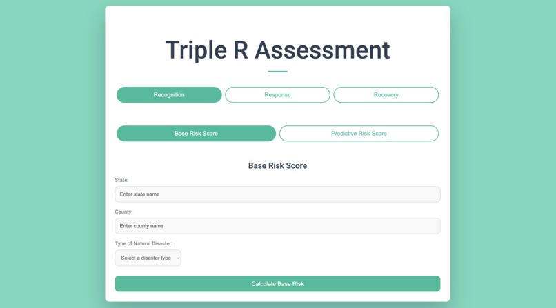
Home Screen that shows options for Recognition Tab
-
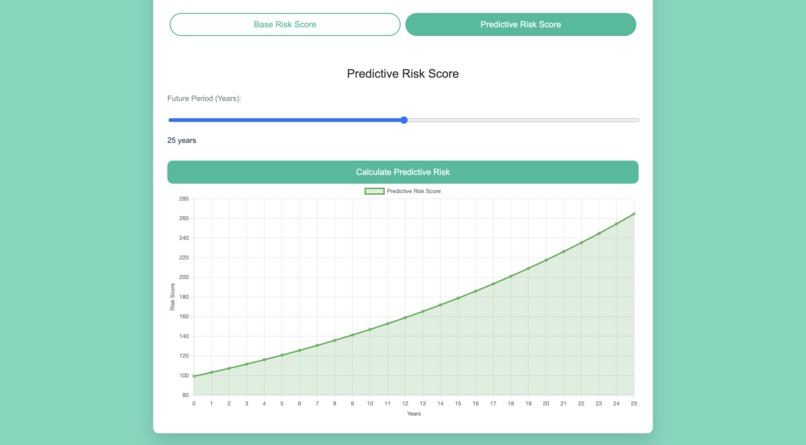
Predictive Model for future risk assessment scores based on climate change
-
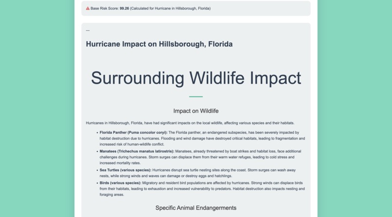
Natural Disaster impact that populates after State, County, and Natural Disaster is chosen.
-
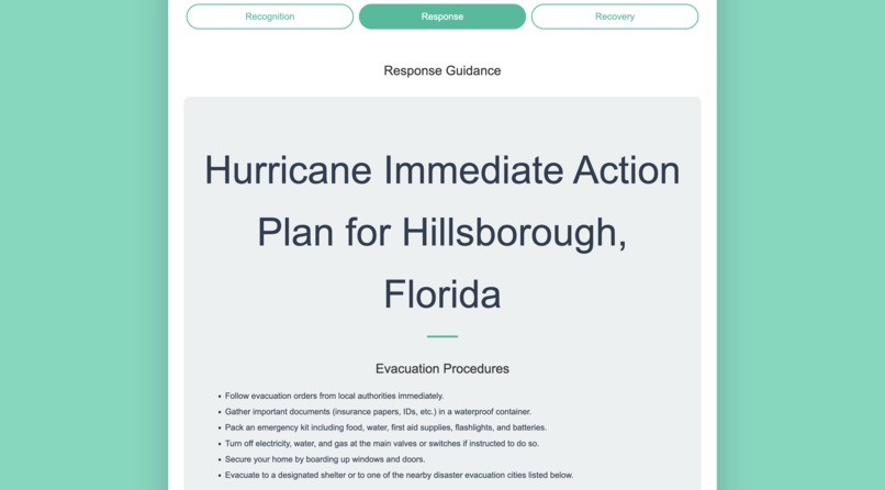
Response Tab with AI generated text about immediate natural disaster plans
-
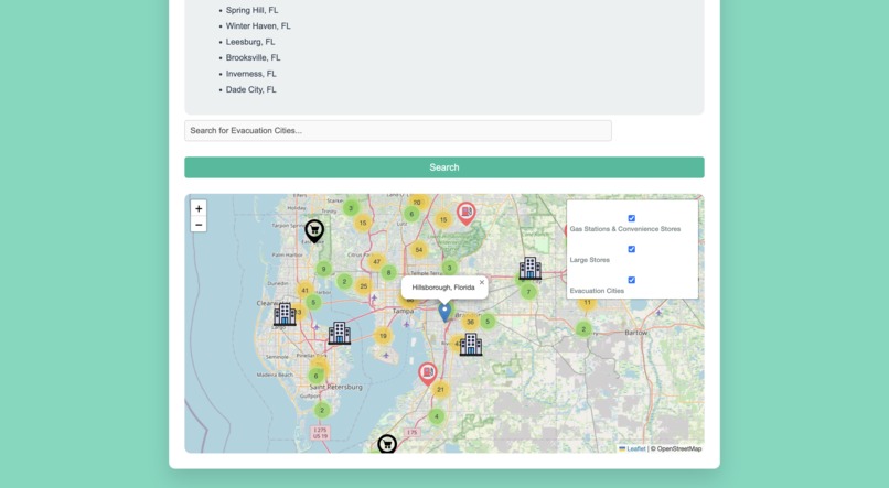
Map from response tab that shows selected county with nearby gas stations, evacuation cities, and grocery stores in a 40km radius
-
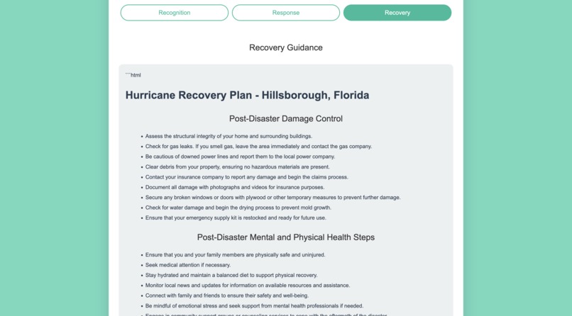
AI generated text under Recovery tab that displays recommended recovery methods and efforts
-
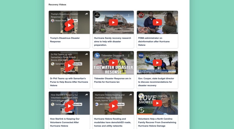
Related youtube videos under recovery tab


Inspiration
The inspiration behind Triple R came from witnessing the impact that natural disasters have on communities. Many people are unprepared and lack access to reliable, personalized guidance when these events occur. Our team envisioned a solution that could provide users with timely, location-specific information, helping them stay safe and navigate each phase of a disaster. We wanted a platform that empowers users by giving them the tools to Recognize risks, Respond effectively, and Recover quickly, all tailored to the unique risks of their area.
What it does
Triple R is a personalized natural disaster management platform that serves users across all U.S. counties. The tool provides:
- Recognition: Risk assessment based on real-time data for natural disasters in the user’s region, helping them stay prepared and informed. We also integrated a prediction model to show the risk assessment in the future to show how climate change affects natural disasters.
- Response: Guidance during active events. An interactive Map including driving routes, nearby important stores, Hospitals, and emergency contacts.
- Recovery: Resources to support users post-disaster, such as access to FEMA assistance, local community aid, helpful aid videos, and other recovery options.
By personalizing each step to the user’s location and specific disaster risks, Triple R equips users to handle emergencies effectively.
How we built it
Triple R was built with a blend of JavaScript, Python, CSS, and AI models from Watson X, which allowed us to leverage predictive analytics and tailor the experience for each user:
- AI Models: Using Watson X, we incorporated LLM models that real-time prompt information specific to the user's location and type of natural disaster.
- APIs: We integrated mapping APIs to offer real-time data, interactive maps, and evacuation routes.
- Frontend: The user interface was designed to be intuitive and responsive, with clear, accessible tabs for Recognize, Respond, and Recover to guide users through each disaster phase.
Challenges we ran into
One of the main challenges was acquiring and integrating reliable, county-level disaster data to ensure accuracy and timeliness. We also faced technical challenges with the mapping and routing APIs. Balancing real-time data processing with a user-friendly design proved tricky, but iterative testing helped us refine the platform.
Accomplishments that we're proud of
We’re especially proud of successfully integrating Watson X AI models to deliver a truly personalized experience. The ability to generate accurate, user-specific recommendations in real time is a significant achievement. Additionally, we’re proud of our interactive mapping feature, which provides practical, actionable evacuation routes during emergencies, helping users make quick decisions when it matters most.
What we learned
This project taught us a lot about the importance of reliable data in emergency preparedness. We learned to leverage AI for personalized insights, the intricacies of combining multiple APIs, and the importance of user-centered design in critical applications. Working with Watson X’s models also deepened our understanding of machine learning in high-stakes, real-time environments. We also gained a lot of experience is coding in a collaborative group and using technologies such as git.
What's next for Triple R
We plan to expand Triple R by:
- Enhanced AI Features: Using AI to continuously improve real-time predictions and add preemptive alerts based on evolving weather patterns and other risk factors.
- Mobile App: Developing a mobile version to provide users with on-the-go access to the platform.
- Community Integration: Partnering with local aid organizations to streamline access to resources for faster recovery post-disaster. -Improve risk score accuracy: Training the prediction model on larger datasets for more accurate risk scores and adding more datapoints for users to search


Log in or sign up for Devpost to join the conversation.