- About NENA
- Member Resources
- Events
- Training
- Standards
- Programs & Services
- Advocacy, Stats, & FAQ
| PSAP Registry |
 The NENA Enhanced PSAP Registry and Census (EPRC) 2.0, developed in conjunction with GeoComm, is a secure database, web portal and map that contains information about Public Safety Answering Points (PSAPs) throughout the United States. This central database helps PSAP and 9-1-1 Authority personnel to locate and contact other PSAPs during critical transfer situations, and helps private-sector entities, such as corporations and nonprofits, quickly locate and contact out-of-area 9-1-1 PSAPs during emergencies and other critical outreach situations. A SECURE CONTACT DATABASE FOR 9-1-1 PSAPSHave you ever had a call from someone who is reaching out on behalf of a person who isn't in your PSAP's jurisdiction? Or have you ever had to contact a distant PSAP because you became aware of an emergency in their jurisdiction? How do you quickly determine the correct PSAP to provide emergency services to those in need? The EPRC is a powerful tool that can assist you with this problem, and it’s FREE for PSAP users and verified government public safety personnel. This map-centric database tool should be used in every PSAP in the United States, no matter where you are. The NENA Enhanced PSAP Registry and Census (EPRC) was developed in conjunction with GeoComm. The EPRC is a secure web portal map database that contains information about Public Safety Answering Points (PSAPs) throughout the United States. The EPRC incorporates Esri’s powerful ArcGIS platform to create a secure, searchable, browser-based online map viewer and API. EPRC users can search for a PSAP by its name or by a location specified by street address, street intersection, point of interest or common name, latitude and longitude, or community name.  PSAP REGISTRY NEEDS YOUR SUPPORTThe EPRC requires the support of the PSAP community to be fully successful. The EPRC contains information sourced from the PSAPs themselves. The EPRC needs the help of every PSAP to ensure the data is accurate and up to date. At launch, all PSAP boundaries in the EPRC were estimated based on publicly available data. "What an awesome tool. We often find ourselves using google maps to find a location and guess which PSAP handles that location. Thank you all for creating such an efficient tool to help the citizens in need on their darkest days." Charles F. Brogan, Administration Lieutenant, Communications, CNT Commander, Warren County Sheriff's Office PSAP ATTRIBUTE DATAThe PSAP registry information contains important information about your PSAP. That information is used for call transfer purposes. To help us update the NENA Enhanced PSAP Registry and Census, log into the NENA EPRC online database viewer and locate your PSAP. At the bottom of the PSAP information panel click the "Update or verify PSAP record data" button to open a data form you can use to submit update requests and fill out the census data. 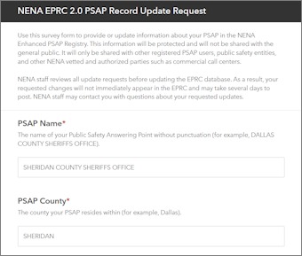 |