AI-Ready GeoIntelligence
for Smarter Insurance Decisions

Built for Insurers. Proven by Global Leaders.

Image

Trusted by Global Insurers & Partners

Why Choose Quarticle?

Image
Single Geospatial Source of Truth
Harmonize underwriting, risk, claims, and event monitoring with a unified, API-ready platform.
Image
Seamless Regulatory Compliance
Automate Solvency II, VAIT, DORA, and risk reporting, backed by transparent, audit-ready data.
Image
Unified and Transparent Data
Eliminate blind spots and minimize claims leakage with clear and reliable data.
Image
Flexible, Sovereign Deployment
Deploy on cloud, hybrid, or air-gapped environments with full control and open-source flexibility.
Image
22× Faster Risk Processing, 65% Cost Reduction
Accelerate decision-making with high-speed, AI-ready cloud geospatial analytics and real-time risk accumulation.

Real-World Results

Used daily by over
15,000
Image
Property & Casualty (P&C) underwriters
800k+
Location Requests/Second Processing Power
40%
Quoting Time Reduction
Harmonized GIS Landscape for Multi-Entity Deployment
Long-Term Partnerships with Global P&C Leaders

Client Success Stories

Image
The largest first insurer in the world reduced costs by 65% and drastically improved performance by replacing their existing GIS solution provider with the Qarta™ geo engine
Image
How the largest first insurer in the world replaced previous solutions with Quarticle’s cloud-native, user-friendly risk assessment suite
Image
Enhancing GIS Performance and Flood Data Management in Europe for the Switzerland-based Global Reinsurance Leader
+ 120,000
hours solving insurance risk at scale
Built for Enterprise-Scale Adoption
With over 120,000 hours dedicated to solving insurance-specific data and risk challenges, Quarticle delivers the precision, speed, and resilience insurers need. More than just a tool, it’s a trusted platform embedded in the daily workflows of thousands of underwriters and operational teams worldwide.

Purpose-Built Solutions for Insurance Transformation

Core Products Overview

What to expect when working with Quarticle

Image

Bold innovation

Image
Excellent quality
Image
Reliable simplicity
Image
Dynamic versatility
Image
Data security
Image
Trusting partnerships

What our customers are saying

Image

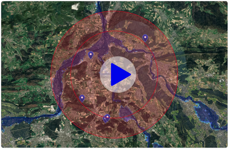
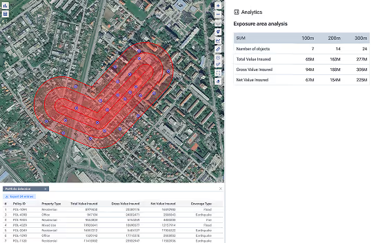
Blazing fast, cost-efficient, and easy to integrate, RAPID empowers our renewal processes and risk modelling. Fully automated geoprocessing and geo-enrichment of both small books and large portfolios is no longer a challenge. We’ve reduced human intervention by more than 300% — from core insurance systems to scenario modelling, everything is connected and enabled within a short implementation phase.

Former Head of GIS, Global P&C Insurer with 150,000+ Employees

Image
Image

Quarticle’s geospatial intelligence platform allowed us to harmonize our application landscape. We can now manage all geospatial workflows centrally, driving efficiency and effectiveness across our underwriting operations. Providing our customers and brokers with significantly faster, higher-quality services not only reduces operating costs, improves underwriting decisions, and increases margins — it also enables us to deliver a best-in-class experience to our users.

Former Head of GIS, Global P&C Insurer with 150,000+ Employees

Image
Image

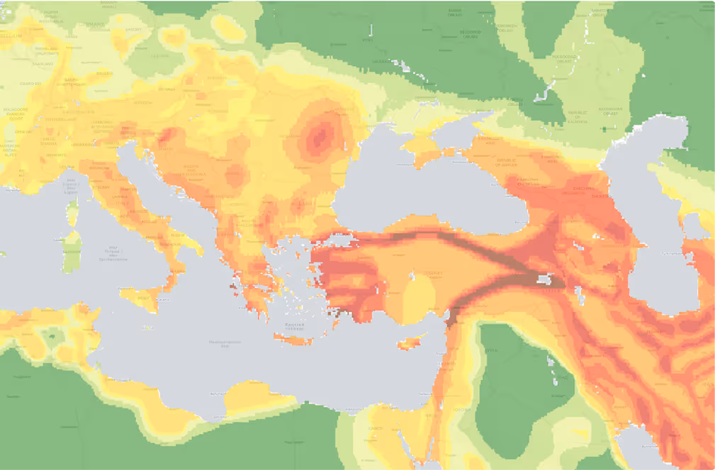
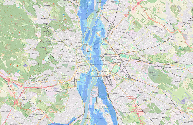
Quarticle's solution drastically improved our GIS performance and data accuracy, allowing us to manage natural hazard risks more effectively. Their expertise in handling complex geospatial data on Microsoft Azure was instrumental in achieving our objectives.

Former Head Geospatial Risk Insights, Global ReInsurer

Image
Ready to transform your insurance and reinsurance operations?
Chat with our agent
Image