-
-
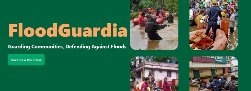
Homepage
-
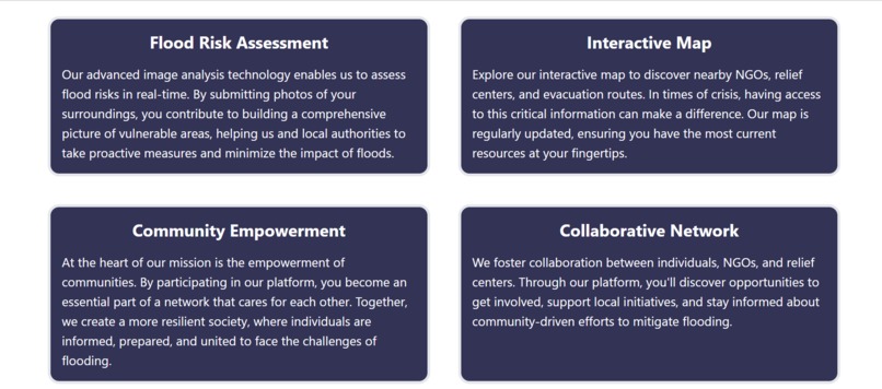
Services Providing
-
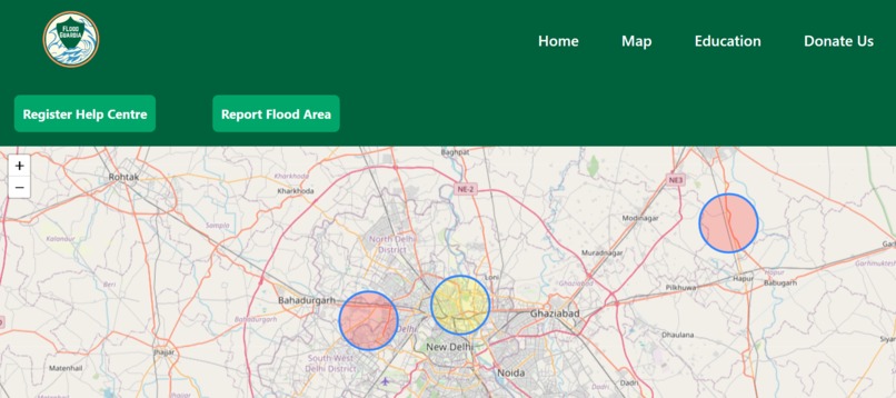
Interactive Map
-
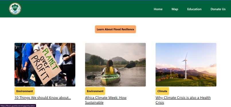
Education Page
-
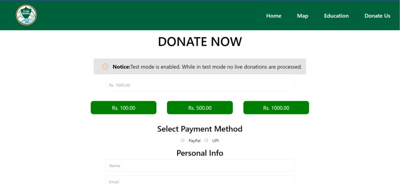
Donation Page


Inspiration
FloodGuardia was inspired by the increasing frequency and severity of flooding events around the world due to climate change. The project aims to leverage technology and data-driven solutions to mitigate the impact of floods on communities and infrastructure.
Floods are one of the most common natural disasters. They can happen anywhere, anytime, and to anyone. Every year, around 200 floods happen worldwide. This leads to catastrophic endings, with around 34.2 million people worldwide being affected by flooding each year, from losing their houses, and business to even their lives. Due to floods, many become homeless and have long-lasting injuries, emotionally and physically. In fact, in 2020 alone, six thousand people died, with millions more having their lives altered by floods. (Source: Statista) And as climate change becomes more prevalent than ever, with temperatures around the globe increasing, floods are expected to become more and more common. So what if we can warn everyday citizens about early signs of flooding near them from just the comfort of their devices? We would be providing education on floods and how to prevent them while also helping them prepare to fight back against the floods. This is FloodGuardia.
What it does
Flood Mapping and Awareness: FloodGuardia provides an interactive map interface that visually identifies flood-prone areas within urban environments. Users can easily access this map to understand their local flood risks and make informed decisions regarding their safety.
Resource Localization: Our platform compiles essential information about shelters, medical aid points, and other critical resources available during floods. Users can quickly locate these resources on the map, ensuring access to timely assistance in emergencies.
Community Contributions: FloodGuardia empowers community members to actively participate by contributing data about flood-prone areas and adding new resources to the map. This collaborative approach enhances the accuracy and relevance of information available on the platform.
Educational Content: We understand the importance of preparedness. FloodGuardia includes an educational section that equips users with essential knowledge on how to respond during floods. This section provides step-by-step guides and safety tips, empowering individuals to take action when faced with flood-related challenges.
NGO and Government Integration: To foster a holistic approach, FloodGuardia offers NGOs and government agencies the ability to add and update resources on the platform. This integration facilitates real-time communication between aid providers and communities, optimizing disaster response efforts.
How we built it
FloodGuardia's development was a collaborative effort driven by a clear vision and technological innovation:
Conceptualization and Research: We researched community needs and mapped out features to address flood vulnerabilities.
Tech Stack Selection: React for front-end interactivity, Django for back-end data management, and Leaflet for mapping.
Design and Wireframing: User-centric design and wireframes were crafted for intuitive navigation.
Interactive Mapping: Leaflet library enabled dynamic flood-prone area visualization and resource markers.
Back-End Development: Django powered resource database, user-contributed data management, and NGO/government integration.
Front-End Implementation: React brought features to life, including map interaction, educational content, and user contribution tools.
Community Collaboration: Users can contribute flood data and resources, fostering accuracy and relevance.
Educational Content: Curated step-by-step guides and safety tips empower users to respond effectively to floods.
NGO/Government Integration: Added features allow aid providers to update resources in real-time.
Testing and Iteration: Rigorous testing ensured functionality and usability.
Challenges we ran into
Data Accuracy: Ensuring the accuracy and reliability of data from different sources was a significant challenge. Data inconsistencies could lead to inaccurate predictions and alerts.
Predictive Accuracy: Developing accurate predictive models that could account for various factors influencing flooding was complex and required continuous refinement.
Time Zone Differences: With our team living in different parts of the world with up to an 11.5-hour difference, it was sometimes challenging to collaborate together. But in the end, we made it work and had a great time with each other.
Accomplishments that we're proud of
Comprehensive Solution: Successfully developed a multifaceted platform addressing flood vulnerability, combining mapping, resources, and education.
Interactive Mapping: Integrated Leaflet to create an engaging and informative interactive map of flood-prone areas and resources.
Community Involvement: Empowered community members to contribute flood data and resources, fostering collaboration and accuracy.
User-Centric Design: Crafted an intuitive user interface through wireframing and design that prioritizes accessibility and ease of use.
Remote Teamwork: Successfully managed remote collaboration across time zones through effective communication and coordination.
Impactful Innovation: Transformed technology into a tool for social good, empowering vulnerable communities to enhance their resilience.
Real-World Relevance: Addressed a critical issue affecting vulnerable populations and created a platform that can make a tangible difference.
What we learned
Seamless Map Integration with Leaflet: One of the technical milestones we achieved was successfully integrating maps using the Leaflet library. We learned to harness Leaflet's capabilities to create a dynamic, interactive map interface that displayed flood-prone areas, shelters, and medical aid points.
Rapid Prototyping: In the time-constrained environment of a hackathon, we honed our rapid prototyping skills, making critical decisions to balance features, functionality, and usability. This experience taught us how to prioritize essential components and create a minimum viable product that remains impactful.
Enhanced Collaboration: Collaboration across time zones reinforced the value of clear communication. Aligning tasks with overlapping time zones enhanced efficiency. This experience prepared us to optimize workflows effectively, even when faced with geographical challenges.
What's next for FloodGuardia
Refinement: Continuously improve predictive models and data accuracy to enhance the system's effectiveness.
Scalability: Expand the system to cover more regions and integrate with additional data sources for comprehensive coverage.
Resilience Planning: Develop strategies for flood-resilient urban planning and infrastructure design based on historical and predictive data.
Expanding: We are also planning to expand our project into a real product that millions of people can use to warn others about floods and their dangers. In the near future, we are planning to have the site available in mobile app forms as well.


Log in or sign up for Devpost to join the conversation.