-
-
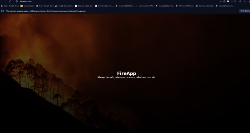
FireSafe app
-
Login
-

Secluded images predicted
-
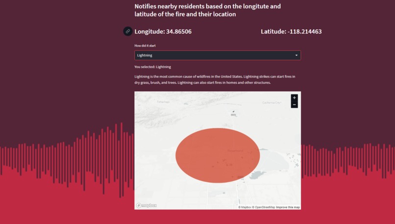
Fire acreage predictor


Our Team
Coming together our team is comprised of two hardworking individual's Tyler and Andy. Tyler is in his fourth year of university and looking to expand his knowledge in the world of computer science. After studying music at the University of Alberta for over three years Tyler has grown an interest in computer science and programming. Andy is a first year student with advanced knowledge in machine learning and programming. Andy's experience in programming with Tyler's broad skillset have allowed them to create impactful apps. Together they are a very diverse team with varying skill sets creating enticing software as they pursue their dreams of becoming fully fledged software engineers.
Inspiration
Our two man team originating from Alberta, Canada is no stranger to the dangers and harsh realities of forest fires. In 2016 we saw one of the biggest forest fires in Alberta's history causing the evacuation of over 90, 000 people destroying over 2400 homes and businesses. Scientists estimate the Earth's temperature to increase by potentially 5 degrees Celsius by 2100 which will continue fueling an epidemic of forest fires. These infernos will continue to rip through the lands displacing our friends and families until a solution is created. As global temperatures rise every single year Canadian wildlife management agencies invest over 1 billion dollars annually fighting fire and evacuating people. This is why we created FireSafe.
What it does
FireSafe was designed to keep individuals in high risk areas updated on fires. It was also designed so that no individual gets left behind in the event of a forest fire erupting. FireSafe uses complex machine learning to locate secluded locations and homes. This allows responders to go down a checklist of locations and ensure individuals are all aware of fire threat and prepared to evacuate. Individual's can also sign up for FireSafe sending a notification when fire threat is in their area. By analyzing thousands of previous fires and the patterns that they follow FireSafe is able to display the path that a fire might take based on location and how it was started. This gives users the ability to see on a map if they are within the fire risk zone.
How we built it
The model itself was built with Pytorch, as I love the inner workings of pythonic frameworks, but it also gives the versatility and efficiency of creating a model from scratch end to end. I created an Efficientnet-b0 model with channels stretched to 10 trained on an Nvidia Tesla P100 for 3 hours. I was initially going to use Efficientnet-b4, a larger, bigger model that scales more, however it was too “slow”, as the tradeoff for deployment is accuracy over speed. So to find the most adequate model during this 1 day timeframe is a smaller model that provides great accuracy as well. I implemented a weighted mean metric and did TTA, (Test Time Augmentation) to enhance my model. The dataset was created with over 120 000 samples of png files worth of poverty stricken satellite images, where I had to custom preprocess, split, and load rapidly as the file was incredibly large. I also had to filter the cloud percentage to reduce cloud coverage by 5%, and split, create dataframe, and read/implement the segmented portion of the dataset. The model was trained on two steps.
- Train solely on segmented data
- Train with combined image and segmented data
- Deploy model
For the fullstack software development aspect, I used Streamlit for Model Deployment, and Typescript, React, and SQL for backend. The SQL was to store and retrieve the longitudes and latitudes that the website finds after user input. I used google colab to train my efficientnet-b0 model on a Tesla P100 GPU on 15 epochs, and training the XGboost.
Challenges we ran into
The time constrain of the hackathon was a very big issue we had to tackle. With planning and implementing occurring within less than 3 days we had to think fast, plan and accurately deploy our idea. We also ran into several issues with deploying our model across the various frameworks being implemented in our code. With a little luck and a lot of thinking we were able to overcome these challenges creating FireSafe into the impactful app it is.
Accomplishments that we're proud of
Through the power of machine learning we were able to feed data into two separate models allowing them to do two things. Firstly, the model is able to locate secluded areas of land where individuals should be notified of a fire. Our second model is able to determine the path and range a fire can reach by training it based on historical forest fire data.
What we learned
Climate change is a very big problem affecting every individual around the globe. Implementing features in our app in such a short span of time forced us to work efficiently and multitask across various things. Our two man team had to juggle several complex features while creating a functional user interface which required several hours of research and patience.
What's next for FireSafe
FireSafe has the potential to impact thousands in fire stricken locations. Our model being 96% accurate is one of our priorities as every individual should not be forgotten during evacuation. We are also looking to create a mobile application for even greater ease of access for consumers. This will allow FireSafe to be on the smartphone of every individual notifying them of fire threat the second it is reported.
Built With
- python
- react
- sqlite
- streamlit
- typescript


Log in or sign up for Devpost to join the conversation.