-
-
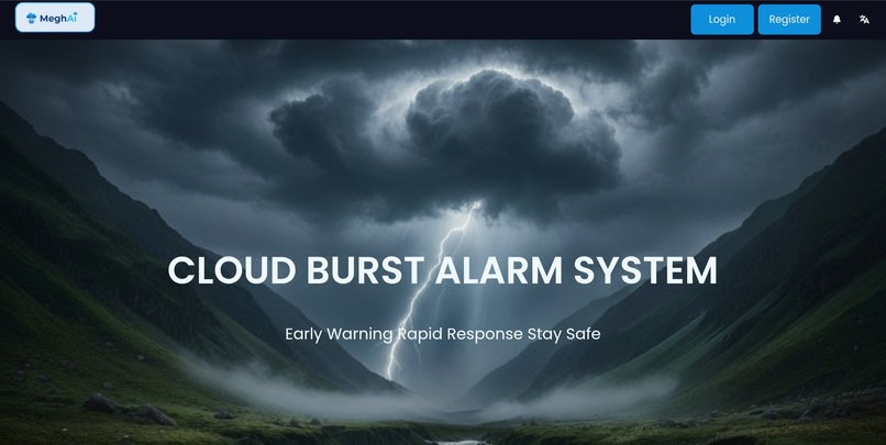
Home page
-
Login Page
-
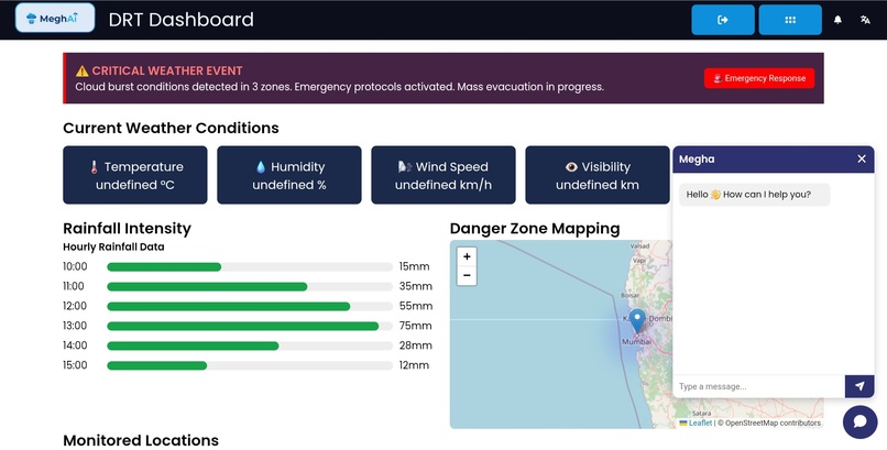
Disaster Response Team Dashboard
-
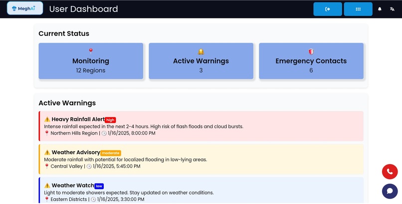
User Dashboard


🌩️ MeghAI — An AI-Powered Cloudburst Early Warning & Alarm System
🚀 Inspiration
Cloudbursts in hilly and sensitive regions trigger sudden flash floods, massive soil erosion, landslides, and irreversible loss of lives and infrastructure. Traditional satellite-based forecasting methods are often delayed, expensive, and lack hyperlocal precision (2).
With the increasing intensity of extreme rainfall events, India urgently needs a real-time, hyperlocal, AI-driven, community-ready early warning system. MeghAI is built to solve exactly that.
🌦️ What MeghAI Does
MeghAI is a sensor + AI-based cloudburst prediction and emergency alert ecosystem. It provides:
- Hyperlocal environmental monitoring using a dense network of rainfall, humidity, pressure, and soil-moisture sensors.
- AI-powered anomaly detection that identifies emerging cloudburst signatures within minutes, inspired by hybrid ML methods like RF + LSTM (3).
- Real-time micro-zone prediction, generating “Low”, “Moderate”, and “Severe” risk levels.
- Instant emergency alerting via SMS, sirens, mobile notifications.
- Village-level & district dashboard for authorities with live charts, risk maps, and trend forecasting.
- Offline-resilient edge processing for alerts even during network failure.
- Integration-ready pipelines for DDMA/SDRF protocols.
🛠️ How We Built It
1. Hardware Layer
- Custom rainfall intensity sensors, float-based precipitation measurement (as used in traditional research models) (4)
- IoT nodes using ESP32, LoRa/WiFi mesh networking
- Redundant power-safe modules with local data caching
- Environmental sensing stack for rainfall, humidity, temperature, pressure, soil moisture
2. AI/ML Layer
- A hybrid model architecture combining:
- LSTM for temporal weather pattern detection
- Random Forest for feature-level classification
(Hybrid modeling demonstrated high accuracy and early warning reliability in literature) (5)
- LSTM for temporal weather pattern detection
- Real-time anomaly detection pipeline optimized for micro-climates
- Rolling-window rainfall spike detection, pressure-drop analysis, humidity-rise correlation
3. Cloud & Backend
- FastAPI/Node backend for ingestion + anomaly scoring
- MQTT & HTTP channels for device ↔ cloud communication
- Geospatial risk computation engine
- District dashboard with:
- Time-series weather visuals
- Heatmaps
- Alert status panels
- Device health monitoring
- Time-series weather visuals
4. Alerts & Community Readiness
- SMS/IVR alerts for communities
- Siren activation at high-risk thresholds
- Emergency instruction cards: safe zones, routes, shelters
- Offline speech alerts at edge nodes for network blackout situations
💡 Challenges We Ran Into
- Handling low-resolution & sparse dataset availability in hilly terrains (6)
- Balancing prediction accuracy vs. false alarms to maintain community trust
- Achieving real-time inference on resource-limited IoT hardware
- Designing a scalable sensor mesh architecture for uneven terrains
- Ensuring reliable communication during monsoon-induced network disruptions
🏆 Accomplishments We’re Proud Of
- Built a working hybrid AI cloudburst predictor inspired by proven academic techniques (7)
- Achieved highly accurate rainfall-intensity calculations in field tests, similar to validated methods (8)
- Completed end-to-end integration: sensors → AI → alerts
- Designed a district-ready dashboard for disaster management authorities
- Created community-first alert mechanisms, focusing on accessibility & speed
📚 What We Learned
- How real cloudburst events evolve, how intensity thresholds behave, and how rainfall spikes correlate with disaster likelihood (9)
- The importance of hybrid AI models (LSTM + RF) for improving precision and lowering false positives (10)
- Hardware-software co-design is critical for real early warning systems
- Designing for rural, sensitive terrain requires network independence, redundancy, and intuitive UX
- Collaboration with domain research improves model reliability drastically
🔮 What’s Next for MeghAI
- Expanding to multi-hazard prediction: landslides, flash floods, glacial lake outburst detection
- Integrating satellite & weather radar datasets for stronger hybrid inference
- Deploying district-level pilots in cloudburst-prone Himalayan regions
- Adding explainable AI to support transparent government decision-making
- Developing an open dataset for cloudburst research & model benchmarking
- Collaboration with DST, IMD, SDRF, NDMA for production-scale rollout
🌈 Closing Note
MeghAI is not just a project — it’s a mission to save lives using advanced IoT, AI, and human-centered design.
Our goal is to make India’s hilly and rural communities more resilient, informed, and future-ready.

Log in or sign up for Devpost to join the conversation.