-
-
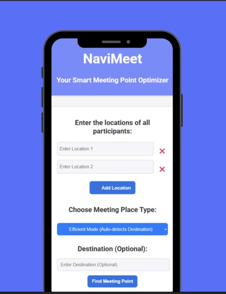
The app preview
-
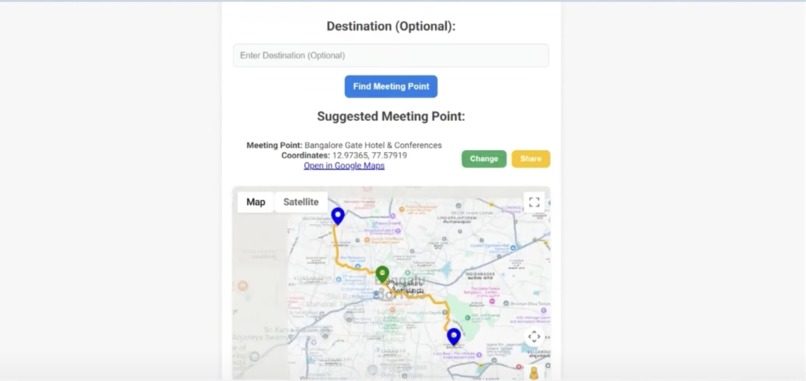
Meeting point output
-

Introduction
-
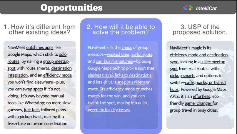
Opportunities
-
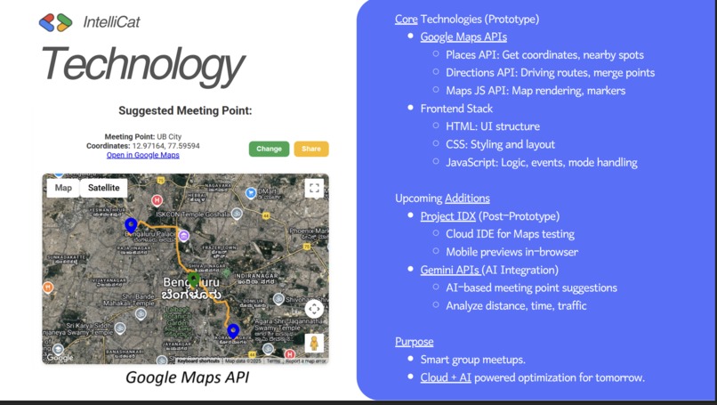
Technology
-
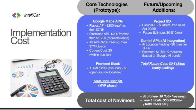
Implementation
-
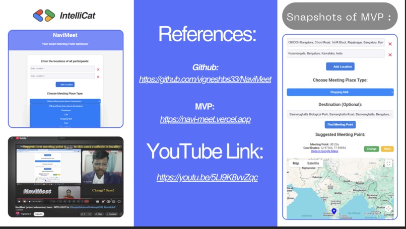
References
-
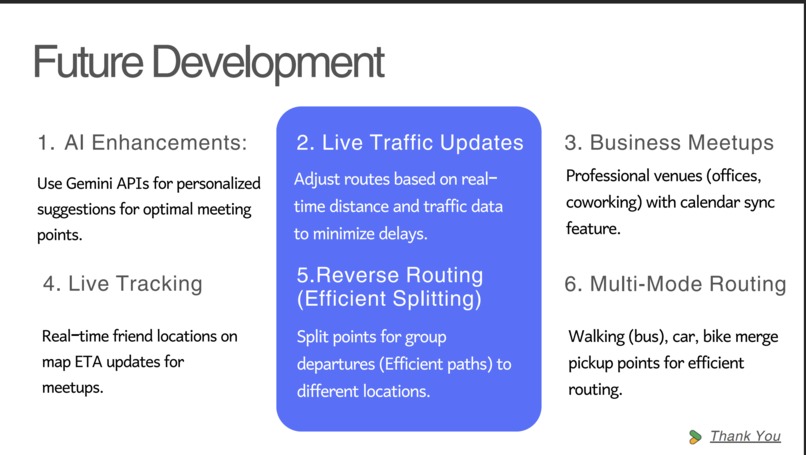
Future developmen


NaviMeet – Smart Meeting Point Optimizer
Overview
NaviMeet is a web-based application designed to intelligently determine the most optimal meeting point for a group of individuals starting from different locations. By leveraging Google Maps APIs, the platform automates route analysis, calculates strategic merge points, and suggests convenient locations such as cafés, parks, or transit hubs. NaviMeet reduces the inefficiencies of manual coordination and promotes eco-conscious, time-efficient group travel in urban environments.
Inspiration
Group meetups in cities often become complex due to varied starting points, different transportation modes, and the reliance on chat-based coordination tools. These manual processes frequently result in delays, confusion, and inefficient meeting spots.
NaviMeet was created to address these challenges by introducing a smarter, automated, and sustainable approach to group travel planning.
Key Features
- Determines optimal meeting points based on real-time route analysis
- Suggests convenient venues near the calculated merge location
- Enables pickup planning by identifying merge points along a driver's path
- Includes an efficiency mode to minimize total group travel time
- Supports flexible location switching for better user preferences
- Promotes eco-friendly travel decisions through optimized routing
Technology Stack
Frontend
- HTML, CSS, JavaScript for user interface, styling, and interactivity
APIs and Services
- Google Maps JavaScript API for map rendering and dynamic markers
- Google Places API for location-based venue suggestions
- Google Directions API for driving route and merge point calculations
- Vercel for deployment and hosting
- Project IDX for cloud-based development and mobile previews
Planned Integrations
- Gemini APIs for AI-driven personalized route suggestions and location intelligence
Challenges Faced
- Developing an algorithm to determine a fair and efficient merge point for multiple users
- Managing API rate limits within the free-tier constraints during prototype testing
- Accounting for real-time route changes and varied transport types
- Designing an intuitive interface suitable for a wide range of users
Accomplishments
- Delivered a functional MVP with dynamic route and location optimization
- Seamlessly integrated multiple Google Maps services into a unified interface
- Developed an intuitive and accessible user experience
- Implemented a group-focused routing model not found in traditional mapping solutions
- Introduced sustainability-focused features aligned with smart city initiatives
Learnings
- Gained hands-on experience with advanced Google Maps APIs and geospatial computations
- Learned to balance usability with technical limitations in real-world applications
- Enhanced understanding of collaborative travel logistics and route merging
- Strengthened skills in cloud-based development and rapid prototyping
Future Roadmap
- Integrate AI-powered suggestions using Gemini APIs
- Introduce real-time traffic and ETA tracking
- Add support for business meetups, including calendar integration
- Develop a mobile application for on-the-go usage
- Enable live location sharing, reverse routing, and multi-modal transport options
- Scale the platform to support a large user base with cost-efficient architecture
Resources
- Live Application: https://navi-meet.vercel.app
- GitHub Repository: https://github.com/vigneshbs33/NaviMeet
- Demo Video: https://youtu.be/5LI9K8vvZqc
Developed by Team IntelliCat
Built With
- directions-api
- javascript
- map-javascript-api
- node.js
- places-api


Log in or sign up for Devpost to join the conversation.