READY TO BECOME A SATELLITE TRACKER?
Finding a satellite crossing your sky is easier than ever with the
Scientific Events Predictions page. This page will use your
observing location and a chosen time to determine which satellites
will be overhead within the next hour. Observing any of the targets
provided will help to build the collection of data necessary to draw
conclusions about the effect the upcoming wave of satellites will
have on the night sky.
Occasionally more targeted campaigns will be
available that focus on specific satellites. You can find out more about
available campaigns in the section below.

Targeted Campaigns
Tanager-1
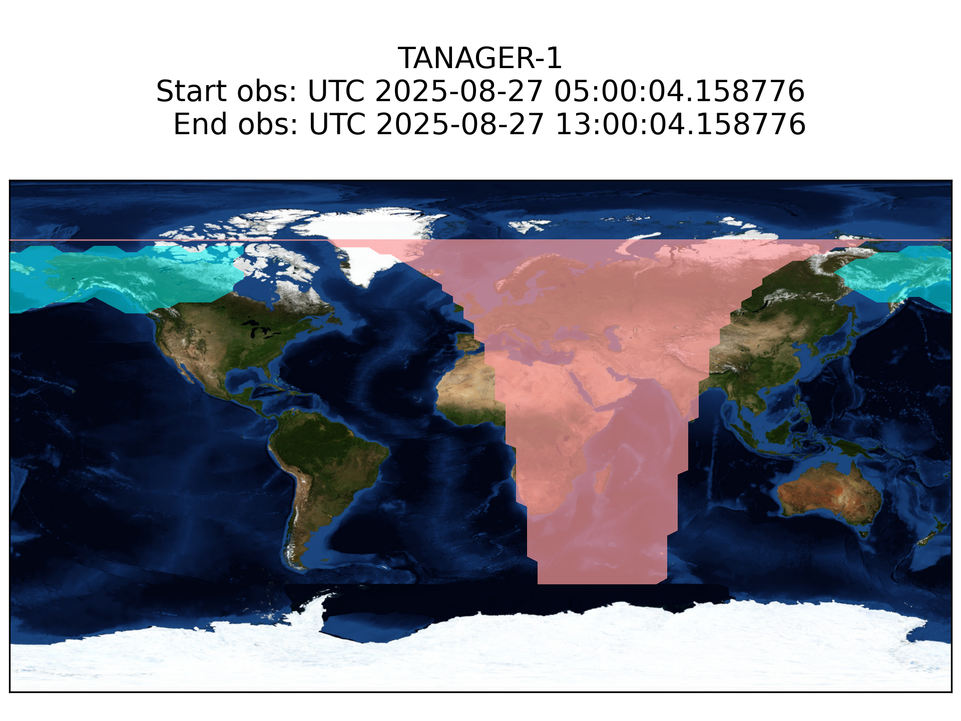
The blue shaded regions are areas of the world where Tanager-1 will appear in the night sky while also outside of the Earth's shadow. This map updates every 6 hours so that users can tell at a glance whether they should plan to observe or not. If you think Tanager-1 will cross your night sky, check the Science Events Predictions web page to confirm!
CTC-0
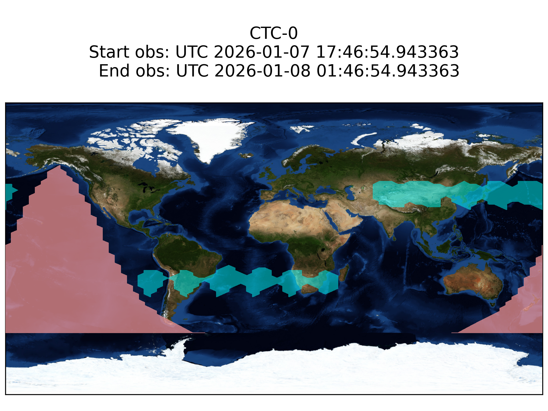
The blue shaded regions are areas of the world where CTC-0 will appear in the night sky while also outside of the Earth’s shadow. This map updates every 6 hours so that users can tell at a glance whether they should plan to observe or not.
ARMSAT1
- Name: Urdaneta-ARMSAT-1, part of the Urdaneta-Armsat series of nanosatellites
- Launch date: May 25, 2022, from Cape Canaveral on a SpaceX Falcon 9 rocket
- Purpose: A wide range of uses, including border control, natural disaster management, and geology
- Features: 16U CubeSat with an iSIM-90 optical instrument, deployable solar panels, and a total mass of 16.4 kg
- Lifetime: Designed to have a nominal lifetime of at least four years in heliosynchronous orbit at 530 km altitude
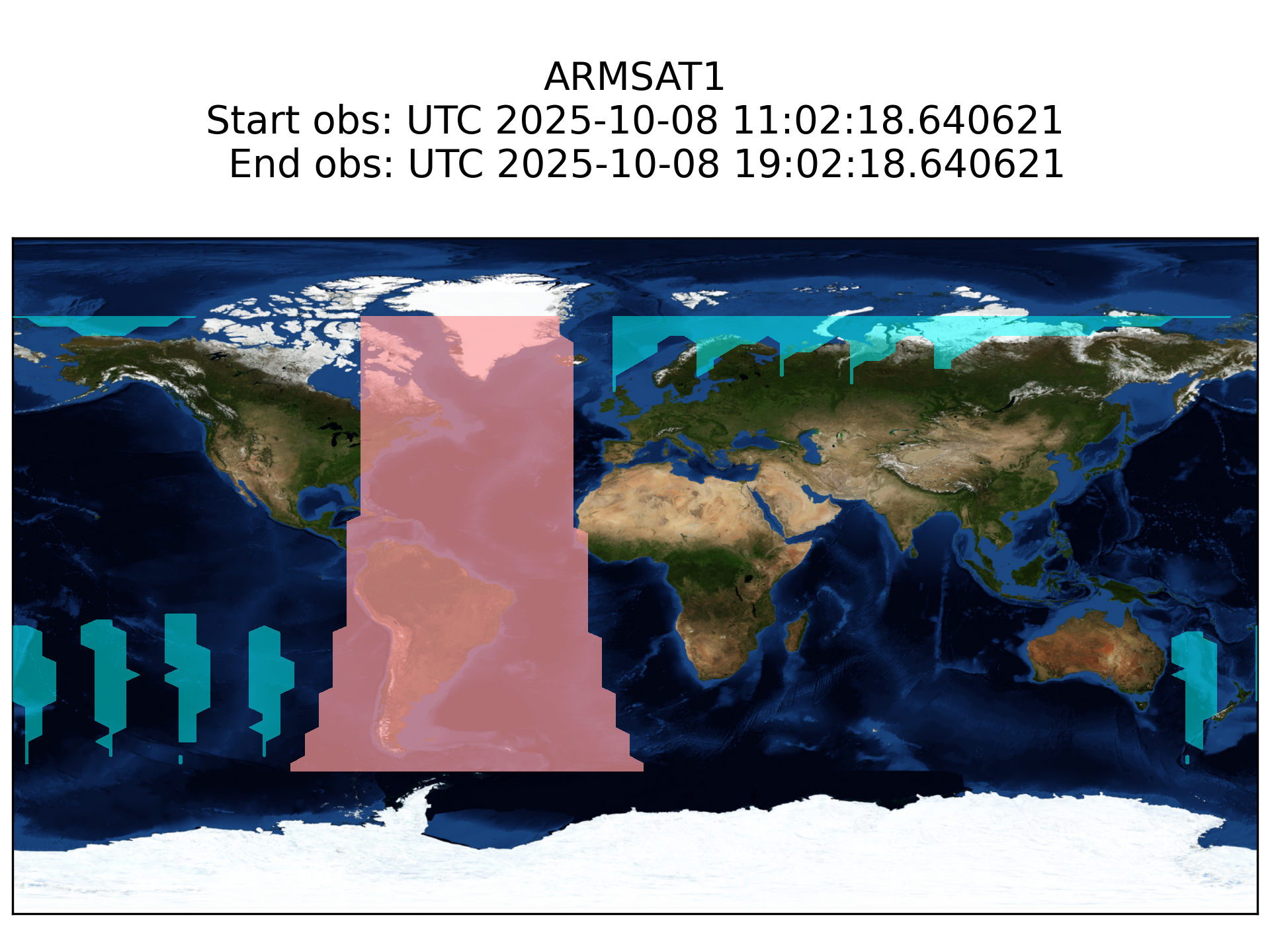
The blue shaded regions denote where ARMSAT1 will be visible from over an 8 hour period. This map updates every 6 hours so be sure to check back even if it isn’t visible in your area right now.
{{ SATELLITE TARGET NAME}}
Image from the link
NEW HERE?
Head to our Tutorial for guidance on how to master your Unistellar telescope and join the Satellite Trackers. If you have any questions please contact us at [email protected].