Log inSign up
MapTiler
3,760 posts
Image
user avatar
MapTiler
@MapTiler
πŸ—ΊοΈ Maps for developers: Visual tools, global data, SDK & APIs for web, mobile, and enterprise applications.
Worldwide 🌍
maptiler.com
Joined June 2009
744
Following
5,307
Followers
  • user avatar
    MapTiler
    @MapTiler
    Jul 18, 2018
    Google Maps Platform too pricey? πŸ’° Try MapTiler Maps API 🌎 with a FREE personal plan and fair prices for businesses. See maptiler.com/google-maps-pl… and design your own map style, use open-source JavaScript APIs and let your project grow.
    MapTiler is the best Google Maps API alternative sharing image
    Top alternative for Google Maps API
    From maptiler.com
  • user avatar
    MapTiler
    @MapTiler
    May 23, 2022
    3D webmaps using #OpenSource MapLibre GL JS are here! All previous apps, styles & custom maps will still work & are now 3D-ready. Read more on our blog: maptiler.link/39NfNzF #maplibre #3d #javascript #webmapping
    Image
    00:00
  • user avatar
    MapTiler
    @MapTiler
    Oct 7, 2022
    Adding new disputed borders to our maps is one thing we’re good at, but after the recent referendum in Kaliningrad, we have to remove one. MapTiler making Czechia great again! πŸ‡¨πŸ‡Ώ #KralovecJeNΓ‘Ε‘ #KaliningradIsCzechia @KralovecCzechia @BaltTweetuje @MyJsmeKralovec
    Image
    00:00
  • user avatar
    MapTiler
    @MapTiler
    Jan 19, 2022
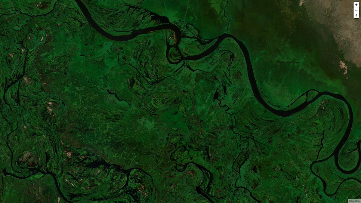
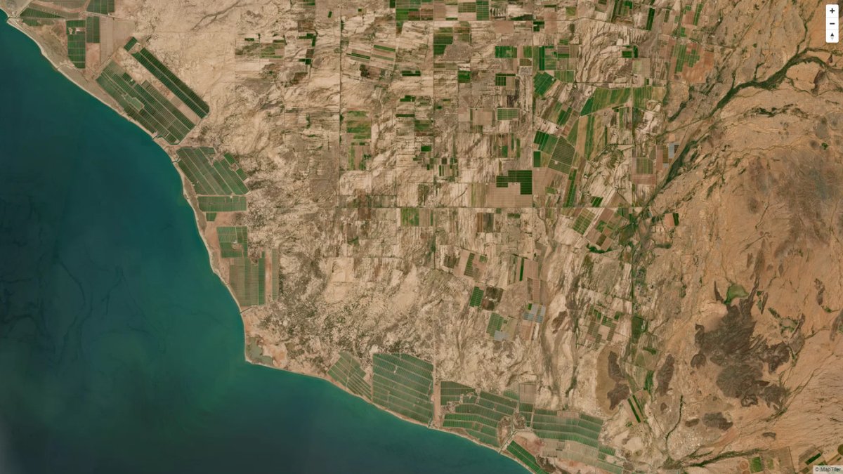
    We have created a single image of the entire world detailed enough to find your own house. If printed it would cover nearly 16 soccer fields! Find out more here: maptiler.link/3o0yFQj #EOChat #satellite #space #maps
    Image
  • user avatar
    MapTiler
    @MapTiler
    Jun 10, 2020
    The new MapTiler QGIS Plugin is here! Easily load street and satellite maps of the entire world to QGIS. Install the plugin, get a free key in MapTiler Cloud, and start to use our maps. Read more at maptiler.link/2YnvnbT #qgisplugin
  • user avatar
    MapTiler
    @MapTiler
    Jul 11, 2022
    Zoom in your #hillshading and contours from the MapTiler QGIS plugin without pixelation. We partnered with @lutraconsulting to add early resampling to the latest version of @qgis. Find out more: maptiler.link/3NWDhRA #Cartography #OpenSource
    Image
    00:00
  • user avatar
    MapTiler
    @MapTiler
    Dec 9, 2020
    The project @MapLibre is born - bringing the true community driven fork to life. See "Mapbox GL JS open-source fork memorandum" agreed by multiple parties today docs.google.com/document/d/1UB… @nyuriks @OSGeo
    Image
    docs.google.com
    mapbox-gl-open-source-fork-memorandum
    Mapbox GL open-source fork memorandum This document summarizes the actions of the open-source community for progressing forward. This is a draft of essential points to agree on for long-term success...
  • user avatar
    MapTiler
    @MapTiler
    Jan 11, 2021
    Community-driven #opensource JavaScript library for web maps is born. Now with native SDKs for Android & iOS! Read the story of Mapbox GL fork at maptiler.link/3ozhBPz Big thanks to @nyuriks @xurxosanz @lseelenbinder and others for starting @maplibre
  • user avatar
    MapTiler
    @MapTiler
    Mar 1, 2022
    We offer free Map APIs to those aiding the #refugees and people of #Ukraine πŸ‡ΊπŸ‡¦ We already support @RedCrossUkraine; Please get in touch if you develop a related project and need free #map services or data: [email protected] @leafletJS @openlayers @maplibre #WebDev
  • user avatar
    MapTiler
    @MapTiler
    Feb 15, 2022
    We've made 180 terabytes of satellite imagery to fit on a 512 gigabyte USB stick. Access it for free via API or download the data for research or art! Find out more here: maptiler.link/3oRQu4q #EOChat #satellite #space #maps
    Image
  • user avatar
    MapTiler
    @MapTiler
    May 23, 2023
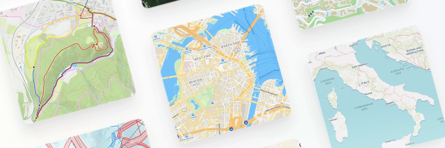
    OpenMapTiles has a new style that shows all the features. Inspired by @openstreetmap Carto, it's a design you are familiar with for a vector dataset you can use at all zoom levels. We’ve proposed that the style is available on the OSM website! Read more: ow.ly/GYM650Ou9Qp
    Image
    6.5K
  • user avatar
    MapTiler
    @MapTiler
    Jul 6, 2022
    Global hillshades are even better in @QGIS 3.26 using the MapTiler plugin! You can now zoom in without getting pixelation. Create beautiful #hillshades of entire mountain ranges or zoom in for more detail. Find out how: maptiler.link/3Ih5NvT #maptiler #cartography
    Image
    00:00
  • user avatar
    MapTiler
    @MapTiler
    Oct 30, 2018
    History of Europe on an interactive map. Visit timemachineatlas.eu to see our #TimeMachine Atlas prototype with data for the last 1000 years of #Venice history! #TimeMachine18
    Image
    00:00
  • user avatar
    MapTiler
    @MapTiler
    Jan 19, 2022
    We've updated MapTiler Server so now you can run live maps directly from a #PostreSQL database: maptiler.link/3KCi0w7
    Image

New to X?

Sign up now to get your own personalized timeline!

Create account

By signing up, you agree to the Terms of Service and Privacy Policy, including Cookie Use.

TermsΒ·PrivacyΒ·CookiesΒ·AccessibilityΒ·Ads InfoΒ·Β© 2026 X Corp.
Don't miss what's happening
People on X are the first to know.
Log inSign up
Advertisement
Advertisement