-
-
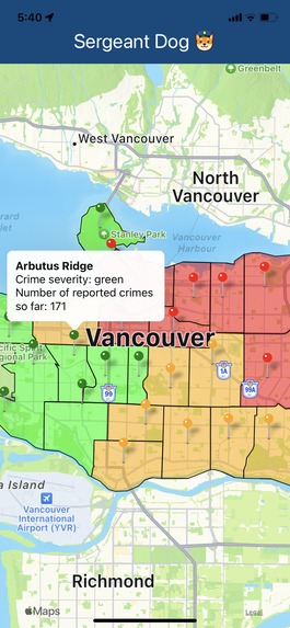
Helpful popups to show crime rate.
-
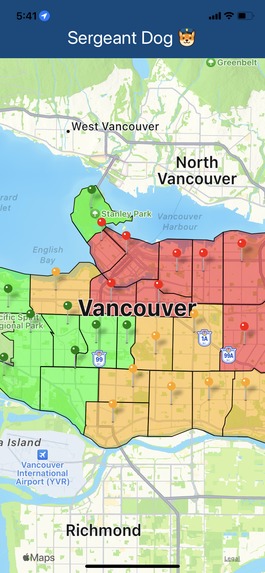
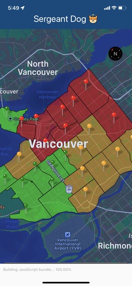
Each region is denoted by red, yellow, or green.
-
Dark mode


Inspiration:
In response to this year's VSHacks theme, we wanted to make Vancouver a safer place to stay. So far, 2023 has led to a total of 16682 reported crimes, 5223 from the Central Business District (downtown) alone.
What it does:
To increase awareness of high and medium crime rate areas, Sergeant Dog maps the 22 different areas of Vancouver according to the number of reported incidents. Red means around 1000, orange is around 500, and green is close to 100 reports. Clicking on each neighborhood marker shows the exact number of incidents each neighborhood has received.
How we built it:
- expo for the mobile app + testing on our phones
- expo-location for the map view, markers, and polygons
- VPD's database of crime statistics, found here: link
What we learned:
- to develop a mobile app using Expo, which allowed us to create a native app that works for both IOS and Android devices.
- to use expo-location to map markers and polygons for the 22 distinct areas/neighborhoods of Vancouver, from the coordinates we found here: link
What's next for Sergeant Dog:
- tracking user location with a custom marker
- sending notifications to the user when crossing into a medium or high-crime area
- automating data collection from VPD's database https://vpd.ca/crime-statistics/ https://opendata.vancouver.ca/explore/dataset/local-area-boundary/map/?disjunctive.name


Log in or sign up for Devpost to join the conversation.