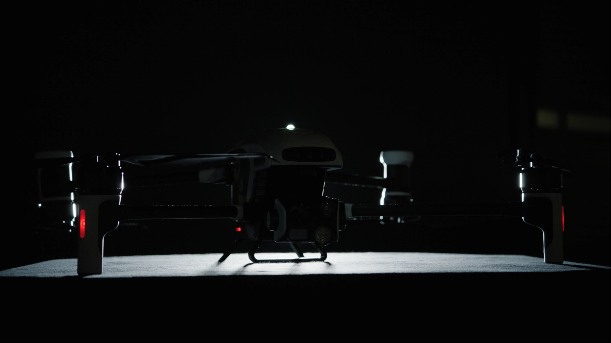
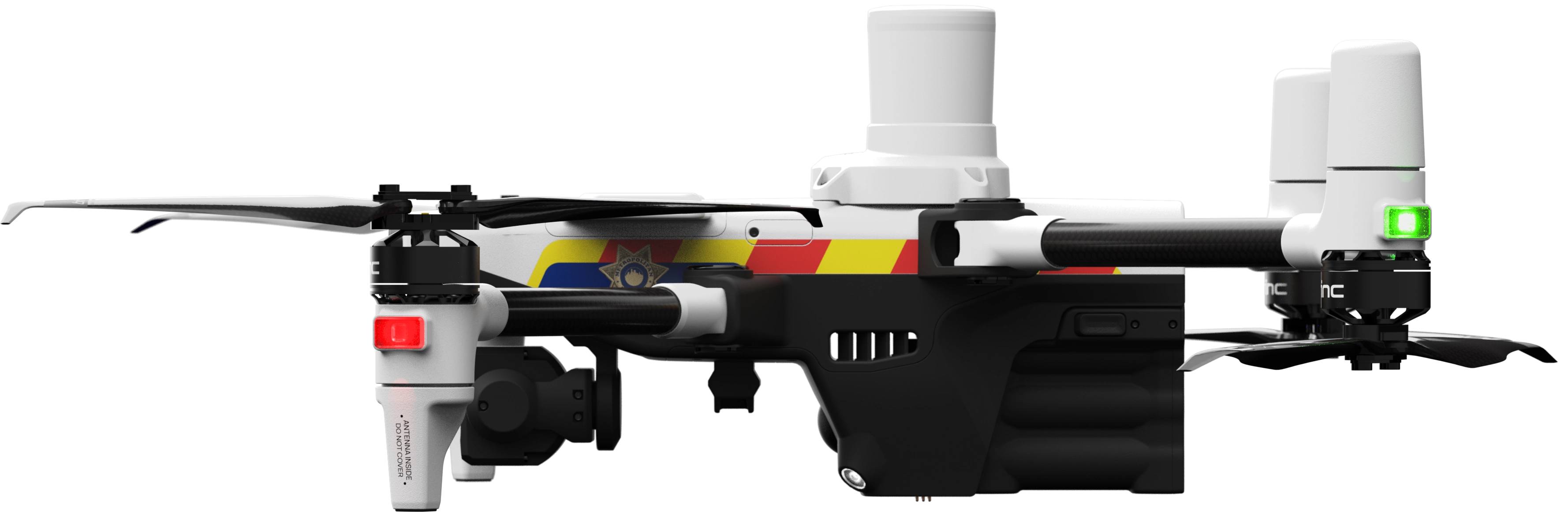
Situational Awareness On-Demand


A powerful aerial tool for public safety agencies – built right here in the USA.
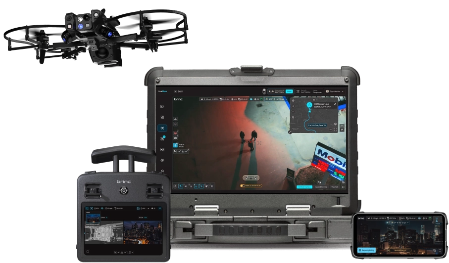
Works Alone or With the Expanded BRINC Ecosystem
Designed to fit seamlessly into the BRINC Drone as First Responder (DFR) solution.


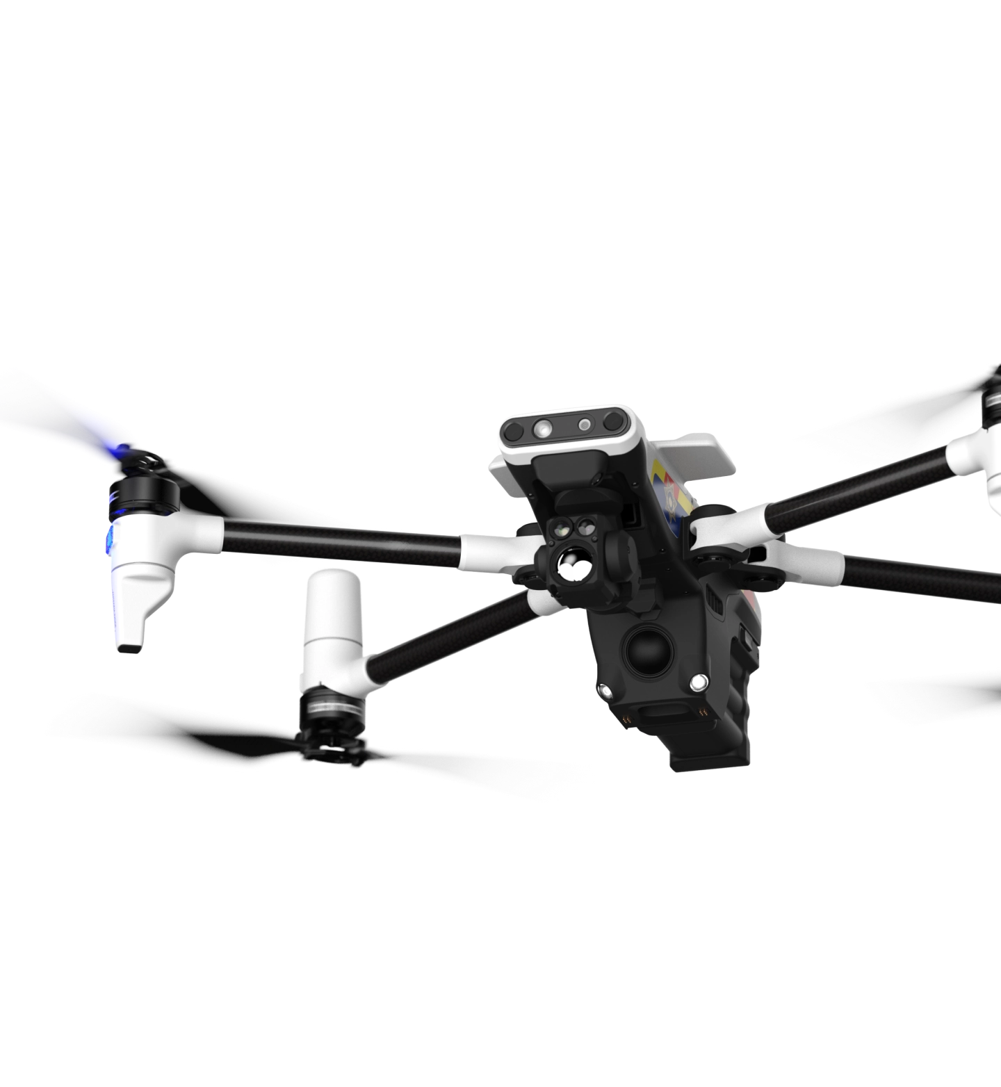
All-In-One Platform.
Simple-to-Use. BRINC
Ecosystem

City Wide Deployments
Two-Way Comms
Common
Platform.
Consistent
Controls.
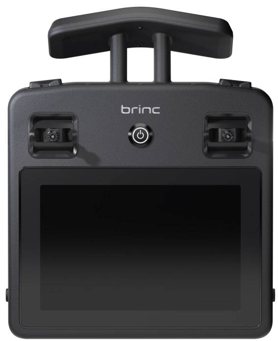
Get up to speed quickly with standardized equipment shared by Responder and LEMUR 2
-
One Remote

Controller -
One WEB
PLATFORM -
Common
Accessories
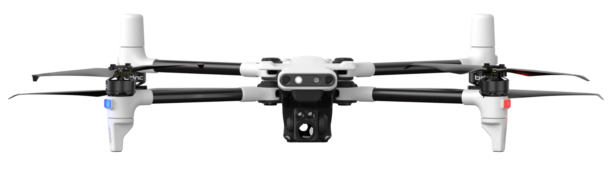
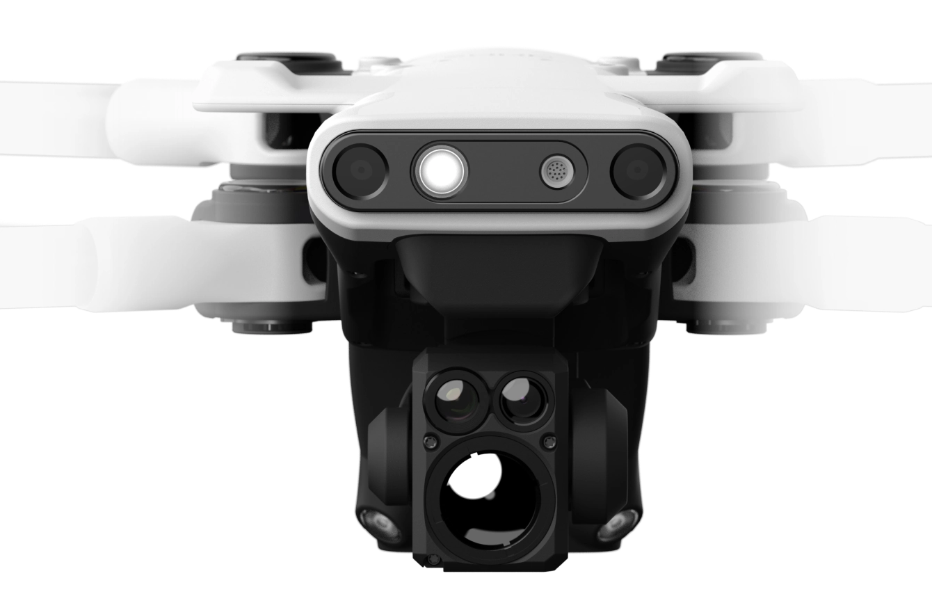
Enhanced Situational Awareness
Powerful cameras for informed decision making.
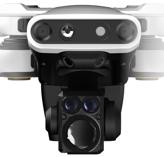

Zoom In to See the Details
Dual visual cameras allow operators to catch every little detail – even from hundreds of feet away.

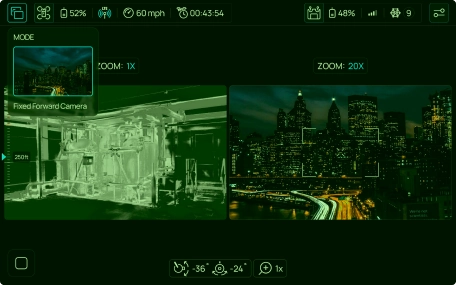
Powerful Thermal Imaging
Visually identify temperature differences, even in low or no light conditions.
8-14 µm
Seamless User Interface
Easy to use and fast to learn.
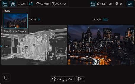
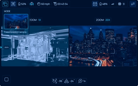
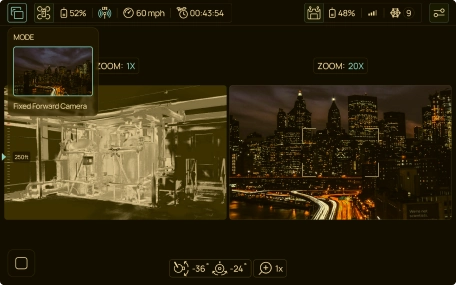
Wide/tele Toggling
Experience lifesaving benefits with BRINC technology
Thermal Fusion
Experience lifesaving benefits with Experience lifesaving benefits with BRINC technology
Thermal Palettes
Experience lifesaving benefits with BRINC technology
PIP Modes
Experience lifesaving benefits with BRINC technology
4G LTE
With integrated cellular, Responder can be remotely operated from a browser.
BRINC Connect
On-scene pilots can take over control of Responder from a teleoperator.
Mesh Networking
BRINC products utilize mesh networking for enhanced transmission strength. Antenna masts can be installed to cover dark areas in a jurisdiction.


Identifiable During
Regular Flight
Identifiable During
An Emergency
Communicate in High-Risk Situations
Integrated loudspeaker and microphone enables clear and reliable communication.
Loudspeaker
Microphone
Over the Phone or Online
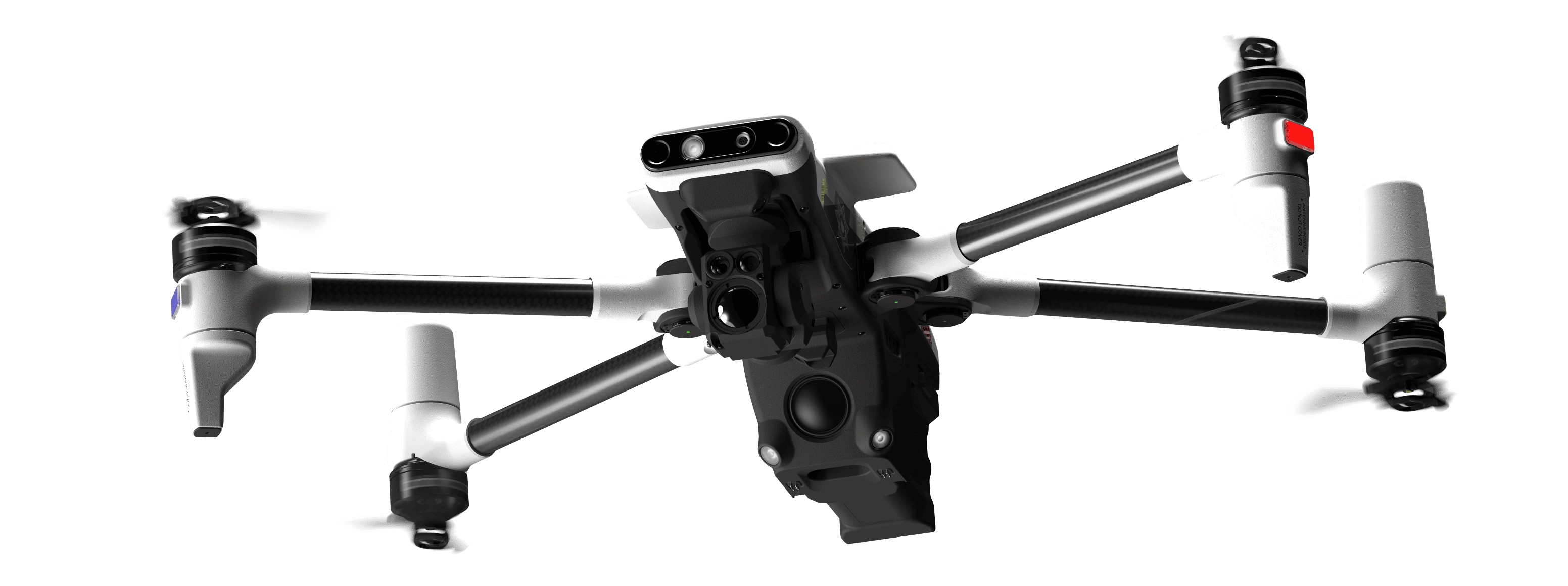

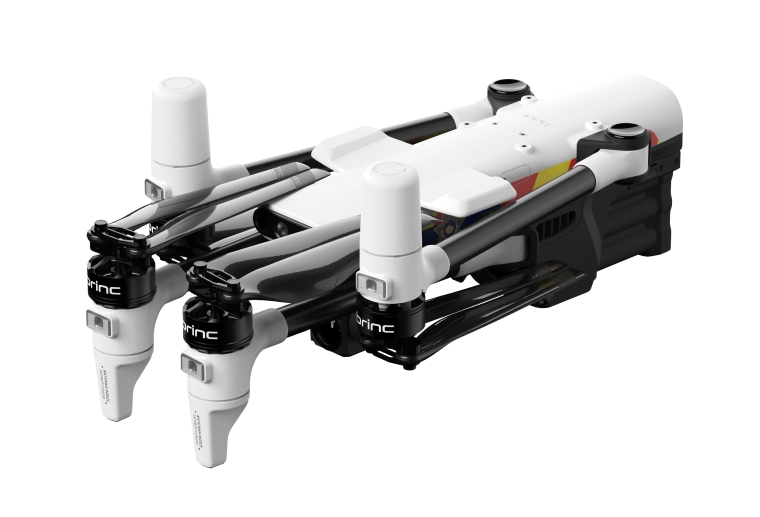
Attachments for Advanced Operations
Mountable attachments let Responder support a variety of missions.
Parachute
For enhanced safety during automated deployments.


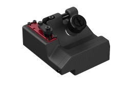
Payload Dropper
Deploy AEDs, Narcan, EpiPens, PFDs or other lifesaving payloads.
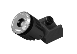
Spotlight
Improves visibility during low light missions.
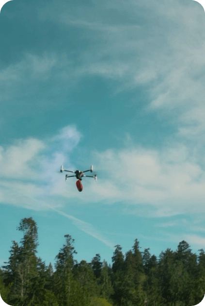
Emergency Deliveries
AED

Narcan
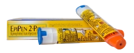
EpiPen
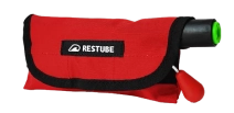
PFD
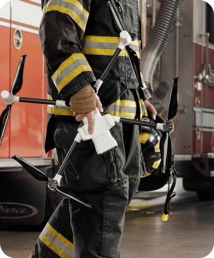
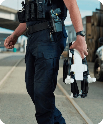
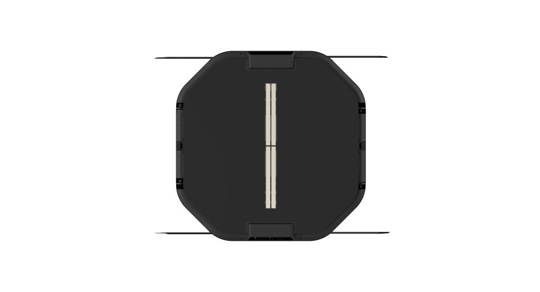
Portable Design
Foldable arms and props enable easy storage and transport.

Intelligent Autonomy Systems
Responder’s powerful onboard compute and redundant autonomy sensors enable obstacle avoidance and automated nest landings - even in the dark.


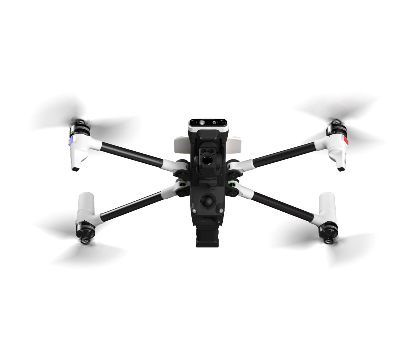
Forward Obstacle Avoidance

GPS RTK + VIO

Autonomous Landing / Takeoff

Works in All Lighting Conditions

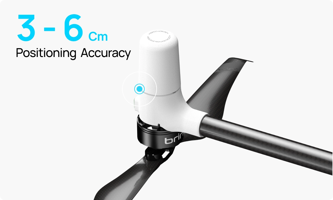
Precise Flight
RTK enables centimeter-level positioning and improved flight stability.
Mapping
Compatible with 3rd party mapping software like Pix4D.

LiveOps Platform
All-in-one drone operations platform accessible from any modern browser.
Explore Features
 Data Never Leaves the US
 AES-256 / FIPS 140-2 Encrypted
 CJIS Compliant
Dedicated Support
Your partner across every stage of
your program.
Planning
Policy development, part 107/
COA, public education
Integration
Training, drone operations,
staffing
Operation
Maintenance, repairs,
replacements, customer support
Expansion
Upgrades, software
integrations, growth
Start of the BRINC Fleet
Responder is the first of a new line of emergency response drones from BRINC. Work with us to design the future of public safety together.
Reach Out