Once again, this year, I had the pleasure of presenting the opening at our now, not so little State of the Map Scotland Conference, which was held at Inspace on the 19th and 20th October 2012.
When I started to write this talk, I wasn’t sure where it was going to end up, I found it interesting and I hope that you do to.
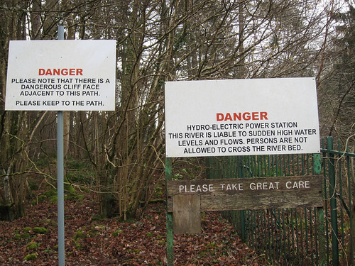
For me one of the most exciting trends, over the last year is seeing OpenStreetMap appearing invarious places:

(photo: http://www.flickr.com/photos/xerones/131963343/)
the switch2osm, 2012 started with an announcement by nestoria that they were moving over OSM.

Triggered by the ever improving quality of OSM, as well as google looking at charging, it was great to see this long term support switch to using our map.
Another example is is foursquare.

I was amazed when I opened the site at the prominence given to the map on the foursquare homepage. This shouldn’t be a surprise, given the nature of the site but I don’t think a google map would have made the landing page here.
It was also interesting to watch the foursquare community, I think overall OSM has gained visibility and exposure from this change (citation needed)
Flickr has continued to have some OSM maps and improve those maps, despite a new deal yahoo has to switch to Nokia maps, has continued to have some OSM maps.

I would love to see OSM as a layer across flickr’s maps, the Nokia maps are a big improvement but are still aimed at car drivers and so still miss lots of places where photo’s might be taken. Hopefully we will see more OSM on flickr in the future.
Finally as a more personal example of a switch2osm. I switched my parents B&B in Kent over to use OSM.

This change was a little overdue, but for me is a milestone on my journey with OSM, I first discovered OpenStreetMap when I was trying to locate local attractions when I first added a google map to this site, back around 2006.

I wasn’t surprised by the detail on the Sissinghurst page, as I mapped this myself.

but in fact zoomed in, almost every page such as this one for Bodiam Castle has lots of the little bits of detail, such as the moat, ticket office and car park (not shown here).
A lot of this is now possible, because more and more companies are starting to provide services around OSM. As I said last year:

Rightly or wrongly OSM is currently setup largely as a data provider -so it’s really great to see these other “consumer” facing options and websites appear as the more people see OSM the better our data becomes even if only a ting percentage of these can be converted into mappers. Obviously better information and simpler tools may help to lower the entry barrier in the future.
The biggest recent impact has been from mapbox:

Also a big shout out to the Stamen map styles and tiles:

such as the toner style above or the acclaimed watercolour style that I used on the first slide.
While we’re on styles, we can’t ignore the continuous improvement’s to the OSM “house” style:

The cycle map style:
 ]
]
public transport style:  ]
]
and mapquest style  ]
]
again mapquest open provides a great example of a complete web mapping site, with search and routing. So provides a potential OSM powered google maps replacement.

So last year we did a comparison between the OS Locator dataset and OSM using the ITO Analysis tool, by region. I’ve added this years data into the table.
| Place | 2012 | OS Locator | 2012 | “Missing” | 2012 Roads | 11 to 12 change |
|---|
| | position | | | | | |
|---|
| Edinburgh | 4 | 4,760 | 4784 | 0 | 9 | 100 -> 99.81 |
| Midlothian | 6 | 1,180 | 1193 | 0 | 9 | 100 -> 99.25 |
| Clackmannanshire | 1 | 817 | 819 | 5 | 0 | 99.27 -> 100 |
| South Lanarkshire | 5 | 5432 | 5491 | 73 | 34 | 98.55 -> 99.38 |
| West Dunbartonshire | 9 | 1,233 | 1236 | 18 | 15 | 98.54 -> 98.79 |
| Shetland Islands | 8 | 309 | 311 | 6 | 3 | 98.06 -> 99.04 |
| Stirling | 12 | 1,361 | 1370 | 29 | 37 | 97.58 -> 97.30 |
| East Ayrshire | 16 | 2039 | 2052 | 50 | 64 | 97.50 -> 96.83 |
| Glasgow City | 1 | 6758 | 6761 | 171 | 0 | 97.44 -> 100% |
| West Lothian | 15 | 2030 | 2038 | 48 | 59 | 97.44 -> 96.96% |
| Inverclyde | 13 | 1239 | 1240 | 32 | 34 | 97.42 -> 97.26% |
| Na H Eileanan An Iar | 10 | 298 | 297 | 5 | 4 | 97.32 -> 98.98% |
| East Lothian | 11 | 1343 | 1353 | 33 | 32 | 97.10 -> 97.19% |
| North Ayrshire | 14 | 2180 | 2189 | 63 | 63 | 97.06 -> 98.08% |
| Dundee City | 20 | 2223 | 2229 | 65 | 76 | 97.03 -> 96.55% |
| Angus | 18 | 1877 | 1878 | 57 | 59 | 96.91 -> 96.81 |
| South Ayrshire | 22 | 1803 | 1809 | 61 | 69 | 96.45 -> 96.08 |
| Argyll And Bute | 21 | 1400 | 1403 | 50 | 48 | 96.43 -> 96.58 |
| Monmouthshire | 17 | 1529 | 1538 | 52 | 48 | 96.34 -> 96.81 |
| Fife | 23 | 5607 | 5627 | 217 | 228 | 95.93 -> 95.75 |
| Scottish Borders | 24 | 1890 | 1902 | 78 | 79 | 95.77 -> 95.74 |
| East Renfrewshire | 27 | 1323 | 1328 | 57 | 60 | 95.62 -> 95.41 |
| Aberdeen City | 1 | 2772 | 2774 | 125 | 0 | 95.27 -> 100 |
| Highland | 28 | 3443 | 3483 | 535 | 388 | 84.05 -> 88.46 |
| Aberdeenshire | 25 | 3886 | 3936 | 626 | 167 | 83.63 -> 95.73 |
| Renfrewshire | 26 | 2447 | 1378 | 430 | 60 | 82.18 -> 95.41 |
| Perth and Kinross | 19 | 2409 | 2424 | 478 | 79 | 79.91 -> 96.45 |
| Dumfries And Galloway | 7 | 2556 | 2580 | 586 | 22 | 76.53 -> 99.15 |
| Moray | 29 | 1545 | 1581 | 366 | 226 | 75.92 -> 85.45 |
The first thing that struck me as that in both Edinburgh and Midlothian the total number of roads has increased, but we’ve missed some so we’re not longer at 100%.
There have been some fantastic, improvements Glasgow was missing 171 roads last year and these have been accounted for. Dumfries And Galloway was bottom of the list last year and it’s now in 7th, as has Aberdeen City.
There are also some places such as Na H Eileanan An Iar; also known as the Outer Hebredies which are looking quite static.
So what does that all add up to?

In 2011, we were shown as having 4316 Roads that hadn’t been accounted for, so 93% match.
When I looked a few days ago, we only don’t align on 1972 missing roads, or a 95% match.
So what are these missing streets? I started by looking at the 9 roads highlighted in Edinburgh.

The first stop are these Roads in Kirkliston, we seem to have one of these roads, but are missing the name, the other two roads are shown in OSM as under construction as below.

So the conclusion is probably a draw on this one, it looks like neither OS Locator or OSM have the full picture, but a visit is needed.
The next example is around Edinburgh Airport

OSM Shows Almond Avenue, but OS Locator Almond drive. A visit here will need to take place to confirm who is right.

Again it looks like some new houses here have led to some new developments that we don’t yet have.

This one was quite simple the Lane and the footpath should be joined, so I fixed this myself.

I think that this one is a new development, that needs visiting.

Again this one in Newhaven is probably a new development, that needs visiting.
Interestingly in the few days since I gave this presentation, some of these have been fixed, by changes such as this one: “Added missing street names from ITO in Kirkliston” and this “Added initial layout of new housing development in Newburgh, Edinburgh.”. I really hope that these were done with local knowledge especially as adding the through road through Kirkliston doesn’t looks like the kind of road layout that would be permitted as it would allow a rat run through a residential area.
Anyway, we have evidence that OS Locator data can’t always be relied upon.

Already in Edinburgh 2.2% of roads in Edinburgh do not match what OS Locator shows.
Glasgow, 1.4 % and looking at one of the other places at 100%, Kings’s Lynn shows 7.4% out. This is really a warning, we should be using this as a datasource to help us know where to map, but this data cannot be relied upon.
Something else was causing me concern, and that was in the Outer Hebrides.

It also helps that I’ve holidayed and mapped here (or should it be the other way round) and so have lots of photos :)
There weren’t many changes in 2011 of 298 roads we were missing 5 and in 2012 the total roads is 297 and we’re missing 4.
So first thing, I thought that I would look at the last modification data of a selection of the objects:

This wasn’t quite what I expected, so far this year there has been a lot of activity.
And so I thought I would break down into months:

So the basic level is quite small, but with a big peak in June and July.
Looking in detail at June I saw, most of the changes:

we’re made by a single user, brianboru. I was very happy to see that he had been there and and some of the information is surveyed on the ground with lots of detailed tracing of terrain, helping to fill in the map, so I thought I would see what else this user was up to?

So he’s from Birmingham, and by the looks of things he like I holidayed and did a ton of mapping and tracing whilse on holiday.
But once I ignored the holiday based tracing binges, there is a steady background work by seumas, and looking at his page, I was again very pleased to see that he does live on the Island.

and busy doing some mapping of shops, pubs, chippies and some paths:

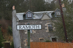
This was really for me the Golden Road, to be honest I didn’t expect to find a local mapper living on the edge of the country, but here he is.

So how much data do we have:

Overall the breakdown over Scotland is:

]he uncompressed XML weighs in at 1.2G on disk, consisting of nearly 6 million nodes, nearly 500 000 ways and 5000 relations.
I also ran this against a dump from before the licence change, and we have grown significantly since then, by over 600 000 nodes, and 30 000 ways. So we are well above the numbers from before the change, and thanks to the hard work of the community in Scotland to get local mappers on board and also to mitigate against loss I don’t think we had any big problems.
What’s in a name?

We have 36 660 named nodes and 134 724 named ways.
Place?

6807 of these are places, from Cities down to Hamlets and localities.
So how long are the ways:
 The table above lists the top 20 way types by length.
The total, motorway length in OSM shows as 827km compares well with the total motorway length in wikipedia (once I remembered that OSM will have ways for both directions)
We have 4 226km of paths, I suspefct there are a lot more in Scotland.
We’re up to 1 645 km of cycleway, and additionally cycling is permitted on a further 1000km of footways and paths.
We have 53 km of steps, I wouldn’t want to climb those all at once.
There is also the longtail of the list:

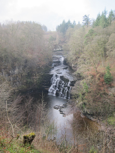
Somewhere we have 30m of broken bridge (not the one pictured), 10 km of racing track and 1 099m of train platforms.
all made possible by OSM’s flexable tagging system:

and the 1776 users who have contributed!

Last year I asked the question.

I still don’t think we have a really good answer to that question, but whatever we do, we must Tell People.

It’s the only way of improving the map.

]]> 
 All motorways in Scotland, red shows the new Motorways
 Service Roads in Scotland
 Paths Tracks and Cycleways - New highways are shown in red


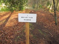
 and I was very happy to find the road was there and we had lots of details around it.


