<?xml version="1.0" encoding="utf-8"?><feed xmlns="http://www.w3.org/2005/Atom" ><generator uri="https://jekyllrb.com/" version="4.3.2">Jekyll</generator><link href="https://benlk.com/feed.xml" rel="self" type="application/atom+xml" /><link href="https://benlk.com/" rel="alternate" type="text/html" /><updated>2024-04-02T12:07:07-04:00</updated><id>https://benlk.com/feed.xml</id><title type="html">The Writing Hat</title><subtitle>Occasionally updated with things I&amp;#39;ve made or written.</subtitle><author><name>Ben Keith</name></author><entry><title type="html">Notes on the Columbia Gas projects in North Linden</title><link href="https://benlk.com/2024/03/21/notes-on-columbia-gas-nchp/" rel="alternate" type="text/html" title="Notes on the Columbia Gas projects in North Linden" /><published>2024-03-21T00:00:00-04:00</published><updated>2024-03-21T00:00:00-04:00</updated><id>https://benlk.com/2024/03/21/notes-on-columbia-gas-nchp</id><content type="html" xml:base="https://benlk.com/2024/03/21/notes-on-columbia-gas-nchp/"><![CDATA[<p>Disclaimer: I'm the Zoning Committee chair for the North Linden Area Commission. My comments in this post do not reflect the position of the Committee or the Commission.</p>

<p>Columbia Gas held a meeting on March 11, 2024, at the Linden Community Center, to present information regarding a zoning variance and the larger project that that variance is for. At the meeting, members of the community had many questions about the larger project, and fewer questions about the specific variance.</p>

<h2 id="the-larger-project">The larger project</h2>

<figure class="fullwidth">
	<img src="https://benlk.com/static/2024-03-12-columbia-gas/central-col-nchp-map.png" alt="Map of the project area" />
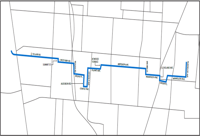
	<figcaption>The new natural gas pipeline crosses North High Street on Tulane Road, turns south on Summit Street, east on Crestview Road, under I-71, south on Beulah Road, east on Edgar Place, south on Audubon Road, east on Cortez Avenue, north on Osceola Avenue, east on Alamo Avenue, north on Atwood Terrace, east on Aberdeen Avenue, south on Bremen Street, east on Minnesota Avenue, south on Cleveland Avenue, east and north along undetermined road segments, east along Minnesota Avenue, and finally north along Parkwood Avenue.</figcaption>
</figure>

<p>Columbia Gas' <a href="https://www.columbiagasohio.com/our-company/about-us/regulatory-information/nchp">North Columbus High Pressure project</a> will install 4.2 miles of 20-inch diameter high-pressure gas gas transmission pipeline across north Columbus, paralleling existing 180- an 20-inch 1950s gas mains installed under Weber Road. The new gas main will eventually replace the old main, and service on the old main will be shut off.</p>

<dl>
  <dt>Why now?</dt>
  <dd>To comply with the Pipeline and Hazardous Materials Safety Administration's "Mega Rule", which is a trio of rules that went into effect in 2023. <a href="https://web.archive.org/web/20240111122205/https://www.columbiagasohio.com/docs/librariesprovider5/rates-and-tariffs/23-0888-ga-bln---central-columbus-nchps---lon.pdf?sfvrsn=f93def51_1">Read more about the compliance in this letter from Columbia Gas</a>, or in <a href="https://dis.puc.state.oh.us/CaseRecord.aspx?Caseno=23-0888&amp;link=DI">the project application to the Ohio Power Siting Board</a>.</dd>
  <dt>Will this affect traffic?</dt>
  <dd>The new gas line will be laid underneath existing streets. Columbia Gas said that the project will only take up one or two lanes' worth of traffic at a time. Columbus regulations prevent them from working on neighboring streets at the same time, in order to preserve traffic flow.</dd>
  <dd>Residents will receive outreach from Columbia Gas in order to make sure that driveways and houses are accessible during construction.</dd>
  <dt>When will this happen?</dt>
  <dd>The timeline given on Columbia Gas' website says that the project will start in spring 2024. At the meeting, Columbia Gas reps said that they don't have specific times for when specific roads will be affected by construction.</dd>
  <dd>Individual residents in the project areas will receive outreach from Columbia Gas with more details on the timeline.</dd>
  <dt>Why can't they lay the new line on Weber Road?</dt>
  <dd>Columbia Gas said it's because of regulations. Current federal and state regulations prevent new utility lines from being placed too close to each other. The City of Columbus has restrictions on digging near brick sewers. Weber Road already has existing brick combined storm-sanitary sewers, and many other utilities laid under the road as well. There simply isn't space to install a new gas line under Weber Road.</dd>
  <dd>I note that the Hudson Street construction project is still ongoing, so if this work happened on Weber Road, that would be two major east-west roads removed from service at the same time.</dd>
  <dt>Is the new gas line safe?</dt>
  <dd>Columbia Gas reps explained the current welding techniques used for gas pipelines. The pipe ends are beveled, so that the bead from the weld penetrates the full depth of the pipe for a secure connection. After welding, workers X-ray the welds to ensure that the weld is of good quality. These techniques and checks were developed in response to <a href="https://en.wikipedia.org/wiki/San_Bruno_pipeline_explosion">the San Bruno pipeline explosion in California in 2010</a>.</dd>
  <dd>The new regulator infrastructure which will be built as part of this project will improve safety.</dd>
  <dt>Is the old gas line safe?</dt>
  <dd>Columbia Gas reps said that the old line met safety standards at the time it was installed, but now we know more about how things break and how to prevent them from breaking. The new line will be <em>safer</em> than anything currently in use.</dd>
  <dt>I didn't ask if it's safer; I asked if it's <em>safe</em>.</dt>
  <dd>The impression I got from the Columbia Gas reps is that the new line will be as safe as they can make it, within currently-existing knowledge of how to make this sort of infrastructure safe.</dd>
  <dt>Does this affect existing gas service?</dt>
  <dd>No, said Columbia Gas. The switch-over from the old line to the new line will happen without impacting residential gas delivery.</dd>
  <dt>Who pays for this?</dt>
  <dd>Columbia Gas pays for it, but the money comes from the fees paid by Columbia Gas subscribers.</dd>
</dl>

<h2 id="the-zoning-variance">The zoning variance</h2>

<blockquote>
  <p><a href="https://portal.columbus.gov/Permits/Cap/CapDetail.aspx?Module=Zoning&amp;TabName=Zoning&amp;capID1=23LAC&amp;capID2=00000&amp;capID3=01245&amp;agencyCode=COLUMBUS&amp;IsToShowInspection=">CV23-141 / 2552-2554</a> Cleveland Avenue: Columbia Gas seeks a variance to <a href="https://library.municode.com/oh/columbus/codes/code_of_ordinances?nodeId=TIT33ZOCO_CH3356RESCCODI_3356.03PEUS">3356.03 C-4 permitted uses</a>, “to allow installation of new equipment to ensure proper operation of a natural gas pipeline that is planned to be installed in 2024.” <a href="https://mcusercontent.com/330bc1a667408c7b6f03e46bb/files/6b93fd2b-b6ee-0ac5-a0ea-23fccde9f7b5/Council_Variance_Cleveland_and_Weber_010_060156_00_and_010_059462_00_.pdf">Application</a>. <a href="https://mcusercontent.com/330bc1a667408c7b6f03e46bb/files/02f49517-5eb5-d2cc-2561-20926e729bee/CV23_141_2552_2554_Cleveland_Ave._North_Linden_Area_Commission_.01.pdf">Additional details</a>. Columbia Gas will brief the North Linden Area Commission on this project at the Area Commission’s February 15 meeting, and the Zoning Committee meeting on March 14. Columbia Gas is specifically interested in receiving community feedback on fencing, shrubbery, landscaping, and pollinator habitats at the property.</p>
</blockquote>

<p>An existing empty lot on Cleveland Avenue near Minnesota Avenue will be fenced off with an eight-foot wrought-iron fence. There will be screening plantings along the sides of the property, outside the fence.</p>

<p>Inside the fence, there will be:</p>
<ul>
  <li>bollards to prevent any crashing vehicle from hitting the machinery</li>
  <li>a small blockhouse for machinery related to the pipeline</li>
  <li>some pipes emerging from the ground and re-entering it, like can currently be seen at 466 East Weber Road (just east of Indianola Avenue)</li>
  <li>a parking pad for service vehicles</li>
  <li>gravel to cover some underground drainage basins</li>
</ul>

<p>Access to the facility will be through a gate on the alley side of the property.</p>

<dl>
  <dt>What changes has Columbia Gas made in response to community feedback?</dt>
  <dd>In response to City laws for development within the <a href="https://library.municode.com/oh/columbus/codes/code_of_ordinances?nodeId=TIT33ZOCO_CH3372PLOV_3372.650CLAVNOLIURCOOV">Cleveland Avenue North Linden Overlay</a>, Columbia Gas has switched from a vinyl fence to a black metal bar fence style.</dd>
  <dd>At the community meeting and at the Zoning Committee meeting, there were requests for brick piers on the fence.</dd>
  <dd>Columbia Gas is working with Green Columbus to determine appropriate native plants for the screening plantings.</dd>
  <dd>The Zoning Committee requested that Columbia Gas add a shade to the building's external lighting, to comply with <a href="https://library.municode.com/oh/columbus/codes/code_of_ordinances?nodeId=TIT33ZOCO_CH3321GESIDEST_3321.03LI">City code's lighting provisions</a></dd>
  <dt>Will construction block Cleveland Avenue?</dt>
  <dd>Vehicle traffic on Cleveland Avenue will not be disrupted, since Columbia Gas says that they expect all construction deliveries will be made through the alley.</dd>
  <dd>Pedestrian access on the east side of Cleveland Avenue, including the bus stop, was something they were less sure about. The specific reason was that if they were doing a crane lift, they might want to keep people a safe distance away for a short period of time. The nearest labeled crosswalks on Cleveland Avenue are at Genessee Avenue and at Aberdeen Avenue, about one block in either direction, so a pedestrian detour is possible.</dd>
  <dt>How will this impact the COTA bus stop?</dt>
  <dd>There will be space behind the shelter to allow pedestrian access.</dd>
  <dd>The depth of that space was originally planned to be 3' of sidewalk and 5' of planting before the fence, with bollards located behind the fence.. This may change in response to a City Staff request that the property preserve space within 50' of the centerline of Cleveland Avenue. This may require pushing the fence farther away from Cleveland Avenue.</dd>
  <dt>Is there any threat to the nearby Linden STEM Academy?</dt>
  <dd>I asked a very hyperbolic question: "If the facility explodes, how much of the surrounding area do we expect to see damaged?" They responded with in-depth details on safety margins in use on this project. I forget the exact numbers, but it was something like: the facility is planned to operate at 20% of its rated capacity, and in emergencies it might operate as high as 40% of its rated capacity. It could operate at 100% of its rated capacity and still be safe. There is a vanishingly-small likelihood of anything going wrong, but of the things that can go wrong, the most-likely one is that there might be a small leak of natural gas. The facility is equipped with automated monitoring equipment that will alert Columbia Gas in the event of any leak, and they'll be able to respond appropriately. Appropriate responses may include things like shutting off gas flow through the facility.</dd>
  <dd>Columbia Gas doesn't anticipate that this facility will have any affect on the ability of children to safely walk to school.</dd>
  <dt>Wasn't this property going to be used for an Autozone?</dt>
  <dd>No. While they are on the same side of Cleveland Avenue, the Autozone property is the next block up the street, between Aberdeen Avenue and Linden Place. This property is between Linden Place and Genessee Avenue. The Autozone development required some demolitions; this Columbia Gas facility requires no demolitions.</dd>
</dl>

<h2 id="next-steps">Next steps</h2>

<p>The Zoning Committee met on March 14 to hear the use variance for the Cleveland Avenue property, and voted to recommend approval of the use variance. The <a href="https://f.benlk.com/nlac-zoning/2024-03-minutes.pdf">draft minutes of that meeting</a> are online, as is <a href="https://f.benlk.com/nlac-zoning/2024-03-report.pdf">the Zoning Committee's report</a> from that meeting.</p>

<p>On Thursday, March 21, at 6:00 p.m., the Area Commission will meet at <a href="https://columbusrecparks.com/community-center/linden/">the Linden Community Center</a> to hear comments on this variance application, among other business.</p>

<h2 id="april-2-update">April 2 update</h2>

<p>On Thursday, March 21, at 6:00 p.m., the Area Commission voted 4-1 with 3 absent to recommend approval of the use variance. Commissioner Ayres objected, saying that she preferred to see housing built along Cleveland Avenue.</p>

<p>The variance now goes before the city.</p>]]></content><author><name>Ben Keith</name></author><category term="Linden" /><summary type="html"><![CDATA[A new pipeline across North Linden, and a new pressure regulator facility on Cleveland Avenue.]]></summary></entry><entry><title type="html">Cleveland Avenue Crosswalks Update</title><link href="https://benlk.com/2024/03/08/cleveland-avenue-crosswalks-update/" rel="alternate" type="text/html" title="Cleveland Avenue Crosswalks Update" /><published>2024-03-08T00:00:00-05:00</published><updated>2024-03-08T00:00:00-05:00</updated><id>https://benlk.com/2024/03/08/cleveland-avenue-crosswalks-update</id><content type="html" xml:base="https://benlk.com/2024/03/08/cleveland-avenue-crosswalks-update/"><![CDATA[<p>Previously: <a href="/2022/05/31/2022-05-31-cleveland-avenue-pedestrian-improvements/">Notes from the Cleveland Avenue Pedestrian Improvements meeting on May 24, 2022</a>.</p>

<h2 id="schedule-of-construction">Schedule of construction</h2>

<p>Department of Neighborhoods Liaison De Lena Scales writes:</p>

<blockquote>
  <p>Construction will start at the intersection of Cleveland Ave and Camden Ave and proceed north by this schedule, weather permitting. As construction occurs at each location, approximately 9 a.m. to 4 p.m. weekdays, right lane closures will be in place. Pedestrian and COTA bus stop access will be maintained.</p>

  <p>Feb 12 – March 24<br />
at Camden Ave<br />
at E. 19th Ave</p>

  <p>March 24 – May 24<br />
at Kenmore Rd<br />
at Republic Ave</p>

  <p>May 24 – June 24<br />
at Lakeview Ave<br />
at Agler Rd<br />
at Lehner Rd</p>
</blockquote>

<p>It's good that these crosswalks are finally getting installed, after decades of requests from the community. Will they be solve the problem? Let's look at the data.</p>

<h2 id="map-of-crosswalks">Map of crosswalks</h2>

<!-- Leaflet -->
<link rel="stylesheet" href="https://unpkg.com/leaflet@1.9.4/dist/leaflet.css" />

<script type="text/javascript" src="https://unpkg.com/leaflet@1.9.4/dist/leaflet.js"></script>

<!-- MapLibre GL JS (still required to handle the rendering) -->
<script type="text/javascript" src="https://unpkg.com/maplibre-gl@4.0.2/dist/maplibre-gl.js"></script>

<link href="https://unpkg.com/maplibre-gl@4.0.2/dist/maplibre-gl.css" rel="stylesheet" />

<!-- Mapbox GL Leaflet -->
<script src="https://unpkg.com/@maplibre/maplibre-gl-leaflet@0.0.20/leaflet-maplibre-gl.js"></script>

<!-- Spread out markers that are too close to each other. -->
<script src="https://cdnjs.cloudflare.com/ajax/libs/OverlappingMarkerSpiderfier-Leaflet/0.2.6/oms.min.js" integrity="sha512-V8RRDnS4BZXrat3GIpnWx+XNYBHQGdK6nKOzMpX4R0hz9SPWt7fltGmmyGzUkVFZUQODO1rE+SWYJJkw3SYMhg==" crossorigin="anonymous" referrerpolicy="no-referrer"></script>

<figure class="">
	<figcaption>
		<p>This map shows the locations of crashes where a driver hit a pedestrian between 2019 and the start of March, 2024. ODOT groups these crashes into the categories shown on this map: Fatality Suspected, Serious Injury Suspected, Minor Injury Suspected, and Injury Suspected. I'm only showing crashes that happened on Cleveland Avenue, excluding ones on side streets intersecting Cleveland Avenue, because the new crosswalks are for pedestrians <em>crossing</em> Cleveland Avenue, not walking along it.</p>
		<p>This map <i>also</i> shows the placements of new crosswalks and existing traffic lights.</p>
	</figcaption>
	<div id="leaflet-map" style="height:min(90vh, 1000px);"></div>
</figure>
<style type="text/css">
	#leaflet-map {
		border: 1px solid black;
	}
	#leaflet-map p {
		max-width: unset;
		width: unset;
	}
	.leaflet-control-zoom,
	.leaflet-control-layers {
		border-radius: 0;
	}
	.leaflet-popup-content-wrapper {
		border-top-right-radius: 0;
		border-top-left-radius: 0;
	}
	.leaflet-control-layers-list {
		padding: 0;
	}
	.leaflet-div-icon {
		font-family: "Apple Color Emoji", "Segoe UI Emoji", "Noto Color Emoji", "Android Emoji", "EmojiSymbols", "EmojiOne Mozilla", "Twemoji Mozilla", "Segoe UI Symbol", "Noto Color Emoji Compat", emoji, sans-serif;
		font-weight: bold;
		
		font-size: 20px;
		line-height: 20px;
		text-align: left;
		background: none;
		border: none;

		& .inner {
			--shadow-color: red;
			text-shadow:
				1px 1px 1px var(--shadow-color),
				1px -1px 1px var(--shadow-color),
				-1px 1px 1px var(--shadow-color),
				-1px -1px 1px var(--shadow-color);

			transform: rotate(20deg);
			height: 20px;
			width: 150px;
			letter-spacing: 1px;
		}

		& .stop {
			--shadow-color: blue;
			text-shadow:
				1px 1px 1px var(--shadow-color),
				1px -1px 1px var(--shadow-color),
				-1px 1px 1px var(--shadow-color),
				-1px -1px 1px var(--shadow-color);

			font-size: 16px;
			line-height: 16px;
		}
	}
	.leaflet-popup-content {
		.icon {
			font-family: "Apple Color Emoji", "Segoe UI Emoji", "Noto Color Emoji", "Android Emoji", "EmojiSymbols", "EmojiOne Mozilla", "Twemoji Mozilla", "Segoe UI Symbol", "Noto Color Emoji Compat", emoji, sans-serif;
		}
		& h3 {
			margin-top: 0;
			width: 100%;
			text-transform: capitalize;
		}
	}
	.leaflet-bottom .leaflet-control-scale {
		margin-bottom: 24px;
	}
</style>

<script type="text/javascript">
var bounds = L.latLngBounds(
	[
		[39.9857731, -82.98969743],
		[40.0625088, -82.94287455]
	]
);
var map = L.map('leaflet-map', {
	minZoom: 13,
	maxZoom: 20,
	maxBoundsViscosity: 1,
	maxBounds: bounds,
}).setView([40.02, -82.96], 13);

L.maplibreGL({
	style: 'https://tiles.stadiamaps.com/styles/stamen_toner_lite.json',
	attribution: '&copy; <a href="https://stadiamaps.com/">Stadia Maps</a>, &copy; <a href="https://openmaptiles.org/">OpenMapTiles</a> &copy; <a href="https://www.openstreetmap.org/copyright">OpenStreetMap</a>',
}).addTo(map);

var oms = new OverlappingMarkerSpiderfier(map, {keepSpiderfied:true, nearbyDistance:30});

var layerControl = L.control.layers(null,null,{
	'collapsed': false
}).addTo(map);

L.control.scale({imperial:true, metric:false}).addTo(map);

var rrfbIcon = new L.Icon({
	iconUrl: '/static/2022-05-cleveland-avenue/rrfb.png',
	iconSize: 32
});
var phbIcon = new L.Icon({
	iconUrl: '/static/2022-05-cleveland-avenue/phb.png',
	iconSize: 32
});
var trafficIcon = new L.Icon({
	iconUrl: '/static/2022-05-cleveland-avenue/traffic-light.png',
	iconSize: 20
});
var fatalIcon = new L.DivIcon({
	html: '<div class="inner">&#x2620;Fatality</div>',
	iconSize: 20
});
var seriousIcon = new L.DivIcon({
	html: '<div class="inner">🚑Serious</div>',
	iconSize: 20
});
var minorIcon = new L.DivIcon({
	html: '<div class="inner">🩹Minor</div>',
	iconSize: 20
});
var injuryIcon = new L.DivIcon({
	html: '<div class="inner">🩹Injury</div>',
	iconSize: 20
});
var stopIcon = new L.DivIcon({
	html: '<div class="stop">🚍</div>',
	iconSize: 16
});
var defaultIcon = new L.Icon.Default();

// This bit from https://tomik23.github.io/leaflet-examples/#15.geoJson-simple
function onEachFeature(feature, layer) {
	switch (feature.properties.owner) {
		case 'Franklin County':
			var ownership = "<p>Construction at this intersection will be handled by the Franklin County Engineer's Office.</p>";
			break;
		case 'Columbus':
			var ownership = "<p>Construction at this intersection will be handled by the City of Columbus Department of Public Service.</p>";
			break;
		default:
			var ownership = '';
	}
	switch (feature.properties.icon) {
		case 'rrfb':
			var type = 'A Rectangular Rapid Flashing Beacon will pause traffic at this intersection to allow pedestrians to cross Cleveland Avenue.';
			break;
		case 'phb':
			var type = 'A Pedestrian Hybrid Beacon will stop traffic at this intersection to allow pedestrians to cross Cleveland Avenue.';
			break;
		case 'traffic-light':
			var type = 'Pedestrian traffic at this traffic light will continue to cross with the light.';
			break;
		default:
			var type = '';
	}
	layer.bindPopup(
		`<h3>${feature.properties.name}</h3>
		<p>${type}</p>
		<p>${feature.properties.description ??= ''}</p>
		${ownership}`,
		{
			'offset': [0, -8]
		}
	);
}

// this bit from https://leafletjs.com/examples/geojson/
function pointToLayer(feature, latlng) {
	// @todo set up different icons for different shape of feature
	var options = {};
	switch (feature.properties.icon) {
		case 'rrfb':
			options.icon = rrfbIcon;
			break;
		case 'phb':
			options.icon = phbIcon;
			break;
		case 'traffic-light':
			options.icon = trafficIcon;
			break;
		default:
			options.icon = defaultIcon;
	};
	marker = L.marker( latlng, options );
	oms.addMarker( marker );
	return marker;
}


// This bit from https://tomik23.github.io/leaflet-examples/#15.geoJson-simple
function onEachCrash(feature, layer) {
	let ownership = feature.properties.agency ?? 'No reporting agency set.';
	switch (feature.properties.fsmip) {
		case 'fatal':
			var title = '<span class="icon">&#x2620;</span> Fatal Crash';
			break;
		case 'serious':
			var title = '<span class="icon">&#x1f691;</span> Serious Injury Crash';
			break;
		case 'minor':
			var title = '<span class="icon">&#x1fa79;</span> Minor Injury Crash';
			break;
		default:
			var title = '<span class="icon">&#x1fa79;</span> Injury Crash';
	}

	let datetime = new Date(feature.properties.datetime);
	let datestring = datetime.toLocaleString();
	let date   = `Date: ${datestring}`;
	let report = `Local crash number: ${feature.properties.reportnum}`;
	let docnum = `ODOT document number: ${feature.properties.docnum}`;
	let plugin = 'Plug these numbers into <a href="https://ohtrafficdata.dps.ohio.gov/crashretrieval">ODOT\'s Crash Retrieval tool</a>';

	layer.bindPopup(
		`<h3>${title}</h3>
		<p>${date}</p>
		<p>Reporting agency: ${feature.properties.agency}</p>
		<p>${report}</p>
		<p>${docnum}</p>
		<p>${plugin}</p>`,
		{
			'offset': [6, -17]
		}
	);
}

// this bit from https://leafletjs.com/examples/geojson/
function pointToCrashes(feature, latlng) {
	// @todo set up different icons for different shape of feature
	var options = {};
	switch (feature.properties.fsmip) {
		case 'fatal':
			options.icon = fatalIcon;
			break;
		case 'serious':
			options.icon = seriousIcon;
			break;
		case 'minor':
			options.icon = minorIcon;
			break;
		case 'injury':
			options.icon = injuryIcon;
			break;
		default:
			options.icon = defaultIcon;
	};
	marker = L.marker( latlng, options );
	oms.addMarker( marker );
	return marker;
}

// this bit from https://leafletjs.com/examples/geojson/
function pointToStops(feature, latlng) {
	// @todo set up different icons for different shape of feature
	marker = L.marker(
		latlng,
		{
			icon: stopIcon
		}
	);
	oms.addMarker( marker );
	return marker;
}

// This bit from https://tomik23.github.io/leaflet-examples/#15.geoJson-simple
function onEachStop(feature, layer) {
	console.log( feature );

	let title=feature.properties.StopName.toLowerCase() ?? 'Bus Stop';

	let shelter = feature.properties.shelter == 'Yes' ? 'This stop has a shelter' : 'This stop has <b>no shelter</b>' ;
	let era = 'Source: <a href="https://cota1974.maps.arcgis.com/home/index.html">COTA January 2024 stops</a>';

	layer.bindPopup(
		`<h3><span class="icon">🚍</span> ${title}</h3>
		<p>Services lines: ${feature.properties.Lines__}</p>
		<p>${shelter}</p>
		<p>${era}</p>`,
		{
			'offset': [6, -17]
		}
	);
}

// This bit from https://tomik23.github.io/leaflet-examples/#15.geoJson-simple
// adding geojson by fetch
fetch("/static/2024-03-cleveland-avenue/map.geojson")
  .then(function (response) {
    return response.json();
  })
  .then(function (data) {
    // use geoJSON
    var crossings = L.geoJSON(data, {
      onEachFeature: onEachFeature,
	  pointToLayer: pointToLayer,
	  attribution: 'City of Columbus, Franklin County Engineer\'s Office',
    })
	crossings.addTo(map);

	layerControl.addOverlay(crossings,"Crossings");
  });

fetch("/static/2024-03-cleveland-avenue/stops.geojson")
  .then(function (response) {
    return response.json();
  })
  .then(function (data) {
    // use geoJSON
	var crashes = L.geoJSON(data, {
      onEachFeature: onEachStop,
	  pointToLayer: pointToStops,
	  attribution: 'COTA',
    });
	crashes.addTo(map);

	layerControl.addOverlay(crashes,"Bus Stops");
  });

fetch("/static/2024-03-cleveland-avenue/crashes.geojson")
  .then(function (response) {
    return response.json();
  })
  .then(function (data) {
    // use geoJSON
	var crashes = L.geoJSON(data, {
      onEachFeature: onEachCrash,
	  pointToLayer: pointToCrashes,
	  attribution: 'ODOT OSTATS',
    });
	crashes.addTo(map);

	layerControl.addOverlay(crashes,"Crashes");
  });

</script>

<p>What are the takeaways?</p>

<ol>
  <li>Crashes happen all along Cleveland Avenue.</li>
  <li>Most pedestrian-involved crashes occur near bus stops. It is unquestionably a good thing that the Franklin County Engineer's Office is installing a central median in the Northern Lights shopping center area, with crosswalks that pause on the island.</li>
  <li>There are several crash clusters, not at existing signalized intersections or marked crosswalks, which <strong>will not receive improvements</strong> as part of the "Walk Safe on Cleveland" intiative:
    <ul>
      <li>Piedmont Road and Dunbar Drive</li>
      <li>Between 25th and 26th Avenues</li>
      <li>At 18th Avenue — there's a new crosswalk going in at 19th, probably because 18th is too close to the existing large intersection at 17th.</li>
    </ul>
  </li>
  <li>Other clusters are getting crosswalks:
    <ul>
      <li>The bus stops at the south end of Northern Lights Shopping Center</li>
      <li>The bus stops at the north end of Northern Lights Shopping Center</li>
      <li>The bus stops at Lehner Road, for the Northern Lights Library</li>
    </ul>
  </li>
</ol>

<hr />

<h3 id="sources">Sources</h3>

<p>Locations of new Rapidly Flashing Rectangular Beacons and Pedestrian Hybrid Beacon crosswalks come from <a href="https://walksafeoncleveland.org/">Walk Safe on Cleveland</a> promotional materials.</p>

<p><a class="button" href="/static/2024-03-cleveland-avenue/map.geojson">Download GeoJSON of crosswalks</a></p>

<p>Locations of crashes come from <a href="https://statepatrol.ohio.gov/dashboards-statistics/ostats-dashboards/crash-dashboard">ODOT's OSTATS Crash Dashboard</a>, which doesn't have an export function. I copied the data out by hand. Locations of crashes are approximate. If you need to know precisely which leg of the intersection or which lane the crash occurred in, take the two numbers provided in the popup and enter them into <a href="https://ohtrafficdata.dps.ohio.gov/crashretrieval">ODOT's Crash Retrieval Tool</a> to get the report that the reporting agency gave to ODOT. If you need even more authoritative data, contact the reporting agency.</p>

<p><a class="button" href="/static/2024-03-cleveland-avenue/crashes.geojson">Download GeoJSON of crashes</a></p>

<p>Locations of bus stops are from the <a href="https://cota1974.maps.arcgis.com/home/index.html">COTA Stops Current (Public View)</a> January 2024 shapefile, which was manually trimmed down using QGIS to the subset of bus stops shown on this map.</p>

<p><a class="button" href="/static/2024-03-cleveland-avenue/stops.geojson">Download GeoJSON of Cleveland Ave. bus stops</a></p>

<p>The map is made using <a href="https://leafletjs.com/">Leaflet JS</a> and <a href="https://docs.stadiamaps.com/map-styles/stamen-toner/#lite-variant">the Stamen Toner Lite Variant map</a> hosted by <a href="https://stadiamaps.com/">Stadia Maps</a>, with a side helping of <a href="https://github.com/jawj/OverlappingMarkerSpiderfier-Leaflet/">Overlapping Marker Spiderfier for Leaflet</a>.</p>]]></content><author><name>Ben Keith</name></author><category term="Linden" /><summary type="html"><![CDATA[Since the "Walk Safe on Cleveland" crosswalks project was announced, there have been more than crashes involving pedestrians on Cleveland Avenue. Most crash locations will not receive a crosswalk.]]></summary></entry><entry><title type="html">City Council Testimony on Traffic Safety Issues</title><link href="https://benlk.com/2024/02/05/city-council-testimony/" rel="alternate" type="text/html" title="City Council Testimony on Traffic Safety Issues" /><published>2024-02-05T00:00:00-05:00</published><updated>2024-02-05T00:00:00-05:00</updated><id>https://benlk.com/2024/02/05/city-council-testimony</id><content type="html" xml:base="https://benlk.com/2024/02/05/city-council-testimony/"><![CDATA[<p>On February 5, I commented on two issues before Council. The first comment was on <a href="https://columbus.legistar.com/LegislationDetail.aspx?ID=6502994&amp;GUID=54408C0C-0160-4456-ADB3-521583655A29&amp;Options=&amp;Search=">a measure funding sidewalks on Sinclair Road</a>, and the second comment was regarding safety issues in North Linden.</p>

<h2 id="sinclair-road-issue">Sinclair Road issue</h2>

<p>Here's the actual testimony:</p>

<iframe width="560" height="315" src="https://www.youtube-nocookie.com/embed/1BfnNrFPfZQ?si=Nnyrx56TUC_iPd4p&amp;start=1641" title="YouTube video player" frameborder="0" allow="accelerometer; autoplay; clipboard-write; encrypted-media; gyroscope; picture-in-picture; web-share" allowfullscreen=""></iframe>

<p>This was my prepared comment:</p>

<blockquote>
  <p>My name is Ben Keith; I’m a commissioner and Zoning Committee Chair of the North Linden Area Commission. But to comment on the Sinclair Road sidewalks ordinance, I’m just here as a concerned member of the community.</p>

  <p>I’m marked as opposed, but that’s kind of misleading. This project is better than the status quo, but it’s not good enough, and I hope that the City can make it better while still passing this funding ordinance.</p>

  <p>Planning work for these improvements on Sinclair Road started in 2020.</p>

  <p>In 2021, Columbus adopted its first Vision Zero policy, with the goal of achieving “<a href="https://www.columbus.gov/Templates/Detail.aspx?id=2147519364">zero fatalities and serious injuries from crashes on city streets</a>.” Columbus said that “Speed is recognized and prioritized as the fundamental factor in crash severity”, and Columbus committed to building Complete Street Infrastructure, including separating pedestrians and bicyclists from cars.</p>

  <p>In 2023, Columbus published the Vision Zero Action Plan 2.0, saying, “<a href="https://www.columbus.gov/uploadedFiles/Columbus/Departments/Public_Service/Vision_Zero/Vision%20Zero%20Columbus%20Action%20Plan%202023-2028.pdf">We commit to protecting lives above all else on our city transportation system</a>.” The plan talked big about providing more separated bikeways, more complete streets, and more Shared-Use Paths.</p>

  <p>If this city’s Vision Zero commitment to all road users was serious, why does this project propose sidewalks instead of shared-use paths, with no consideration for bikes or scooters on a 45mph road?</p>

  <p>Your average bike or scooter rider cannot go 45mph. The safest thing for us to do is not ride in the road, but riding in the road is the only legal route that this project allows. Columbus City Code section 2173.10 bans riding bikes and scooters on sidewalks.</p>

  <p>So we’re left with three options:</p>

  <ol>
    <li>Do the safe but illegal thing, and ride on the sidewalk.</li>
    <li>Do the legal thing by riding on the road, but risk life and limb.</li>
    <li>Or just don’t ride at all, and contribute to Columbus’ growing pollution and traffic problems.</li>
  </ol>

  <p>None of those options are in keeping with Columbus’ Vision Zero goals or Columbus’ Climate Action Policy goals.</p>

  <p>To fix this, I request that the City do three things:</p>

  <ol>
    <li>The Department of Public Service needs to revise this project to add a shared-use path on at least one side of Sinclair Road, connecting to the Morse Road bike lanes. I hope you can do that without delaying construction.</li>
    <li>City Council needs to repeal City Code section 2173.10, or at the very least amend that section to allow riding on the sidewalk in cases where the road is unsafe.</li>
    <li>Council needs to require Complete Streets policy compliance on all projects currently being designed, and on all future projects.</li>
  </ol>

  <p>Thank you for your time.</p>
</blockquote>

<h2 id="general-street-safety-comments">General Street Safety Comments</h2>

<p>There's no official video for this portion of my testimony, as Council turns off the cameras during the non-agenda comment period. <a href="https://gopro.com/v/46RrL1L011KyK">Kyle Campbell posted this video of my testimony, and other advocates' testimony</a>.</p>

<p>My prepared remarks:</p>

<blockquote>
  <p>My name is Ben Keith; I’m a commissioner and Zoning Committee Chair of the North Linden Area Commission. With the consent of Commission chair Carol Perkins, I’m here to testify on behalf of <a href="https://cbusareacommissions.org/north-linden/">the North Linden Area Commission</a>.</p>

  <p>Last Tuesday, <a href="https://abc6onyourside.com/news/local/bicyclist-dies-being-struck-car-northeast-columbus-morse-road-stelzer-road">a bicyclist was killed while crossing Morse Road</a>. Columbus Police Department's report<label for="sn-report" class="margin-toggle sidenote-number" role="switch"></label><input role="switch" type="checkbox" id="sn-report" class="margin-toggle" /><span role="note" class="sidenote">To read this report, enter document ID <code>20243018382</code> in <a href="https://ohtrafficdata.dps.ohio.gov/CrashRetrieval/OhioCrashReportRetrieval/">ODOT's Crash Report Retrieval site</a>.</span> didn’t identify the bike rider, but it determined that he was crossing at night, in the rain, in the middle of a block, without street lighting, five hundred feet from the nearest crosswalk, in the middle of a road that is ten lanes wide with a 45mph speed limit. Because of where he crossed, many people will say that his death was his own fault.</p>

  <p>What is certain is that Morse Road is designed without thought for vulnerable road users like that poor man. We know this because putting a simple fence in the median would have been enough to direct him to the safe crossing at Stelzer Road. We know this because the bike lanes on Morse Road still don’t have protection.</p>

  <p>Morse Road is not uniquely unsafe. When you look at ODOT’s crash records for the Linden area, from 2020 to 2022, they show that:</p>

  <ul>
    <li>Fatal crashes only happen on arterial roads with speed limits at or above 35mph.</li>
    <li>The majority of fatal and serious injury crashes in Linden happen on Cleveland Avenue.</li>
    <li>The only place in Linden where pedestrians are killed in crashes is on Cleveland Avenue, all in head-on collisions.</li>
  </ul>

  <p>Now, the city has promised to, at some point in the future, <a href="https://benlk.com/2022/05/31/2022-05-31-cleveland-avenue-pedestrian-improvements/">install marked pedestrian crosswalks with flashing lights and beg buttons at certain locations</a> on Cleveland Avenue. The construction schedule for these crosswalk improvements has slipped since they were first announced in 2022’s <a href="https://walksafeoncleveland.org/">Walk Safe On Cleveland</a> project. The improvements might be installed this year.</p>

  <p>Our community has for years been asking Columbus to actually make meaningful safety improvements. The problem is that big projects like installing crosswalk flashers take years to complete. People die in the interim. The City refuses to even paint the crosswalks until they can install the flashing lights. While we wait for the lights, three more pedestrians have died on Cleveland Avenue since 2022.</p>

  <p>We need quick-build solutions that can be deployed in days or weeks to improve safety.</p>

  <p>I think there are three quick fixes that this Council could implement as early as next week to improve the traffic safety issues we see on these roads:</p>

  <ol>
    <li>Lower the speed limits on surface streets to 25mph. Cleveland Avenue from 71 to Morse Road has enough commercial properties that Council can designate Cleveland Avenue as a “business district”, <a href="https://columbusunderground.com/street-safety-city-wins-grant-for-livingston-avenue-downtown-speed-limit-to-change-bw1/">just like you did for Downtown</a>. In areas where there aren’t businesses, Columbus can designate those roads as not “through streets”, like <a href="https://web.archive.org/web/20230628094600/https://www.cleveland.com/data/2022/12/why-cleveland-heights-was-able-to-change-speed-limits-on-some-local-roads-starting-wednesday.html">Cleveland Heights did</a>.</li>
    <li>Direct the Department of Public Service to change <a href="https://www.columbus.gov/Templates/Detail.aspx?id=2147517964">its crosswalk design memo</a>. Change the default crosswalk marking from two skimpy stripes of paint that can’t be seen in the rain to the high-visibility ladder-style or continental-style markings, which state and <a href="https://www.fhwa.dot.gov/environment/bicycle_pedestrian/resources/crosswalk_marking_selection_guide.pdf">federal guidance say are safer for everyone</a>. Just adding paint will reduce driver speeds and improve pedestrian survivability.</li>
    <li>Direct the Department of Public Service to paint all the currently-unmarked crosswalks on 35mph roads like Cleveland Avenue, and to install temporary paint-and-bollard curb bump-outs wherever a crosswalk is hidden by street parking. This will require a bit of paint, but drivers will then know where to look out for pedestrians.</li>
  </ol>

  <p>Those three simple changes, and a few week’s painting and sign swaps, would be a significant start towards actually achieving Columbus’ Vision Zero goals.</p>
</blockquote>

<p>The fatal and serious injury pedestrian crashes on Cleveland Avenue that I referenced above:</p>

<table>
  <thead>
    <tr>
      <th style="text-align: left">ODOT Document</th>
      <th style="text-align: left">Date</th>
      <th style="text-align: left">Outcome</th>
      <th style="text-align: left">Notes</th>
      <th style="text-align: left">Location</th>
    </tr>
  </thead>
  <tbody>
    <tr>
      <td style="text-align: left">20204091698</td>
      <td style="text-align: left">2020-01-12</td>
      <td style="text-align: left">Pedestrian severely injured crossing Cleveland Avenue at Northern Lights shopping center</td>
      <td style="text-align: left">Report says “not in a crosswalk”, but there are several curb cuts in this stretch, and bus stops on either side of the street.</td>
      <td style="text-align: left">3518 Cleveland Avenue, Golden House Chinese Restaurant</td>
    </tr>
    <tr>
      <td style="text-align: left">20203029868</td>
      <td style="text-align: left">2020-02-21</td>
      <td style="text-align: left">Pedestrian in crosswalk on Hudson struck by hit-and-run driver headed across Cleveland.</td>
      <td style="text-align: left">At signalized intersection with marked crosswalk. <br /> ODOT <a href="https://publicinput.com/N7038">plans intersection improvements here</a>, consisting primarily of widening Cleveland Avenue, making it harder to cross.</td>
      <td style="text-align: left">Hudson Street at Cleveland Avenue</td>
    </tr>
    <tr>
      <td style="text-align: left">20206170464</td>
      <td style="text-align: left">2020-08-10</td>
      <td style="text-align: left">Pedestrian severely injured crossing Cleveland Avenue at Dunbar Drive from the east to the west.</td>
      <td style="text-align: left">There’s an unmarked crosswalk at this location with curb cuts, and the road was not lighted at the time.</td>
      <td style="text-align: left">Cleveland Avenue and Dunbar Drive</td>
    </tr>
    <tr>
      <td style="text-align: left">20206149395</td>
      <td style="text-align: left">2020-08-26</td>
      <td style="text-align: left">Pedestrian fatally injured crossing Cleveland Avenue at Northern Lights shopping center</td>
      <td style="text-align: left">Outside a crosswalk</td>
      <td style="text-align: left">3411 Cleveland Avenue</td>
    </tr>
    <tr>
      <td style="text-align: left">20203159256</td>
      <td style="text-align: left">2020-09-21</td>
      <td style="text-align: left">Pedestrian “darted out into the roadway” traffic in front of oncoming vehicle, outside an intersection</td>
      <td style="text-align: left">There are curb cuts for a crosswalk at 26th Avenue, but the crosswalk is not painted. No improvements planned.</td>
      <td style="text-align: left">Cleveland Avenue and 26th Avenue</td>
    </tr>
    <tr>
      <td style="text-align: left">20216102881</td>
      <td style="text-align: left">2021-06-12</td>
      <td style="text-align: left">Pedestrian severely injured crossing Cleveland Avenue</td>
      <td style="text-align: left">Report claims pedestrian was intoxicated and not in a crosswalk. The point of crossing is between two bus stops. <br />An RRFB crosswalk with median island is planned at this location as part of future FCEO work in the Northern Lights area.</td>
      <td style="text-align: left">3350 Cleveland Avenue</td>
    </tr>
    <tr>
      <td style="text-align: left">230837427</td>
      <td style="text-align: left">2023-11-07</td>
      <td style="text-align: left"><a href="https://www.nbc4i.com/news/local-news/columbus/two-juveniles-killed-adult-and-juvenile-injured-after-being-hit-by-car-in-south-linden/">Two children killed, mother and third child seriously injured</a> when crossing Cleveland Avenue</td>
      <td style="text-align: left">Report says “not in a crosswalk” but there are curb cuts establishing a crosswalk.</td>
      <td style="text-align: left">Cleveland Avenue and 25th Avenue</td>
    </tr>
    <tr>
      <td style="text-align: left">20233214215</td>
      <td style="text-align: left">2023-11-23</td>
      <td style="text-align: left"><a href="https://www.nbc4i.com/news/local-news/columbus/pedestrian-struck-in-hit-and-run-on-cleveland-avenue-on-thanksgiving/">Pedestrian fatally injured in a hit-and run</a></td>
      <td style="text-align: left">Report says that the pedestrian was “illegally walking east across Cleveland Avenue in front of 1431 Cleveland Avenue. Due to [the pedestrian] not walking in a marked crosswalk,” the collision occurred. But there’s a curb cut on the east side of Cleveland Avenue here, so there’s an unmarked crosswalk.</td>
      <td style="text-align: left">1431 Cleveland Avenue</td>
    </tr>
  </tbody>
</table>

<p>This data is sourced from news reports for 2023, <a href="https://gis.dot.state.oh.us/tims/map?center=-83.03205384853514,39.95629676931144&amp;level=11&amp;visiblelayers=Boundaries:-1%7CRoadway%20Information:-1%7CProjects:-1%7CEnvironmental:-1%7CAssets:-1">ODOT’s Transportation Information Mapping System</a> for 2020-2022, and ODOT’s <a href="https://ohtrafficdata.dps.ohio.gov/CrashRetrieval">Crash Report Retrieval site</a>. My selection criteria in TIMS were a crash severity of 1 (fatal) or 2 ("Serious Injury Suspected") within Franklin County, exported by year, imported to QGIS, and then visually analyzed for location, with events further selected by having a "Unit Type" value greater than 20. The visual selection criteria were on Cleveland Avenue from I-71 to Morse Road, excluding events that happened in parking lots.</p>

<h2 id="coverage-and-responses-to-these-comments">Coverage and responses to these comments</h2>

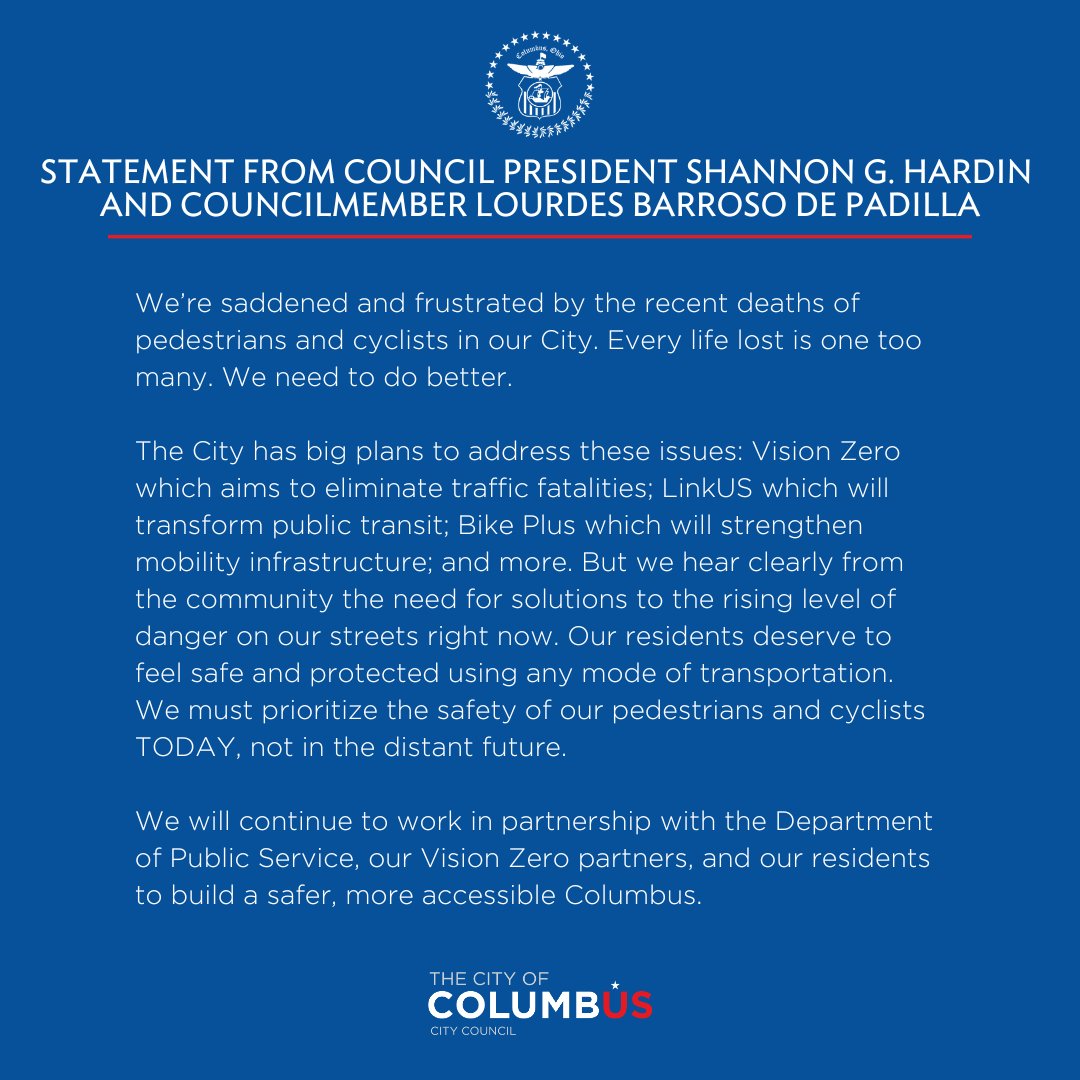
<p><a href="https://transitcolumbus.org/news-updates/bicyclist-killed-in-columbus">Transit Columbus led a letter-writing and turnout campaign</a>, which resulted in City Council issuing a statement several days before the hearing:</p>

<figure class="">
	<img src="https://benlk.com/static/2024-02-council-safety/GFRqCwMWcAAwwzR.jpeg" alt="Statement from Council President Shannon G. Hardin and Councilmember Lourdes Barroso de Padilla: We're saddened and frustrated by the recent deaths of pedestrians and cyclists in our City. Every life lost is one too many. We need to do better. The City has big plans to address these issues: Vision Zero which aims to eliminate traffic fatalities; LinkUS which will transform public transit; Bike Plus which will strengthen mobility infrastructure, and more. But we hear clearly from the community the need for solutions to the rising level of danger on our streets right now. Our residents deserve to feel safe and protected using any mode of transportation. We must prioritize the safety of our pedestrians and cyclists TODAY, not in the distant future. We will continue to work in partnership with the Department of Public Service, our Vision Zero partners, and our residents to build a safer, more accessible Columbus." />
	<figcaption><a href="https://twitter.com/columbuscouncil/status/1753151384591966506">Columbus City Council tweeted statement from Council President Shannon G. Hardin and Councilmember Lourdes Barroso de Padilla on the recent deaths of pedestrians and cyclists in Columbus</a>, February 1, 2024.</figcaption>
</figure>

<p>After the meeting:</p>

<figure class="">
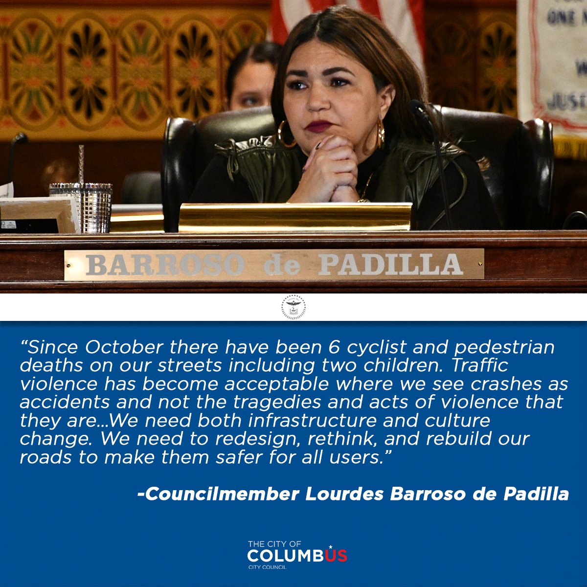
	<img src="https://benlk.com/static/2024-02-council-safety/GFm_vNRWAAEwcGN.jpeg" alt="Since October there have been 6 cyclist and pedestrian deaths on our streets including two children. Traffic violence has become acceptable where we see crashes as accidents and not the tragedies and acts of violence that they are...We need both infrastructure and culture change. We need to redesign, rethink, and rebuild our roads to make them safer for all users. - quote from Councilmember Lourdes Barroso de Padilla, posted underneath a photo of her in the Council chambers, looking serious." />
	<figcaption>Columbus City Council tweeted: <a href="https://twitter.com/ColumbusCouncil/status/1754650721889173677">"Tonight, Council heard suggestions from community advocates and activists on traffic safety. We appreciate their voices and remain committed to working with the community."</a> February 5, 2024.</figcaption>
</figure>

<ul>
  <li><a href="https://columbusunderground.com/advocates-call-for-action-in-wake-of-recent-cyclist-and-pedestrian-deaths-bw1/">Advocates Call for Action in Wake of Recent Cyclist and Pedestrian Deaths</a>, Columbus Underground, February 5</li>
  <li><a href="https://www.nbc4i.com/news/local-news/columbus/advocates-make-voices-heard-at-columbus-city-council-after-bicyclist-killed-by-truck/">Advocates make voices heard at Columbus City Council after bicyclist killed by truck</a>, NBC4i, February 5</li>
  <li><a href="https://www.10tv.com/article/news/local/group-pushes-for-short-term-changes-improve-biker-pedestrian-safety-in-columbus/530-2d49c91b-b86b-443e-8509-ee564d8356eb">Group pushes for short term changes to improve biker, pedestrian safety in Columbus</a>, 10TV, February 5</li>
  <li><a href="https://www.dispatch.com/story/news/local/2024/02/06/columbus-council-asked-to-consider-allowing-bikes-on-some-sidewalks-along-dangerous-roadways/72456131007/">Cyclists want Columbus to allow bikes on certain sidewalks and inclusion in road upgrades</a>, Columbus Dispatch, February 6</li>
  <li><a href="https://twitter.com/estabrookbae/status/1754872144767377868">Statement from Brian Estabrook</a>, board president of <a href="https://www.yaybikes.com/">Yay Bikes!</a>, February 6</li>
</ul>

<h2 id="how-can-you-help">How can you help?</h2>

<ol>
  <li>If there are areas where you want to see a crosswalk marked, <a href="https://new.columbus.gov/311-Customer-Service-Center">file a 311 request</a></li>
  <li>Write to <a href="https://new.columbus.gov/Government/City-Council">your City Council members</a> to ask them for safety improvements in your area, and include suggestions for specific fixes</li>
  <li>Provide comments on <a href="https://www.morpc.org/news/public-comments-to-be-accepted-on-updates-to-two-regional-transportation-funding-policies/?utm_source=substack&amp;utm_medium=email">MORPC's proposed Complete Streets policy</a>.</li>
  <li><a href="https://cbusareacommissions.org/">Attend your local Area Commission meetings</a> and push for improved street safety</li>
  <li><a href="https://storymaps.arcgis.com/stories/fa0d7f19855a46f5a67ad741da665439?header=false&amp;cover=false">Sign up for Columbus' Bike Plus newsletter</a> and give them feedback when they announce new plans</li>
  <li><a href="https://survey123.arcgis.com/share/64a48600b44a452093434a89a638f5cb">Sign up for Columbus' Vision Zero newsletter</a> (by "taking the pledge") and <a href="https://vision-zero-columbus.hub.arcgis.com/">keep an eye on the Vision Zero website</a> for future updates</li>
  <li><a href="https://twitter.com/bikelaneuprise/status/1754711242802123133">Donate money towards providing free bike lights to Columbus residents</a></li>
  <li><a href="https://www.moveoh.io/">Follow Move Ohio</a>, a state-level transit org.</li>
</ol>

<p>If you want to receive notice of future group actions like this, good ways to do so include:</p>

<ul>
  <li>Subscribe to <a href="https://goodworkscolumbus.substack.com/">Trevin Flickinger's Good Works Columbus newsletter</a></li>
  <li>Join <a href="https://transitcolumbus.org/">Transit Columbus</a></li>
  <li>Join <a href="https://www.yaybikes.com/">Yay Bikes!</a></li>
</ul>]]></content><author><name>Ben Keith</name></author><category term="Columbus," /><category term="Linden" /><summary type="html"><![CDATA[Columbus has big plans for the future, but Columbus needs to also make quick fixes in the present.]]></summary></entry><entry><title type="html">Proposal for improved street safety in Ohio</title><link href="https://benlk.com/2023/11/22/speed-limit-street-safety/" rel="alternate" type="text/html" title="Proposal for improved street safety in Ohio" /><published>2023-11-22T00:00:00-05:00</published><updated>2023-11-22T00:00:00-05:00</updated><id>https://benlk.com/2023/11/22/speed-limit-street-safety</id><content type="html" xml:base="https://benlk.com/2023/11/22/speed-limit-street-safety/"><![CDATA[<h2 id="the-current-state-of-affairs">The current state of affairs</h2>

<p>It's hard for Ohio municipalities to lower speed limits on their roads.</p>

<p>In early 2023, the City of Columbus had to designate its entire downtown as a "business area" <a href="https://web.archive.org/web/20230325052152/https://www.dispatch.com/story/news/local/2023/02/07/odot-approval-sought-to-cut-downtown-speed-limits-to-25-mph-limit/69871374007/">in order to lower the speed limit on several roads to 25mph</a>. The city of Cleveland Heights had to <a href="https://www.cleveland.com/data/2022/12/why-cleveland-heights-was-able-to-change-speed-limits-on-some-local-roads-starting-wednesday.html">redesignate several streets as not thru streets</a> in order to lower their speed limits to 25mph. These cities couldn't simply change the speed limits on their roads; they had to change how the road was classified.</p>

<p>The reason for this procedure is because of how speed limits are set in Ohio: <a href="https://codes.ohio.gov/ohio-revised-code/section-4511.21">Section 4511.21 of the Ohio Revised Code</a> prescribes the speed limits for certain types of roads, which sounds quite simple and straightforward. There's three<sup id="fnref:three" role="doc-noteref"><a href="#fn:three" class="footnote" rel="footnote">1</a></sup> general ways that Ohio cities can create a lower-speed zone:<sup id="fnref:zone" role="doc-noteref"><a href="#fn:zone" class="footnote" rel="footnote">2</a></sup></p>

<ol>
  <li>Change the road's designation from "through" to "local" (4511.21(B)(2)) — but only if the road is not a state route outside a business district (4511.21(B)(3))</li>
  <li>Designate an area as a "business district", which requires that "fifty per cent or more of the frontage between such successive intersections is occupied by buildings in use for business" (4511.01(NN))</li>
  <li>Conduct a speed study to determine the "safe" or "reasonable" speed limit for that piece of road (4511.21(H)(1))</li>
</ol>

<p>For example, consider the stretch of Cleveland Avenue where a driver hit a family of four, <a href="https://www.nbc4i.com/news/local-news/columbus/two-juveniles-killed-adult-and-juvenile-injured-after-being-hit-by-car-in-south-linden/">killing two children and hospitalizing the mother and remaining child</a>: It's Ohio State Route 3, so the starting speed limit is 35mph. Changing the road designation from "through" to "local" doesn't override that, because it's a state route. There isn't a high density of businesses there, thanks to <a href="https://columbusunderground.com/city-hopes-to-jumpstart-investment-in-linden-with-new-plan-bw1/">historical disinvestment and population declines</a>, so it cannot be designated a "business district". The only way to lower the speed limit would be to conduct a speed study.</p>

<p><a href="https://www.transportation.ohio.gov/programs/traffic-regulations/speed-zones/local-speed-zones">Here's a flowchart of the speed study process</a>. The speed study depends on <a href="https://highways.dot.gov/safety/speed-management/uslimits2">USLIMITS2</a>, a program which uses the 85th-percentile rule to determine the appropriate speed limit:</p>

<blockquote>
  <p>Traffic engineers record how fast vehicles are traveling on a road, determine the speed that 85 percent of drivers are traveling at or below, then set the new speed limit by rounding from that speed to the nearest 5 mph increment. Traffic engineers who use the 85th percentile method are instructed to raise the speed limit when more than 15% of drivers are driving faster than posted signs. This method forces engineers to adjust speed limits to match observed driver behavior instead of bringing driver behavior in line with safety goals and the law. When it comes to safety, this method is designed to fail. <cite><a href="https://nacto.org/publication/city-limits/the-need/designed-to-fail/">Designed to Fail: The Problem with Percentile-Based Speed Limits</a>, National Association of City Transportation Officials</cite></p>
</blockquote>

<p>If municipalities want to lower their speed limits on high-speed roads, the process is not designed to support that.</p>

<p>We need a way for Ohio municipalities to control their own speed limits.</p>

<h2 id="where-change-is-needed">Where change is needed</h2>

<p>The places where change is most sorely needed are the places where there are significant mixings of vehicles with other forms of traffic. This means places like school zones, roads without sidewalks, and areas with lots of bike and scooter riders. How do we make these areas safer? Well, studies show that lowering the speed limit reduces the chance that a crash kills someone<sup id="fnref:2" role="doc-noteref"><a href="#fn:2" class="footnote" rel="footnote">3</a></sup>, whether that person is on a scooter or on foot or in a car.</p>

<blockquote>
  <p>The greater the speed of a vehicle at the time of a crash, the higher the risk of death for a pedestrian struck. <cite><a href="https://highways.dot.gov/public-roads/winter-2022/05">Speed management is key to road safety</a>, Federal Highway Administration, 2022</cite></p>
</blockquote>

<h2 id="the-proposal">The proposal</h2>

<p>First, amend <a href="https://codes.ohio.gov/ohio-revised-code/section-4511.01">4511.01</a> to define some terms that aren't currently defined in Ohio law. New text is shown in green with a dotted underline:</p>

<ul>
  <li>(WWW) "Low-speed micromobility device" means a device weighing less than one hundred pounds that has handlebars, is propelled by an electric motor or human power, and has an attainable speed on a paved level surface of not more than twenty miles per hour when propelled by the electric motor</li>
  <li><ins>(XXX) "Bikeway" means a way improved, designed, or ordinarily used for travel by bicycle and low-speed micromobility device, whether that way is part of a street or highway or is on an independent alignment. A bikeway does not include shared lanes, sidewalks, signed bicycle routes, or shared lanes with shared lane markings, but does include bicycle boulevards and bicycle lanes.</ins></li>
  <li><ins>(YYY) "Bicycle lane" or "bike lane" means a lane marked on a roadway for the exclusive use of bicycles and low-speed micromobility devices. Bike lanes may be designated by means including signage, road markings, and alternative pavement coloration.<ins>
</ins></ins>    <ul>
      <li><ins>(1) "Paint-only bike lane", "painted bike lane", or "striped bike lane" means a bike lane with no horizontal or vertical separation from motor vehicle traffic or adjacent parking lanes, other than lane markings. </ins></li>
      <li><ins>(2) "Buffered bike lane" means a striped on-street bike lane paired with a striped or painted horizontal buffer space separating the bike lane from the adjacent motor vehicle travel lane and/or parking lane.<ins></ins></ins></li>
      <li><ins>(3) "Separated bike lane" means a bicycle lane that is physically separated from motor vehicle traffic by non-crashworthy vertical elements and a horizontal buffer space.</ins></li>
      <li><ins>(4) "Protected bike lane" means a bicycle lane that is physically separated from motor vehicle traffic by crashworthy vertical elements such as a curb, Jersey barrier, railing, bollard, or other object capable of stopping a motor vehicle from entering the bike lane.</ins></li>
      <li><ins>(5) "Sidewalk-level bike lane" means a protected bike lane which is elevated above the adjacent roadway to the level of the adjacent sidewalk, and which is separated from the roadway by a vertical curb.</ins></li>
    </ul>
  </li>
  <li><ins>(ZZZ) "Bicycle boulevard", also known as a "bike boulevard" or "neighborhood bikeway", means a roadway designated by local authorities which gives priority to pedestrians and users of low-speed micromobility devices by minimizing motorized traffic volumes and operating speeds.</ins></li>
  <li><ins>(AAAA) "Bus lane" means a lane on a roadway designated for the exclusive use of public transit buses, or other bus operators as designated on signage by the local or state authority which established the bus lane. Bus lanes may be designated by means including signage, road markings, and alternative pavement coloration.</ins></li>
</ul>

<p>Why do the specific types of bike lane need to be enumerated? To provide a clear list of what is meant by "protected" and "unprotected", because there is some disagreement on whether "protected" allows for flexible plastic posts or whether it requires barriers capable of stopping cars.</p>

<p>Then, amend the <em>prima-facie</em> speed limits defined in <a href="https://codes.ohio.gov/ohio-revised-code/section-4511.21">4511.21</a> to provide for lower default speed limits in residential districts:</p>

<ul>
  <li>(B) It is prima-facie lawful, in the absence of a lower limit declared or established pursuant to this section by the director of transportation or local authorities, for the operator of a motor vehicle, trackless trolley, or streetcar to operate the same at a speed not exceeding the following:
    <ul>
      <li>… <br />
(2) Twenty-five miles per hour in all other portions of a municipal corporation, except on state routes outside business districts <ins>and residence districts</ins>, through highways outside business districts, and alleys;</li>
    </ul>
  </li>
</ul>

<p>This is necessary because Ohio law currently only allows speed limits to be lowered by designation of a "business area", which Columbus recently did for its downtown. If you have a road running through a dense walkable housing area, like most streetcar neighborhoods in Columbus, the default speed limit is 35mph and cannot be lowered without traffic studies. This is why the speed limit on Cleveland Avenue is 35mph, despite residents asking the city to lower the speed for decades.</p>

<p>While we're in 4511.21, add a speed limit clause to allow municipalities to lower the speed limit on roads where there are higher amounts of Vulnerable Road Users sharing the roadway with vehicles:</p>

<ul>
  <li>(B) It is prima-facie lawful, in the absence of a lower limit declared or established pursuant to this section by the director of transportation or local authorities, for the operator of a motor vehicle, trackless trolley, or streetcar to operate the same at a speed not exceeding the following:
    <ul>
      <li>…<br />
<ins>(17) Fifteen miles per hour on:</ins>
        <ul>
          <li><ins>(a) all designated bike boulevards</ins></li>
          <li><ins>(b) all streets and highways within a residence district, provided that the street or highway has two lanes or fewer and lacks sidewalks or shared-use paths on at least one side of the road, or has more than two lanes and lacks sidewalks or shared-use paths on both sides of the road.</ins></li>
          <li><ins>(c) a street or highway that is directly connected to, and within half a mile of, a school zone as defined in division (B)(1) of this section, provided that the street or highway has two lanes or fewer and lacks sidewalks on at least one side of the road, or has more than two lanes and lacks sidewalks on both sides of the road.</ins></li>
        </ul>
      </li>
      <li><ins>(18) Twenty miles per hour on all streets and highways within a municipal corporation which have a bike lane, provided that the bicycle lane is not a protected bike lane or a sidewalk-level bike lane.</ins></li>
    </ul>
  </li>
</ul>

<p>Finally, extend the list of locations in <a href="https://codes.ohio.gov/ohio-revised-code/section-4511.68">4511.68</a> where parking is not allowed, to add two more places where parking creates an obstruction to the orderly flow of traffic and introduces new hazards:</p>

<ul>
  <li>(A) No person shall stand or park a trackless trolley or vehicle, except when necessary to avoid conflict with other traffic or to comply with sections 4511.01 to 4511.78, 4511.99, and 4513.01 to 4513.37 of the Revised Code, or while obeying the directions of a police officer or a traffic control device, in any of the following places:
    <ul>
      <li>… <br />
<ins>(17) Within a bike lane;</ins></li>
      <li><ins>(18) Within a bus lane.</ins></li>
    </ul>
  </li>
</ul>

<h2 id="the-reasoning">The reasoning</h2>

<p>This set of changes is designed to allow Ohio municipalities to lower speed limits where they believe it is necessary, using a toolkit that is designed to encourage good street design while rewarding protective upgrades. Because the Ohio Revised Code recognizes that signage trumps the <em>prima facie</em> speed limits in the ORC, no delay in implementation is necessary. The revised speed limits will go into effect when a local municipality adjusts their signage to match the new speed limits, which they can do immediately, or as part of a road redesign to incorporate protections for non-drivers.</p>

<p>This bill isn't just about bicycles, though most of the new definitions are about classes of bike lane. This bill would improve safety for children walking to school and other pedestrians. It would improve service reliability for bus operators. Faster, more-reliable buses mean that people will switch to buses, which are safer than cars. It'll also help school buses get to school on time, and shorten commutes. It would also reduce the amount of damage from motor vehicle crashes on these streets by lowering vehicle speeds.</p>

<p>Finally, the new speed limits in 4511.21(B)(17-18) are low, and <em>could</em> be adjusted higher,<sup id="fnref:higher" role="doc-noteref"><a href="#fn:higher" class="footnote" rel="footnote">4</a></sup> but do we allow people to drive more than 15mph in parking lots? Why should drivers be allowed to go faster in other places with similar volumes of pedestrians? This proposal is somewhat radical, I know.</p>

<p>Less radical is the notion that municipalities should have the power to set safe speed limits, instead of begging unelected Columbus bureaucrats for permission to make streets safe. ODOT does care about street safety, and often allows municipalities to set their own speed limits, but if ODOT is going to approve the changes anyways, why should municipalities be forced to waste money on traffic studies to justify a lowered speed limit? It's time to apply <a href="https://www.statenews.org/government-politics/2019-10-21/home-rule-in-ohio-under-attack-or-reined-in">Ohio's Home Rule provisions</a> to lower speed limits.</p>

<p>Also note that this bill doesn't remove street parking to create bus lanes or bike lanes. It just reserves those lanes for their intended use, protecting them against blockages.</p>

<p>I believe that these changes could be pitched to the House as a "Safe Streets for Kids" law, with a particular focus on making streets safe for children to walk and bike to school, and allowing children to develop healthy independence in a responsible and age-appropriate manner.</p>

<h2 id="how-you-can-help">How you can help</h2>

<p>Organizations: Review this bill, then be prepared to testify in support when it comes before committee. <sup id="fnref:2024" role="doc-noteref"><a href="#fn:2024" class="footnote" rel="footnote">5</a></sup></p>

<p>Individuals: Contact your reps and ask them to support Rep. Ismail Mohamed's street safety bills.</p>

<p>You can also contact your legislators to ask them to reintroduce <a href="https://legislature.ohio.gov/legislation/132/hb436">A bill to permit locals to request stop sign or lower speed limit</a>, last seen as HB 436 in committee in January 2018, and you can speak in favor of some <a href="https://web.archive.org/web/20231124112739/https://www.dispatch.com/story/news/politics/2023/11/23/heres-what-ohio-traffic-laws-changed-were-introduced-in-2023/71570997007/">current bills addressing bus safety, drunk driving, and drivers who kill parents</a>.</p>

<hr />

<style>
  h2#notes {
    font-size: 1.6rem;
  }
</style>

<h2 id="notes">Notes</h2>

<div class="footnotes" role="doc-endnotes">
  <ol>
    <li id="fn:three" role="doc-endnote">
      <p>These three methods are the methods that I'm aware of, and which I have heard planners talk about. <a href="#fnref:three" class="reversefootnote" role="doc-backlink">&#8617;</a></p>
    </li>
    <li id="fn:zone" role="doc-endnote">
      <p>The stretch of road where this new speed limit applies is called a <a href="https://www.transportation.ohio.gov/programs/traffic-regulations/speed-zones">speed zone</a>. ODOT maintains <a href="https://odotextrpt.dot.state.oh.us/traffic/">a database listing all speed zones in the state</a> — at least in some ODOT districts. District 6, which covers Columbus, and District 2, covering Toledo, are not included. <a href="#fnref:zone" class="reversefootnote" role="doc-backlink">&#8617;</a></p>
    </li>
    <li id="fn:2" role="doc-endnote">
      <p><a href="https://www.ncbi.nlm.nih.gov/pmc/articles/PMC5906382/">Traveling by Bus Instead of Car on Urban Major Roads: Safety Benefits for Vehicle Occupants, Pedestrians, and Cyclists</a>, by Patrick Morency, Jillian Strauss, Félix Pépin, François Tessier, and Jocelyn Grondines. Journal of Urban Health, April 2018. <a href="https://doi.org/10.1007%2Fs11524-017-0222-6">doi: 10.1007/s11524-017-0222-6</a>. Key quote: "Results show that city bus is a safer mode than car, for vehicle occupants but also for cyclists and pedestrians traveling along these bus routes." <a href="#fnref:2" class="reversefootnote" role="doc-backlink">&#8617;</a></p>
    </li>
    <li id="fn:higher" role="doc-endnote">
      <p>Introduce the speed limits at 15, amend to 20. #TwentyIsPlenty <a href="#fnref:higher" class="reversefootnote" role="doc-backlink">&#8617;</a></p>
    </li>
    <li id="fn:2024" role="doc-endnote">
      <p>My proposal may be introduced as early as January 2024. <a href="#fnref:2024" class="reversefootnote" role="doc-backlink">&#8617;</a></p>
    </li>
  </ol>
</div>]]></content><author><name>Ben Keith</name></author><category term="Blog," /><category term="Columbus" /><summary type="html"><![CDATA[A bill providing for safer speed limits on roads with high populations of vulnerable road users, and preserving free use of reserved lanes.]]></summary></entry><entry><title type="html">How to make an award-winning costume in very little time, or: A Day In The Life Of A Pumpkin 🎃</title><link href="https://benlk.com/2023/10/01/halloween-project-delivery/" rel="alternate" type="text/html" title="How to make an award-winning costume in very little time, or: A Day In The Life Of A Pumpkin 🎃" /><published>2023-10-01T00:00:00-04:00</published><updated>2023-10-01T00:00:00-04:00</updated><id>https://benlk.com/2023/10/01/halloween-project-delivery</id><content type="html" xml:base="https://benlk.com/2023/10/01/halloween-project-delivery/"><![CDATA[<p>This blog post was written for 10up's internal blog, and was published the day of Halloween in 2022.</p>

<p>I had received several questions about the pumpkin head I wore to the monthly all-hands meeting on the Thursday before Halloween, including how I could even see while wearing the pumpkin. This blog post was the reaction.</p>

<p>This post contains the view from the inside: the development process, resources used, a user experience study, client feedback, lessons learned, and next steps in this pumpkin’s development.</p>

<hr />

<figure class="">
	<img src="https://benlk.com/static/2022-halloween/image-1-1-1024x202.png" alt="" />
	<figcaption>The winners of the 2022 Spooktacular Monthly All Hands Meeting Costume Contest. Congrats to Mr Jangles and the Cookie Monster for their excellent costumes.</figcaption>
</figure>

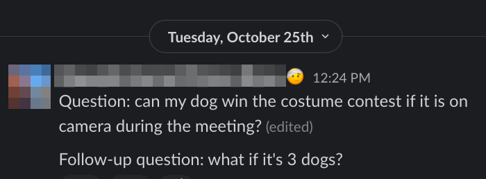
<p>The first part of any good costume is coming up with an idea. During last year’s Halloween Town Hall, I carved a couple of pumpkins live on camera. I knew that I was going to carve again this year, but the idea of dressing up for it didn’t enter my head until one of my frontend engineer coworkers asked in #watercooler:</p>

<figure class="">
	<img src="https://benlk.com/static/2022-halloween/Screen-Shot-2022-10-27-at-12.28.57.png" alt="" />
</figure>

<p>I knew immediately that I needed to make a pumpkin head for work-related purposes.</p>

<h2 id="functional-requirements">Functional Requirements</h2>

<p>From the beginning, I knew that using a real pumpkin as a costume head wouldn’t work. A real pumpkin large enough to fit my head inside would be too heavy to comfortably wear, and then there’s the minor issue of getting pumpkin guts in my hair. I would need an artificial pumpkin.</p>

<p>Other important requirements for this project included:</p>

<ul>
  <li>Being able to see out of the pumpkin while wearing it</li>
  <li>Limiting the cost of supplies</li>
  <li>Acquiring no new tools</li>
  <li>Limiting construction techniques to only those which have been previously used</li>
  <li>Documenting the development process, in order to satisfy coworker expectations</li>
  <li>A two-day turnaround (noon Tuesday to 10:15 a.m. Thursday)</li>
</ul>

<h2 id="resourcing">Resourcing</h2>

<p>Where could I find an artificial pumpkin on short notice?</p>

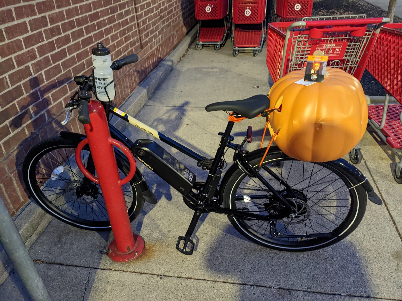
<p>After searching local drug-store and craft-store websites, I discovered that the local Target was finishing clearing out their Halloween decorations, and they had a selection of plastic pumpkins available. After work on Tuesday, I hopped on my bike and rode down to the Target to acquire a pumpkin.</p>

<p>Target had a decent selection of plastic pumpkins, and after weighing the various options, I chose the biggest one, to be sure that my head would fit inside.</p>

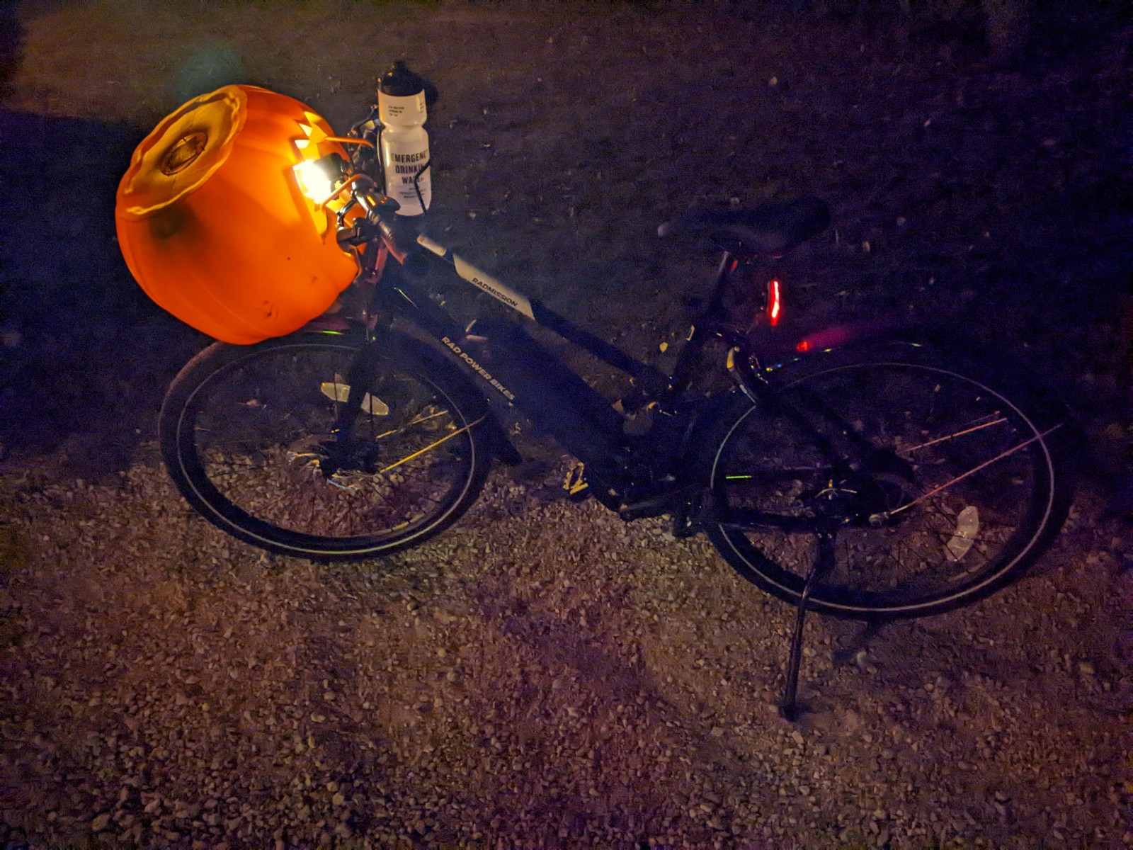
<p>But then I had to get it home, and my bike — freshly assembled last weekend — didn’t have a cargo rack yet. I brought bungee cords, but without a rack to secure the pumpkin, its placement was iffy.</p>

<figure class="">
	<img src="https://benlk.com/static/2022-halloween/PXL_20221025_225634337.jpg" alt="" />
	<figcaption>On the rear of my bike, the pumpkin blocked the taillight, which is an essential safety feature when riding on the road. This solution was a nonstarter.</figcaption>
</figure>

<figure class="">
	<img src="https://benlk.com/static/2022-halloween/PXL_20221025_232701552.jpg" alt="" />
	<figcaption>I rode three miles with the headlight shining into the pumpkin, before deciding that the glare was unacceptable.</figcaption>
</figure>

<p>I ended up bungeeing the pumpkin to my backpack for the last mile and a half of my ride.</p>

<h2 id="development">Development</h2>

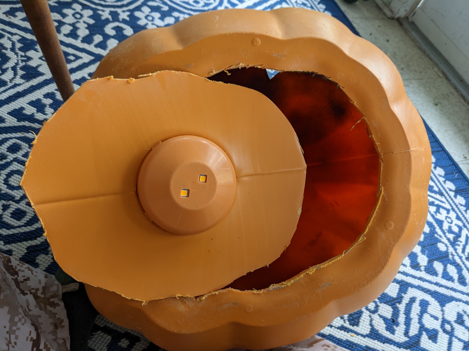
<p>Safely home, I needed to carve a neck hole to put the pumpkin on my head. This plastic pumpkin is quite sturdy, with 3/32″ plastic walls that a boxcutter, craft knife, and cleaver wouldn’t cut. Fortunately, I have a Dremel rotary tool with cutting wheels, which made swift work of the neck hole.</p>

<figure class="">
	<img src="https://benlk.com/static/2022-halloween/PXL_20221027_132638364.jpg" alt="" />
	<figcaption>
The neck hole is about 8.5″ front to back, and 11″ shoulder to shoulder. This is small enough that I have to put the pumpkin on sideways and then rotate it into position. I’m glad I bought the largest pumpkin.</figcaption>
</figure>

<h2 id="considerations">Considerations</h2>

<p>There are two important considerations to any costume mask:</p>

<ol>
  <li>Being able to see out</li>
  <li>Only showing what you want others to see.</li>
</ol>

<p>To improve the wearer’s ability to see out of costume masks I make, I paint the inside a matte black. This improves contrast and reduces glare. Unfortunately, my matte black spraypaint can ran out of paint before I could get a solid coat completed.</p>

<figure class="">
	<img src="https://benlk.com/static/2022-halloween/PXL_20221027_132613087.jpg" alt="" />
	<figcaption>The spraypaint barely covers the inside of the mask. Good enough for a rush job, I guess?</figcaption>
</figure>

<p>To make sure I’m only showing off what I want to show, I decided to use a stretchy black gauze, sourced from my fabric scraps bin, to filter light in the eye holes. To secure it inside the pumpkin, I used hot glue at the corners of the carvings. Hot glue worked great to bond the synthetic fabric to the plastic pumpkin.</p>

<figure class="">
	<img src="https://benlk.com/static/2022-halloween/PXL_20221027_133701465.jpg" alt="" />
	<figcaption>
A progress photo showing partially-applied gauze, inside the pumpkin. The eyes and nose are already covered, but the sheet covering the mouth has only been secured at the corners of the smile.</figcaption>
</figure>

<p>Some scope reductions were necessary to meet the deadline. If I’d had time, and a spare construction-worker hard hat, I would have used the hard hat liner to provide a rig for wearing the pumpkin. Position the liner inside the pumpkin with zip ties, then hot-glue in hard supports made from scrap cardboard. Unfortunately, I was out of spare hard hat liners, and I didn’t have the time to do this, so when I wore this pumpkin to the first client call of the day, the pumpkin just kind of flopped around on my head.</p>

<h2 id="deployment-and-user-acceptance-testing">Deployment and User Acceptance Testing</h2>

<figure class="">
	<img src="https://benlk.com/static/2022-halloween/Screen-Shot-2022-10-27-at-12.58.49.png" alt="" />
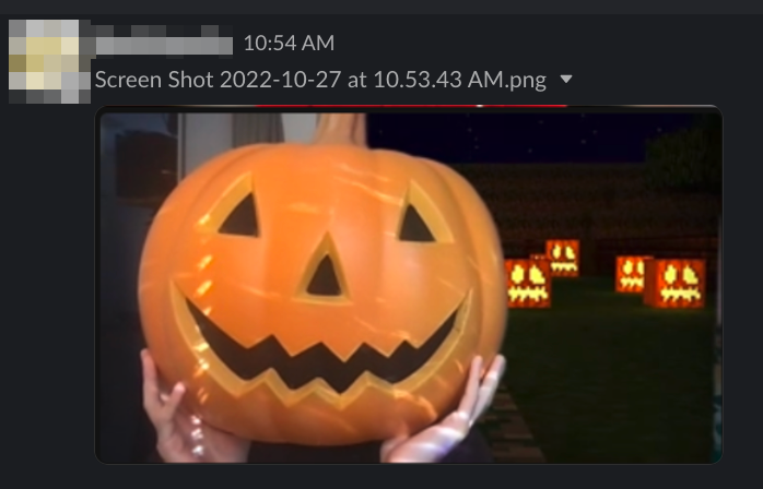
	<figcaption>Context: this poster is one of our clients' WordPress team lead. The screenshot he posted in our shared channel comes from the weekly client call.</figcaption>
</figure>

<p>All the 10uppers on my first client call Thursday morning were wearing our Halloween best, and the client team loved it.</p>

<p>The floppy, unsecured head was actually a benefit, because it allowed me to move my head around within the pumpkin. The black gauze had its intended effect of hiding the head within the pumpkin head, so no one could see me frantically moving my head around in order to find my mouse pointer on the screen.</p>

<p>Over the course of the meeting, hot air built up in the pumpkin, and it really was quite warm. After the call, I used the Dremel to hollow out the top of the stem, to provide a chimney for air to exit the pumpkin.</p>

<p>Then it was time for the Monthly All Hands, and pumpkin carving.</p>

<figure class="">
	<img src="https://benlk.com/static/2022-halloween/Screen-Shot-2022-10-27-at-13.03.34.png" alt="" />
	<figcaption>Team members expressed appropriate levels of concern.</figcaption>
</figure>

<p>The limited field of view really wasn’t a problem for pumpkin carving. Unlike trying to find a mouse pointer on a screen, I can feel where the pumpkin and carving tools are. But I also wasn’t carving blind, by any means! Knowing where the moving parts are let me line up my head inside the pumpkin to make sure I had a good line of sight on the tools.</p>

<p>Here’s the view from inside:</p>

<figure class="">
	<img src="https://benlk.com/static/2022-halloween/PXL_20221027_161923673-scaled.jpg" alt="" />
	<figcaption>See? The knives and spoon and steel are right there, in the right-hand corner of the smile. And the pumpkin guts are on the left. This isn’t actually a representative image of what I saw; my camera has trouble focusing inside the pumpkin. Having stereo vision and movement detection makes it easier for me to see things through the gauze.</figcaption>
</figure>

<p>Most of the time, I was looking out through the mouth, as it provided the widest viewport.</p>

<h2 id="lessons-learned">Lessons learned</h2>

<p>New lessons learned:</p>

<ul>
  <li>Order the bike basket at the same time as the bicycle</li>
  <li>Check paint levels more frequently, and check the number of spare hard hats on hand</li>
  <li>Cut vents on the top of hard-shell costumes, to prevent overheating and encourage ventilation.</li>
</ul>

<p>This project also benefited from lessons learned in past years’ costume head projects:</p>

<ul>
  <li>Use hot glue to secure the gauze, not super glue. Cyanoacrylate super glues will take days for the fumes to finish evaporating from the mask. These fumes are noxious, and painful to have right near your eyes for any extended period of time.</li>
  <li>Spraypaint the inside of the mask at least 12 hours before wearing it, to allow the fumes time to dissipate.</li>
  <li>A Dremel tool’s cut-off wheel is often faster and easier for cutting entrances and holes in large plastic items, when compared to using a drill to make an entry and then using a hacksaw blade to cut.</li>
  <li>Always wear safety goggles when using a Dremel rotary tool. When the cut-off wheel shatters, its pieces go flying.</li>
  <li>Do your cutting, painting, and gluing in a well-ventilated space. Screened porches, driveways, and garages are all acceptable. If you must do your fuming work inside, leave the window open, and use a kitchen or bathroom extractor fan to pull fumes out of the work area.</li>
  <li>Plastic dropcloths make for easier pumpkin-guts cleanup than newspaper.</li>
  <li>A narrow blade is more maneuverable when carving pumpkins. Long and thick knives look flashy, but are awkward, unwieldy, and hard to steer.</li>
</ul>

<p>Alternative solutions, if you’re now thinking about building your own pumpkin head for next Halloween:</p>

<ul>
  <li>Shopping purchases can be transported on foot, by bus, or in a car, not just bikes.</li>
  <li>Windowscreen also serves as a good obscuring fabric for eye and mouth holes, and is easier to paint if you want to do that.</li>
  <li>Prefab plastic pumpkins can be substituted with papier-mâché, paper models, or 3d printing. This is a good way to diversify from pumpkins into other categories of objecthead, or even character models.</li>
  <li>The entry hole can be cut in a plastic pumpkin with a hot knife, or a drill and hacksaw or coping saw. For paper pumpkins, I recommend a craft knife.</li>
  <li>Heirloom kitchen knives can be replaced in real-pumpkin-carving duty with regular-duty kitchen knives, but plastic “kid-safe” pumpkin-carving tools are not suited to the task.</li>
</ul>

<h2 id="next-steps">Next steps</h2>

<p>The jury is still out on the question of whether I’m going to wear this head agin. If I choose to wear it after this Halloween, next steps include:</p>

<ul>
  <li>Acquire a spare hard hat, and fit it within the pumpkin so that I can see out of the mouth easily.</li>
  <li>Touch up the interior paint.</li>
  <li>(optional) Build little periscopes so I can see out of the pumpkin’s eyes.</li>
  <li>(optional) Sew a gaiter for the neck of the pumpkin, to improve its integration with clothing.</li>
</ul>

<h2 id="costs">Costs</h2>

<p>Time invested on the pumpkin:</p>

<ul>
  <li>90 minutes on the shopping trip, plus other errands rolled into the same expedition</li>
  <li>30 minutes carving and painting</li>
  <li>30 minutes gluing</li>
</ul>

<p>Consumables:</p>

<ul>
  <li>Light-up plastic pumpkin (Target): $30</li>
  <li>Black gauze (cut-up drugstore tights): $5, maybe? This has been in my craft bin since 2014, I think.</li>
  <li>Black matte spraypaint: $8/can, already on hand from a summer project</li>
  <li>Hot glue: a pack of 100 sticks will run you about $7. I bought a pack in 2019 and haven’t run out yet. This project took one whole 4″ stick.</li>
  <li>Plastic painter’s dropcloths (to contain pumpkin guts): maybe $10? This was leftover from house painting in 2021.</li>
  <li>Pumpkins: $7 each at the grocery store</li>
</ul>

<p>Tools:</p>

<ul>
  <li>Hot glue gun, probably from Ace Hardware</li>
  <li>Dremel 200 dual-speed rotary tool with cut-off wheel, from Ace Hardware</li>
  <li>7″ fabric scissors, from Joann Fabrics</li>
  <li>A selection of my great-grandfather’s knives, from Tru-Edge Ontario Knife Co. and Harrington Cutlery Co.</li>
  <li>A knife sharpening steel, of unknown provenance</li>
  <li>A 3-ounce foodservice ladle, McDonald’s pattern, via Amazon</li>
</ul>

<h2 id="conclusion">Conclusion</h2>

<p>Thank you all for celebrating Halloween this year. It’s my favorite holiday, and it’s great to see everyone put forward their best costumes. Have a happy Halloween!</p>

<figure class="">
	<img src="https://benlk.com/static/2022-halloween/PXL_20221028_001841234-scaled.jpg" alt="" />
	<figcaption>An 😮 face and a 10up logo.</figcaption>
</figure>]]></content><author><name>Ben Keith</name></author><category term="Blog" /><summary type="html"><![CDATA[Notes from a 2022 Halloween project, as written up for work.]]></summary></entry><entry><title type="html">Slide Deck Handout: State of Columbus Urbanism</title><link href="https://benlk.com/2023/09/15/state-of-columbus-urbanism/" rel="alternate" type="text/html" title="Slide Deck Handout: State of Columbus Urbanism" /><published>2023-09-15T00:00:00-04:00</published><updated>2023-09-15T00:00:00-04:00</updated><id>https://benlk.com/2023/09/15/state-of-columbus-urbanism</id><content type="html" xml:base="https://benlk.com/2023/09/15/state-of-columbus-urbanism/"><![CDATA[<p>This blog post accompanies a presentation given on Friday, September 15, to provide links. You can't click on a PowerPoint presentation if you're in the audience.</p>

<h2 id="amtrak">Amtrak</h2>

<p>Map of current considerations for new Amtrak passenger rail service in Ohio, <a href="https://docs.google.com/presentation/d/1tvCmIFFNaRBwiCI7TGN-B11n9CuUoYxQHXP3FEw9WHM/edit#slide=id.g27e7697e4aa_0_55">via MORPC and /u/huskerduer</a>:</p>

<ul>
  <li>3C+D route: Cleveland, Mansfield, Delaware, Columbus, Dayton, Cincinnati</li>
  <li>NIRCC's Midwest Connect, which is better explained by the <a href="https://niprarail.org/who-we-are/">Northern Indiana Passenger Rail Association webpage's map</a>: Chicago, Gary, Balparaiso, Plymouth, Warsaw, Fort Wayne, Lima, Kenton, Marysville, Columbus. This is backed by MORPC who endorsed extending it from Columbus to Newark and Pittsburgh.</li>
  <li>Columbus-Mansfield-Toledo-Detroit service, by TMACOG and/or MORPC</li>
</ul>

<p>We'll know which of these routes get funding sometime this fall.</p>

<p>How to stay up to date?</p>

<ul>
  <li><a href="https://www.morpc.org/news/">MORPC's news page</a> and newsletter</li>
  <li><a href="https://www.allaboardohio.org/blog">All Aboard Ohio's blog</a></li>
  <li><a href="https://rail.ohio.gov/">Ohio Rail Development Commission newsletter</a> which is 95% about freight</li>
  <li>Someone is guaranteed to post about it to <a href="https://www.reddit.com/r/Columbus/">/r/Columbus</a></li>
</ul>

<h2 id="linkus---better-buses">LinkUS - better buses</h2>

<p>The first three corridors are Bus Rapid Transit:</p>

<ul>
  <li><a href="https://linkuscolumbus.com/northwest/">Northwest along the Olentangy</a></li>
  <li><a href="https://linkuscolumbus.com/east-main-street-brt-corridor/">East Main</a></li>
  <li><a href="https://linkuscolumbus.com/west-broad-street-brt-corridor/">West Broad</a></li>
</ul>

<p>Construction of those corridors depends on <a href="https://columbusunderground.com/mayor-says-linkus-transit-vote-planned-for-fall-2024-bw1/">a 2024 ballot measure</a> raising the COTA sales tax from 0.5% to 1%, matching other Ohio municipalities. This will fund both the BRT service as well as sidewalk improvements within half a mile of fixed-route bus stops and bikeway improvements within three miles of bus stops, as long as those connect to the bus stop.</p>

<p>Eventually, this plan might build a tram or light-rail connecting Downtown to the Airport and possibly Easton. For more about that, you'll need to dig into the Insight 2050 report, the JET Task Force, or other historical proposals.</p>

<p>But first, they're doing Bus Rapid Transit on surface streets in dedicated lanes.</p>

<p>How to stay up to date?</p>

<ul>
  <li><a href="https://www.morpc.org/news/">MORPC's news page</a> and newsletter</li>
  <li><a href="https://mailchi.mp/transitcolumbus/september-updates-bikeplus-overview?e=ae7a214baa">Transit Columbus's newsletter</a></li>
  <li><a href="https://columbusunderground.com/category/metro/transportation/">Columbus Underground has good coverage</a></li>
</ul>

<h2 id="cota">COTA</h2>

<p>COTA is still recovering from the COVID-19 pandemic. They're still short on drivers, and they haven't been the best at communicating to riders about things. This will hopefully improve.</p>

<p>How to stay up to date?</p>

<ul>
  <li><a href="https://cota.com/blog/">COTA's own blog</a> for some announcements. Route status changes are posted to the "Service alerts" section of <a href="https://cota.com/">the COTA homepage</a>, and new reroutes are announced via a temporary banner at the top of the page. Current reroute maps are not posted. For stop closures, you'll need to follow COTA on <a href="https://twitter.com/COTABus/">Twitter</a> or <a href="https://facebook.com/cotabus">Facebook</a>, where they post announcements about upcoming meetings regarding <a href="https://cota.com/servicechanges/">service changes</a>. There is no all-in-one solution. Some announcements are only posted in paper form on buses or at bus stops. The routes and stops shown in the official COTA maps, in Google Maps, or in the Transit App, may not reflect actual service, despite all of those drawing from COTA's own GTFS feeds.</li>
  <li>For long-term updates, subscribe to <a href="https://mailchi.mp/transitcolumbus/september-updates-bikeplus-overview?e=ae7a214baa">Transit Columbus's newsletter</a> and socials: <a href="https://twitter.com/transitcolumbus">Twitter</a>, <a href="http://www.facebook.com/transitcolumbus">Facebook</a>, <a href="https://bsky.app/profile/transitcolumbus.bsky.social">Bluesky</a>.</li>
</ul>

<h2 id="zoning-code-updates">Zoning Code Updates</h2>

<p>Columbus is updating its zoning code. The first phase is focused on <a href="https://experience.arcgis.com/experience/9299b1c7faba444b95e7720eb770ebc8/">several mixed-use corridors</a>, and will go before City Council in spring 2024 after several more rounds of community discussion. After that, they'll work on zoning code updates for the neighborhoods and for business districts.</p>

<p>Updating the zoning code to allow for more density isn't <em>mandatory</em> but <a href="https://benlk.com/2023/02/25/growth-and-density-training/">it is <em>necessary</em></a>. Intel will bring 30k people to Central Ohio, and the Central Ohio population has been growing by ~16k people per year. We're only building 10k units of housing per year. If we want to avoid becoming San Francisco, we need to build more housing fast. City employees have said that we need to double it at minimum.</p>

<p>How to stay updated:</p>

<ul>
  <li><a href="https://zone-in-columbus.hub.arcgis.com/pages/how-to-engage">View the list of upcoming events</a> on the Zone In Columbus website, and sign up for their newsletter or <a href="https://public.govdelivery.com/topics/OHCCC_340/feed.rss">subscribe to the Zone In Columbus RSS feed</a>.</li>
  <li>Go to those meetings!</li>
  <li><a href="https://columbusunderground.com/opinion-clintonville-nimbys-couldnt-be-more-wrong-on-zoning-updates-we1/">Columbus Underground has good pro-change coverage</a>; the Columbus Dispatch regularly <a href="https://www.dispatch.com/story/news/local/2023/09/05/columbus-officials-say-expected-population-surge-and-housing-shortage-driving-zoning-changes/70646477007/">platforms NIMBYs without fact-checking them</a>.</li>
  <li><a href="https://www.matternews.org/community/developus">Matter News' development coverage</a> is also good, as is the occasional <a href="https://ohiocapitaljournal.com/2023/09/11/whats-the-matter-with-zoning/">Ohio Capital Journal commentary</a></li>
</ul>

<h2 id="bike-plus">Bike Plus</h2>

<p><a href="https://storymaps.arcgis.com/stories/fa0d7f19855a46f5a67ad741da665439?cover=false&amp;header=false&amp;utm_medium=email&amp;utm_source=govdelivery">Bike Plus</a> is about bikes, scooters, skateboards, rollerskates, monowheels, and really every form of transportation that isn't your own feet or a motor vehicle. It's about building more safe infrastructure.</p>

<p>They might even be able to write <a href="https://usa.streetsblog.org/2023/09/06/american-streets-may-soon-get-their-first-accessible-design-standards-from-the-feds">the Public Right Of Way Access Guidelines</a> (PROWAG) into Columbus' code. Or take into account <a href="https://mutcd.fhwa.dot.gov/index.htm">the delayed 11th Edition of the Manual on Uniform Traffic Control Devices for Streets and Highways</a>, which was due on May 15, 2023.</p>

<p>Ways to stay involved:</p>

<ul>
  <li>Find your local group bike ride. For some reason, most of these are on Instagram</li>
  <li><a href="https://survey.alchemer.com/s3/7363343/Columbus-Bikeways-and-Micromobility">Fill out the Bike Plus survey</a> and visit <a href="https://storymaps.arcgis.com/stories/fa0d7f19855a46f5a67ad741da665439?cover=false&amp;header=false&amp;utm_medium=email&amp;utm_source=govdelivery">the bike plus website</a> and subscribe to their newsletter.</li>
  <li><a href="https://mailchi.mp/transitcolumbus/september-updates-bikeplus-overview?e=ae7a214baa">Transit Columbus's newsletter</a> and socials: <a href="https://twitter.com/transitcolumbus">Twitter</a>, <a href="http://www.facebook.com/transitcolumbus">Facebook</a>, <a href="https://bsky.app/profile/transitcolumbus.bsky.social">Bluesky</a>.</li>
  <li>Yay Bikes does some advocacy in this area; <a href="https://www.yaybikes.com/">check out their newsletter</a></li>
</ul>

<h2 id="accessory-dwelling-units">Accessory Dwelling Units</h2>

<p>ADUs are one tiny part of <a href="https://www.housingforallcbus.com/housing-initiatives">City Council's Upcoming Housing Initiatives</a>, but they're a big one. If Columbus legalizes ADUs citywide, that has the potential to double the housing density in most neighborhoods.</p>

<p>How to stay involved:</p>

<ul>
  <li>Subscribe to the newsletters put out by the city. I can't point you to one single place to do that.</li>
  <li>Therefore: <a href="https://www.wired.com/story/best-rss-feed-readers/">get yourself an RSS Feed Reader</a>, then <a href="https://github.com/benlk/columbus-govdelivery-rss/">subscribe yourself to the RSS feeds of every single Columbus GovDelivery newsletter</a></li>
</ul>

<h2 id="airport-renovations">Airport Renovations</h2>

<p>The Columbus Regional Airport Authority is planning <a href="https://flycolumbus.com/at-port-columbus/terminal-modernization-program">to build a new airport terminal at John Glenn Columbus International Airport</a>, replacing the current three terminals with a single terminal. No longer will you have to exit the secure area to switch airlines!</p>

<p>How to stay up to date:</p>

<ul>
  <li>No real good way; CRAA has a <a href="https://flycolumbus.com/news-hub">News Hub</a> but doesn't post this stuff there</li>
  <li>Columbus Business First or Columbus Underground are your best bets</li>
</ul>

<h2 id="vision-zero">Vision Zero</h2>

<p>Vision Zero is the goal to eliminate fatal and serious-injury crashes. Columbus was one of the first cities in the country to have a Vision Zero plan; over the first few years of its existence there were no improvements in safety. Now, Council has passed the Vision Zero Action Plan 2.0, which includes <em>a lot</em> of safety improvements, but nowhere near as much as advocates wished for.</p>

<p>How to get involved:</p>

<ul>
  <li>Sign up for Vision Zero updates by clicking "<a href="https://survey123.arcgis.com/share/64a48600b44a452093434a89a638f5cb">Take the Pledge</a>" on the Vision Zero Columbus "<a href="https://vision-zero-columbus.hub.arcgis.com/pages/get-involved">Get Involved</a>" page.</li>
  <li><a href="https://mailchi.mp/transitcolumbus/september-updates-bikeplus-overview?e=ae7a214baa">Transit Columbus's newsletter</a> and socials: <a href="https://twitter.com/transitcolumbus">Twitter</a>, <a href="http://www.facebook.com/transitcolumbus">Facebook</a>, <a href="https://bsky.app/profile/transitcolumbus.bsky.social">Bluesky</a>.</li>
  <li>Yay Bikes does some advocacy in this area; <a href="https://www.yaybikes.com/">check out their newsletter</a></li>
</ul>

<h2 id="urban-forestry-master-plan">Urban Forestry Master Plan</h2>

<p>Columbus is updating the parts of its laws that govern trees on public property, including street trees. This has reached the public-comment stage.</p>

<p>How to stay involved:</p>

<ol>
  <li><a href="https://www.columbusufmp.org/public-tree-code-updates.html">Read the public tree code update</a> and leave your comments on it.</li>
  <li><a href="https://www.columbusufmp.org/canopy-by-neighborhood.html">Look at how many trees are in your area</a></li>
  <li><a href="https://www.greencbus.org/freetrees2023">Request a free tree from Green Columbus</a> for your yard, or <a href="https://www.columbus.gov/street-tree-faqs/">request a free street tree in front of your property</a> via 311.</li>
  <li>Sign up for the Urban Forestry Master Plan newsletter, <a href="https://public.govdelivery.com/accounts/OHCCC/subscriber/new?qsp=OHCCC_262">via this sign-up link</a>, or <a href="https://public.govdelivery.com/topics/OHCCC_262/feed.rss">subscribe to their RSS feed</a></li>
</ol>

<h2 id="how-to-stay-generally-informed">How to stay generally informed</h2>

<ul>
  <li>Subscribe to <a href="https://github.com/benlk/columbus-govdelivery-rss/">every GovDelivery RSS feed</a></li>
  <li>subscribe to other email newsletters as you find them</li>
  <li>follow <a href="https://twitter.com/CCouncilReview/">Columbus Council Review</a> on Twitter; thy have a pretty good grasp of what will be controversial</li>
  <li>check the <a href="https://www.columbus.gov/council/toolkit/city-bulletins/">Columbus City Bulletin webpage</a> or <a href="https://columbus.legistar.com/Calendar.aspx">the City Council Agendas page</a></li>
  <li>find <a href="https://cbusareacommissions.org/">your local Area Commission</a> and attend their meetings; maybe join a committee</li>
  <li>join <a href="https://www.strongtowns.org/membership">the Strong Towns Slack's Columbus channel</a> and <a href="https://groups.google.com/g/strongtowns-cbus">mailing list</a></li>
  <li>subscribe to local news: <a href="https://www.thelantern.com/">The Lantern</a> for OSU development and policy news, or the other ones I mentioned earlier on this page.</li>
  <li>follow <a href="https://twitter.com/CycleCbus">CycleCbus on Twitter</a> and Prof. Harvey Miller on <a href="https://twitter.com/MobileHarv">Twitter</a> or <a href="https://u.osu.edu/miller.81/">his blog</a></li>
</ul>]]></content><author><name>Ben Keith</name></author><category term="Columbus" /><summary type="html"><![CDATA[A linkdump of urbanism and urbanism-related things in Columbus]]></summary></entry><entry><title type="html">On my role in local government</title><link href="https://benlk.com/2023/08/15/area-commissioner/" rel="alternate" type="text/html" title="On my role in local government" /><published>2023-08-15T00:00:00-04:00</published><updated>2023-08-15T00:00:00-04:00</updated><id>https://benlk.com/2023/08/15/area-commissioner</id><content type="html" xml:base="https://benlk.com/2023/08/15/area-commissioner/"><![CDATA[<p>I've been active with the <a href="https://cbusareacommissions.org/north-linden/">North Linden Area Commission</a> for years; attending most meetings and advocating for North Linden as a resident. I've pushed for COTA to mark the rerouted Line 31 on its maps. I've provided copious feedback to the city's zoning code update initiative. And I've pushed the Department of Public Service to improve bike and pedestrian infrastructure.</p>

<p>As several NLAC commissioners have told me, it was only a matter of time before I joined.</p>

<p>I had been running the NLAC Zoning Committee since Ocotober 2022, with the assistance of commissioner Michelle Dranichack. When Dr. Katharine Swidarski stepped down from her seat on the commission, I was told that I should apply.</p>

<p>2023 is a good year to join. There's a lot going on in Columbus, where the right feedback can tip government towards making better decisions:</p>

<ul>
  <li>Columbus is <a href="zone-in-columbus.hub.arcgis.com/">updating its zoning code</a></li>
  <li>Columbus is <a href="https://storymaps.arcgis.com/stories/fa0d7f19855a46f5a67ad741da665439">updating its plans for bikes, scooters, and pedestrians</a></li>
  <li>The Mid-Ohio Regional Planning Commission is <a href="https://www.morpc.org/2024-2050-metropolitan-transportation-plan/">composing the 2024-2050 Metropolitan Transportation Plan</a>, where projects must be listed before receiving federal funding</li>
  <li>Ohio <em>might</em> receive federal funding to <a href="https://columbusunderground.com/planning-updates-amtrak-linkus-rapid5-zone-in-more-we1/">restore passenger rail service to Columbus</a></li>
</ul>

<p>On June 15, NLAC appointed me to fill its empty seat. I will use this new title for continued advocacy. Columbus can be better, but it won't get better unless people push for change. And so I'll do the pushing, for now.</p>

<p>My term as area commissioner is up for re-election in the <a href="https://cbusareacommissions.org/citywide-area-commission-elections/">August 23, 2023 area commission elections</a>, and I hope to be re-elected.</p>

<hr />

<p>The zoning committee and area commission are unpaid, volunteer positions, but they are offices within local government. No conflict of interest is known with my current employment.</p>]]></content><author><name>Ben Keith</name></author><category term="Blog" /><summary type="html"><![CDATA[I'm a zoning committee chair, and an area commissioner.]]></summary></entry><entry><title type="html">Notes from the Columbus Growth and Density Training with Michael Wilkos of United Way</title><link href="https://benlk.com/2023/02/25/growth-and-density-training/" rel="alternate" type="text/html" title="Notes from the Columbus Growth and Density Training with Michael Wilkos of United Way" /><published>2023-02-25T00:00:00-05:00</published><updated>2023-02-25T00:00:00-05:00</updated><id>https://benlk.com/2023/02/25/growth-and-density-training</id><content type="html" xml:base="https://benlk.com/2023/02/25/growth-and-density-training/"><![CDATA[<p>On February 25, the City of Columbus held a training session for members of its Area Commissions, zoning committee members, and members of the public. I was invited as the Zoning Co-Chair of the North Linden Area Commission. The presentation was a lot of stuff I've heard from YIMBYs, from urbanists, and from the City before, but Michael Wilkos wrapped it up in a nice presentation, putting everything in context and explaining the demographic changes that result from, and drive, our city's housing market.</p>

<h2 id="about-the-presentation">About the presentation</h2>

<p>From the email which was sent out to Area Commissioners announcing the training opportunity:</p>

<blockquote>
  <p>The Department of Neighborhoods will host an interactive training to discuss our city’s recent record growth and change. This session will be facilitated by <a href="https://liveunitedcentralohio.org/team/michael-wilkos/">Michael Wilkos, Senior Vice President, United Way of Central Ohio</a>.</p>

  <p>The training session will be held in person at the Reeb Center, 280 Reeb Avenue on Saturday, February 25th from 10:00 - 11:30 AM. Free parking is available in parking lots adjacent to the Reeb Center or on Reeb Avenue.</p>

  <p>The training is open to the community and city staff, is first come, first serve, and limited to 75 participants.</p>
</blockquote>

<blockquote>
  <p>Since 2010, Columbus started on an accelerated growth trajectory that would be the envy of most communities in the Midwest. Between 2010 and 2021, our metropolitan region added 250,000 residents while the rest of Ohio lost 5,500. The last decennial census revealed the City of Columbus grew at the fastest pace in 70 years and numerically, it was the largest increase in people in a 10 year period in our city’s history. This fast paced presentation takes a deep dive into the past 10 years with use of maps, charts, and data to bring the participants to a common understanding of the city we now share. We will look into the history of redlining, highway building, urban renewal and busing to provide a template for how the city continues to evolve and suggest that while history does not repeat itself, it does rhyme.</p>
</blockquote>

<blockquote>
  <p>For more information, please contact David Hooie at 614-645-7343 or via email at dehooie@columbus.gov.</p>
</blockquote>

<h2 id="slides-link">Slides link</h2>

<p><a class="button" href="https://benlk.com/static/2023-02-growth-density/Neighborhood%20Conference%20Final.pdf">Download the slides for this talk (56.9 MB PDF)</a></p>

<p>Note that these slides have a lot of pretty pictures, but no speaker notes, and little text on them. If you need speaker notes, or have questions about the content of the presentation, you're best off <a href="https://liveunitedcentralohio.org/team/michael-wilkos/">asking Michael Wilkos directly</a>.</p>

<p>Some of what Wilkos talked about in this presentation can be found in <a href="https://web.archive.org/web/20210922184431/https://www.dispatch.com/story/news/2021/08/12/columbus-ohio-census-results-population-growth-suburbs-black-residents/8116735002/">a 2021 article in <em>The Columbus Dispatch</em></a>.</p>

<h2 id="notes-on-what-was-said-in-the-presentation">Notes on what was said in the presentation</h2>

<p>Common refrain in this presentation: growing up and not out.</p>

<p>3 things impacting the nonprofits that UWCO works with:</p>

<ul>
  <li>staffing shortage, including because of housing costs relative to pay</li>
  <li>mental health issues among staff from short-staffing</li>
  <li>housing is #1 issue for clients and for their staff: too expensive for nonprofit staff to lie in Columbus</li>
</ul>

<p>Columbus is growing; the rest of the state is shrinking. Rate of growth in metro region is steady but growth is moving into Franklin County. Neighboring counties demand large houses on large lots. Columbus added 905k in 2010-2021. Columbus is fastest-growing city in country.</p>

<p>Columbus will not let any two suburbs touch. Morse road is 50' wide, and separates New Albany from Gahanna. But Columbus is not expanding much anymore.</p>

<p>Why must we build up? Land costs.</p>

<p>What drives demand for land in urban areas? Convenience and lifestyle. Demographic shifts.</p>

<p>We're living in <a href="https://web.archive.org/web/20201023093816/https://www.huffpost.com/entry/rural-brain-drain-iowa_b_830352">rural brain drain</a> decades.</p>

<p>Everywhere with schools is getting more New American families, and the old empty-nester White families are moving out. 16k new people per year in Columbus, but only 10k more houses per year.</p>

<p>Drivers of decreases of specific demographics:</p>
<ul>
  <li>social issues</li>
  <li>wealthy low-density occupancies driving out poor high-density occupancies, e.g.: single homeowner replaces renter family of 5.</li>
  <li>demographic changes driven in part by fewer people identifying as white,</li>
  <li>but it's also white flight. Franklin County needs more richer people, but statistically speaking non-whites are poorer. Franklin County (and governments serving it) needs to fix the racial wealth gap, and to prevent white flight.</li>
</ul>

<p>The number of New Americans in Franklin County is larger than entire pop of Dayton.</p>

<p>If you're a major employer, who doesn't have a racially inclusive workplace, by 2030 you will be shutting out half of the workforce. Columbus is still segregated. Bexley, German Village, Grandview, Upper Arlington, Clintonville: these are the most-racially-homogeneous parts of the city. Dublin and New Albany are economically homogeneous, but racially diverse. They were built after racial covenants. It matters.</p>

<p>The fastest-growing tracts in county are all within the city of Columbus.</p>

<h3 id="linden">Linden</h3>

<p>Linden shows 11/12 tracts growing in the 2020 Census data. The area is growing for first time in 60 years. Population is up 7%, but still losing housing stock. Housing stock is down by 4%. Trends without precedent. Fewer people per unit trend has reversed itself: people are living doubled-up because of cost. Doubling-up is not occurring in the richer neighborhoods, but in the poorer neighborhoods. There is much less vacant housing in Linden than in richer areas.</p>

<p>Vacancy has dropped because of demolitions and renovations. 1100 structure decrease in vacancies: 400 demolitions, but 700 renovations. Real-estate companies do renovations to make profits, yes, but they're also bringing uninhabitable housing back onto the market. Linden is more diverse than it was, but it's also growing. Even the White population has increased.</p>

<h3 id="northland-intel">Northland, Intel</h3>

<p>Every Census tract in Northland had growth, all 22 tracts. The area added one whole Bexley in population, but only 484 units of growth to accommodate 13k more people. Occupancy increased without new construction: vacancies are down as a result. Densities up. Morse Road is the #1 retail destination in Franklin County. Most of new business permits there are issued to immigrants.</p>

<p>Linden and Northland are surrounded by jobs. Wilcos calls this "bookending". The South Side doesn't have that. The new Intel plant in New Albany by 2033 may be responsible for 33k new jobs between Intel and its suppliers; Wilcos expects that Intel workers will begin driving out renters in Northland. Construction workers are the first wave of that: construction will drive out the renters. He's heard that the worker shortage in Columbus is such that folks from across the state are being hired at 12h pay for 8h work. He expects workers sharing apartments in Northland Monday-Friday, driving back to other Ohio communities on weekend. Massive housing crunch.</p>

<h3 id="near-east-side-black-population-shifts">Near East Side, Black population shifts</h3>

<p>The Near East Side is experiencing a dramatic racial shift. From Broad to 670 is the heart of Franklin County's Black community, but they're dispersing.</p>

<p>The new version of the historical redlining, racial covenants, urban renewal, busing, and highways: it's the new housing market dynamics.</p>

<p>The Near East side is losing retail because the population has halved in recent decades.</p>

<p>Housing in Columbus is still 1/3 cheaper than in the rest of the country, but people moving here have a lot of cash to buy crappy houses and renovate them to suit their tastes. This is especially true with the tech-company work-from-home shift, as folks earning Silicon Valley or Seattle wages move to Ohio. Sure, their locality pay adjustment decreases, but they're still earning significantly more money than the former residents that they are now outbidding.</p>

<p>Black pop is rising in the suburbs: the suburbs are cheaper, from 2010 onwards. White middle-class is moving out of suburbs, moving into Downtown: Black population is swapping with them. Black pop is epicenter of a great migration that is moving to a neighborhood called "Far West Albany". They're making the same choice that every middle-class family makes: move to New Albany.</p>

<h3 id="displacement-gentrification-choice-and-demographic-shifts">Displacement, Gentrification, Choice, and Demographic Shifts</h3>

<p>No one really knows the difference between displacement, gentrification, and choice, in terms of what drives people to move. But we know that incomes are dropping relative to inflation, as housing prices rise. Low-income families are increasingly competing against moderate-income people, as moderate-income people lower their standards to achieve affordability, as a result, the low-income families are being driven out.</p>

<p>I-71 is the race demarcation line in Columbus, but that's beginning to change in Oakland Park. Middle-income White families are crossing I-71 because of the cost of acquiring housing in Clintonville, SoHud, Beechwold. Black middle-class moves to areas that aren't new, aren't old, and aren't architecturally interesting, which is where the white middle class moves out.</p>

<p>At the rate that population demographics are changing in Columbus, there will not be a racial minority in Columbus by 2030.</p>

<p>White population is near the King Arts complex. Black households with children moving to north, northeast. White families without kids are moving in in the Near East Side, South of Main, Downtown. This population demographic change is not reflected in school demographics because the new neighbors don't have new kids. Seniors moving out, kids not present. Neighborhoods are responding to housing prices, kicking out people who don't monetarily contribute to the housing market.</p>

<p>Columbus has the largest and most diverse Asian population in the state. Large concentrations in New Albany and Dublin, but note that "Asian" is a Census category which conflates several distinct populations: Chinese, Japanese, Korean, Vietnamese, Southeast Asian.</p>

<p>The Hispanic population has increased in almost every Census tract in the county, with a couple tracts' exception. I think one of the tracts is in Bexley.</p>

<p>Wilcos pulls up the Kirwin Opportunity Maps: most determining factors of success. From Parsons Avenue to Bexley is a channel of low opportunity. Famed cartoonist Billy Ireland predicted the later developments in the Short North: it's bookended by big money and lots of employers. As people move up from low-income jobs, they move out of low-opportunity housing tracts.</p>

<p>Reynoldsburg and Canal Winchester are increasingly diverse, but they're not keeping up with appreciation in home prices. This is because people say that divere neighborhoods are lower-value.  Race is encoded in geography, says Robin DiAngelo in <em>White Fragility</em>, but don't take her word for it: the proposition is reflected in decades of housing policy. Observe redlining, where the desirability of a neighborhood, and therefore the Federal Housing Administration' willingness to insure a mortgage, was calculated based on the proportion of ethnic minorities present in the neighborhood.</p>

<h3 id="the-scope-of-the-housing-shortage-worse-than-san-francisco">The scope of the housing shortage: worse than San Francisco</h3>

<p>Columbus has been chronically under-building housing. 2021 showed the most new housing in decades, at 12k units constructed, but that is not enough. We ned to reach 14k. Building 1 housing unit per 3 jobs leads to a huge scarcity of available housing. Where we are constructing new housing, and what sort of housing is being constructed, doesn't align with the demographics that are increasing, in terms of household size and income levels. Why is this? It's zoning, even in areas outside the City of Columbus.</p>

<p>The racial wealth gap centres on housing equity and costs.</p>

<p>There are no naturally-occurring affordable housing units anymore, thanks to demand. Rents are up 56% since 2016 due to scarcity. Eviction filings are up, red-tag writs of restitution up, set-outs flat. Wilcos says that the flat rate of set-outs is because of successful interventions made by housing charities to help people keep their places.</p>

<p>NLAC Commissioner and Zoning Co-chair Michelle Dranichak remarks that the flatness is not from a diversion from set-outs thanks to funding of housing nonprofits, as Wilcos said. Dranichak believes that it's because people move out before eviction proceedings are completed, which means that the displacement and eviction numbers are worse than Wilkos believes.</p>

<p>As an example of how bad it can get: Honolulu has legalized homeless camps because they can't do anything else. Columbus doesn't yet have significant numbers of people driven homeless because of affordability, <em>yet</em>. San Francisco, Denver, Los Angeles, and other bigger cities do. When rents go up, their shelter population goes up. Dwell time in shelters increases from 24 to 72 days on average. As rents increase, the cost to re-house families goes up. Franklin County now has a lower housing vacancy rate than San Francisco. We are in a quantifiably worse situation than 2010.</p>

<h3 id="the-future-of-columbus">The future of Columbus</h3>

<p>The City of Columbus is reinventing itself, and people are pushing back. But we have to take this change, or lose affordability. Columbus and the surrounding areas are anticipated to gain another million people by 2050. High Street is absorbing a lot of the density increase in Columbus now, but we have to do that all over the city if we want to actually accommodate those million people. <em>Every</em> neighborhood has to build more housing, or else the population will be out in the farmlands, commuting by car, making traffic jams worse. By building locally, we can utilize existing sewer and water and power and road infrastructure, so the City will not have to make expensive capital investments.</p>

<p>"If we don't build cities worthy of human affection, we will have cities no one cares about," says Wilcos, and repeats it. Poverty is being driven out of Columbus and that isn't going to be sustainable for the neighboring communities. They don't have the infrastructure to deal with homeless people, don't have the charities to support the shelters, and don't have the people to staff the charities or shelters. Columbus is subsidizing these communities by taking on the duty and responsibility of caring for the region's homeless people. Suburbs around healthy communities will do better than suburbs around a sick city.</p>

<p>Lowering density accelerates gentrification. A scarcity of units means everything gets more expensive for everyone, especially the poor. If we don't increase density, then we will push the poor out of Columbus into the suburbs.</p>

<p>Upcoming positive changes:</p>
<ul>
  <li>LinkUS: not just buses, but also active mobility - <em>maybe</em> in 2023? Wilcos said that he heard that Columbus is waiting for school funding issues to pass, probably? The LinkUS funding issue will probably come in Fall of 2024. He asks area commissions to endorse LinkUS and the associated sales tax increase (0.5% to 1.0%)</li>
  <li>Columbus zoning code update: Columbus seeks to avoid the mistakes of Austin TX</li>
  <li>Columbus affordable housing bond package: 2019 vote for affordable housing used $50m to leverage $50m, 2022 $200m for $1b hopefully. Worthington considering a similar package.</li>
  <li>Columbus' source of income ordinance: disallows landlords from looking at sources of income to qualify renters: makes it easier for low-income renters.</li>
</ul>

<h3 id="question-and-answer-session">Question and Answer session</h3>

<p>Clintonville Area Commissioner says that city needs to stop giving communities the option to reject improvements to housing and zoning. Rejecting C2P2 was an option, and that was a mistake.</p>

<p>Wilcos: "A home is where a job goes at night." If you want jobs, you need housing.</p>

<p>Audience Question: how do you build city worthy of affection if there is no human connection?</p>

<p>Answer: Americans live in condensed isolation. We chose not to communicate even when we can, like when we're riding buses. Wilkos emphasizes the need to build social places: walkable neighborhoods, houses with porches, and third places. What makes American streets safe is people. You've got to have porches facing the streets, not garages. And this plays into "asset-based community development": find the people who actually care about the thing, not just people who have opinions. Invite those people to live in your community. Wilkos says that Area Commissions are spending way too much time litigating setbacks and parking and height, when they should be building communities.</p>

<p>Comment: Shout-out to Locke's second treatise of original government: if you don't know your original position, you'll be better at designing a community. Transportation and housing are actively preferred in our communities, and we downplay options that aren't nuclear families with two cars, two families, two kids, a commute. We need to support other options.</p>

<h2 id="next-sessions">Next Sessions</h2>

<blockquote>
  <p>Understanding Growth &amp; Housing Trends in Columbus</p>

  <p>Tues., March 21st, 6:30pm @ Bishop Hartley High School Cafeteria</p>

  <p>Greater South East Coalition invites everyone to hear: Michael Wilkos (United Way), Erin Prosser Assistant Director Development, Anthony Celebrezze, Director of Building and Zoning Services, City Councilmember Favor, and Tiara Ross, Assistant City Atty., Zone Initiative Cols., City Atty. Zach Klein</p>

  <p>All Residents are invited.</p>
</blockquote>]]></content><author><name>Ben Keith</name></author><category term="Blog" /><summary type="html"><![CDATA[tl;dr: Columbus needs to build a lot more housing, ASAP.]]></summary></entry><entry><title type="html">North Linden Area Commision Zoning Report, February 2023, and other notes</title><link href="https://benlk.com/2023/02/16/nlac-zoning-etc/" rel="alternate" type="text/html" title="North Linden Area Commision Zoning Report, February 2023, and other notes" /><published>2023-02-16T00:00:00-05:00</published><updated>2023-02-16T00:00:00-05:00</updated><id>https://benlk.com/2023/02/16/nlac-zoning-etc</id><content type="html" xml:base="https://benlk.com/2023/02/16/nlac-zoning-etc/"><![CDATA[<h2 id="zoning-committee-report">Zoning Committee Report</h2>

<p>The Zoning Committee brought forward one item for the North Linden Area Commission to vote on in their February Meeting</p>

<ul>
  <li>DEMO for 2425 Linden Avenue, which is owned by Columbus Holding Group, and will be demolished and sold to Homeport.</li>
</ul>

<p>At the meeting, NLAC voted to approve the request, but noted that they wanted the city to follow up and ensure that the property would be fenced in using something better than chain link fence.</p>

<p><a class="button" href="https://f.benlk.com/nlac-zoning/2023-02-zoning.pdf">Download the February 2023 report (7.2MB PDF)</a></p>

<h2 id="other-notes-from-this-meeting">Other notes from this meeting</h2>

<ul>
  <li>Recognition of Health and Safety Committee members: Chair Perkins described their efforts this past year: so, so much stuff. TKTK ask Carol for those notes.</li>
</ul>

<h3 id="councilmember-remy">Councilmember Remy</h3>

<p><a href="https://www.columbus.gov/council/remy/">Emmanuel Remy</a> is chair of city council's Public Safety, Environment, and Administration committees.</p>

<ul>
  <li>Re: <a href="http://localhost:4000/2023/01/19/nlac-zoning-etc/#757-carolyn-avenue-demolition-and-the-future-public-safety-campus">the public safety campus concept</a> discussed in January: he supports it.</li>
  <li>Old Fire Station 16 will be demolished this year</li>
  <li>He talked with parents of the Kia Boys (and Girls); he says that kids these days can't handle themselves without electronics. This year's budget has a Block Watch grant, for training and funding for them. Catalytic Converter etching to make sure they're identifiable. Club programs. The City Attorney suing Kia and Hyundai for selling insecure cars. But he's focused on the police/fire mentality.</li>
  <li>Alleviating overuse of 911 for non-emergency medical stuff: Columbus is working to add a nurse triage line to 911, and add telemedicine and transport to urgent care and pharmacy. Designed to support folks without good access to standard medical systems.</li>
  <li>Environmental work includes refuse and recycling collection: new weekly recycling pickup this year.</li>
  <li>April 1 scarlet cart thing? Channel 4 is media partner on that.</li>
  <li>Ramp cleanups to come this spring.</li>
</ul>

<h3 id="chassidy-barham-assistant-city-attorney-zone-initiative">Chassidy Barham, Assistant City Attorney, zone initiative</h3>

<p>Handles public nuisance abatements actions in CPD Zone 4.</p>

<ul>
  <li>1191 Loretta Ave.: drug activity, gunshots, overdoses: court ordered it to be boarded up on Friday the 17th</li>
  <li>Kia lawsuit</li>
  <li>Family Dollar trash settlement entered today, affecting several local Family Dollars: 2732 Cleveland, 675 Hudson, 1449 Oakland Park. They'll be forced to clean up trash and keep their buildings clean.</li>
  <li>Two new police officers are undergoing community immersion training in 2 Precinct (Hudson to Cooke). Their project is educating people on how to deal with trespassers, how to properly fill out trespass documents, and how to finish the process. Also helping create a group chat for "beware of these troublemakers" warnings. Officers Jeffrey Sprow and Jared Helber.</li>
  <li>Barham is leaving Columbus. She's moving to South Carolina, with her husband's job.</li>
</ul>

<h3 id="columbus-police-department-liaison">Columbus police department liaison</h3>

<ul>
  <li>City and Waserstrom cleaned up a homeless encampment near Wasserstrom, a restaurant supply store on Silver Drive. They also removed a lot of trees and low branches along I-71, to make it less hospitable.</li>
  <li>City crime stats are normal with exception of residential burglaries near Hudson+71, 90% from unlocked doors or windows.</li>
  <li>Two suspects arrested in burglary spree covering South Side and Linden; spree stopped</li>
  <li>Peak burglary time is 11p-1a on Monday nights.</li>
</ul>

<h3 id="liaison-scales">Liaison Scales</h3>

<ul>
  <li>Highlights the 311 Campaign; asks commission to choose their top 5 complaints to focus on. Suggests based on convos: illegal dumping, recycling bins, parking complaints, slow streets.</li>
  <li>New cancer program with support for cancer patients, sponsored by Omega Psi Phi.</li>
</ul>

<h3 id="council-liaison-sandra-lopez">Council liaison Sandra Lopez</h3>

<ul>
  <li>Regular budget passed, including $23m additional affordable housing funding</li>
  <li>Capital budget is now in the process; expect to hear from city over next couple months. Public Service maintains a list of budget requests. Operations are off-schedule due to COVID and they're working to get back on schedule.</li>
  <li>Mitch Brown replaces Liz Brown on Council. He will not be allowed to run under the new charter's elections.</li>
  <li><a href="https://columbus.maps.arcgis.com/apps/webappviewer/index.html?id=7db35f3529294a6d8eaff9dac0958189">Ward system</a>: councilmembers are now required to live in their districts. 9 members on the new council, seated Jan 2024.</li>
  <li>Downtown speed limit has been dropped to 25; city is looking into expanding that into other areas of the city.</li>
  <li>Councilmember Rob Dorans is making a Community Benefit Agreement Board to force compliance with CBA provisions, which allow tax cuts if businesses meet certain conditions.</li>
  <li>The City of Columbus is updating its contractor identification process updates to expand support for minority-owned, LGBTQ-owned, women-owned.</li>
  <li>Area commissioner training program will come later this year; commissioners to be paid for their time.</li>
</ul>

<h3 id="habitat-for-humanity">Habitat for Humanity</h3>

<p>Lisa Jones</p>

<p>Requesting letter of support for new projects. Only doing singles, splitting 80' lots to 40'</p>
<ul>
  <li>1495 Arlington</li>
  <li>1315 Minnesota</li>
</ul>

<p>Habitat housing applications will open in March.</p>

<h3 id="housing-stuff">Housing stuff</h3>

<ul>
  <li>2425 Linden Avenue: demolition to get rid of a nuisance property owned by a woman now in a nursing home; property will be sold to Homeport to be included in Mulby Place development, possibly as green space.</li>
  <li>Code violation repair funds available to seniors 65+ with code violations as a diversion program to avoid fines, as a way of preventing further court dates.</li>
</ul>

<h3 id="homeport">Homeport</h3>

<ul>
  <li>Hired a resident of one Homeport project to do trash pick-up</li>
  <li>They now have someone on staff at the development across from New Salem every day of the week.</li>
</ul>

<h3 id="updates-to-bylaws">Updates to bylaws</h3>

<p>Some technical revisions must come up: they need to put a cap on membership. Motion carried to cap it at 9.</p>

<p>Commissioner Dranichak takes up the Code Enforcement committee chair.</p>

<p>Strategy session on last Saturday is on hold. But branding work continues; met with the donated company from last meeting. GetCR8V presented their concepts to the commission.</p>

<h3 id="zoning-presentation">Zoning presentation</h3>

<p>See link at the top of the page.</p>

<p>Scales: C2P2 could be voted in as an overlay on North Linden</p>

<p>Commission Chair Perkins: Our programs and initiatives are nice, but zoning and code enforcement are what are central to our purpose as an organization.</p>

<h3 id="public-comment">Public comment</h3>

<p>George Lopez, resident:</p>

<ul>
  <li>NLAC logo options 3 and 4 are good, but these logos don't seem to adapt well for the blind or people who need large print</li>
  <li>Says he doesn't get much opportunity for input, as a resident</li>
  <li>Hasn't heard anything from the NLAC on support for the visually-impaired</li>
  <li>Wants to see coffeeshops, jazz shops, entertainment, affordable housing on Cleveland Avenue</li>
  <li>References 1425 Agler</li>
  <li>Wants a seat or voice at NLAC for himself or for multiple-disability advocates</li>
  <li>Wants to make sure that NLAC documents are in large print, or are in Braille</li>
  <li>He's writing a book on what Cleveland Avenue used to look like.</li>
</ul>

<p>In reply, Commission Chair Perkins reports her history of work at COTA on paratransit; says that the NLAC is trying to do the work to be better in its communications.</p>

<p>Dr. Katherine Swidarski is collecting signatures to run for the next NLAC election; she's a resident and also a climate action plan implementation manager at Sustainable Columbus.</p>]]></content><author><name>Ben Keith</name></author><category term="Linden" /><summary type="html"><![CDATA[One demolition, approved. Lots of tidbits from the various city departments.]]></summary></entry><entry><title type="html">Notes from the One Linden Area Commission Leadership Roundtable</title><link href="https://benlk.com/2023/02/14/ac-joint-meeting-notes/" rel="alternate" type="text/html" title="Notes from the One Linden Area Commission Leadership Roundtable" /><published>2023-02-14T00:00:00-05:00</published><updated>2023-02-14T00:00:00-05:00</updated><id>https://benlk.com/2023/02/14/ac-joint-meeting-notes</id><content type="html" xml:base="https://benlk.com/2023/02/14/ac-joint-meeting-notes/"><![CDATA[<p>I was invited to a Department of Neighborhoods meeting that gathered the North and South Linden Area Commissions with several members of the City</p>

<h2 id="director-carla-williams-scott-dept-neighborhoods">Director Carla Williams-Scott, Dept. Neighborhoods</h2>

<p>The Department of Neighborhoods is looking to update the information it vased the One Linden Plan on, as the One Linden Plan's initial survey data is five years old.</p>

<p>Upcoming One Linden Plan Update meeting: A Tuesday in late March; 27th? Marketing to continue.</p>

<h2 id="shannon-pine-department-of-zoning">Shannon Pine, Department of Zoning</h2>

<p>Notes for Zoning folks on zoning variances:</p>
<ul>
  <li>If you need printouts or additional materials, talk to the people</li>
  <li>Assigned planners is the best source for additional questions when you have it</li>
  <li>Parking variances are common request</li>
</ul>

<p>Lots of 2-family homes in R3 zoning in South Linden. Much of Linden in '70s and '90s downzoned from R4 with apartments to R3 single-family. Planning staff supports the requests to upzone; traffic management does not have concerns. South Linden has been the target of this growth, and the South Side, but these requests may soon be coming to North Linden.</p>

<p>Mayor's priority is to build as much housing as soon as possible, subject to process.</p>

<p>Scales asks: We're trying to decrease time to get applications through; how much time is reasonable?</p>

<p>Pine responds: Best to respond within first month after the application has been received. BZA gets their side of things done in two weeks; City Staff review is done in 2-3 weeks.</p>

<p>Scales asks about density. Pine responds that in much of the city, the density is lower than the area plans recommend. These area plans are posted to the Department of Development's document library. https://www.columbus.gov/planning/documentlibrary/</p>
<ul>
  <li>South Linden Area Plan updated in 2018 in 2018 as part of C2P2</li>
  <li>North Linden Area Plan was adopted in 2003, amended in 2014. To update, since the city is doing the rezoning process right now, the North Linden Area Commission could choose to adopt the C2P2 plan.</li>
</ul>

<p>On the subject of parking, Pine says that one space per unit is reasonable.</p>

<p>Scales says that area commissions often ask questions during zoning applications which are not relevant to the subject of the variance. Pine says that these questions are OK to be asked, but it's not reasonable to condition a parking variance on whether or not there's a washer-dryer hookup.</p>

<p>If you don't like the application, you can't hold it up. You just recommend disapproval.</p>

<h2 id="linden-311-campaign">Linden 311 Campaign</h2>

<p>Scales presents a PowerPoint about the Linden 311 Campaign. Theme: "Equity isn't Equal". Each neighborhood has different circumstances, and 311 is a way to get the city to allocate the city's resources to achieve better outcomes.</p>

<p>Campaign's goals:</p>
<ul>
  <li>Increase awareness of 311 services and programs</li>
  <li>Increase utilization of 311 services and programs</li>
</ul>

<p>Current outreach elements:</p>
<ul>
  <li>Campaigns on the smart displays in three locations on Cleveland Avenue</li>
  <li>The Area Commission websites</li>
</ul>

<p>Suggestions that the Department of Neighborhoods has heard:</p>
<ul>
  <li>Training residents to do 311 requests in the app</li>
  <li>Training students as part of schooling</li>
  <li>Maybe fliers or a door-to-door campaign</li>
  <li>Street signs once there are big 311 improvements to a specific area</li>
  <li>Billboards, suggests one commissioner</li>
</ul>

<h2 id="qa-session">Q&amp;A session</h2>

<p>How do you send positive feedback? Turns out there's a way to send compliments as a 311 request! Search for "Comp" in the 311 app or website.</p>

<p>My remaining questions:</p>
<ul>
  <li>The Hudson bike lane - are there plans to connect across I-71?</li>
  <li>Safe Routes to Schools spending and construction - does the City have a map of where they'll be building new sidewalks and paths?</li>
  <li>Bus stuff: COTA Route 31 doesn't show up in trackers?</li>
  <li>Is there a plan to add a mapping component to the zoning portal to make it easier to see applications?</li>
  <li>Has USPS explained why there are only one or two residential deliveries per week for these neighborhoods?</li>
</ul>]]></content><author><name>Ben Keith</name></author><category term="Linden" /><summary type="html"><![CDATA[The City of Columbus is ramping up its 311 campaign. There'll be a One Linden Plan update meeting in late March.]]></summary></entry></feed>