End of today's 0z European ensemble shows some similarities to late November 1995 (another La Niña, -EPO, -WPO, and +GLAAM month), which preceded cold and very volatile winter.
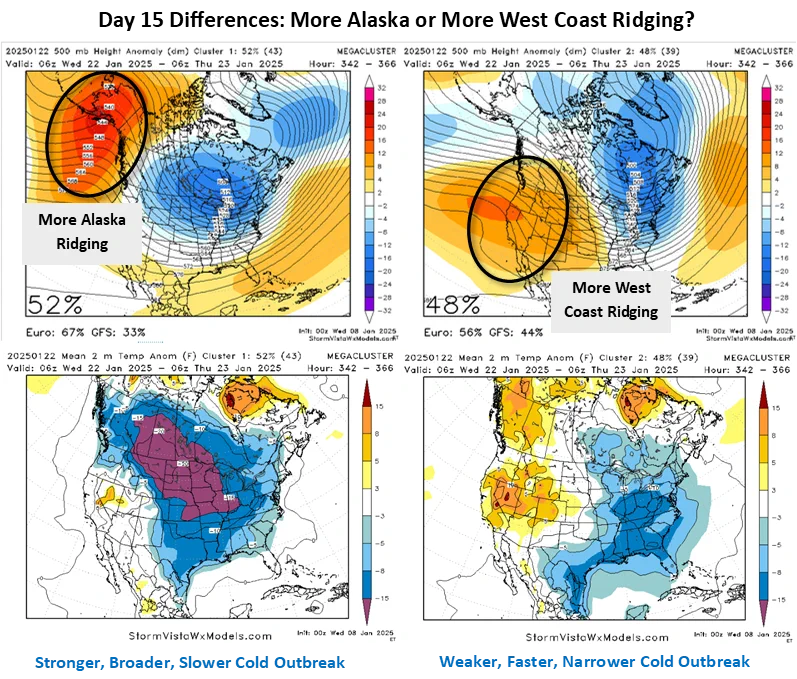
Increasing concern for severe Texas cold event in Jan 20-22 range. AI and operational models are most aggressive, but American/European ensembles trending colder for event too.
Potential strong stratospheric warming in late 6-10 day through 11-15 day could be season's only official (and final) Sudden Stratospheric Warming with Northern Hemisphere potential cooler to colder impacts later in March and even April.
Mid-February stratospheric warming event could be strongest so far this winter with potential impacts for North America, Europe, and Asia for late-winter and early spring.
MJO approach to phase 7 could flip pattern back to cold side for U.S. by 2nd week of February, similar to super-warm late December to cold early January flip from this winter.
Continued North Pacific ridging, including -WPO, -EPO, and -ABNA signals, should continue to favor southward cold transport through Lower 48 in early February.
Intense Arctic outbreak next week to deliver 2nd coldest EIA week of winter. ERCOT should see colder temperatures than January event with lows in low teens for Dallas and 20s for Houston.