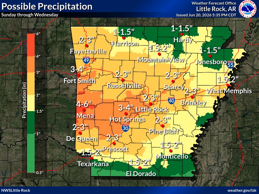
Several rounds of precipitation are expected from Sunday through the middle of next week as the weather pattern remains active. The highest amounts of rain are likely to fall over western and west central Arkansas. #arwx
High temperatures are expected to climb into the upper 80s to mid 90s on Sunday. The combination of these warm temperatures and high humidity will produce heat index values above the century mark for many. #arwx
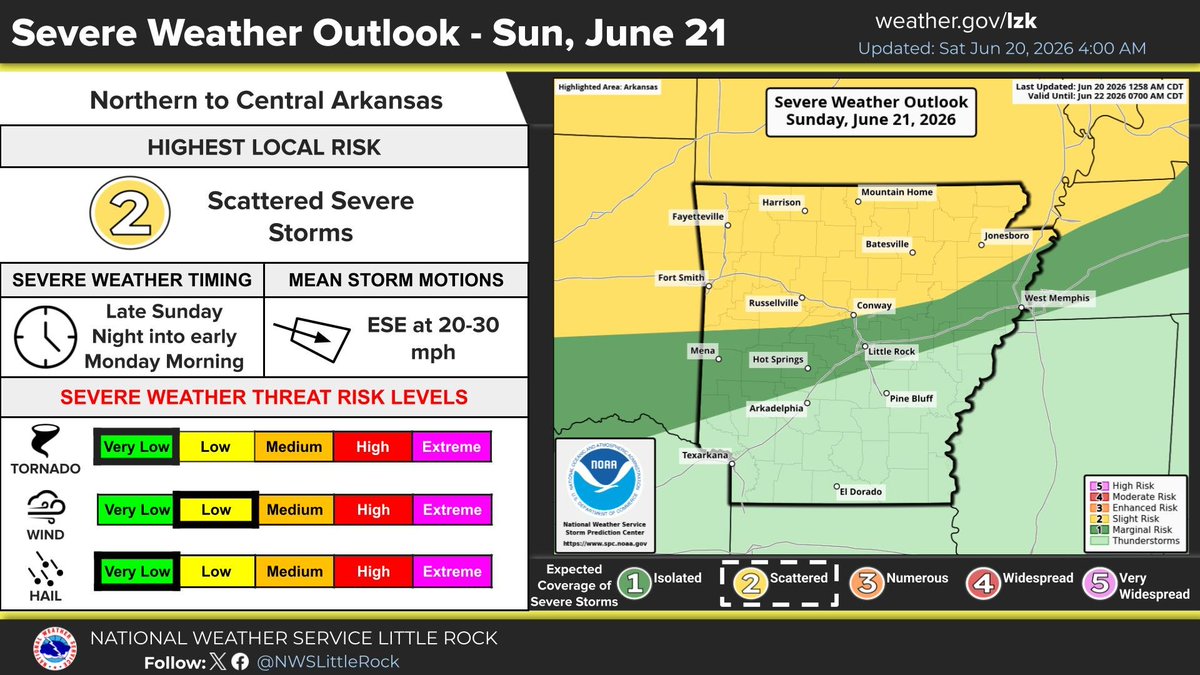
Strong storms will move into northern Arkansas late Sunday night into Monday morning resulting in areas of heavy rain. These storms will leave a boundary that may cause new storms to develop on Monday during the day. #arwx
Much of Arkansas is under a Marginal (1 out of 5) Severe Risk for Monday. The main hazards will include strong to damaging wind gusts from a cluster of storms moving south across the state early Monday morning and through the afternoon. #arwx
Portions of northern Arkansas remain under a Slight Severe Risk (Level 2 of 5) for Sunday Night into the early morning hours on Monday. The main hazards will include strong to damaging wind gusts, a few instances of large hail cannot be ruled out, and isolated tornadoes. #arwx
Sunday heat index values will range from 105 to 108 across portions of the Arkansas River Valley into Central Arkansas on Sunday afternoon into Sunday evening. #arwx
[6/20/26 8:26 AM CDT]: Radar continuing to show rain and thunderstorms across far southern and part of east-central Arkansas. This activity is expected to exit the state completely by midday. Note a few active Flash Flood Warnings across Arkansas into Louisiana. #arwx
Good Morning Arkansas!
An unsettled pattern will persist through the weekend, with widespread rainfall of 2-4", and greater totals near 4-6" possible over western AR through next week. Daily flooding risks will be possible, so be sure to stay weather aware!
#arwx
There will be an elevated risk for flash flooding across much of the state the next few days as an unsettled pattern persists. Be sure to stay weather aware if you are camping on smaller rivers and streams across the Natural State. #arwx
Daily rain chances will be seen across much of the Natural State through the coming week. Daily elevated flash flooding concerns will be possible, with area rainfall totals near two to four inches, and even greater totals across western Arkansas through next Friday. #arwx
The marginal risk area of seeing severe weather this afternoon has been trimmed back a bit with now only the southern part of the state in that designation. The strongest storms will still be capable of producing some gusty winds but heavy rain remains possible. #arwx