NWS Quad Cities
33.2K posts
Official X Account for the National Weather Service Quad Cities. Details: weather.gov/nws_x
Also Facebook: facebook.com/NWSQuadCities
- ⛈️Storms in southeast Iowa will gradually increase in coverage as they inch east-southeast. • Arriving in Burlington & Fort Madison between 9:45 & 10:45 PM. • Lightning, downpours, & occasional gusts of >25 mph with any storms. • Isolated severe still possible. #IAwx
GIF - Severe Thunderstorm Warning including Tampico IL and Hooppole IL until 8:15 PM CDT
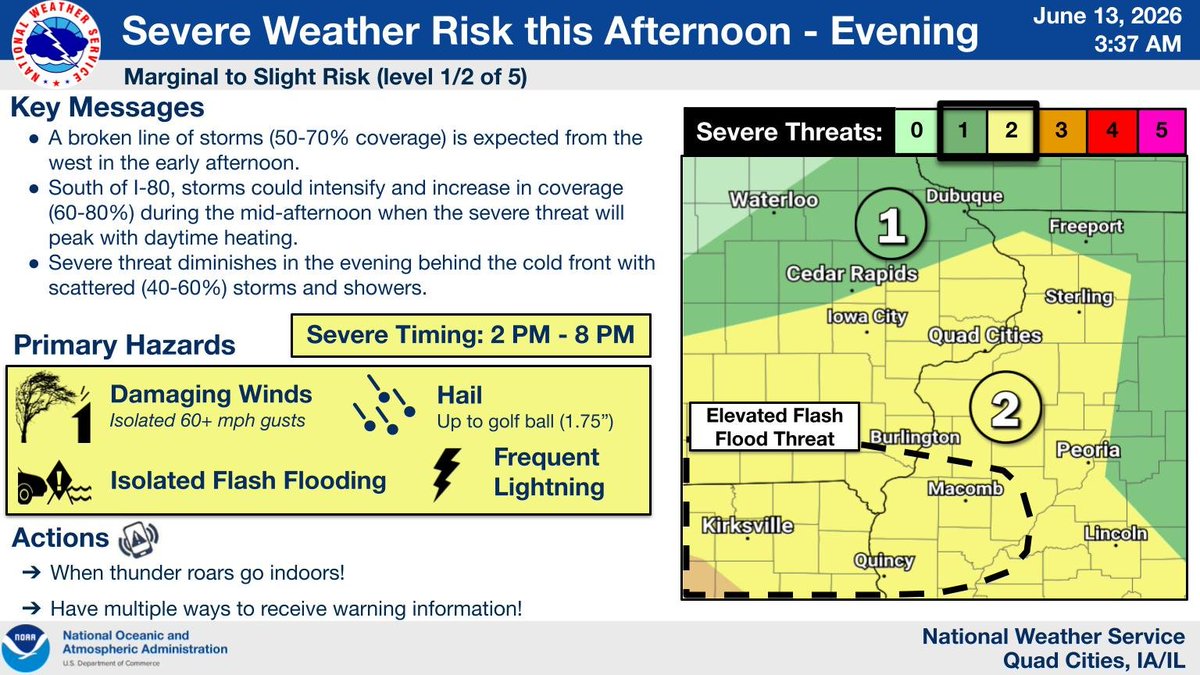
- After scattered t-storms and showers in the early afternoon, additional storms will develop late afternoon into the evening when a few of them could be strong to severe. Primary threats will be isolated damaging winds, large hail (up to golf ball), and localized flash flooding.
- Severe Thunderstorm Warning including Iowa City IA, Coralville IA and Washington IA until 1:45 PM CDT
- A special weather statement has been issued for Williamsburg IA, Sigourney IA and Wellman IA until 1:30 PM CDT
- A special weather statement has been issued for Macomb IL, Bushnell IL and Industry IL until 9:30 AM CDT
- NWS Quad Cities repostedThe damaging wind swath from Wednesday, June 10 has been preliminarily confirmed as a derecho. The wind swath had a track length over 400 miles with a footprint just under 100,000 square miles. The strongest known gust was measured at over 94 mph.


