Log inSign up
cstats1
632 posts
Image
user avatar
cstats1
@cstats1
reddit: u/newishtodc instagram: cstats1 amzn.to/3oji6xp
redbubble.com/people/cstats/
Joined March 2017
195
Following
4,285
Followers
  • Pinned
    user avatar
    cstats1
    @cstats1
    Nov 11, 2020
    #30DayMapChallenge day 11 (3d) Elevation of the USA made in #rayshader - #rstats #rspatial
    Image
  • user avatar
    cstats1
    @cstats1
    Jan 14, 2023
    Realized I never made a South America elevation tile map #rayshader #rstats
    Image
    3.4M
  • user avatar
    cstats1
    @cstats1
    Jan 18, 2023
    Asia Elevation Tiles used the proper continent shapefile of Asia this time. #rstats #rayshader
    Image
    384K
  • user avatar
    cstats1
    @cstats1
    Sep 15, 2023
    % of US population by race made in #rstats with #tidycensus and #rayshader
    Image
    183K
  • user avatar
    cstats1
    @cstats1
    Jan 9, 2023
    South America Population Density map -- figured I'd get to work on some of the continents #rayshader #rstats #dataviz
    Image
    33K
  • user avatar
    cstats1
    @cstats1
    Jan 25, 2023
    Europe elevation tile map A relief that this now uses the correct shapefile, better lighting, greater vertical exaggeration, and more cropped out lakes #rayshader #rspatial
    Image
    65K
  • user avatar
    cstats1
    @cstats1
    Feb 1, 2023
    World Elevation Tile Map #rstats #rayshader
    Image
    137K
  • user avatar
    cstats1
    @cstats1
    Nov 23, 2020
    #30DayMapChallenge day 23 (boundaries) - Contiguous US borders by elevation - Made in #rayshader #rstats #rspatial
    Image
  • user avatar
    cstats1
    @cstats1
    Jan 8, 2023
    North America Population #dataviz made in #rayshader
    Image
    25K
  • user avatar
    cstats1
    @cstats1
    Jan 2, 2023
    Replying to @milmillesencore and @waitbutwhy
    thank you: found one on my hard drive from a while back
    Image
    306K
  • user avatar
    cstats1
    @cstats1
    Nov 24, 2020
    #30DayMapChallenge day 24 (elevation): North America Elevation (minus Greenland). Had a ton of requests for Canada, Mexico, HI, AK, etc - so here it is
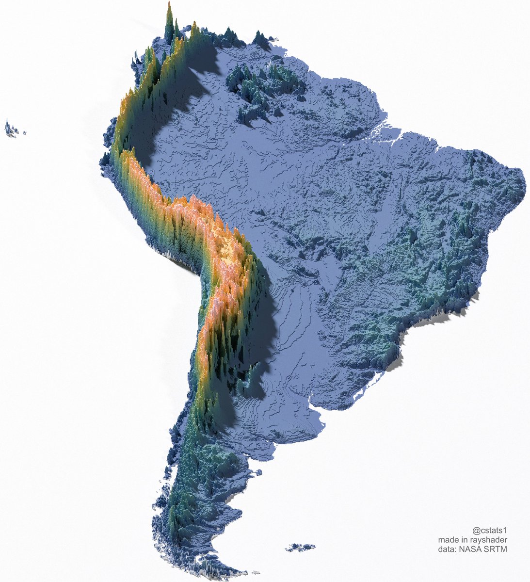
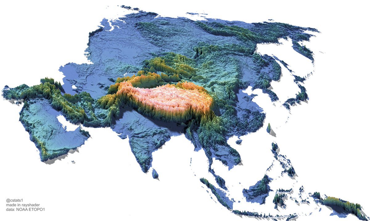
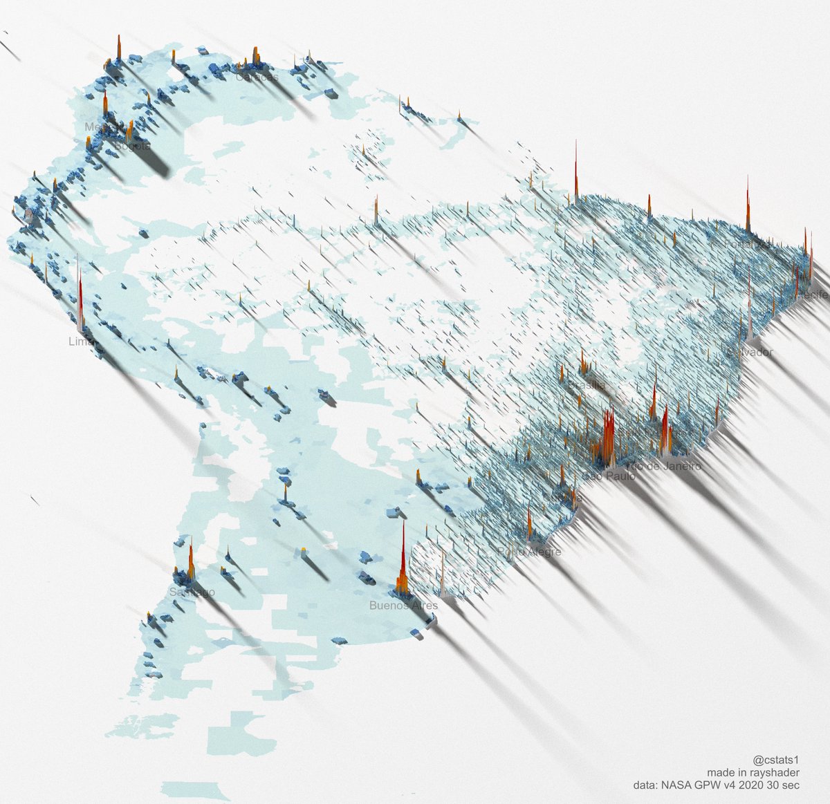
 - Made in #rayshader #rstats #rspatial
    Image
  • user avatar
    cstats1
    @cstats1
    Jan 25, 2023
    Australia tile map made in #rstats #rayshader
    Image
    16K
  • user avatar
    cstats1
    @cstats1
    Jan 1, 2023
    US population line map made with 20 million data points #rstats #dataviz
    Image
    31K
  • user avatar
    cstats1
    @cstats1
    Nov 4, 2020
    #30DayMapChallenge: Day 4 (Hexagons): California elevations built with #rayshader and #tidyverse in #rstats (#rspatial)
    Image
    00:00

New to X?

Sign up now to get your own personalized timeline!

Create account

By signing up, you agree to the Terms of Service and Privacy Policy, including Cookie Use.

Terms·Privacy·Cookies·Accessibility·Ads Info·© 2026 X Corp.
Don't miss what's happening
People on X are the first to know.
Log inSign up
Advertisement
Advertisement