Services
Innovative Spatial Solutions for Complex Challenges
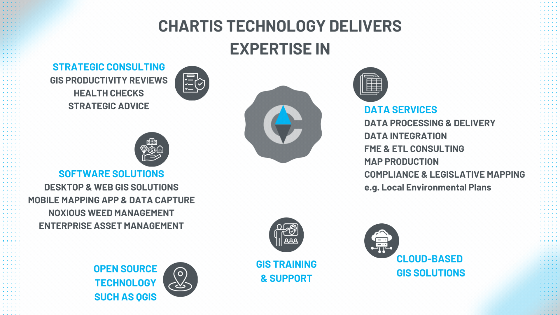
At Chartis Technology, we help public and private sector clients solve complex spatial problems through innovative, end-to-end geospatial solutions. We specialise in high-impact spatial technology that delivers real outcomes — even in environments with traditionally high barriers to entry.
Our experienced team offers full project lifecycle services, including strategic assessments, implementation, documentation and certified training. We work with some of Australia’s largest spatial data custodians and technology-driven organisations. We also deliver expert
QGIS services, including enterprise-grade deployments, system integration, custom configuration and ongoing support — enabling organisations to harness the power of open-source GIS at scale.
Alongside our enterprise GIS services, we develop and support three powerful software products:
Metrix Assets – enterprise asset management
Chartis Weeds – mobile solution for biosecurity professionals
Pozi – intuitive, web-based mapping software for sharing and exploring location-based information
easyeia – Simplifying environmental impact assessments with smart technology.
Need Support?
Existing customers can contact our support team by clicking below.
Service Packages
Clients Words
Don’t take our word for it – here’s what our clients say
Our Council now has a GIS and Asset Management System rich in data, easily shared across the organisation and benefitting our staff, customers, and the broader community we serve.
Working with people with so much integrity and professionalism has been, and still is a pleasure.
Junee Shire Council
The support we have received from your team has been faultless and has really made my job so much easier.
Ballina Shire Council
You have saved the day again.
(in reference to NSW Spatial Services assistance provided by Kathy)
MidCoast Council