Log inSign up
National Weather Service
46.9K posts
National Weather Service profile banner
@NWS

National Weather Service

@NWS
Official X account for @NOAA's National Weather Service. A list of official NWS accounts can be found at x.com/i/lists/725042…
United States
weather.gov
Joined January 2012
323
Following
3.1M
Followers
RepliesRepliesRepostsRepostsMediaMedia

Log in or sign up for X

See what’s happening and join the conversation

Continue with phone
or
Log in with username or email
Terms·Privacy·Cookies·Accessibility·Ads Info·© 2026 X Corp.
  • @NWS
    National Weather Service
    @NWS
    Sep 5
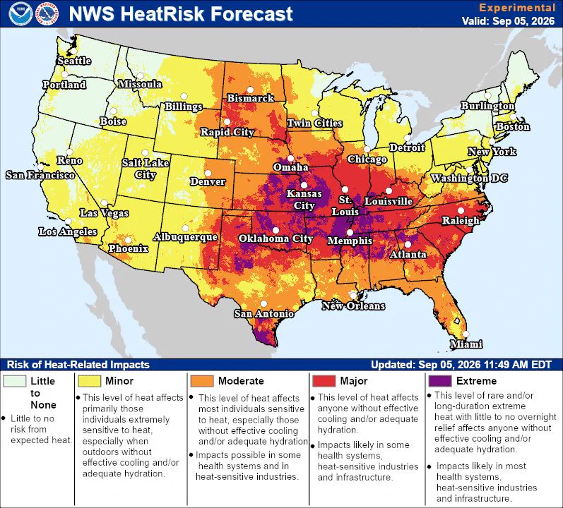
    Widespread strong thunderstorms with damaging winds and locally heavy rain are expected across portions of the Ohio Valley into southern Mid-Atlantic and Carolinas. Sweltering heat remains most persistent across the South-Central Plains and Lower/Middle Mississippi Valley through
    US weather map showing widespread rain and thunderstorms across the central and eastern states, with heavy rain/flash‑flood risk and possible severe thunderstorms centered over parts of Virginia and North Carolina; valid 8am EDT Sep 5 to 8am EDT Sep 6, 2026.
    NWS HeatRisk forecast map for Sep 5, 2026 showing extreme (purple) and major (red/orange) heat impacts concentrated across the central and southeastern U.S.—worst in Oklahoma, Texas, Arkansas, Missouri, Tennessee and the lower Mississippi Valley—while West and Northeast show lower risk.
    6
  • @NWS
    National Weather Service
    @NWS
    Sep 5
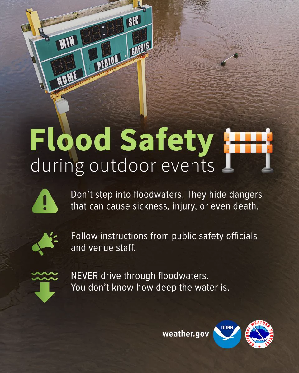
    Don’t let the excitement of rushing to catch your home team take on their rival let you forget about flood safety. Never walk or drive through floodwaters. Muddy flood water can easily conceal how deep the water really is.
    Graphic titled Flood Safety during outdoor events with a road barricade icon.

Safety Tips:

Warning Icon: Don't step into floodwaters. They hide dangers that can cause sickness, injury, or even death.

Megaphone Icon: Follow instructions from public safety officials and venue staff.

Water & Arrow Icon: NEVER drive through floodwaters. You don't know how deep the water is.

Photo:
The top half shows a photo of a flooded sports field where murky brown water partially submerges an outdoor electronic scoreboard.
  • @NWS
    National Weather Service
    @NWS
    Sep 4
    Fall can bring a secondary peak of severe weather. Do you know the difference between a National Weather Service Watch and Warning? ⛈️ A Watch means that ingredients are favorable for severe weather to develop. This is the time to stay informed and be prepared to take action.
    Image
    00:00
    2
  • @NWS
    National Weather Service
    @NWS
    Sep 4
    Temperatures continue to be well above average for September across most areas east of the Rockies into the Labor Day weekend. Heat Advisories are widespread from the south-central Plains into the Mid-Atlantic, with Extreme Heat Warnings centered in the Mid-Mississippi Valley,
    Practice Heat Safety wherever you are. Job Sites: stay hydrated and take breaks in the shade as often as possible. Indoors: Check up on the elderly, sick and those without AC. Vehicles: Never leave kids or pets unattended - LOOK before you LOCK. Outdoors: Limit strenuous outdoor activities, find shade, and stay hydrated. Heat-related deaths are preventable. Protect yourself and others from the impacts of heat waves.
    2
  • @NWS
    National Weather Service
    @NWS
    Sep 4
    Widespread strong thunderstorms with damaging winds and locally heavy rain are expected from the Upper Ohio Valley into the southern Mid-Atlantic today. Remember for the latest warnings check weather.gov.
    @NWSSPC
    NWS Storm Prediction Center
    @NWSSPC
    Sep 4
    7:57am CDT #SPC Day1 Outlook Slight Risk: from the southern Great Lakes into the Mid-Atlantic states spc.noaa.gov/products/outlo…
    Image
    1
Advertisement
Advertisement