1. X
  2. Tyler Sebree ⚡️
Log inSign up
Tyler Sebree ⚡️
58.5K posts
Image
user avatar
Tyler Sebree ⚡️
@TylerSebreezy
Spectrum News 1 Ohio Meteorologist. Columbus, OH📍. Ohio State🌰, UC🐾, UK🐱, Reds🔴, Colts🐎 & Thunder⚡. Coffee & craft beer. ☕️🍺. Born & raised Ohioan. 🎢
Columbus, Ohio
spectrumnews1.com/oh/columbus
Joined November 2012
3,431
Following
7,245
Followers
RepliesRepliesMediaMedia
  • user avatar
    Tyler Sebree ⚡️
    @TylerSebreezy
    19m
    While it won't play out exactly like this, the overall look of the RRFS is solid in this kind of regime. There will undoubtedly be multiples rounds of storms over the next several days. When they move through, the risk of flash flooding and damaging winds will exist. #OHwx
    Image
    GIF
  • user avatar
    Tyler Sebree ⚡️
    @TylerSebreezy
    39m
    A LOT of rain will fall across Ohio this week. Exact totals will be determined by the path and intensity of storm clusters/complexes. However, I'd expect just about everyone to see 2" to 3" with multiple totals likely in the 3" to 6" range. Flash flooding is a big concern. #OHwx
    Image
  • user avatar
    Tyler Sebree ⚡️
    @TylerSebreezy
    1h
    Wildfire smoke -- and lots of it -- will be in our skies over the next few days (at least). Most of the smoke will be aloft in the atmosphere. This means less of an impact to air quality. Hazy/milky skies will be very noticeable. Sunrises & sunsets will look different too. #OHwx
    Image
    GIF
  • user avatar
    Tyler Sebree ⚡️
    @TylerSebreezy
    6h
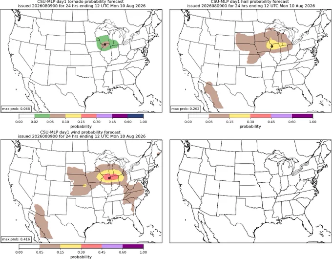
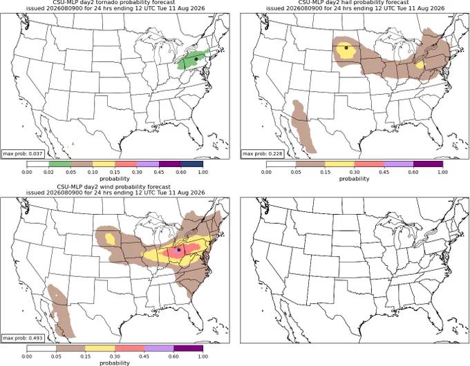
    For those interested, here are the CSU machine-learning severe probabilities by hazard type for the next 3 days. As expected, damaging wind gusts will be the main concern from a severe aspect. However, some large hail and isolated tornado risk does exist.
    Image
    Image
    Image
  • user avatar
    Tyler Sebree ⚡️
    @TylerSebreezy
    6h
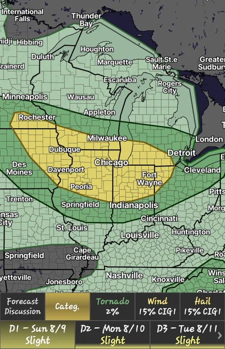
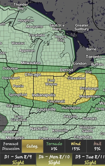
    Yeah, I'd say we're in a busy pattern. Here are the severe weather outlooks for the next 4 days starting today. The first 3 outlooks actually nearly look the same. The main concern will be clusters and complexes of storms capable of producing wind damage and an isolated tornado.
    Image
    Image
    Image
    Image

Log in or sign up for X

See what’s happening and join the conversation

Continue with phone
or
Log in with username or email
Terms·Privacy·Cookies·Accessibility·Ads Info·© 2026 X Corp.
Advertisement
Advertisement