I can't explain why I find this documentary short so compelling and perhaps even a bit haunting. Perhaps it is the skill of the documentarian Matthew Arnold-Ladensack and the score by Rhian Sheehan or perhaps it is the history being discussed or perhaps is the story of the miniature-maker-turned-amateur-historian Gerald William Cox. Probably it is a bit of each. Watch and enjoy!
LA // 1:87 from Humanity Pictures on Vimeo.

Showing posts with label California Kitsch. Show all posts
Showing posts with label California Kitsch. Show all posts
Sunday, August 28, 2016
Wednesday, January 13, 2016
Graphic of the Day - California For Beginners
 |
| I found this the other day and immediately loved it. I like the disaster mentions with "tsunami magnet" up Crescent City way, "big volcano" up Mount Shasta way, "death caldera" over Mammoth Lakes way, and "usually on fire" down Santa Ynez Mountains way. |
Saturday, April 11, 2015
Of Central Coast Volcanoes & Earthquakes
Today I joined my fellow members of the San Luis Obispo Gem & Mineral Club on a most amazing local geology field trip-by-bus. It was headed by geologist Al Stevens and we rented a small shuttle bus so we could all listen to his narration as we drove along. We also made a number of stops to get a closer look at various sites.


 |
| Our rendezvous site at Avila Beach Harbor. |
 |
| Leslie Nelson made the arrangements for this adventure. Here she is handing out the guidebooks to this field trip. |
 |
| Franciscan Formation pillow lava structures at the west end of the Avila Beach Pier parking lot. |
 |
| Another view of the Franciscan Formation pillow lavas which erupted from the ocean floor 180,000,000 years ago when this location was near the equator. |
 |
| Avila Bay with bedrock mortars in the foreground. |
 |
| The Chumash People created this grinding holes over many centuries. |
 |
| Upper Pliocene Squire Sandstone along Avila Beach Drive which is 1.5 million years old and the youngest marine sediment in the San Luis Obispo County. |
 |
| Lower Miocene Obispo Tuff deposited in water about 16 to 20 million years ago during the final phase of the creation of the morros. |
 |
| Miocene Monterey Formation oceanic sediment about 16 to 5 million years ago along San Luis Bay Drive. |
 |
| Upper Pliocene Pismo Sandstone about 3 million years old featuring these expansion features which look like concretions. |
 |
| Edna Valley Fault delineated by line of trees as viewed from US101 south of San Luis Obispo, CA. |
 |
| Lenses of serpentine at Madonna Inn in San Luis Obispo. |
 |
| Dike protruding up through serpentine at same location in San Luis Obispo. |
 |
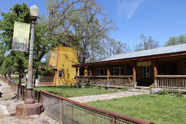
| Madonna Inn |
 |
| Famous/infamous grotto urinal in the Madonna Inn subterranean men's room. |
 |
| Giant clam sinks in the same men's room. |
 |
| This is a view looking east from near the base of the Cuesta Grade. Note the mining excavation on the hill in the foreground. |
 |
| Near the base of the Cuesta Grade looking north towards the grade and the Santa Lucia Range partially created by the Oceanic Fault Zone which appears on the west side of the ridge line. |
 |
| At the intersection of Highways 58 and 229 east of Santa Margarita. |
 |
| Salinian Granite which originated near Palm Springs, CA. |
 |
| Pliocene Paso Robles Formation sediments 1 million to 100,000 years old as found in Pine Mountain Cemetery in Atascadero, CA. |
 |
| The gang in route to the Cholame-Parkfield segment of our adventure. |
 |
| The hill in the foreground is a scarp of the San Andreas Fault at the south end of the Cholame Valley as seen from Davis Road. Note: here where the pipeline crosses the fault it has been run across the surface and expansion joints join the pipe segments so the line won't break even if the fault breaks and there is large offset. |
 |
| Note the fault scarp in the middle foreground trending left to right. |
 |
| This is the San Andreas Fault as seen from near the top of Davis Road. This section broke in the 1857 Fort Tejon Quake. |
 |
| Landslide originating from a spring located along the San Andreas Fault Zone (SAFZ). |
 |
| View northward from the south end of the Cholame Valley as viewed from Davis Road. SAFZ trends from left up the image towards the top which is the north end of the Cholame Valley. |
 |
| David Road headed down into the Cholame Valley and near the intersection of Highways 41 and 46 where actor James Dean died in a collision in 1955. |
 |
| San Andreas Fault as a green grassy swale as viewed from Cholame Valley Road north of Cholame Valley. |
 |
| Westward view of the bridge on the west side of Parkfield, CA. Note: it is bent by the creeping of the SAFZ here. |
 |
| Westward view of bridge railing warped by fault creep. |
 |
| Westward view of west end of bridge. |
 |
| Eastward view of bridge on west side of Parkfield, CA. |
 |
| Eastward view of bridge. |
 |
| Slightly confusing road sign. |
 |
| The San Luis Obispo Gem & Mineral Club gathering for a group portrait. |
 |
| Here we are with a rare image of me (fat guy sitting down). |
 |
| Iconic water tank sign. |
 |
| I love this Franciscan field stone chimney. |
 |
| Words to live by in this place. |
 |
| The gang dining together in celebration of an awesome adventure. |
 |
| Quite a bit of remodeling has occurred at the cafe since last I was here and this is the earthquake-themed northeast corner of the new pool table room . |
 |
| The segment of the cafe visible at left is the add-on to the structure and contains both a pool table room and additional kitchen capacity. |
 |
| This area has also been remodeled a new play structure for the kids and a stage. |

 |
| USGS Earthquake Monitoring Station on the grounds of the CAL FIRE station in Parkfield. |
 |
| Apparently, the Parkfield CAL FIRE station is being relocated. |
 |
| I can confirm this branch was not snapped off in a major earthquake this day. |
 |
| The CAL FIRE station's fire danger sign needs updating: MODERATE. |
 |
| I like a town with a smaller population number than its elevation number. |


 |
| Middle Mountain is at right and sits atop the SAFZ and is often the location for small to moderate earthquakes. SAFOD is located in the distance. All images by Kim Patrick Noyes (all rights reserved). |
Subscribe to:
Comments (Atom)