Here's and update of what we expect into this afternoon with regards to any flash flooding threats. Stay tuned to the forecast as we head into this afternoon:
Showers/tstms expected throughout the day, with the most numerous coverage this afternoon. Some storms could produce heavy rainfall, resulting in the potential for flash flooding. In addition, a few severe storms with damaging wind gusts are also possible this aftn/eve.
Scattered showers and storms will continue mainly south of Pittsburgh this afternoon. These will be heavy rain producers and could drop a quick 1-2", especially in any area that sees repeated rounds of rain. Remember, turn around don't drown if you encounter a flooded road.
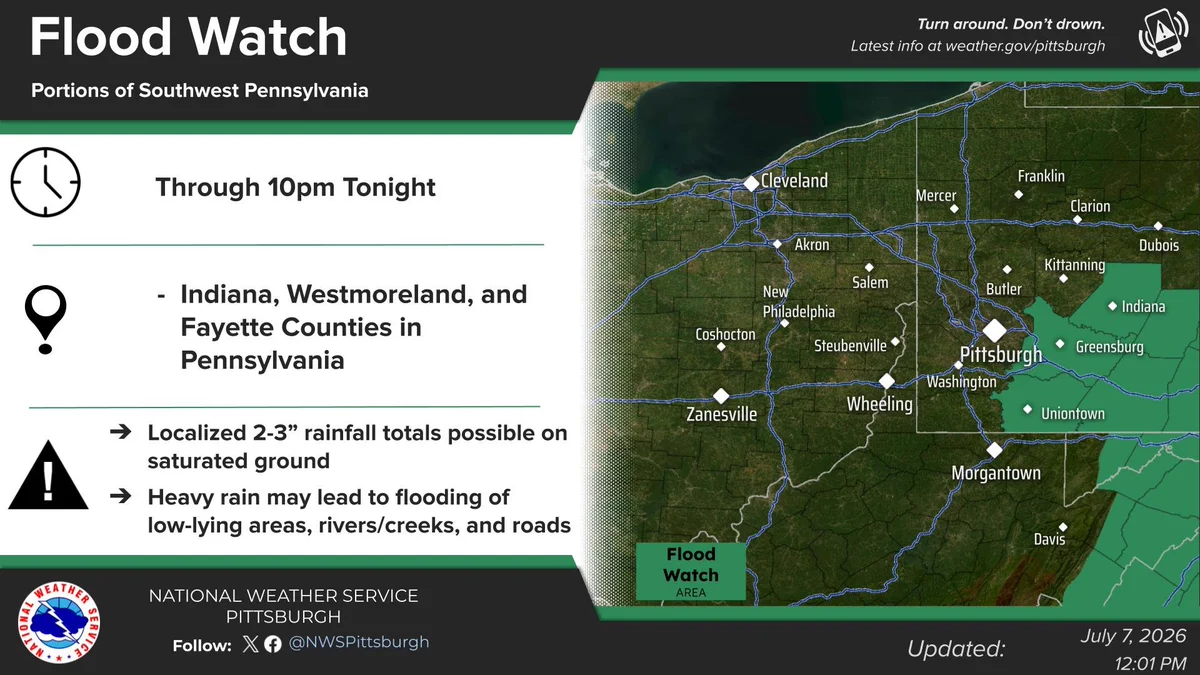
With the round of morning rain saturating the ground and additional development of locally heavy rain expected later, we've issued a flood watch for areas mainly south of I-70 where just another 1-1.5" of rain this afternoon will be enough to cause flash flooding.
Showers and storms will continue south of Pittsburgh this morning. Radar estimates and gauge observations are showing rainfall rates of 2 to 3 inches per hour, so take it easy on the commute this morning if you run into heavier rain.
Scattered showers and thunderstorms are expected today. A few storms could be severe with damaging wind gusts this afternoon, south of I-70. In addition, locally heavy rainfall will be possible throughout the day south of I-70, which could result in isolated flash flooding.
Afternoon radar imagery shows some showers and storms popping off to the south and east of Pittsburgh. They will remain in that area for the next few hours and could bring a brief, localized downpour, but coverage will not be as widespread as the past few days.
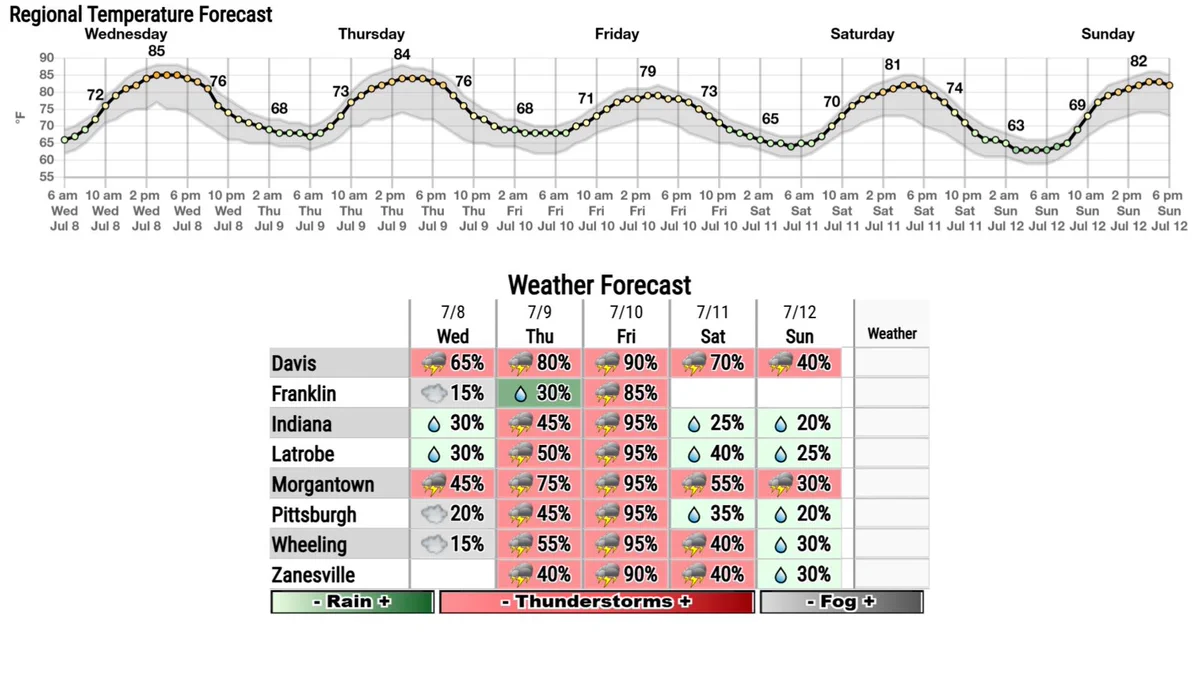
Here is the outlook through the weekend. An active pattern is expected, especially through Friday. In addition, there will be some patchy fog around the region this morning.
A partly sunny Wednesday will likely only be broken by an isolated shower or storm southeast of Pittsburgh. Storm coverage increases southeast of Pittsburgh on Thursday before much of the area could see showers and storms on Friday.
A Flood Watch has been issued for a few counties east of Pittsburgh until 10 PM. Localized 2-3" rainfall totals on nearly saturated ground could cause instances of flash flooding. Remember: Turn Around, Don't Drown!