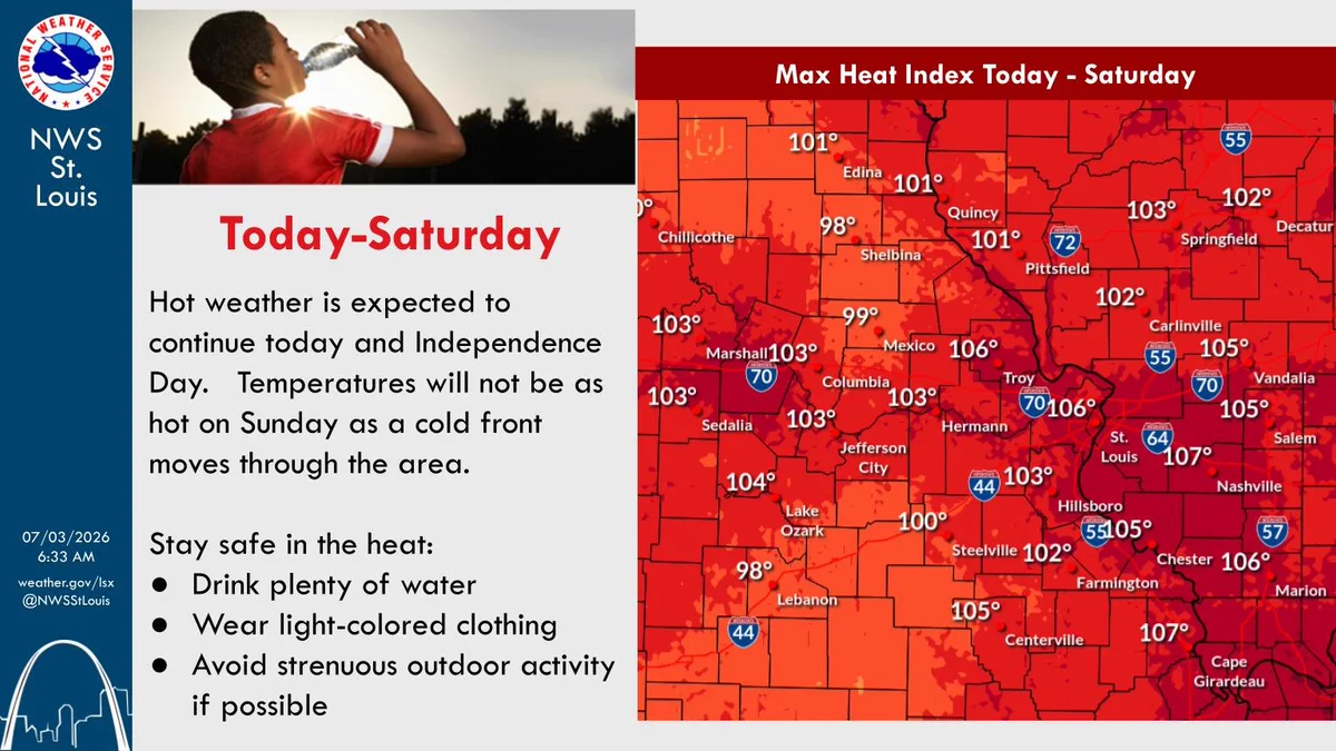
Heat index values will be mainly in the 100 to 105 degree range the next two afternoons. Make sure to drink plenty of water and take frequent breaks in the shade. #stlwx#midmowx#mowx#ilwx
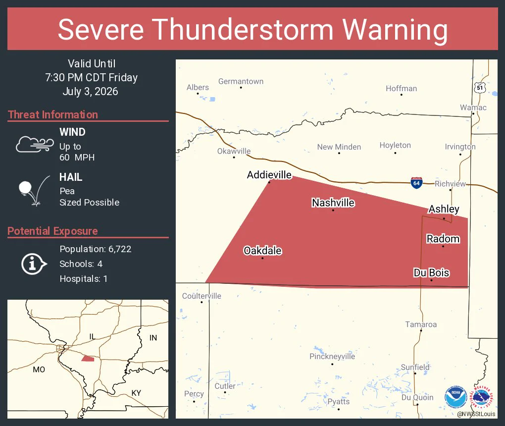
Isolated strong to severe thunderstorms are possible during the afternoon and early evening hours both today and on Saturday. Damaging wind gusts to 60 mph is the the primary threat so move inside if threatening weather approaches your location. #stlwx#midmowx#mowx#ilwx
Hot and humid conditions persist through at least Saturday, with daily chances for isolated to scattered thunderstorms during the afternoon. A cold front arrives Sunday that brings more widespread rain chances and a return of more typical July temperatures.
June was a wet month across the region with Quincy receiving 10.89" of rainfall. Columbia saw the highest 24 hour total out of the three sites with 3.98" of rain on June 6th. Monthly temperatures were near normal this month. #stlwx#mowx#ilwx
Heat will continue & peak during the work week, but it is still expected to be hot over the holiday weekend along with some afternoon & evening showers & thunderstorms. However, it will be far from a washout.
#stlwx#mowx#ilwx
Hot and humid conditions are forecast into the holiday weekend with some heat relief possible Sunday. Slight chances (20%) for showers and storms return Saturday with 30-40% chances on Sunday. Heat index values may exceed 100F into the weekend. #stlwx#mowx#ilwx
Extreme heat and humidity is expected this week. If you're planning to spend time outdoors, make sure you are prepared for the heat. Take frequent breaks, drink plenty of water, and have a place to cool down.
It's a hot week ahead. Daytime highs in the upper 90s will combine with humid conditions to produce heat index values of 100-110 degrees. Rain chances start to tick up again by Friday.
It took more than 3 months, but we finally got hotter than we did back in March. The high on Sunday, June 28 in St Louis was 94 degrees. That beats March 26 as the hottest day of the year (so far). The rest of the week we'll be in the mid to upper 90s.
An Extreme Heat Warning is in effect for the St. Louis region, and a Heat Advisory is in effect elsewhere. Expect heat index values of 105-110F through Thursday.
Find out exactly how hot your location will be at weather.gov/stlouis.
Hot and humid weather will likely linger through July 4th, with a low threat (20% chance) for afternoon thunderstorms. Keep an eye on weather.gov/stlouis to plan out your Independence Day celebrations!