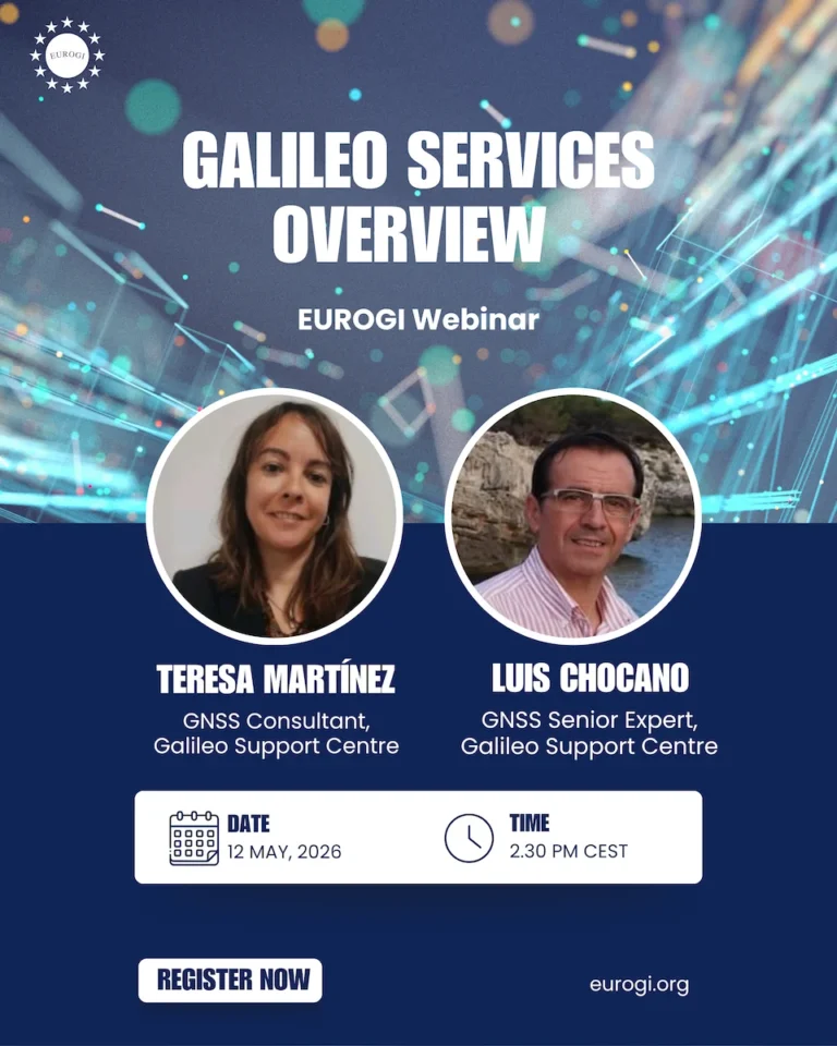
Galileo Services Overview: A GSC Webinar for the EUROGI Community
EUROGI is pleased to invite its community to an upcoming webinar dedicated to the Galileo programme, Europe’s global navigation satellite
Galileo Services Overview: A GSC Webinar for the EUROGI Community
EUROGI is pleased to invite its community to an upcoming webinar dedicated to the Galileo programme, Europe’s global navigation satellite