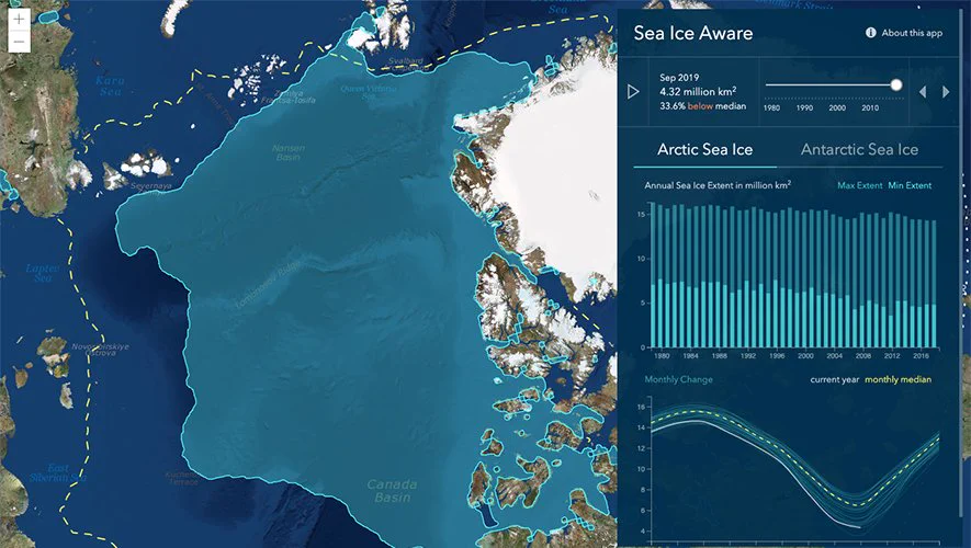
Let's look back at over 10,000 years of volcanic eruptions. This animated map groups eruptions using the Volcanic Explosivity Index (VEI) with indices from 0 to 8. Learn more here: ow.ly/VwEu50wtH5R#ArcGISPro#DataViz
You're looking at earthquakes from inside the Earth. 🌏 Created by Raluca Nicola with the #ArcGIS API for #JavaScript. Explore the app here: ow.ly/yXOS50x3Omt
Did you see the @USAA's incredible deep learning presentation at #EsriUC? Here's a walk through of each step in the Woolsey Fire damage assessment process: p.ctx.ly/r/9k32#DeepLearning
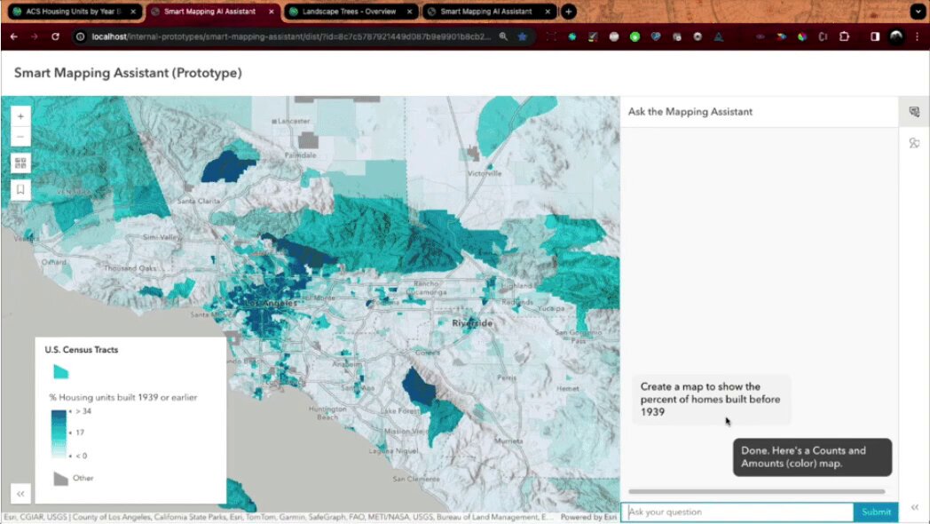
ChatGPT but for maps.💡Here's a first look at our work on a Smart Mapping Assistant prototype that combines the power of GIS with generative AI. esri.social/Sezi50RixSO#AIinMapping#GeospatialAI
Catch the excitement of the #EsriUC Plenary Session during our livestream on Monday, July 8! The Livestream Show starts at 8:15 AM (PDT), and the Plenary at 8:30 AM (PDT). Sign up and we'll send you an email reminder that morning: p.ctx.ly/r/9hfv#GIS
From the bottom of our hearts, thank you for making our first virtual #EsriUC amazing. We look forward to seeing you virtually, or in person in 2021!
🔹86,482 attendees from 180 countries
🔹153 exhibitors
🔹250 demos
🔹232 live & on demand workshops
🔹200 user videos
🔹39 SIGs
We’re excited to announce that now through August 31, 2020, university & college students ages 18 & over can have free access to ArcGIS for their continued #education during #coronavirus closures.
Final day to join is June 30, 2020. Sign up: ow.ly/xIoW50z3vwX@learnarcgis
Learn how to create your own #3D globe app - it's easier than you think! Click here to get started: ow.ly/gEP950ESJip
🔸This app by Raluca Nicola (@nicolaraluk) visualizes earthquakes with exaggerated depth.
Paleogeography—it’s a thing. These 41 paleo-elevation models (#DEM) show Earth’s evolution from #Pangea to the Holocene. Try the prototype #app here: p.ctx.ly/r/93v7
1,700 maps, 2,400 gallons of coffee, 105,600 buttons and, most importantly, 17,901 attendees! Thank you for making this the best #EsriUC yet - we'll see you back here in #SanDiego in 359 days!
The latest release of #ArcGISOnline is now available! 🙌 This update introduces new and improved configurable apps, new and updated #LivingAtlas content, and lots more. Take a look: ow.ly/3SjN50wzZFH
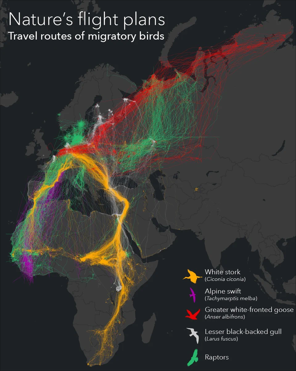
If your holiday travel plans feel hectic, consider the itineraries of migrating birds. 🦅 This map by @Esri_de shows five species who travel great distances to winter or breed.
🔹Data: Movebank
#cartography#birding
Happy #GISDay! 🌎 Today, we celebrate you and the incredible work you're doing with #GIS. You truly inspire us. Here's a special message from Jack Dangermond.