1. X
  2. NWS Boston
Log inSign up
NWS Boston
62.4K posts
Image
user avatar
NWS Boston
@NWSBoston
Official Twitter Account for National Weather Service - Boston / Norton, MA. Details: weather.gov/twitter
Norton, MA
weather.gov/boston
Joined July 2012
162
Following
150.1K
Followers
RepliesRepliesMediaMedia

New to X?

Sign up now to get your own personalized timeline!

Create account

By signing up, you agree to the Terms of Service and Privacy Policy, including Cookie Use.

Terms·Privacy·Cookies·Accessibility·Ads Info·© 2026 X Corp.
Don't miss what's happening
People on X are the first to know.
Log inSign up
  • user avatar
    NWS Boston
    @NWSBoston
    1h
    Another storm system brings a risk for scattered severe thunderstorms late in the day into the evening on Tuesday. Localized wind damage is the main risk, to go along with torrential rain which could cause street flooding.
    Graphic showing the severe weather outlook for Tuesday with anticipated thunderstorm hazards.
    1.6K01.6K
  • user avatar
    NWS Boston
    @NWSBoston
    14h
    Seasonable temperatures are expected throughout the upcoming week and into next weekend. After a dry Monday, showers and thunderstorm chances return late Tuesday into Wednesday, drying out again late week into the weekend.
    tables showing the temperature and precipitation forecast for the week.
    6K06K
  • user avatar
    NWS Boston
    @NWSBoston
    Jul 19
    Aviso Especial Marítimo incluye Aguas costeras desde Provincetown MA a Chatham MA a Nantucket MA hacia afuera 20 mn, Aguas Costeras desde Montauk NY a Marthas Vineyard extendiéndose hacia afuera a 20 mn al Sur de la Isla Block y Bahía Buzzards hasta las 3:00 AM EDT
    Este gráfico muestra la localización en el mapa de un Aviso Especial Marítimo. El aviso estará en efecto hasta las 3:00 AM EDT. El aviso incluye a Aguas costeras desde Provincetown MA a Chatham MA a Nantucket MA hacia afuera 20 mn, Aguas Costeras desde Montauk NY a Marthas Vineyard extendiéndose hacia afuera a 20 mn al Sur de la Isla Block y Bahía Buzzards . Las amenazas asociadas a este aviso son: ráfagas de vientos de mayor de 34 nudos y granizo del tamaño de una pequeña canica. Las trombas marinas no son esperadas. Alto oleaje. Busque un puerto seguro y tome medidas de precaución.
    6K06K
  • user avatar
    NWS Boston
    @NWSBoston
    Jul 19
    Special Marine Warning including the Ocean Waters from Provincetown to Nantucket from 20 to 60 NM, Ocean Waters from Marthas Vineyard to Nantucket from 25 to 60 NM, Coastal waters from Provincetown MA to Chatham MA to Nantucket MA out 20 NM and Buzzards Bay until 3:00 AM EDT
    This graphic displays a special marine warning plotted on a map. The warning is in effect until 3:00 AM EDT. The warning includes Ocean waters from Provincetown to Nantucket from 20 to 60 NM, Ocean waters from Marthas Vineyard to Nantucket from 25 to 60 NM, coastal waters from Provincetown MA to Chatham MA to Nantucket MA out 20 NM and Buzzards Bay. The threats associated with this warning are wind gusts greater than 34kts and pea sized hail. Waterspouts are not expected. Steep waves can be expected. Seek safe harbor and take protective actions.
    5.7K05.7K
  • user avatar
    NWS Boston
    @NWSBoston
    Jul 19
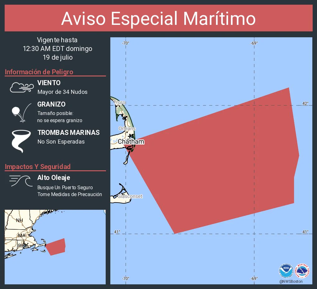
    Aviso Especial Marítimo incluye Aguas costeras desde Provincetown MA a Chatham MA a Nantucket MA hacia afuera 20 mn y Pasaje de Nantucket hasta las 12:30 AM EDT
    Este gráfico muestra la localización en el mapa de un Aviso Especial Marítimo. El aviso estará en efecto hasta las 12:30 AM EDT. El aviso incluye a Aguas costeras desde Provincetown MA a Chatham MA a Nantucket MA hacia afuera 20 mn y Pasaje de Nantucket . Las amenazas asociadas a este aviso son: ráfagas de vientos de mayor de 34 nudos yno se espera granizo. Las trombas marinas no son esperadas. Alto oleaje. Busque un puerto seguro y tome medidas de precaución.
    5.7K05.7K
  • user avatar
    NWS Boston
    @NWSBoston
    Jul 19
    Special Marine Warning including the Ocean Waters from Provincetown to Nantucket from 20 to 60 NM, Coastal waters from Provincetown MA to Chatham MA to Nantucket MA out 20 NM and Nantucket Sound until 12:30 AM EDT
    This graphic displays a special marine warning plotted on a map. The warning is in effect until 12:30 AM EDT. The warning includes Ocean waters from Provincetown to Nantucket from 20 to 60 NM, coastal waters from Provincetown MA to Chatham MA to Nantucket MA out 20 NM and Nantucket Sound. The threats associated with this warning are wind gusts greater than 34kts and no hail expected.Waterspouts are not expected. Steep waves can be expected. Seek safe harbor and take protective actions.
    5.4K05.4K
  • user avatar
    NWS Boston
    @NWSBoston
    Jul 19
    Aviso Especial Marítimo continúa Aguas costeras desde Provincetown MA a Chatham MA a Nantucket MA hacia afuera 20 mn y Pasaje de Nantucket hasta las 11:45 PM EDT
    Este gráfico muestra la localización en el mapa de un Aviso Especial Marítimo. El aviso estará en efecto hasta las 11:45 PM EDT. El aviso incluye a Aguas costeras desde Provincetown MA a Chatham MA a Nantucket MA hacia afuera 20 mn y Pasaje de Nantucket . Las amenazas asociadas a este aviso son: ráfagas de vientos de mayor de 34 nudos yno se espera granizo. Las trombas marinas no son esperadas. Alto oleaje. Busque un puerto seguro y tome medidas de precaución.
    5K05K
  • user avatar
    NWS Boston
    @NWSBoston
    Jul 19
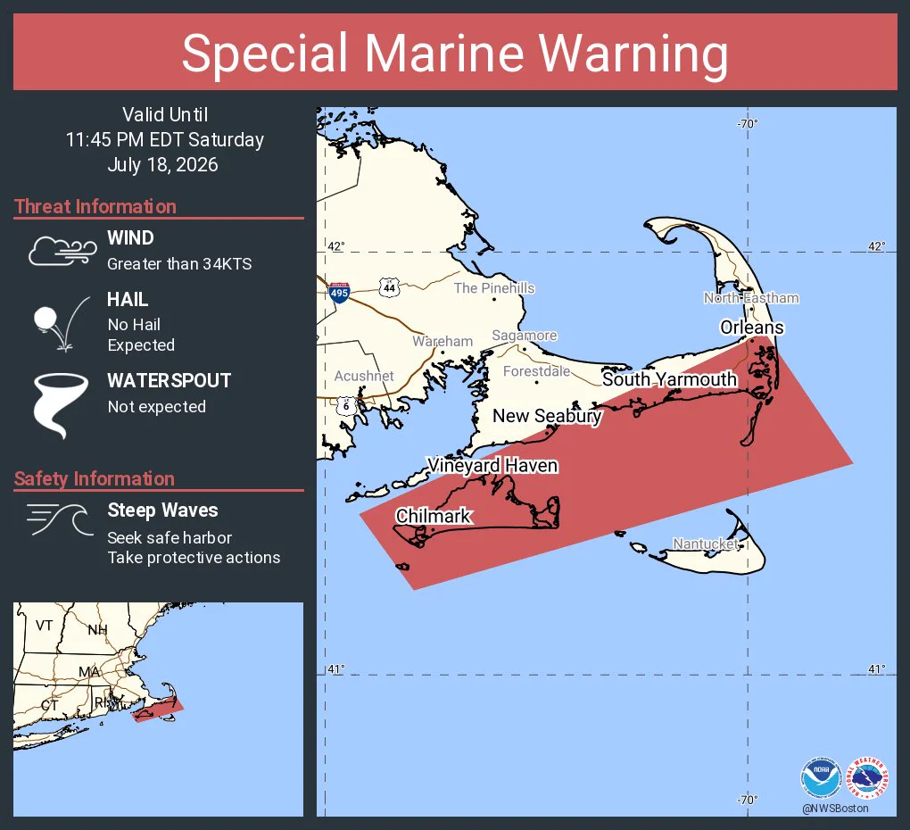
    Special Marine Warning continues for the Coastal waters from Provincetown MA to Chatham MA to Nantucket MA out 20 NM and Nantucket Sound until 11:45 PM EDT
    This graphic displays a special marine warning plotted on a map. The warning is in effect until 11:45 PM EDT. The warning includes coastal waters from Provincetown MA to Chatham MA to Nantucket MA out 20 NM and Nantucket Sound. The threats associated with this warning are wind gusts greater than 34kts and no hail expected.Waterspouts are not expected. Steep waves can be expected. Seek safe harbor and take protective actions.
    5K05K
  • user avatar
    NWS Boston
    @NWSBoston
    Jul 19
    Dry weather returns Sunday and continues into Monday, along with abundant sunshine, seasonable temperatures and comfortable humidity both days.
    Graphic showing weather conditions and temperatures for Sunday and Monday.
    7.2K07.2K
  • user avatar
    NWS Boston
    @NWSBoston
    Jul 19
    Aviso Especial Marítimo incluye Aguas costeras desde Provincetown MA a Chatham MA a Nantucket MA hacia afuera 20 mn y Aguas Costeras desde Montauk NY a Marthas Vineyard extendiéndose hacia afuera a 20 mn al Sur de la Isla Block hasta las 11:45 PM EDT
    Este gráfico muestra la localización en el mapa de un Aviso Especial Marítimo. El aviso estará en efecto hasta las 11:45 PM EDT. El aviso incluye a Aguas costeras desde Provincetown MA a Chatham MA a Nantucket MA hacia afuera 20 mn y Aguas Costeras desde Montauk NY a Marthas Vineyard extendiéndose hacia afuera a 20 mn al Sur de la Isla Block . Las amenazas asociadas a este aviso son: ráfagas de vientos de mayor de 34 nudos yno se espera granizo. Las trombas marinas no son esperadas. Alto oleaje. Busque un puerto seguro y tome medidas de precaución.
    5.8K05.8K
  • user avatar
    NWS Boston
    @NWSBoston
    Jul 19
    Special Marine Warning including the Coastal waters from Provincetown MA to Chatham MA to Nantucket MA out 20 NM, Coastal Waters from Montauk NY to Marthas Vineyard extending out to 20 NM South of Block Island, Nantucket Sound and Rhode Island Sound until 11:45 PM EDT
    This graphic displays a special marine warning plotted on a map. The warning is in effect until 11:45 PM EDT. The warning includes coastal waters from Provincetown MA to Chatham MA to Nantucket MA out 20 NM, coastal waters from Montauk NY to Marthas Vineyard extending out to 20 NM South of Block Island, Nantucket Sound and Rhode Island Sound. The threats associated with this warning are wind gusts greater than 34kts and no hail expected.Waterspouts are not expected. Steep waves can be expected. Seek safe harbor and take protective actions.
    4.9K04.9K
  • user avatar
    NWS Boston
    @NWSBoston
    Jul 19
    Aviso Especial Marítimo continúa Aguas Costeras desde Montauk NY a Marthas Vineyard extendiéndose hacia afuera a 20 mn al Sur de la Isla Block , Aguas Costeras extendidas hacia afuera 25 mn al Sur de Marthas Vineyard y Nantucket y Bahía Buzzards hasta las 10:45 PM EDT
    Este gráfico muestra la localización en el mapa de un Aviso Especial Marítimo. El aviso estará en efecto hasta las 10:45 PM EDT. El aviso incluye a Aguas Costeras desde Montauk NY a Marthas Vineyard extendiéndose hacia afuera a 20 mn al Sur de la Isla Block , Aguas Costeras extendidas hacia afuera 25 mn al Sur de Marthas Vineyard y Nantucket y Bahía Buzzards . Las amenazas asociadas a este aviso son: ráfagas de vientos de mayor de 34 nudos y granizo del tamaño de una pequeña canica. Las trombas marinas no son esperadas. Alto oleaje. Busque un puerto seguro y tome medidas de precaución.
    5.2K05.2K
  • user avatar
    NWS Boston
    @NWSBoston
    Jul 19
    Special Marine Warning continues for the Coastal Waters from Montauk NY to Marthas Vineyard extending out to 20 NM South of Block Island, Coastal Waters extending out to 25 NM South of Marthas Vineyard and Nantucket, Nantucket Sound and Rhode Island Sound until 10:45 PM EDT
    This graphic displays a special marine warning plotted on a map. The warning is in effect until 10:45 PM EDT. The warning includes coastal waters from Montauk NY to Marthas Vineyard extending out to 20 NM South of Block Island, coastal waters extending out to 25 NM South of Marthas Vineyard and Nantucket, Nantucket Sound and Rhode Island Sound. The threats associated with this warning are wind gusts greater than 34kts and pea sized hail. Waterspouts are not expected. Steep waves can be expected. Seek safe harbor and take protective actions.
    5.1K05.1K
  • user avatar
    NWS Boston
    @NWSBoston
    Jul 19
    Aviso Especial Marítimo incluye Aguas Costeras desde Montauk NY a Marthas Vineyard extendiéndose hacia afuera a 20 mn al Sur de la Isla Block , Aguas Costeras extendidas hacia afuera 25 mn al Sur de Marthas Vineyard y Nantucket y Bahía Buzzards hasta las 10:45 PM EDT
    Este gráfico muestra la localización en el mapa de un Aviso Especial Marítimo. El aviso estará en efecto hasta las 10:45 PM EDT. El aviso incluye a Aguas Costeras desde Montauk NY a Marthas Vineyard extendiéndose hacia afuera a 20 mn al Sur de la Isla Block , Aguas Costeras extendidas hacia afuera 25 mn al Sur de Marthas Vineyard y Nantucket y Bahía Buzzards . Las amenazas asociadas a este aviso son: ráfagas de vientos de mayor de 34 nudos yno se espera granizo. Las trombas marinas no son esperadas. Alto oleaje. Busque un puerto seguro y tome medidas de precaución.
    5.6K05.6K
Advertisement
Advertisement