1. X
  2. NWS Pendleton
Log inSign up
NWS Pendleton
13.9K posts
Image
user avatar
NWS Pendleton
@NWSPendleton
Official Twitter account for the National Weather Service Pendleton. Details: weather.gov/twitter
Pendleton Oregon
weather.gov/pendleton
Joined June 2012
249
Following
10.3K
Followers
RepliesRepliesMediaMedia

New to X?

Sign up now to get your own personalized timeline!

Create account

By signing up, you agree to the Terms of Service and Privacy Policy, including Cookie Use.

Terms·Privacy·Cookies·Accessibility·Ads Info·© 2026 X Corp.
Don't miss what's happening
People on X are the first to know.
Log inSign up
  • user avatar
    NWS Pendleton
    @NWSPendleton
    Jul 24
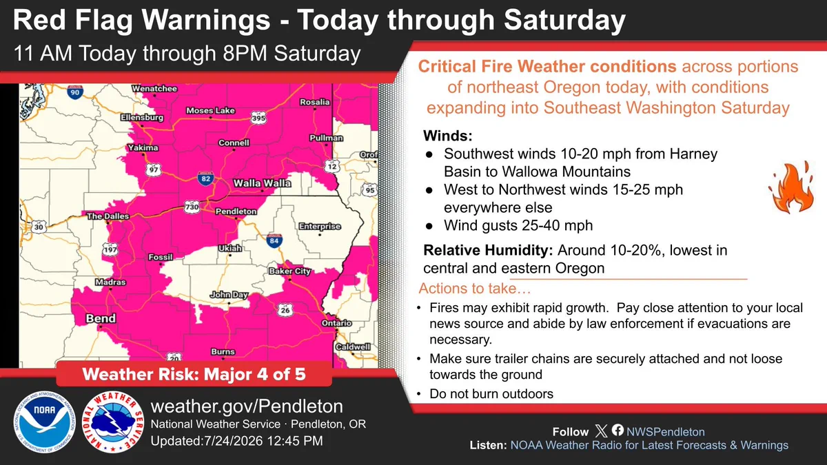
    Red Flag warnings are in effect for portions of northeast Oregon and southeast Washington through Saturday evening. The threat will be focused in central and northeast OR today, then spread into northeast and southeast Washington Saturday. #wawx #orwx
    Map shows Red Flag Warnings across northeast Oregon and southeast Washington.

Critical Fire Weather conditions across portions of northeast Oregon today, with conditions expanding into Southeast Washington Saturday

Winds:
Southwest winds 10-20 mph from Harney Basin to Wallowa Mountains
West to Northwest winds 15-25 mph everywhere else
Wind gusts 25-40 mph
Relative Humidity: Around 10-20%, lowest in central and eastern Oregon

Actions to take...

Fires may exhibit rapid growth.  Pay close attention to your local news source and abide by law enforcement if evacuations are necessary.

Make sure trailer chains are securely attached and not loose towards the ground

Do not burn outdoors
    3K
  • user avatar
    NWS Pendleton
    @NWSPendleton
    Jul 24
    A special weather statement has been issued for Wallowa County, OR until 7:45 PM PDT
    This graphic displays a special weather statement plotted on a map. The statement is in effect until 7:45 PM PDT.  The statement includes Wallowa County, OR.  A STRONG THUNDERSTORM WILL IMPACT EAST CENTRAL WALLOWA COUNTY THROUGH 745 PM PDT. The threats associated with this storm are wind gusts up to 50 MPH and half inch sized hail. Seek shelter in a sturdy structure until the storm passes.
    462
  • user avatar
    NWS Pendleton
    @NWSPendleton
    Jul 24
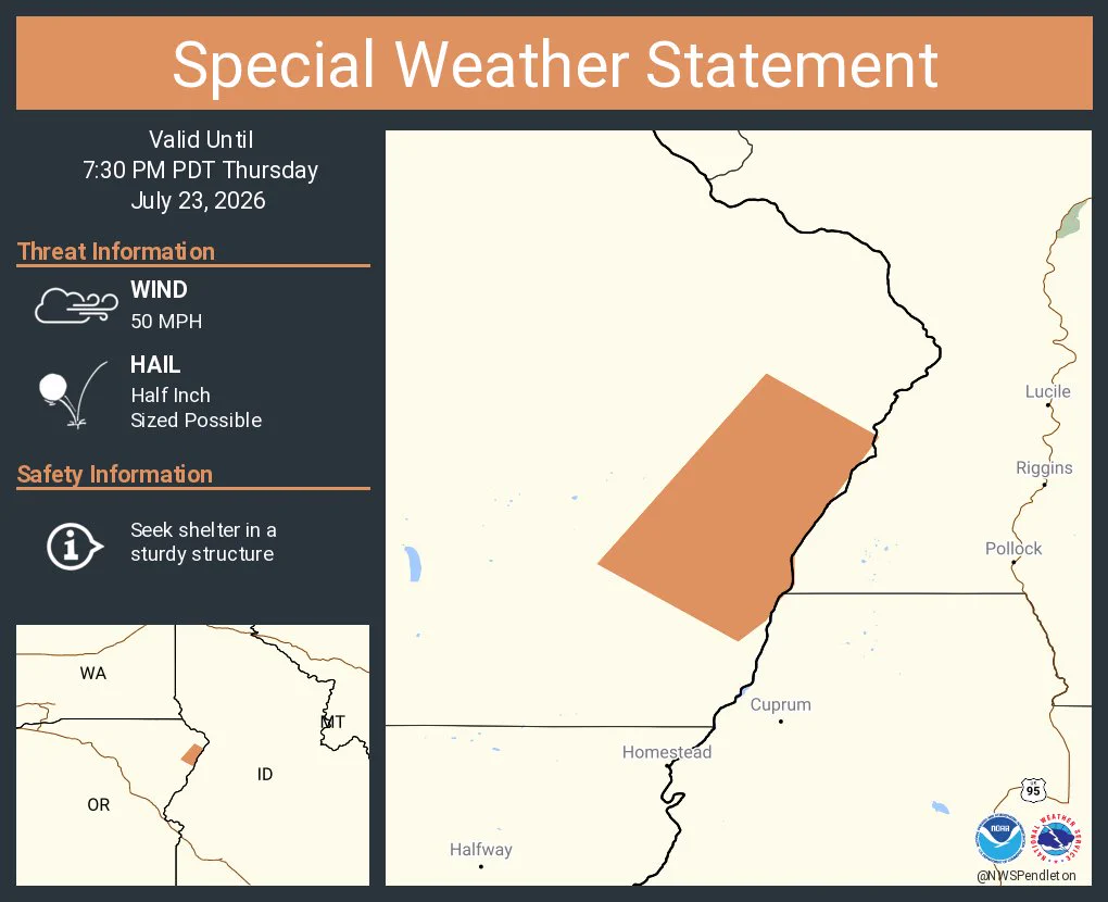
    A special weather statement has been issued for Wallowa County, OR until 7:30 PM PDT
    This graphic displays a special weather statement plotted on a map. The statement is in effect until 7:30 PM PDT.  The statement includes Wallowa County, OR.  A STRONG THUNDERSTORM WILL IMPACT SOUTHEASTERN WALLOWA COUNTY THROUGH 730 PM PDT. The threats associated with this storm are wind gusts up to 50 MPH and half inch sized hail. Seek shelter in a sturdy structure until the storm passes.
    484
  • user avatar
    NWS Pendleton
    @NWSPendleton
    Jul 24
    A special weather statement has been issued for Wallowa County, OR until 7:00 PM PDT
    This graphic displays a special weather statement plotted on a map. The statement is in effect until 7:00 PM PDT.  The statement includes Wallowa County, OR.  A STRONG THUNDERSTORM WILL IMPACT SOUTHEASTERN WALLOWA COUNTY THROUGH 700 PM PDT. The threats associated with this storm are wind gusts up to 50 MPH and half inch sized hail. Seek shelter in a sturdy structure until the storm passes.
    362
  • user avatar
    NWS Pendleton
    @NWSPendleton
    Jul 23
    A special weather statement has been issued for Flora OR until 5:00 PM PDT
    This graphic displays a special weather statement plotted on a map. The statement is in effect until 5:00 PM PDT.  The statement includes Flora OR.  A STRONG THUNDERSTORM WILL IMPACT NORTH CENTRAL WALLOWA COUNTY THROUGH 500 PM PDT. The threats associated with this storm are wind gusts up to 40 MPH and pea sized hail. Seek shelter in a sturdy structure until the storm passes.
    366
  • See @NWSPendleton's full profile

    Sign up
    Log in
Advertisement
Advertisement