1. X
  2. USGS EROS
Log inSign up
USGS EROS
US Department of the Interior
4,912 posts
Image
user avatar
USGS EROS
US Department of the Interior
@USGS_EROS
USGS Earth Resources Observation and Science Center. The changing face of your planet: documented, studied & shared since 1973. Questions: [email protected]
Sioux Falls, SD
usgs.gov/centers/eros
Joined April 2018
155
Following
7,169
Followers
RepliesRepliesMediaMedia

New to X?

Sign up now to get your own personalized timeline!

Create account

By signing up, you agree to the Terms of Service and Privacy Policy, including Cookie Use.

TermsĀ·PrivacyĀ·CookiesĀ·AccessibilityĀ·Ads InfoĀ·Ā© 2026 X Corp.
Don't miss what's happening
People on X are the first to know.
Log inSign up
  • user avatar
    USGS EROS
    US Department of the Interior
    @USGS_EROS
    Jul 9
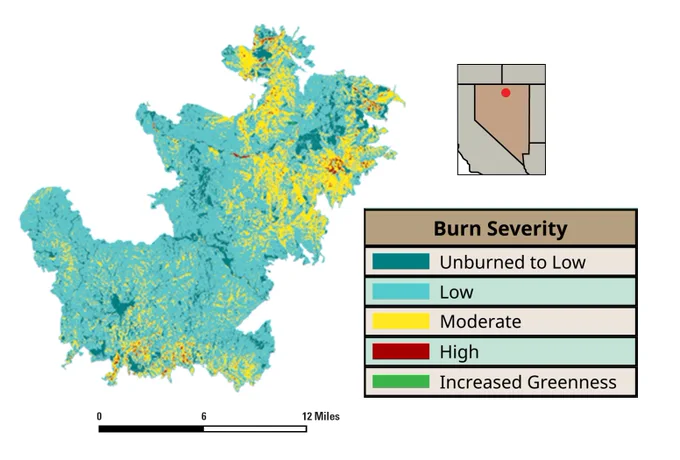
    Every wildfire leaves a signature on the landscape. More than 200 new maps now help tell that story. šŸ”„ Long-term fire records help scientists and land managers understand how burned landscapes change over time and prepare for future fires. The Monitoring Trends in Burn
    Vast dry grassland with an old weathered wooden cabin under a large billowing cloud of smoke in the distance.
    Map showing burn severity levels in a Nevada region with areas marked from unburned to high severity and zones of increased greenness.
    4050405
  • user avatar
    USGS EROS
    US Department of the Interior
    @USGS_EROS
    Jul 7
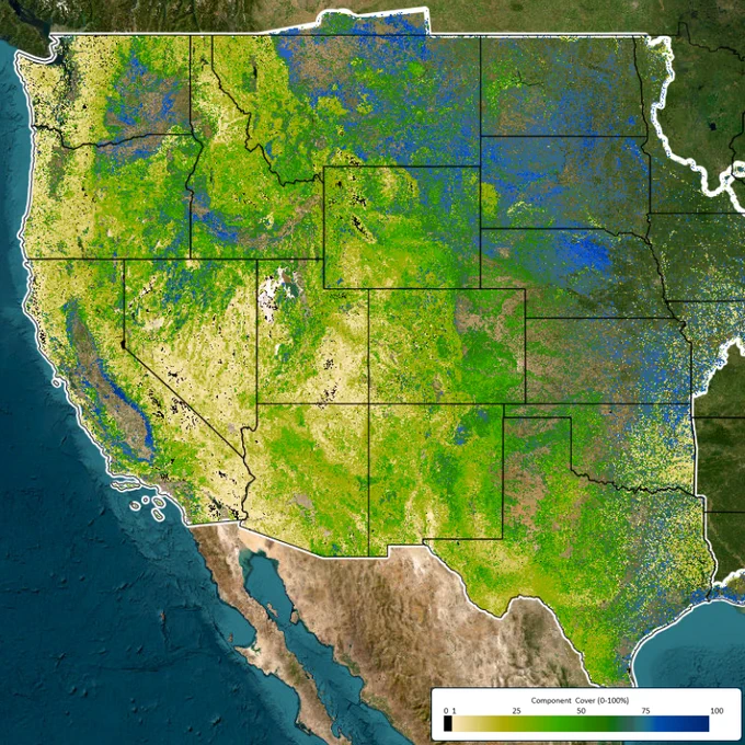
    Learn from the past to plan for the future! A 40-year view of America's western rangelands is now available. New maps showing annual changes in grasses, shrubs, trees, bare ground, and more can help federal and state land managers, habitat managers, and researchers make future
    Image
    Image
    Image
    2600260
  • user avatar
    USGS EROS
    US Department of the Interior
    @USGS_EROS
    Jul 2
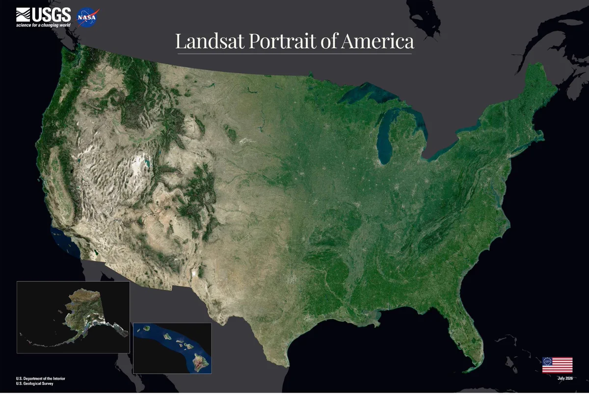
    America, from space. šŸ›°ļø To celebrate America's 250th anniversary, the USGS has created a new portrait of the nation using imagery from Landsat 8 and Landsat 9. For more than 50 years, the @USGS and @NASA Landsat program has provided a continuous record of Earth's changing land
    Image
    2960296
  • user avatar
    USGS EROS
    US Department of the Interior
    @USGS_EROS
    Jun 30
    A new year of land cover data is here. Annual NLCD now provides a 41-year record of change across the conterminous United States. The latest release of the Annual National Land Cover Database (NLCD) extends annual mapping through 2025, documenting how landscapes have changed
    Image
    Image
    Image
    3450345
  • user avatar
    USGS EROS
    US Department of the Interior
    @USGS_EROS
    Jun 10
    How drought reshaped Lake Corpus Christi in just one year. Lake Corpus Christi, one of three reservoirs supplying water to the Corpus Christi area, dropped below 10% capacity earlier this year after prolonged drought. Recent rains have improved conditions, raising the reservoir
    Image
    Image
    3950395
  • user avatar
    USGS EROS
    US Department of the Interior
    @USGS_EROS
    May 24
    Today is the 110th Indianapolis 500! šŸ The speedway may look a little different than when it was built in 1909 to serve as a testing facility for newfangled automobiles, but it’s still dedicated to the dream of driving. This National Agriculture Imagery Program (NAIP)
    Image
    2680268
  • user avatar
    USGS EROS
    US Department of the Interior
    @USGS_EROS
    May 21
    Managing land in the West? Improvements to weekly maps of invasive grasses make it easier! Aggressive invasive grasses can crowd out native plants, damage habitats, and increase the risk of wildfire. Monitoring tools are important for treatment timing, fire management, grazing
    Image
    Image
    3800380
  • user avatar
    USGS EROS
    US Department of the Interior
    @USGS_EROS
    May 13
    By special request: Landsat nighttime images! šŸŒ‹šŸ”„ Want to know what a certain volcano or fire looks like at night from space? Or see glaciers at twilight? Landsat satellites don’t have to take the night off. In fact, they can offer more to science if they don’t, including
    Glowing lava erupting from a volcanic crater with thick smoke rising against an early morning sky.
    Fiery lava illuminating jagged fissures in a volcanic surface and ash above.
    8980898
  • user avatar
    USGS EROS
    US Department of the Interior
    @USGS_EROS
    May 7
    Pecora Award nominations are due May 29! You can help recognize an individual or group for their innovative work, impactful research, and dedication to Earth observation through the William T. Pecora Award. The award honors those using satellite or aerial remote sensing to make
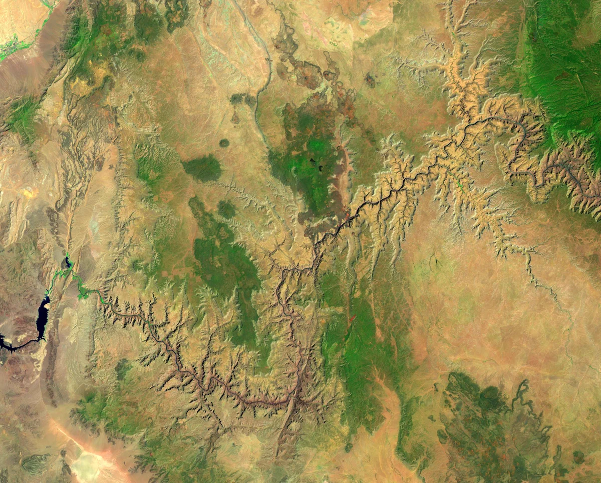
    Aerial view of the vast of the Grand Canyon landscape with scattered green vegetation patches.
    1770177
  • user avatar
    USGS EROS
    US Department of the Interior
    @USGS_EROS
    May 6
    Get a good look at trees in southeastern Alaska, Hawaii, Puerto Rico, and the U.S. Virgin Islands! 🌳🌲🌓 Tree canopy maps can help communities monitor change, support planning, and inform resource management decisions. The Annual National Land Cover Database (NLCD) has added
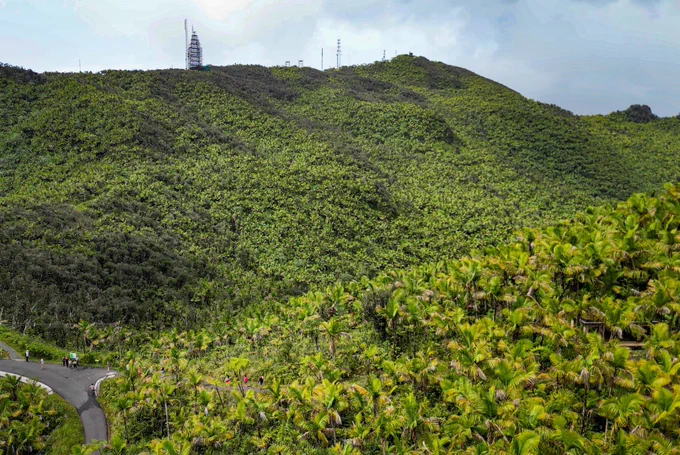
    Lush green hillside densely covered with tropical vegetation under a cloudy sky.
    Satellite-derived view of eastern Puerto Rico's dense forest canopy coverage with San Juan and El Yunque National Forest labeled.
    3600360
  • user avatar
    USGS EROS
    US Department of the Interior
    @USGS_EROS
    Apr 29
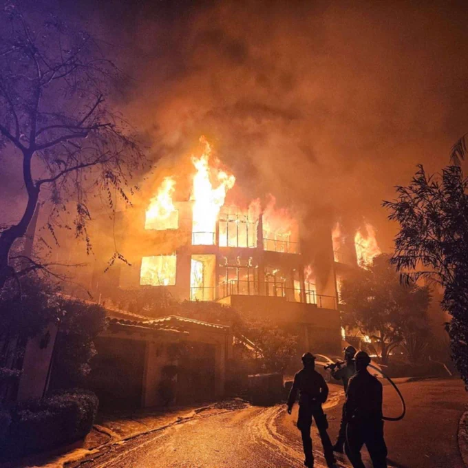
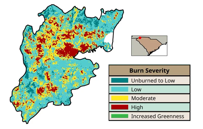
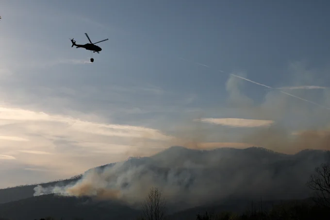
    Over 1,000 new fire maps across the United States! šŸ”„ Mapping where and how severely a fire has burned the landscape is important right away for fire responders and in the long-term for land and fire-risk managers. The Burn Severity Portal provides access to a range of maps of
    Map showing burn severity levels with large areas marked as unburned to low, scattered moderate and high severity zones, and some increased greenness patches.
    Helicopter carrying a water bucket flies over smoky mountains to combat a wildfire at dusk.
    1910191
  • USGS EROS reposted
    user avatar
    CEOS
    @CEOSdotORG
    Apr 22
    šŸ’¬ LSI-VC-19 & WGCV-56 @USGS_EROS Discussing: šŸ“„ 2026 CEOS-ARD Strategy šŸŽÆ Calibration and Validation networks ā›°ļø Land surface imaging thematic topics āš–ļø Expressing uncertainty šŸ¤ Commercial engagement + tours of the EROS Center and Cal/Val field site šŸ˜Ž
    Image
    Image
    2630263
  • user avatar
    USGS EROS
    US Department of the Interior
    @USGS_EROS
    Apr 22
    See our planet in a new way this Earth Day! šŸŒŽ Our Earth As Art collections showcase the beauty of sweeping landscapes as they feature satellite and drone images with creative combinations of visible and infrared light. You’ve never seen deserts, deltas, rivers, or ridges look
    A vibrant abstract landscape with swirling patterns in pink, purple, green, and blue hues resembling geological formations.
    A drone image showing a rainforest as blue with yellowish-greenish water
    2020202
  • user avatar
    USGS EROS
    US Department of the Interior
    @USGS_EROS
    Apr 13
    Need Landsat imagery that isn’t routinely acquired? There’s a process for that. Did you know Landsat can capture more than standard daytime scenes? Researchers can submit special requests for non-routine acquisitions to support unique science needs—and this webinar will walk you
    Image
    2070207
Advertisement
Advertisement