REAL TIME ALERTS AND INFORMATION
Google makes critical and helpful information available when it matters most — helping people stay safe and access authoritative resources.
Critical information
Public safety and emergency alerts
AI and expert-informed alerts
Extreme heat
Earthquake warnings
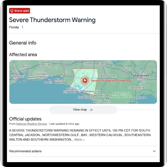
Public safety and emergency alerts
When disasters strike, access to authoritative information is critical. Our Public Alerts deliver emergency messages issued by public authorities using the Common Alerting Protocol (CAP) standard — such as weather warnings, floods warnings, wildfire alerts, and other public safety information.
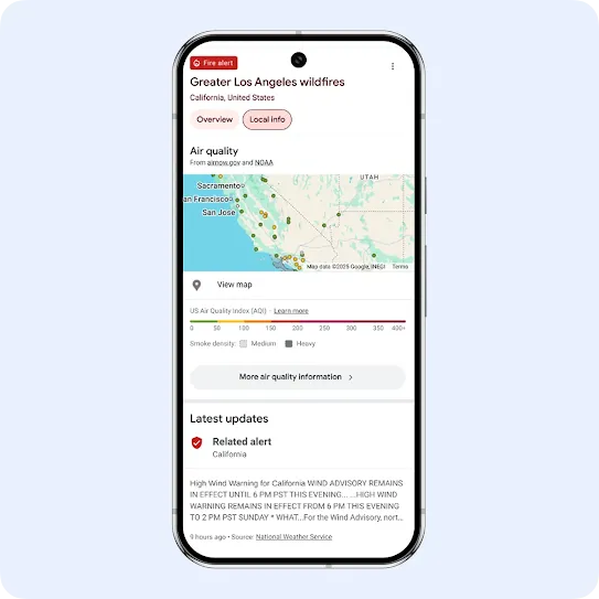
AI and expert-informed alerts
Google’s crisis alerts on Search and Maps deliver helpful, real-time updates from official agencies, local emergency contacts, top news stories, and safety tips from authoritative partners. These alerts are built on our AI-powered early detection, data from authoritative sources, and human vetting by crisis operations specialists.
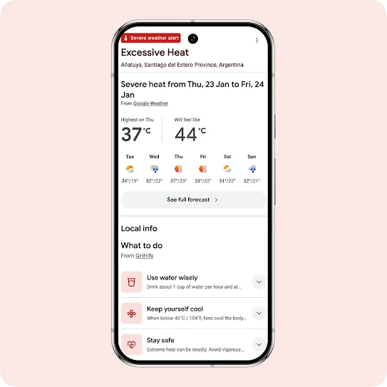
Extreme Heat
Extreme heat alerts are automatically triggered on Google Search based on heat index calculations and global climate data. These provide warnings for people in over 100 countries and display safety tips developed in partnership with the Global Heat Health Information Network (GHHIN).
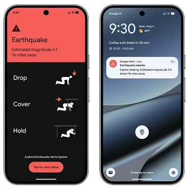
Earthquake warnings
The Android Earthquake Alerts System can detect earthquakes and alert Android users before shaking reaches them, so people can take action to protect themselves.
Helpful resources
Navigation warnings
Local resources and merchant updates
Air quality information
Emergency location services
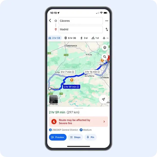
Navigation warnings
Google Maps shows prominent alerts for routes that may be affected by crisis activity. When possible, it will provide alternate routes from the disrupted area so people can navigate safely.

Local resources and merchant updates
Merchants can use Google Business Profile to update hours, share critical info, and surface crisis-related locations — like shelters, food banks, and more — directly on Google Maps.
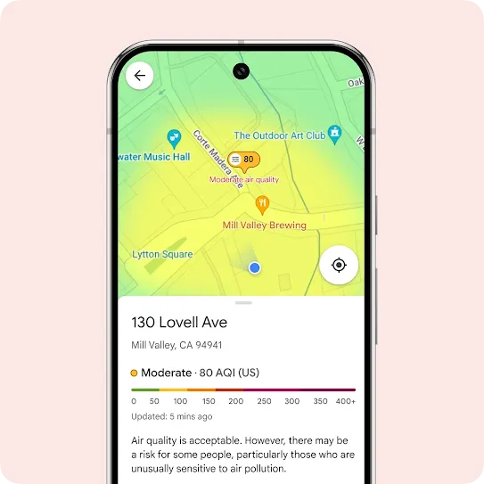
Air quality information
The air quality layer on Maps provides users in over 30 countries with up-to-date air quality data. This can help users make more informed decisions about outdoor activities and reduce their exposure to pollution.
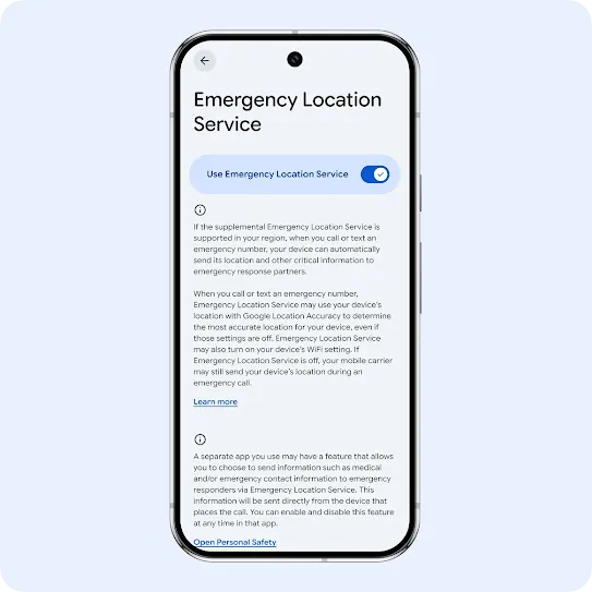
Emergency location services
Android’s Emergency Location Service and Pixel’s safety app help share real-time location and emergency info with first responders faster during a crisis.