Predicting natural disasters to help people stay safe
Building AI models for more accurate forecasts to help communities prepare for natural disasters.
AI-powered flood forecasting
Flood Hub
Flood Hub displays our state-of-the-art riverine flood forecasts, showing the trajectory of floods up to 7 days in advance across 150 countries. It also includes flash flood predictions for urban areas up to 24 hours in advance to provide governments, nonprofits and users with critical, actionable information.
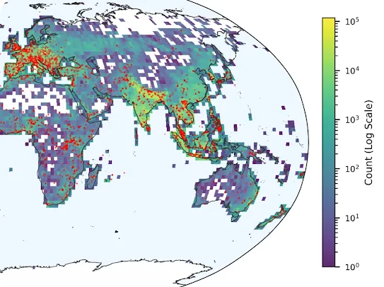
Groundsource
Groundsource uses Gemini to transform millions of public reports into a high-quality data archive to aid better crisis predictions. Our open-access dataset for urban flash floods includes 2.6 million records and was used to train our new urban flash flood model.
Early detection and real-time wildfire tracking
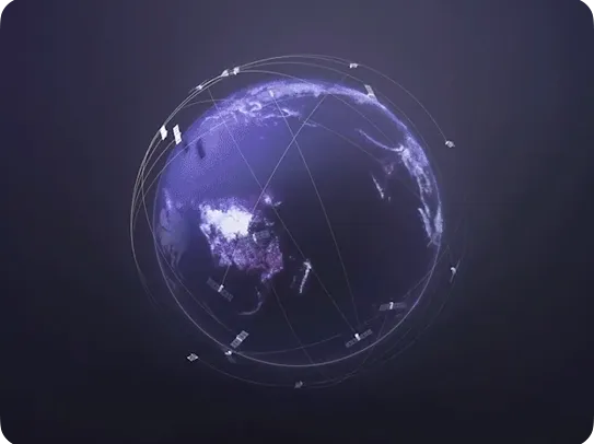
FireSat
Developed in partnership with the Earth Fire Alliance and Muon Space, FireSat uses multispectral satellite imagery and AI to provide near real-time insights on wildfires. When the full constellation is operational, it will provide updates every 20 minutes, enabling the detection of wildfires that are roughly the size of a classroom.
Wildfire boundary tracking
We’re using AI and satellite imagery to map the boundaries of large wildfires and display them on Google Maps and Google Search in over 30 countries.
Earthquake detection
Android Earthquake Alerts
We developed a system that detects earthquakes using aggregated measurements from a global network of Android smartphones equipped with accelerometers (like tiny seismometers!). This enables us to deliver early warnings to users nearby.
Forecasting extreme weather events
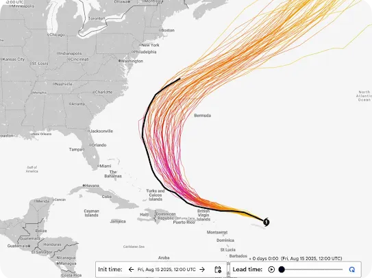
WeatherNext
WeatherNext delivers our most accurate predictions for extreme weather events. It is used by the US National Hurricane Center to support their forecasts, and has successfully predicted the path and intensity of cyclones with high confidence days in advance. WeatherNext is also being used to help power all of Google’s weather results.
Post-disaster damage assessment
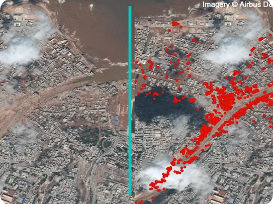
SKAI
SKAI is an AI-powered post-disaster damage assessment model. Developed in partnership with the United Nations World Food Programme (WFP) and UN DISHA, it’s designed to accelerate the work of humanitarian aid organizations following natural disasters. By utilizing machine learning and computer vision to compare pre- and post-disaster satellite imagery, the system can map structural and building damage across vast urban zones in near-real time.