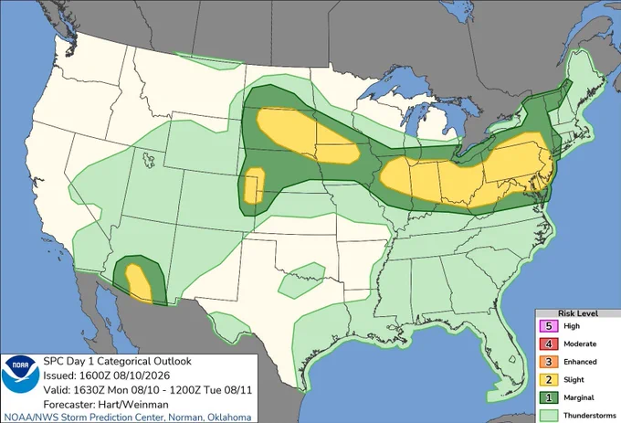
Severe thunderstorms with damaging wind gusts will be possible today from the eastern Iowa/northern Illinois vicinity into parts of the Ohio Valley and central Appalachians. Areas of severe wind gusts and hail will also be possible over parts of the northern Plains. See
Official X account for @NOAA's National Weather Service.
A list of official NWS accounts can be found at x.com/i/lists/725042…
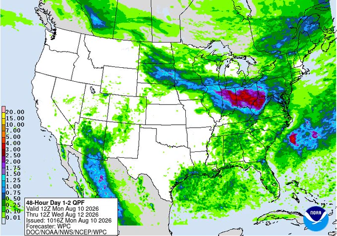
- A front meandering across the north-central U.S. will bring heavy rainfall eastward into the Midwest, lower Great Lakes, and Ohio Valley over the next few days. Thunderstorms capable of producing severe wind gusts will be possible from parts of northern Illinois eastward into
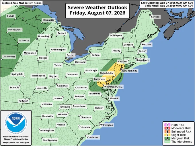
- Thunderstorms capable of scattered damaging wind gusts are possible this afternoon and early evening over parts of the Mid-Atlantic states. A few thunderstorm clusters are likely to develop and move over the I-95 corridor. Isolated strong to locally severe wind gusts (50 to 60
- A flooded field is more than just a rain delay—it’s a hazard. ✅ Always follow instructions from public safety officials and venue staff. 🚫 Never walk or drive through floodwaters; you can’t see what’s hiding beneath the surface or how deep the water really is.
- Hot and dry weather combined with increasing winds will allow elevated fire weather conditions to return to the northern Intermountain West Friday into the weekend. Stay Weather-Ready and protect yourself from wildfires, visit weather.gov/wildfire