1. X
  2. NOAA
Log inSign up
NOAA
21K posts
Image
user avatar
NOAA
@NOAA
NOAA provides science, service and stewardship to protect life, property & Earth's natural resources. An agency of @CommerceGov. Join us on Instagram & Facebook
USA (Formerly @usNOAAgov)
noaa.gov
Joined April 2008
160
Following
1.3M
Followers
RepliesRepliesMediaMedia

New to X?

Sign up now to get your own personalized timeline!

Create account

By signing up, you agree to the Terms of Service and Privacy Policy, including Cookie Use.

Terms·Privacy·Cookies·Accessibility·Ads Info·© 2026 X Corp.
Don't miss what's happening
People on X are the first to know.
Log inSign up
  • user avatar
    NOAA
    @NOAA
    Jul 17
    Why are sharks snatching snapper right off the hook? NOAA’s new Shark Depredation Strategy is investigating the big questions about shark depredation: 🦈 Are shark populations exploding? 🎣 Have sharks learned to associate boat noise with an easy meal? 🛡️ Which deterrents
    Image
    NOAA’s Strategy for Understanding Shark Depredation
    From fisheries.noaa.gov
    12K012K
  • user avatar
    NOAA
    @NOAA
    Jul 17
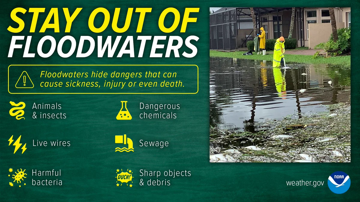
    Do you know what could be lurking in floodwaters? Live wires and sharp objects are just a few of the possibilities: #TurnAroundDontDrown
    user avatar
    National Weather Service
    @NWS
    Jul 17
    During and after flooding be sure to listen to local officials. Stay out of floodwaters. They can contain dangerous chemicals and objects that could harm you or make you sick. For the latest flood watches and warnings check weather.gov.
    Stay out of floodwaters. Floodwaters hide dangers that can cause sickness, injury or even death, including animals and insects, live wires, harmful bacteria, dangerous chemicals, sewage, and sharp objects and debris.
    12K012K
  • NOAA reposted
    user avatar
    NWS Weather Prediction Center
    @NWSWPC
    Jul 17
    Heat and humidity persists across the Northern Plains/Upper Midwest; lingers in the Mid-Atlantic through tomorrow wpc.ncep.noaa.gov/discussions/hp…
    13K013K
  • NOAA reposted
    user avatar
    NWS Weather Prediction Center
    @NWSWPC
    Jul 17
    Air quality alerts span from the Upper Midwest Great Lakes to New England wpc.ncep.noaa.gov/discussions/hp…
    12K012K
  • NOAA reposted
    user avatar
    NWS Weather Prediction Center
    @NWSWPC
    Jul 17
    Heavy rainfall threat continues in the Texas Big Bend today; dangerous flash flooding remains possible wpc.ncep.noaa.gov/discussions/hp…
    16K016K
  • NOAA reposted
    user avatar
    NIDIS Drought.gov
    @NOAADrought
    Jul 16
    New Seasonal Drought Outlook by @NOAA's @NWSCPC Expected drought development: Northwest, Upper Midwest, Puerto Rico Improvement: Southwest, Great Basin, Rockies, High Plains, East, and a few other areas Otherwise, drought persists. drought.gov/forecasts
    A map of the United States showing the Seasonal Drought Outlook for July 16 through October 31, 2026 indicates that drought is expected to persist heavily across the Pacific Northwest, Northern California, parts of the interior West, the Southern Plains, the Midwest, and the Mid-Atlantic/Southeast regions, while drought removal or improvement is forecasted across parts of the Southwest, Great Basin, Rockies, High Plains, East, and a few other scattered areas. Areas of new drought development are likely primarily in the Northwest, Northern Plains, and parts of Puerto Rico.
    5.8K05.8K
  • NOAA reposted
    user avatar
    NIDIS Drought.gov
    @NOAADrought
    Jul 16
    Next week, monsoon moisture is expected through the Southwest into the Great Basin and Central Rockies. The East also looks wet. Temps: Warmer than normal likely for the West and South. Cooler for the Upper Midwest, Northeast, and Mid-Atlantic. Drought.gov @NOAA @NWS
    NOAA’s 6–10 Day Precipitation Outlook map for July 21–25, 2026, indicates a higher probability of above-normal precipitation centering over the Intermountain West and stretching toward the East Coast, near-normal conditions for much of the Northwest, Central Plains, and parts of the Southeast, and a small area of below-normal precipitation along the southern tip of Texas.
    NOAA’s 6–10 Day Temperature Outlook map for July 21–25, 2026 indicates a high probability of above-normal temperatures spanning the West Coast, the southern Great Plains, and the Southeast, while the Great Lakes region and the Northeast are favoring below-normal temperatures, and the Northern Plains favor near-normal temperatures.
    6.9K06.9K
  • NOAA reposted
    user avatar
    NIDIS Drought.gov
    @NOAADrought
    Jul 16
    #DroughtMonitor 7/14: Extreme heat in the northern US. Heavy rains in the southern US. Parts of the Northwest, N. Plains, and Upper Midwest worsened. S. Plains, Lower Midwest, and South/Southeast improved. #Drought2026's Footprint: 38.8% of the USA drought.gov @NOAA
    U.S. Drought Monitor map from July 14, 2026, shows severe (D2) to exceptional (D4) drought conditions heavily concentrated across the Western United States and portions of the Southeast, including Florida and the Carolinas.
    5.5K05.5K
  • NOAA reposted
    user avatar
    National Weather Service
    @NWS
    Jul 15
    Life-threatening and locally catastrophic flash and urban flooding is expected across portions of southwestern Texas through early Friday, with significant river flooding and rapid rises on small streams, arroyos, and typically dry washes expected. Monitor weather.gov
    NOAA Weather Prediction Center Day 1 Excessive Rainfall Outlook valid from 12Z Wednesday, July 15, 2026, through 12Z Thursday, July 16, 2026. A High Risk (magenta) for excessive rainfall and flash flooding is centered over portions of south-central Texas, surrounded by a Moderate Risk (red) and a broader Slight Risk (yellow) extending across much of southern Texas near the Rio Grande and Gulf Coast regions. Additional Slight Risk areas are highlighted over parts of southern Nevada and northwestern Arizona. Marginal Risk areas (green) cover a larger portion of Texas and the southern Plains, extend northeastward into the Mid-South and lower Ohio Valley, and include separate areas over the Great Basin, central Rockies, and northern Rockies. The legend indicates probabilities of rainfall exceeding flash flood guidance within 25 miles of a point, with thresholds of 5% for Marginal, 15% for Slight, 40% for Moderate, and 70% for High Risk.
    48K048K
  • NOAA reposted
    user avatar
    NWS Weather Prediction Center
    @NWSWPC
    Jul 16
    Severe thunderstorms for portions of western Montana later today; strong thunderstorms possible for northern New England today wpc.ncep.noaa.gov/discussions/hp…
    12K012K
  • NOAA reposted
    user avatar
    NWS Weather Prediction Center
    @NWSWPC
    Jul 16
    Monsoonal showers and thunderstorms persist across the interior western U.S with greatest flash flooding threat near the southern borders of Arizona and New Mexico wpc.ncep.noaa.gov/discussions/hp…
    11K011K
  • NOAA reposted
    user avatar
    NWS Weather Prediction Center
    @NWSWPC
    Jul 16
    Air quality alert from the upper Midwest through the Great Lakes into the Northeast wpc.ncep.noaa.gov/discussions/hp…
    11K011K
  • NOAA reposted
    user avatar
    NWS Weather Prediction Center
    @NWSWPC
    Jul 16
    Anomalous heat and humidity persisting across the Northern Plains/Upper Midwest while spreading into the northern Mid-Atlantic wpc.ncep.noaa.gov/discussions/hp…
    9.6K09.6K
  • NOAA reposted
    user avatar
    NWS Weather Prediction Center
    @NWSWPC
    Jul 16
    Additional excessive rainfall likely across the Texas Hill Country today, with focus shifting toward the Big Bend on Friday wpc.ncep.noaa.gov/discussions/hp…
    10K010K
Advertisement
Advertisement